|
Migneint
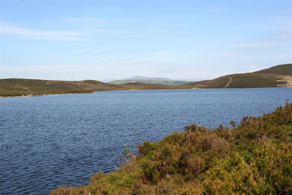
The Migneint () is a large expanse of moorland in central Snowdonia, north-west Wales. It is part of the ''Migneint-Arenig-Dduallt'' Special Area of Conservation, along with the mountains Arenig Fawr, Arenig Fach and Dduallt, covering a range of nearly . It is either the largest area of blanket bog in Wales, or the second largest, after the Berwyn range, further to the east. The area includes a few small lakes, including Llyn Conwy, the source of the River Conwy, and is bisected by the B4407 road from Ffestiniog to Ysbyty Ifan. Plans have been suggested to hold water on the Migneint for longer, to help prevent flooding in the Conwy valley; but local farmers have voiced concern that this could be harmful to livestock. References External linksPhotos of Migneint and surrounding area at Geograph *Migneint is at coordinates / Bogs of Wales Landforms of Conwy County Borough Landforms of Gwynedd Wetland Sites of Special Scientific Interest Ysbyty Ifan Bro Machno Moorlands of W ... [...More Info...] [...Related Items...] OR: [Wikipedia] [Google] [Baidu] |
River Conwy
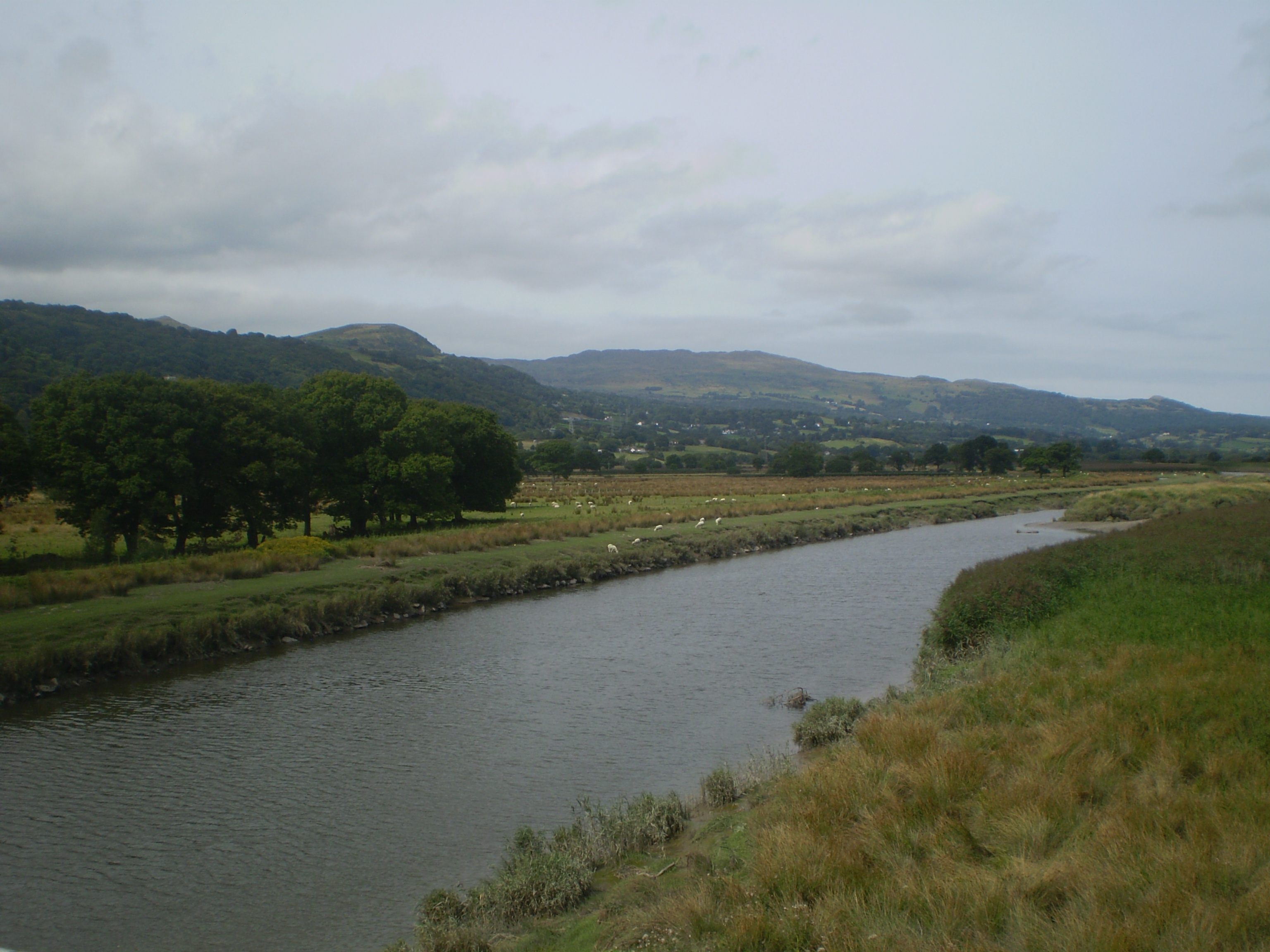
, name_etymology = , image = Boats in River Conwy.jpg , image_size = 300 , image_caption = Boats in the river estuary at Conwy , map = , map_size = , map_caption = , pushpin_map = , pushpin_map_size = , pushpin_map_caption= , subdivision_type1 = Country , subdivision_name1 = Wales , subdivision_type2 = , subdivision_name2 = , subdivision_type3 = , subdivision_name3 = , subdivision_type4 = District , subdivision_name4 = County Borough of Conwy , subdivision_type5 = City , subdivision_name5 = Conwy , length = , width_min = , width_avg = , width_max = , depth_min = , depth_avg = , depth_max = , discharge1_location= Cwm Llanerch , discharge1_min = , discharge1_avg = , discharge1_max = , source1 = , source1_location = Migneint moor where a number of small ... [...More Info...] [...Related Items...] OR: [Wikipedia] [Google] [Baidu] |
Snowdonia
Snowdonia or Eryri (), is a mountainous region in northwestern Wales and a national park of in area. It was the first to be designated of the three national parks in Wales, in 1951. Name and extent It was a commonly held belief that the name is derived from ("eagle"), and thus means "the abode/land of eagles", but recent evidence is that it means ''highlands'', and is related to the Latin (to rise) as leading Welsh scholar Sir proved. The term first appeared in a manuscript in the 9th-century , in an account of the downfall of the semi-legendary 5th-century king (Vortigern). In the Middle Ages, the title ''Prince of Wales and Lord of Snowdonia'' () was used by ; his grandfather used the title ''Prince of north Wales and Lord of Snowdonia.'' The name ''Snowdonia'' derives from '' Snowdon'', the highest mountain in the area and the highest mountain in Wales at . Before the boundaries of the national park were designated, "Snowdonia" was generally used to refer to a s ... [...More Info...] [...Related Items...] OR: [Wikipedia] [Google] [Baidu] |
Conwy Valley
, name_etymology = , image = Boats in River Conwy.jpg , image_size = 300 , image_caption = Boats in the river estuary at Conwy , map = , map_size = , map_caption = , pushpin_map = , pushpin_map_size = , pushpin_map_caption= , subdivision_type1 = Country , subdivision_name1 = Wales , subdivision_type2 = , subdivision_name2 = , subdivision_type3 = , subdivision_name3 = , subdivision_type4 = District , subdivision_name4 = County Borough of Conwy , subdivision_type5 = City , subdivision_name5 = Conwy , length = , width_min = , width_avg = , width_max = , depth_min = , depth_avg = , depth_max = , discharge1_location= Cwm Llanerch , discharge1_min = , discharge1_avg = , discharge1_max = , source1 = , source1_location = Migneint moor where a number of small ... [...More Info...] [...Related Items...] OR: [Wikipedia] [Google] [Baidu] |
Ysbyty Ifan
Ysbyty Ifan (often formerly anglicised as Yspytty Ifan) is a small, historic village and community in the Conwy County Borough of Wales. The population in 2011 was 196 in 76 households (29 household spaces had no usual residents), over 79% of the population were able to speak Welsh. It has one of the smallest populations of any Welsh community, the smallest being Ganllwyd. It is in the electoral ward of Uwch Conwy. History Ysbyty Ifan, until about 1190, was known as Dôl Gynwal (Welsh for ''Cynwal's Meadow''). Then, it came to the attention of the Knights of St John, the Order of Hospitallers, who set up a hospital to care for pilgrims and also to be a hostel for them on their journeys (Ysbyty Ifan means ''hospital of St John''). Ysbyty Ifan was on the ancient pilgrimage routes, for example, from Bangor Is Coed ( Bangor-on-Dee) to Holyhead and Bardsey Island and the Cistercian Way between Aberconwy and Cymer. It is centrally located among a significant number of importan ... [...More Info...] [...Related Items...] OR: [Wikipedia] [Google] [Baidu] |
Arenig Fach
Arenig Fach is a mountain in southern Snowdonia, north Wales. It is a peak in the Arenig range and lies to the north of its parent peak Arenig Fawr. It lies close to Llyn Celyn alongside the A4212 between Trawsfynydd and Bala. Carnedd y Filiast and Foel Goch (Arenigs) is to the east, while Moel Llyfnant, Gallt y Daren and Arenig Fawr are to the south. The summit itself is known as Carnedd Bachgen, named after the ancient cairn, ''Carnedd y Bachgen'' (which lies just north-east of the summit), and is the highest point at the north end of a wide plateau. There is a trig point and a substantial shelter cairn. The mountain rises from the Migneint moorland and looks like a bulky heathery "lump" from most directions. However, its north-eastern face has steep cliffs with a small corrie lake, Llyn Arenig Fach, at their bottom. The last glacier occupation of this corrie is thought to have happened during the Loch Lomond Stadial The Younger Dryas (c. 12,900 to 11,700 years ... [...More Info...] [...Related Items...] OR: [Wikipedia] [Google] [Baidu] |
Moorland Moorland or moor is a type of habitat found in upland areas in temperate grasslands, savannas, and shrublands and montane grasslands and shrublands biomes, characterised by low-growing vegetation on acidic soils. Moorland, nowadays, generally means uncultivated hill land (such as Dartmoor in South West England), but also includes low-lying wetlands (such as Sedgemoor, also South West England). It is closely related to heath, although experts disagree on what precisely distinguishes these types of vegetation. Generally, moor refers to highland and high rainfall zones, whereas heath refers to lowland zones which are more likely to be |


