|
Miangas
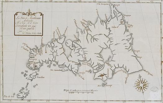
Miangas or Palmas is the northernmost island of North Sulawesi, and one of 92 officially listed outlying islands of Indonesia. Etymology ''Miangas'' means "exposed to piracy", because pirates from Mindanao used to visit the island. In the Sasahara language, the island is called ''Tinonda'' ( Minahasan: ''Poilaten''), meaning "people who live separated from the main archipelago" and "our island", respectively. During the 16th century, the island was named in Spanish as ''Isla de las Palmas'', and in Portuguese ''Ilha de Palmeiras''. History According to local tradition, there were a number of kingdoms in the area. Sangir, Talaud and Sitaro belonged to two kingdoms, Tabukan and Kalongan. To justify their sovereignty over Miangas, the Dutch argued that the island had been under the domination of the princes of Sangir. Early modern era In October 1526, Garcia Jofre de Loaísa, Spanish sailor and researcher, was the first European to visit the island. The island was used ... [...More Info...] [...Related Items...] OR: [Wikipedia] [Google] [Baidu] |
Talaud Islands
The Talaud Islands Regency () is a Regency (Indonesia), regency of North Sulawesi province, Indonesia. The Talaud Islands form an archipelago situated to the northeast of the Minahasa Peninsula, with a land area of 1,251.02 km2. It had a population of 83,434 at the 2010 Census,Biro Pusat Statistik, Jakarta, 2011. increasing to 94,521 at the 2020 Census;Badan Pusat Statistik, Jakarta, 2021. the official estimate as of mid-2023 was 97,312 (comprising 50,061 males and 47,251 females).Badan Pusat Statistik, Jakarta, 28 February 2024, ''Kabupaten Kepulauan Talaud Dalam Angka 2024'' (Katalog-BPS 1102001.7104) The largest island is Karakelong, on which lies the regency seat in the town of Melonguane. To its south lie the islands of Salibabu and Kabaruan, while the Nanusa group of 7 small islands lies to the northeast of Karakelong, and Miangas island is situated midway between Karakelong and the Philippines. It is one of the three regencies to the north of North Sulawesi that are located ... [...More Info...] [...Related Items...] OR: [Wikipedia] [Google] [Baidu] |
Talaud Islands Regency
The Talaud Islands Regency () is a regency of North Sulawesi province, Indonesia. The Talaud Islands form an archipelago situated to the northeast of the Minahasa Peninsula, with a land area of 1,251.02 km2. It had a population of 83,434 at the 2010 Census,Biro Pusat Statistik, Jakarta, 2011. increasing to 94,521 at the 2020 Census;Badan Pusat Statistik, Jakarta, 2021. the official estimate as of mid-2023 was 97,312 (comprising 50,061 males and 47,251 females).Badan Pusat Statistik, Jakarta, 28 February 2024, ''Kabupaten Kepulauan Talaud Dalam Angka 2024'' (Katalog-BPS 1102001.7104) The largest island is Karakelong, on which lies the regency seat in the town of Melonguane. To its south lie the islands of Salibabu and Kabaruan, while the Nanusa group of 7 small islands lies to the northeast of Karakelong, and Miangas island is situated midway between Karakelong and the Philippines. It is one of the three regencies to the north of North Sulawesi that are located between Sulawesi a ... [...More Info...] [...Related Items...] OR: [Wikipedia] [Google] [Baidu] |
List Of Outlying Islands Of Indonesia
Under a presidential decree in 2005, Indonesia has categorised 92 geographically isolated and distant islands as ''pulau terluar'' or "outlying islands". 67 of them are close to a neighbouring country, and 28 are inhabited. List Statistics Bordering countries Indonesia's outlying islands share borders with the following 9 countries: Provinces These outlying islands are located in one of the following 18 provinces: Potential disputes According to Indonesia, amongst these outlying islands, 12 might be claimed by another nation:''Kompas'' 12 March 2005 See also * Foreign relations of Indonesia Since independence, Indonesian foreign relations have adhered to a "free and active" foreign policy, seeking to play a role in regional affairs commensurate with its size and location but avoiding involvement in conflicts among major powers. ... * Indonesia–Malaysia border * Indonesian Small Islands Directory References External links {{DEFAULTSORT:List ... [...More Info...] [...Related Items...] OR: [Wikipedia] [Google] [Baidu] |
North Sulawesi
North Sulawesi () is a Provinces of Indonesia, province of Indonesia. It is mainly located on the Minahasa Peninsula of the island of Sulawesi, south of the Philippines and southeast of Sabah, Malaysia, but also includes various small archipelagoes situated between the Minahasa Peninsula and southern Philippines. It borders the Philippines province of Davao Occidental and Soccsksargen, Soccsksargen regions to the north, the Maluku Sea to the east, Gorontalo (its sole land border) and the Celebes Sea to the west and the Gulf of Tomini to the southwest. The province's furthest extent, the outlying and isolated island of Miangas to its north, is the northernmost island of Indonesia that has the country's sole and only border with the Philippines. The province's area is , and its population was 2,270,596 according to the 2010 census;Biro Pusat Statistik, Jakarta, 2011. this rose to 2,621,923 at the 2020 Census,Badan Pusat Statistik, Jakarta, 2021. while the official estimate as at ... [...More Info...] [...Related Items...] OR: [Wikipedia] [Google] [Baidu] |
Mindanao
Mindanao ( ) is the List of islands of the Philippines, second-largest island in the Philippines, after Luzon, and List of islands by population, seventh-most populous island in the world. Located in the southern region of the archipelago, the island is part of an island group of the same name that also includes its adjacent islands, notably the Sulu Archipelago. According to the 2020 census, Mindanao had a population of 26,252,442, while the entire island group had an estimated population of 27,021,036. Mindanao is divided into six administrative regions: the Zamboanga Peninsula, Northern Mindanao, the Caraga region, the Davao Region, Davao region, Soccsksargen, and the autonomous region of Bangsamoro. According to the 2020 census, Davao City is the most populous city on the island, with 1,776,949 people, followed by Zamboanga City (pop. 977,234), Cagayan de Oro (pop. 728,402), General Santos (pop. 697,315), Butuan (pop. 372,910), Iligan (pop. 363,115) and Cotabato City (pop. ... [...More Info...] [...Related Items...] OR: [Wikipedia] [Google] [Baidu] |
Leonard Wood
Leonard Wood (October 9, 1860 – August 7, 1927) was a United States Army major general, physician, and public official. He served as the Chief of Staff of the United States Army, List of colonial governors of Cuba, Military Governor of Cuba, and Governor-General of the Philippines. He began his military career as an army doctor on the frontier, where he received the Medal of Honor. During the Spanish–American War, he commanded the Rough Riders, with Theodore Roosevelt as his second-in-command. Wood was bypassed for a major command in World War I, but then became a prominent Republican Party (United States), Republican Party leader and a leading candidate for the 1920 Republican National Convention, 1920 presidential nomination. Born in Winchester, New Hampshire, Wood became an army surgeon after earning a Doctor of Medicine degree from Harvard Medical School. He received the Medal of Honor for his role in the Apache Wars and became the personal physician to the President of ... [...More Info...] [...Related Items...] OR: [Wikipedia] [Google] [Baidu] |
Manado
Manado (, ) is the capital City status in Indonesia, city of the Indonesian Provinces of Indonesia, province of North Sulawesi. It is the second largest city in Sulawesi after Makassar, with the 2020 census giving a population of 451,916,Badan Pusat Statistik, Jakarta, 2021. and the official estimates for mid 2023 showing 458,582 inhabitants (229,982 males and 228,600 females),Badan Pusat Statistik, Jakarta, 28 February 2024, ''Kota Manado Dalam Angka 2024'' (Katalog-BPS 1102001.7171) distributed over a land area of 157.26 km2.Badan Pusat Statistik, Jakarta, 28 February 2024, ''Kota Manado Dalam Angka 2024'' (Katalog-BPS 1102001.7171) The Manado metropolitan area had a population of 1,377,815 as of mid 2023.Badan Pusat Statistik, Jakarta, 28 February 2024, ''Kota Manado Dalam Angka 2024'' (Katalog-BPS 1102001.7171) The city is situated on the Bay of Manado, and is surrounded by a mountainous area. Manado is among Indonesia's top-five tourism priorities and Bunaken National ... [...More Info...] [...Related Items...] OR: [Wikipedia] [Google] [Baidu] |
Spanish East Indies
The Spanish East Indies were the colonies of the Spanish Empire in Asia-Pacific, Asia and Oceania from 1565 to 1901, governed through the Captaincy General of the Philippines, captaincy general in Manila for the Monarchy of Spain, Spanish Crown, initially reporting to Mexico City, then later directly reporting to Madrid after the Spanish American wars of independence, Spanish American Wars of Independence. The king of Spain traditionally styled himself "King of the East and West Indies" (). From 1565 to 1821 these territories, together with the Spanish West Indies, were administered through the New Spain, Viceroyalty of New Spain based in Mexico City. After Declaration of Independence (Mexico), independence of the First Mexican Empire, Mexican Empire, Manila reported directly to Madrid. The territories ruled included present-day Philippines, Guam and the Mariana Islands, as well as Palau, part of Micronesia and for a brief period Spanish Formosa, Northern Taiwan and parts of North ... [...More Info...] [...Related Items...] OR: [Wikipedia] [Google] [Baidu] |
Dutch East Indies
The Dutch East Indies, also known as the Netherlands East Indies (; ), was a Dutch Empire, Dutch colony with territory mostly comprising the modern state of Indonesia, which Proclamation of Indonesian Independence, declared independence on 17 August 1945. Following the Indonesian National Revolution, Indonesian War of Independence, Indonesia and the Netherlands Dutch–Indonesian Round Table Conference, made peace in 1949. In the Anglo-Dutch Treaty of 1824, the Dutch ceded the governorate of Dutch Malacca to Britain, leading to its eventual incorporation into Malacca, Malacca (state) of modern Malaysia. The Dutch East Indies was formed from the nationalised Factory (trading post), trading posts of the Dutch East India Company, which came under the administration of the Batavian Republic, Dutch government in 1800. During the 19th century, the Dutch fought Royal Netherlands East Indies Army, many wars against indigenous rulers and peoples, which caused hundreds of thousands of d ... [...More Info...] [...Related Items...] OR: [Wikipedia] [Google] [Baidu] |
Treaty Of Paris (1898)
The Treaty of Peace between the United States of America and the Kingdom of Spain, commonly known as the Treaty of Paris of 1898, was signed by Spain and the United States on December 10, 1898, and marked the end of the Spanish–American War. Under it, Spain relinquished all claim of sovereignty over and title to territories described there as ''the island of Porto Rico and other islands now under Spanish sovereignty in the West Indies, and the island of Guam in the Marianas or Ladrones, the archipelago known as the Philippine Islands, and comprehending the islands lying within the following line:'' (details elided), to the United States. The cession of the Philippines involved a compensation of $20 million from the United States to Spain.Puerto Rico is spelled as "Porto Rico" in the treaty. The treaty came into effect on April 11, 1899, when the documents of ratification were exchanged. It was the first treaty negotiated between the two governments since the 1819 Adams– ... [...More Info...] [...Related Items...] OR: [Wikipedia] [Google] [Baidu] |
The Hague
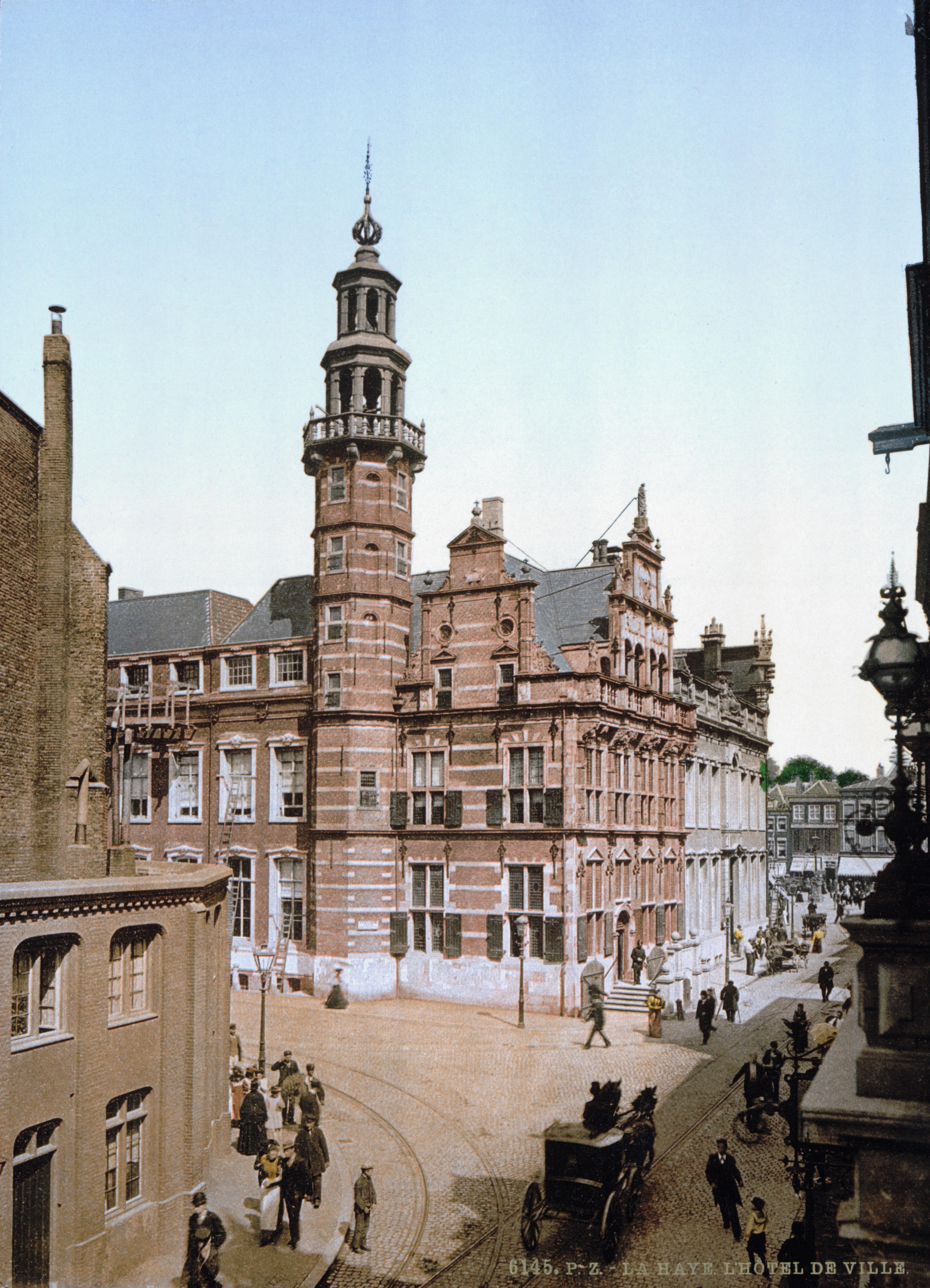
The Hague ( ) is the capital city of the South Holland province of the Netherlands. With a population of over half a million, it is the third-largest city in the Netherlands. Situated on the west coast facing the North Sea, The Hague is the country's administrative centre and its seat of government, and has been described as the country's ''de facto'' capital since the time of the Dutch Republic, while Amsterdam is the official capital of the Netherlands. The Hague is the core municipality of the COROP, Greater The Hague urban area containing over 800,000 residents, and is also part of the Rotterdam–The Hague metropolitan area, which, with a population of approximately 2.6 million, is the largest metropolitan area of the Netherlands. The city is also part of the Randstad region, one of the largest conurbations in Europe. The Hague is the seat of the Cabinet of the Netherlands, Cabinet, the States General of the Netherlands, States General, the Supreme Court of the Neth ... [...More Info...] [...Related Items...] OR: [Wikipedia] [Google] [Baidu] |


