|
Miami, Oklahoma
Miami ( ) is a city in and the county seat of Ottawa County, Oklahoma, United States, founded in 1891. Lead and zinc mining were established by 1918, causing the area's economy to boom. This area was part of Indian Territory. Miami is the capital of the federally recognized Miami Tribe of Oklahoma, after which it is named; the Modoc Tribe of Oklahoma, the Ottawa Tribe of Oklahoma, the Peoria (tribe), Peoria Tribe of Indians, and the Shawnee Tribe. As of the 2020 United States census, 2020 census, the population was 12,969. History The city was founded in an unusual way, compared to other towns established in Indian Territory. Per the ''Encyclopedia of Oklahoma History and Culture'' "... it was settled in a business-like way by men of vision who looked into the future and saw possibilities. It didn't just grow. It was carefully planned." W. C. Lykins petitioned the U.S. Congress to pass legislation on March 3, 1891, to establish the town. He met with Thomas F. Richardville, chie ... [...More Info...] [...Related Items...] OR: [Wikipedia] [Google] [Baidu] |
Ottawa County, Oklahoma
Ottawa County is a county located in the northeastern corner of the U.S. state of Oklahoma. As of the 2020 census, the population was 30,285. Its county seat is Miami. The county was named for the Ottawa Tribe of Oklahoma. It is also the location of the federally recognized Modoc Nation and the Quapaw Nation, which is based in Quapaw. Ottawa County comprises the Miami, OK Micropolitan Statistical Area, which is included in the Joplin-Miami, MO-OK Combined Statistical Area. The county borders both Kansas and Missouri. The county was an important lead and zinc mining region during the early 1900s, and in 1983 the Tar Creek Superfund site was inaugurated to clean up tailings and prevent groundwater and waterway contamination with leachates. History Archaeological studies indicate this area was inhabited for thousands of years by succeeding cultures of prehistoric indigenous peoples. According to the ''Encyclopedia of Oklahoma History & Culture'', at the start of the 20th c ... [...More Info...] [...Related Items...] OR: [Wikipedia] [Google] [Baidu] |
Peoria (tribe)
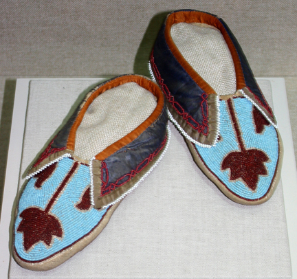
The Peoria are a Native American people. They are enrolled in the federally recognized Peoria Tribe of Indians of Oklahoma headquartered in Miami, Oklahoma. The Peoria people are the remnants of the nations which constituted the Illinois Confederation. The Peoria Tribe were located east of the Mississippi River and north of the Ohio River. In the colonial period, they traded with French colonists in that territory. After 1763, when the British took over those lands following victory in the Seven Years' War, the Peoria were moved west across the Mississippi. In 1867 their descendants moved to Indian Territory with remnants of related tribes and were assigned land in present-day Ottawa County, Oklahoma. The land which they were assigned belonged to the Quapaw, who were made to cede this land for the Peoria and Miami. Language and name The Peoria speak a dialect of the Miami–Illinois language, a Central Algonquian language in which these two dialects are mutually intelligible ... [...More Info...] [...Related Items...] OR: [Wikipedia] [Google] [Baidu] |
Pensacola Dam
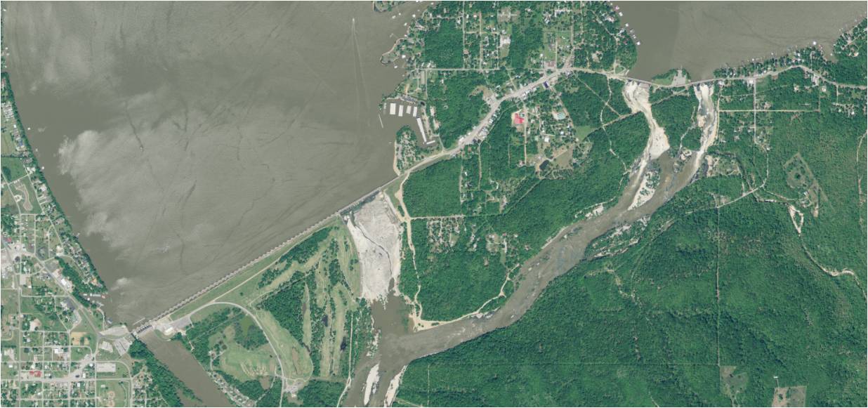
The Pensacola Dam, also known as the Grand River Dam, is a multiple-arch buttress dam located between the towns of Disney and Langley on the Grand River in Mayes County, Oklahoma. The dam is operated by the Grand River Dam Authority and creates Grand Lake o' the Cherokees. After decades of vision and planning, it was constructed between 1938 and 1940 for the purposes of hydroelectric power generation, flood control and recreation. It is Oklahoma's first hydroelectric power plant and is referred to as the longest multiple-arch dam in the world. Background The idea to construct a dam on the Grand River originated in the late 1800s with Henry C. Holderman, a Cherokee Nation citizen, who wanted to provide electric power to the Cherokee Nation. Holderman and a few colleagues soon conducted the first survey of the river in 1895 on their own handmade houseboat. Holderman later left the United States at the age of 16 and worked on dam projects in India and Africa before returning ... [...More Info...] [...Related Items...] OR: [Wikipedia] [Google] [Baidu] |
2019 Arkansas River Floods
Between May and June 2019, an extended sequence of heavy rainfall events over the South Central United States caused historic flooding along the Arkansas River and its tributaries. Major and record river flooding occurred primarily in northeastern Oklahoma, and the elevated flows continued downstream into Arkansas where they caused additional inundation. Antecedent soil moisture levels and water levels in lakes and streams were already high from previous rains, priming the region for significant runoff and flooding. The prolonged combination of high atmospheric moisture and a sustained weather pattern extending across the continental United States led to frequent high-yield rainfall over the Arkansas River watershed. The overarching weather pattern allowed moisture levels to quickly rebound after each sequential rainfall episode. With soils already saturated, the excess precipitation became surface runoff and flowed into the already elevated lakes and streams. Most rainfall o ... [...More Info...] [...Related Items...] OR: [Wikipedia] [Google] [Baidu] |
Great Flood Of 1951
In mid-July 1951, heavy rains led to a great rise of water in the Kansas River, Missouri River, and other surrounding areas of the Central United States. Flooding occurred in the Kansas, Neosho, Marais Des Cygnes, and Verdigris river basins. The damage in June and July 1951 across eastern Kansas and Missouri exceeded (equivalent to $ in ). The flooding killed 17 people and displaced 518,000. Flood The 1951 flood in Kansas began in May with the flood of the Big Creek, (a tributary of the Smoky Hill River) in Hays after of rain in two hours. The creek overflowed, flooding Hays (the location of Fort Hays State University) to a depth of in most locations inhabited by the students on campus, necessitating a midnight evacuation of the barracks by families on the G.I. Bill and dorms to the Stadium's third floor, which was still dry. Dr. Charles F. Wiest, Professor of Philosophy and Religion, and his seven-year-old daughter perished when their home caved in under the weight of ... [...More Info...] [...Related Items...] OR: [Wikipedia] [Google] [Baidu] |
Neosho River
The Neosho River is a tributary of the Arkansas River in eastern Kansas and northeastern Oklahoma in the United States. Its tributaries also drain portions of Missouri and Arkansas. The river is about long.U.S. Geological Survey. National Hydrography Dataset high-resolution flowline dataThe National Map accessed May 31, 2011 Via the Arkansas, it is part of the Mississippi River watershed. Its name is an Osage word meaning "clear water." The lower section is also known as the Grand River. Course The Neosho's headwaters are in Morris County, Kansas, and it flows southeast through Kansas. In Ottawa County, Oklahoma, the river turns south-southwest for the remainder of its course through Oklahoma. It meets the Arkansas River near the city of Muskogee, about a mile downstream of the confluence of the Arkansas River and the Verdigris River. The area of convergence of the three rivers Arkansas, Verdigris and Neosho is called "Three Forks." In Oklahoma the Neosho ends ... [...More Info...] [...Related Items...] OR: [Wikipedia] [Google] [Baidu] |
United States Census Bureau
The United States Census Bureau, officially the Bureau of the Census, is a principal agency of the Federal statistical system, U.S. federal statistical system, responsible for producing data about the American people and American economy, economy. The U.S. Census Bureau is part of the United States Department of Commerce, U.S. Department of Commerce and its Director of the United States Census Bureau, director is appointed by the president of the United States. Currently, Ron S. Jarmin is the acting director of the U.S. Census Bureau. The Census Bureau's primary mission is conducting the United States census, U.S. census every ten years, which allocates the seats of the United States House of Representatives, U.S. House of Representatives to the U.S. state, states based on their population. The bureau's various censuses and surveys help allocate over $675 billion in federal funds every year and it assists states, local communities, and businesses in making informed decisions. T ... [...More Info...] [...Related Items...] OR: [Wikipedia] [Google] [Baidu] |
New Orleans
New Orleans (commonly known as NOLA or The Big Easy among other nicknames) is a Consolidated city-county, consolidated city-parish located along the Mississippi River in the U.S. state of Louisiana. With a population of 383,997 at the 2020 United States census, 2020 census, it is the List of municipalities in Louisiana, most populous city in Louisiana and the French Louisiana region, the second-most populous in the Deep South, and the twelfth-most populous in the Southeastern United States. The city is coextensive with Orleans Parish, Louisiana, Orleans Parish. New Orleans serves as a major port and a commercial hub for the broader Gulf Coast of the United States, Gulf Coast region. The New Orleans metropolitan area has a population of approximately 1 million, making it the most populous metropolitan area in Louisiana and the List of metropolitan statistical areas, 59th-most populous in the United States. New Orleans is world-renowned for Music of New Orleans, its distincti ... [...More Info...] [...Related Items...] OR: [Wikipedia] [Google] [Baidu] |
Winnipeg
Winnipeg () is the capital and largest city of the Provinces and territories of Canada, Canadian province of Manitoba. It is centred on the confluence of the Red River of the North, Red and Assiniboine River, Assiniboine rivers. , Winnipeg had a city population of 749,607 and a metropolitan population of 834,678, making it Canada's List of the largest municipalities in Canada by population, sixth-largest city and List of census metropolitan areas and agglomerations in Canada, eighth-largest metropolitan area. The city is named after the nearby Lake Winnipeg; the name comes from the Cree language, Western Cree words for 'muddy water' – . The region was a trading centre for Indigenous peoples in Canada, Indigenous peoples long before the European colonization of the Americas, arrival of Europeans; it is the traditional territory of the Anishinaabe (Ojibway), Ininew (Cree), Oji-Cree, Dene, and Dakota people, Dakota, and is the birthplace of the Métis people in Canada, Métis ... [...More Info...] [...Related Items...] OR: [Wikipedia] [Google] [Baidu] |
Jefferson Highway
The Jefferson Highway was an automobile highway stretching through the central United States from New Orleans, Louisiana, to Winnipeg, Manitoba in Canada. The Jefferson Highway was replaced with the new numbered US Highway system in the late 1920s. Portions of the highway are still named Jefferson Highway, including the portions that run through Jefferson Parish, Louisiana; East Baton Rouge Parish, Louisiana; Lee's Summit, Missouri; Osseo, Minnesota; and Wadena, Minnesota. It was built in the 1910s as part of the National Auto Trail system. Named for President Thomas Jefferson, inspired by the east–west Lincoln Highway, it was nicknamed the "Palm to Pine Highway", for the varying types of trees found at either end. History The southern terminus of the Jefferson Highway was in New Orleans, Louisiana at the intersection of St. Charles Avenue and Common Street. It is marked by a six-foot tall Georgia granite obelisk donated by the New Orleans chapter of the Daughters o ... [...More Info...] [...Related Items...] OR: [Wikipedia] [Google] [Baidu] |
Quapaw
The Quapaw ( , Quapaw language, Quapaw: ) or Arkansas, officially the Quapaw Nation, is a List of federally recognized tribes in the United States, U.S. federally recognized tribe comprising about 6,000 citizens. Also known as the Ogáxpa or “Downstream” people, their ancestral homelands are traced from what is now the Ohio River, west to the Mississippi River to present-day St. Louis, south across present-day Arkansas and eastern and southern Oklahoma. The government Trail of Tears, forcibly removed them from Arkansas Territory in 1834. The Oklahoma Tribal Statistical Area, tribal Capital city, capital is Quapaw, Oklahoma, Quapaw, Oklahoma. Etymology The Quapaw broke from the other Dhegiha tribes and migrated down the Mississippi River into present-day Arkansas many generations before European contact. After that, the tribe began to refer to themselves Ogáxpa, which means the “Downstream” people." This was the name of their primary village or tribal band. Historicall ... [...More Info...] [...Related Items...] OR: [Wikipedia] [Google] [Baidu] |
United States Department Of The Interior
The United States Department of the Interior (DOI) is an United States federal executive departments, executive department of the Federal government of the United States, U.S. federal government responsible for the management and conservation of most federal lands and natural resources. It also administers programs relating to Native Americans in the United States, Native Americans, Alaska Natives, Native Hawaiians, territorial affairs, and insular areas of the United States, as well as programs related to historic preservation. About 75% of federal public land is managed by the department, with most of the remainder managed by the United States Department of Agriculture, Department of Agriculture's United States Forest Service, Forest Service. The department was created on March 3, 1849. It is headquartered at the Main Interior Building, located at 1849 C Street Northwest, Washington, D.C., NW in Washington, D.C. The department is headed by the United States Secretary of the ... [...More Info...] [...Related Items...] OR: [Wikipedia] [Google] [Baidu] |


