|
Megafloods
In geomorphology, an outburst flood—a type of megaflood—is a high-magnitude, low-frequency catastrophic flood involving the sudden release of a large quantity of water. During the last deglaciation, numerous glacial lake outburst floods were caused by the collapse of either ice sheets or glaciers that formed the dams of proglacial lakes. Examples of older outburst floods are known from the geological past of the Earth and inferred from geomorphological evidence on Mars. Landslides, lahars, and volcanic dams can also block rivers and create lakes, which trigger such floods when the rock or earthen barrier collapses or is eroded. Lakes also form behind glacial moraines or ice dams, which can collapse and create outburst floods. Definition and classification Megafloods are paleofloods (past floods) that involved rates of water flow larger than those in the historical record. They are studied through the sedimentary deposits and the erosional and constructional landforms that i ... [...More Info...] [...Related Items...] OR: [Wikipedia] [Google] [Baidu] |
Zanclean Flood
The Zanclean flood or Zanclean deluge is theorized to have refilled the Mediterranean Sea 5.33 million years ago. This flooding ended the Messinian salinity crisis and reconnected the Mediterranean Sea to the Atlantic Ocean, although it is possible that even before the flood there were partial connections to the Atlantic Ocean. The re-connection marks the beginning of the Zanclean age (geology), age which is the name given to the earliest age on the geologic time scale of the Pliocene. According to this model, water from the Atlantic Ocean refilled the Endorheic basin, dried-up basin through the modern-day Strait of Gibraltar. Ninety percent of the Mediterranean Basin flooding occurred abruptly during a period estimated to have been between several months and two years, following low water discharges that could have lasted for several thousand years. Sea level rise in the basin may have reached rates at times greater than . Based on the erosion features preserved until mod ... [...More Info...] [...Related Items...] OR: [Wikipedia] [Google] [Baidu] |
Paleoflooding
The phenomenon of paleoflooding is apparent in the geologic record over various spatial and temporal scales. It often occurred on a large scale, and was the result of either glacial ice melt causing large outbursts of freshwater, or high sea levels breaching bodies of freshwater. If a freshwater outflow event was large enough that the water reached the ocean system, it caused changes in salinity that potentially affected ocean circulation and global climate. Freshwater flows could also accumulate to form continental glacial lakes, and this is another indicator of large-scale flooding. In contrast, periods of high global sea level (often during interglacials) could cause marine water to breach natural dams and flow into bodies of freshwater. Changes in salinity of freshwater and marine bodies can be detected from the analysis of organisms that inhabited those bodies at a given time, as certain organisms are more suited to live in either fresh or saline conditions. Paleoflooding resul ... [...More Info...] [...Related Items...] OR: [Wikipedia] [Google] [Baidu] |
Lake Agassiz
Lake Agassiz ( ) was a large proglacial lake that existed in central North America during the late Pleistocene, fed by meltwater from the retreating Laurentide Ice Sheet at the end of the last glacial period. At its peak, the lake's area was larger than all of the modern Great Lakes combined. It eventually drained into what is now Hudson Bay, leaving behind Lake Winnipeg, Lake Winnipegosis, Lake Manitoba, and Lake of the Woods. First postulated in 1823 by William H. Keating, it was named by Warren Upham in 1879 after Louis Agassiz, the then recently deceased (1873) founder of glaciology, when Upham recognized that the lake was formed by glacial action. Geological progression During the last glacial maximum, northern North America was covered by an ice sheet, which alternately advanced and retreated with variations in the climate. This continental ice sheet formed during the period now known as the Wisconsin glaciation, and covered much of central North America betw ... [...More Info...] [...Related Items...] OR: [Wikipedia] [Google] [Baidu] |
Pantai Remis Landslide
The Pantai Remis landslide was a rock fall and flood that occurred on 21 October 1993, near Pantai Remis in Perak, Malaysia. The landslide took place in an abandoned open cast tin mine (in a region of the state well known for its tin mining industry) close to the Strait of Malacca. Video footage shows the rapid collapse of the working face closest the sea, allowing complete flooding of the mine and forming a new cove measuring approximately . YouTube video A video of the event was uploaded to YouTube on 17 May 2007. The accompanying description in Cantonese reads: Prof. Dave Petley, the Wilson Chair in Hazard and Risk in the Department of Geography at the University of Durham Durham University (legally the University of Durham) is a collegiate public research university in Durham, England, founded by an Act of Parliament in 1832 and incorporated by royal charter in 1837. It was the first recognised university to ..., England, and founder and director of the Internation ... [...More Info...] [...Related Items...] OR: [Wikipedia] [Google] [Baidu] |
Lake Bonneville
Lake Bonneville was the largest Late Pleistocene paleolake in the Great Basin of western North America. It was a pluvial lake that formed in response to an increase in precipitation and a decrease in evaporation as a result of cooler temperatures. The lake covered much of what is now western Utah and at its highest level extended into present-day Idaho and Nevada. Many other hydrographically closed basins in the Great Basin contained expanded lakes during the Late Pleistocene, including Lake Lahontan in northwestern Nevada. Geologic description Shorelines of Lake Bonneville are visible above Salt Lake City along the western front of the Wasatch Mountains and on other mountains throughout the Bonneville basin.Gilbert, G.K., 1890. Lake Bonneville. U.S. Geological Survey Monograph 1. 438 pp. These shorelines appear as shelves or benches that protrude from the mountainside above the valley floor, are visible on the ground from long distances and on satellite images, and have both ... [...More Info...] [...Related Items...] OR: [Wikipedia] [Google] [Baidu] |
Flood Myth
A flood myth or a deluge myth is a myth in which a great flood, usually sent by a deity or deities, destroys civilization, often in an act of divine retribution. Parallels are often drawn between the flood waters of these Mythology, myths and the primeval Abzu, cosmic ocean which appear in certain creation myths, as the flood waters are described as a measure for the social cleansing, cleansing of humanity, for example in preparation for wikt:rebirth, rebirth. Most flood myths also contain a culture hero, who "represents the human craving for life". The oldest known narrative of a List of flood myths, divinely inititated flood originates from the Sumer, Sumerian culture in Mesopotamia, among others expressed in the Akkadian Atra-Hasis, Athra-Hasis epic, which dates to the 18th century BCE. Comparable flood narratives appear in many other cultures, including the biblical Genesis flood narrative, ''manvantara-sandhya'' in Hinduism, Deucalion and Pyrrha in Greek mythology, also ... [...More Info...] [...Related Items...] OR: [Wikipedia] [Google] [Baidu] |
Jökulhlaup
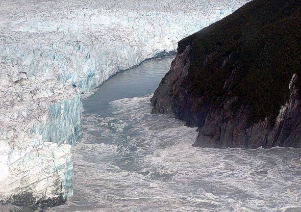
A jökulhlaup ( ) (literally "glacial run") is a type of glacial outburst flood. It is an Icelandic term that has been adopted in glaciological terminology in many languages. It originally referred to the well-known subglacial outburst floods from Vatnajökull, Iceland, which are triggered by geothermal heating and occasionally by a volcanic subglacial eruption, but it is now used to describe any large and abrupt release of water from a subglacial or proglacial lake/reservoir. Since jökulhlaups emerge from hydrostatically sealed lakes with floating levels far above the threshold, their peak discharge can be much larger than that of a marginal or extra-marginal lake burst. The hydrograph of a jökulhlaup from Vatnajökull typically either climbs over a period of weeks with the largest flow near the end, or it climbs much faster during the course of some hours. These patterns are suggested to reflect channel melting, and sheet flow under the front, respectively. Similar p ... [...More Info...] [...Related Items...] OR: [Wikipedia] [Google] [Baidu] |
Black Sea Deluge Hypothesis
The Black Sea deluge is the best known of three hypothetical flood scenarios proposed for the Late Quaternary history of the Black Sea. One other flood scenario proposes a rapid, even catastrophic, rise in sea level of the Black Sea. History In 1997, William Ryan, Walter Pitman, Petko Dimitrov, and their colleagues first published the ''Black Sea deluge hypothesis''. They proposed that a catastrophic inflow of Mediterranean seawater into the Black Sea freshwater lake occurred around 7,600 years ago, . As proposed, the Early Holocene Black Sea flood scenario describes events that would have profoundly affected prehistoric settlement in Eastern Europe and adjacent parts of Asia and possibly was the basis of oral history concerning the myth of Noah's flood. Some archaeologists support this theory as an explanation for the lack of Neolithic sites in northern Turkey. In 2003, Ryan and coauthors revised the dating of the early Holocene flood to 8,800 years ago, . Before that date ... [...More Info...] [...Related Items...] OR: [Wikipedia] [Google] [Baidu] |
Dadu River (Sichuan)
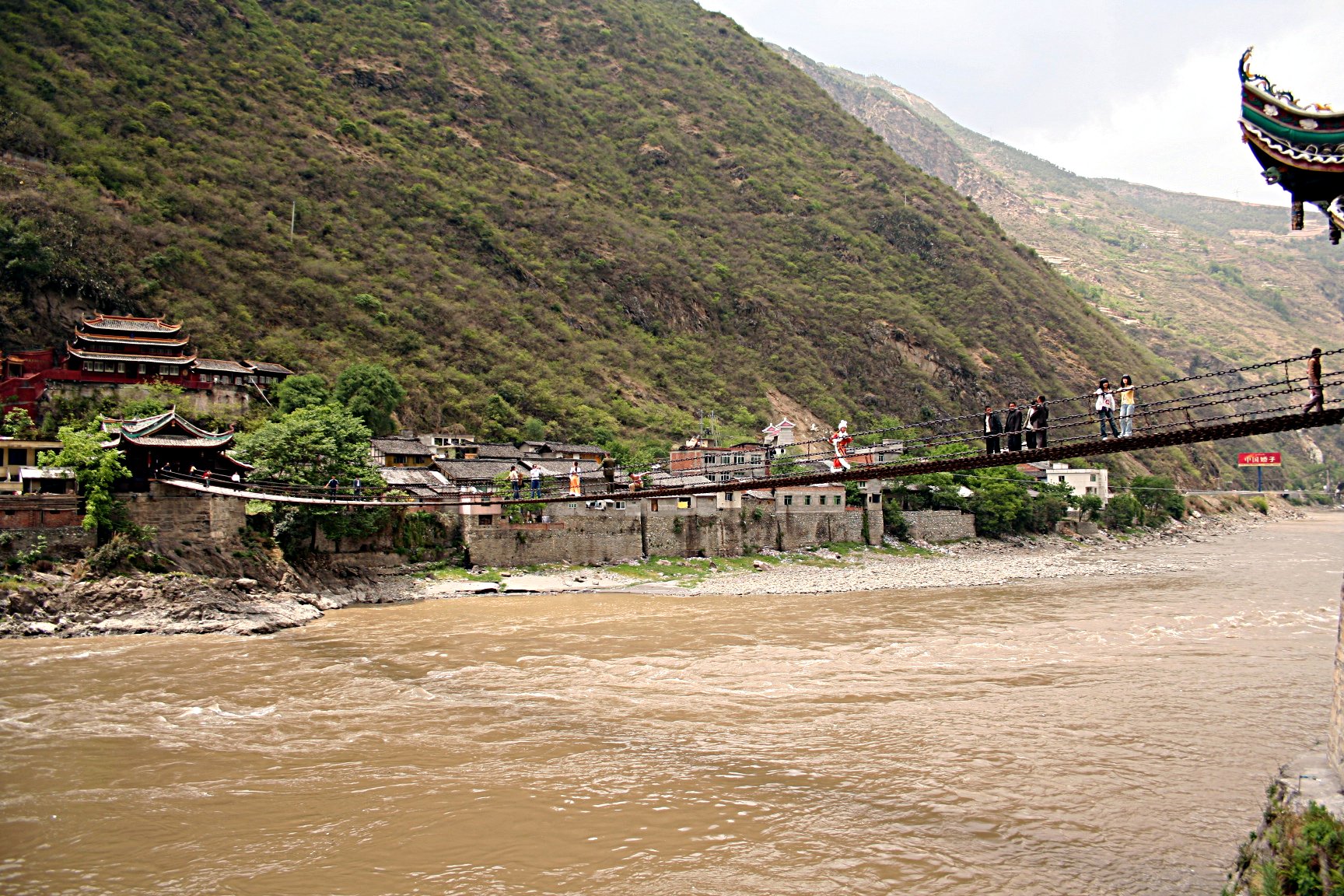
The Dadu River (, ), known in Tibetan as the Gyelmo Ngul Chu (), is a major river located primarily in Sichuan province, southwestern China. The Dadu flows from the eastern Tibetan Plateau into the Sichuan Basin where it joins with the Min River, a tributary of the Yangtze River. Measured from its geographic source, the Dadu is actually longer than the Min River, with a total length of and thus forms the main stem of the Min River system. Shuangjiangkou Dam, expected to be the tallest dam in the world, is being built on the Dadu River. Geography Sources The Dadu River originates, in name, in Danba and ends in Leshan where it meets the Min River. The true source of Dadu, and thus the entire Min River system, however, lies in Qinghai Province in the eastern Tibetan Plateau. In this region there are multiple headwaters of the Dadu with nearly identical lengths that have resulted in competing claims as the true source of the Dadu. In 2013, the China Academy of Sciences ann ... [...More Info...] [...Related Items...] OR: [Wikipedia] [Google] [Baidu] |
Postglacial Rebound
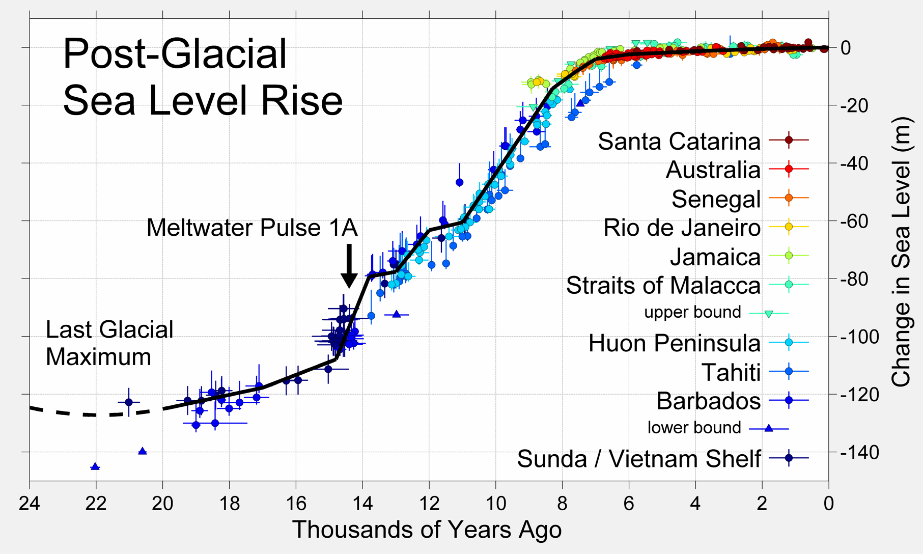
Post-glacial rebound (also called isostatic rebound or crustal rebound) is the rise of land masses after the removal of the huge weight of ice sheets during the last glacial period, which had caused isostatic depression. Post-glacial rebound and isostatic depression are phases of glacial isostasy (glacial isostatic adjustment, glacioisostasy), the deformation of the Earth's crust in response to changes in ice mass distribution. The direct raising effects of post-glacial rebound are readily apparent in parts of Northern Eurasia, Northern America, Patagonia, and Antarctica. However, through the processes of ''ocean siphoning'' and ''continental levering'', the effects of post-glacial rebound on sea level are felt globally far from the locations of current and former ice sheets.Milne, G.A., and J.X. Mitrovica (2008) ''Searching for eustasy in deglacial sea-level histories.'' Quaternary Science Reviews. 27:2292–2302. Overview During the last glacial period, much of northern E ... [...More Info...] [...Related Items...] OR: [Wikipedia] [Google] [Baidu] |
Geomorphology
Geomorphology () is the scientific study of the origin and evolution of topographic and bathymetric features generated by physical, chemical or biological processes operating at or near Earth's surface. Geomorphologists seek to understand why landscapes look the way they do, to understand landform and terrain history and dynamics and to predict changes through a combination of field observations, physical experiments and numerical modeling. Geomorphologists work within disciplines such as physical geography, geology, geodesy, engineering geology, archaeology, climatology, and geotechnical engineering. This broad base of interests contributes to many research styles and interests within the field. Overview Earth's surface is modified by a combination of surface processes that shape landscapes, and geologic processes that cause tectonic uplift and subsidence, and shape the coastal geography. Surface processes comprise the action of water, wind, ice, wildfire, and lif ... [...More Info...] [...Related Items...] OR: [Wikipedia] [Google] [Baidu] |
Esker
An esker, eskar, eschar, or os, sometimes called an ''asar'', ''osar'', or ''serpent kame'', is a long, winding ridge of stratified sand and gravel, examples of which occur in glaciated and formerly glaciated regions of Europe and North America. Eskers are frequently several kilometres long and, because of their uniform shape, look like railway embankments. Etymology The term ''esker'' is derived from the Irish word (), which means "ridge or elevation, especially one separating two plains or depressed surfaces". The Irish word was and is used particularly to describe long sinuous ridges, which are now known to be deposits of fluvio-glacial material. The best-known example of such an ''eiscir'' is the '' Eiscir Riada'', which runs nearly the whole width of Ireland from Dublin to Galway, a distance of , and is still closely followed by the main Dublin–Galway road The synonym ''os'' comes from the Swedish word , "ridge". Geology Most eskers are argued to have formed with ... [...More Info...] [...Related Items...] OR: [Wikipedia] [Google] [Baidu] |


