|
Meade, Ohio
Meade or Mutton Jerk or Salem is an unincorporated community in Pickaway Township, Pickaway County, Ohio, United States. Meade is located at the intersection of State Route 159 and Hayesville Rd. (Pickaway County Rd. #11). Its population is 79. Its children attend school in the Logan Elm Local School District. The nearest towns are Kingston ( Ross County) and Circleville (Pickaway County). Meade has only one commercial building, which is the Salem United Methodist Church The United Methodist Church (UMC) is a worldwide mainline Protestant Christian denomination, denomination based in the United States, and a major part of Methodism. In the 19th century, its main predecessor, the Methodist Episcopal Church, was .... Its central thoroughfare is Hayesville Road. Meade has previously gone by the names Mutton Jerk and Salem. A post office called Meade was established in 1892, and remained in operation until 1903. Gallery File:MeadeOhio1.JPG, Salem United Methodist Church in ... [...More Info...] [...Related Items...] OR: [Wikipedia] [Google] [Baidu] |
Unincorporated Area
An unincorporated area is a parcel of land that is not governed by a local general-purpose municipal corporation. (At p. 178.) They may be governed or serviced by an encompassing unit (such as a county) or another branch of the state (such as the military). There are many unincorporated communities and areas in the United States and Canada, but many countries do not use the concept of an unincorporated area. By country Argentina In Argentina, the provinces of Chubut Province, Chubut, Córdoba Province (Argentina), Córdoba, Entre Ríos Province, Entre Ríos, Formosa Province, Formosa, Neuquén Province, Neuquén, Río Negro Province, Río Negro, San Luis Province, San Luis, Santa Cruz Province, Argentina, Santa Cruz, Santiago del Estero Province, Santiago del Estero, Tierra del Fuego Province, Argentina, Tierra del Fuego, and Tucumán Province, Tucumán have areas that are outside any municipality or commune. Australia Unlike many other countries, Australia has only local go ... [...More Info...] [...Related Items...] OR: [Wikipedia] [Google] [Baidu] |
Pickaway Township, Pickaway County, Ohio
Pickaway Township is one of the fifteen townships of Pickaway County, Ohio, United States. The 2020 census found 2,036 people in the township. Geography Located in the southeastern part of the county, it borders the following townships: * Circleville Township - north, west of Washington Township * Washington Township - north, east of Circleville Township * Clearcreek Township, Fairfield County - northeast corner * Salt Creek Township - east * Colerain Township, Ross County - southeast corner * Green Township, Ross County - south * Union Township, Ross County - southwest * Wayne Township - northwest No municipalities are located in Pickaway Township. Name and history It is the only Pickaway Township statewide. Government The township is governed by a three-member board of trustees, who are elected in November of odd-numbered years to a four-year term beginning on the following January 1. Two are elected in the year after the presidential election and one is elected in the yea ... [...More Info...] [...Related Items...] OR: [Wikipedia] [Google] [Baidu] |
Pickaway County, Ohio
Pickaway County is a County (United States), county in the U.S. state of Ohio. As of the 2020 United States census, 2020 census, the population was 58,539. Its county seat is Circleville, Ohio, Circleville. Its name derives from the Pekowi band of Shawnee Indians, who inhabited the area. (See List of Ohio county name etymologies.) Pickaway County is part of the Columbus, Ohio Metropolitan Area, Columbus, OH Metropolitan Statistical Area. History The future state of Ohio was part of the Northwest Territory, created in 1787. To begin providing local control of this area, several counties were designated, among them Washington County, Ohio, Washington (1788) and Wayne County, Ohio, Wayne (1796) Counties. Portions of these counties were partitioned off to create Ross County, Ohio, Ross (1798), Fairfield County, Ohio, Fairfield (1800), and Franklin County, Ohio, Franklin (1803) Counties. An act of the General Assembly of Ohio (January 12, 1810) directed that portions of Fairfield ... [...More Info...] [...Related Items...] OR: [Wikipedia] [Google] [Baidu] |
Ohio
Ohio ( ) is a U.S. state, state in the Midwestern United States, Midwestern region of the United States. It borders Lake Erie to the north, Pennsylvania to the east, West Virginia to the southeast, Kentucky to the southwest, Indiana to the west, and Michigan to the northwest. Of the 50 List of states and territories of the United States, U.S. states, it is the List of U.S. states and territories by area, 34th-largest by area. With a population of nearly 11.9 million, Ohio is the List of U.S. states and territories by population, seventh-most populous and List of U.S. states and territories by population density, tenth-most densely populated state. Its List of capitals in the United States, capital and List of cities in Ohio, most populous city is Columbus, Ohio, Columbus, with the two other major Metropolitan statistical area, metropolitan centers being Cleveland and Cincinnati, alongside Dayton, Ohio, Dayton, Akron, Ohio, Akron, and Toledo, Ohio, Toledo. Ohio is nicknamed th ... [...More Info...] [...Related Items...] OR: [Wikipedia] [Google] [Baidu] |
United States
The United States of America (USA), also known as the United States (U.S.) or America, is a country primarily located in North America. It is a federal republic of 50 U.S. state, states and a federal capital district, Washington, D.C. The 48 contiguous states border Canada to the north and Mexico to the south, with the semi-exclave of Alaska in the northwest and the archipelago of Hawaii in the Pacific Ocean. The United States asserts sovereignty over five Territories of the United States, major island territories and United States Minor Outlying Islands, various uninhabited islands in Oceania and the Caribbean. It is a megadiverse country, with the world's List of countries and dependencies by area, third-largest land area and List of countries and dependencies by population, third-largest population, exceeding 340 million. Its three Metropolitan statistical areas by population, largest metropolitan areas are New York metropolitan area, New York, Greater Los Angeles, Los Angel ... [...More Info...] [...Related Items...] OR: [Wikipedia] [Google] [Baidu] |
Ohio State Route 159
State Route 159 (SR 159) is a northeast-southwest state highway (signed north–south) in the south-central portion of the U.S. state of Ohio. Its southern terminus is in Chillicothe at the U.S. Route 50 and State Route 104 concurrency; its northern terminus is at U.S. Route 22 approximately southwest of Lancaster. History SR 159 was original signed in 1923, on much of its current alignment. In 1927 the route was extended south to US 23, along the alignment of former State Route 27. The first section of road paved was in 1933 and it was a section from the southern terminus to Meade. In 1935 the second section was paved between Meade and Tarlton. The final section of the roadway was paved between Tarlton and the northern terminus, in 1938. The route was extended north to its current terminus along the former alignment of U.S. Route 22, in 1971. In 1972 the highway was extended south to its current terminus along the former alignment of U.S. Route 23. A constr ... [...More Info...] [...Related Items...] OR: [Wikipedia] [Google] [Baidu] |
Kingston, Ohio
Kingston is a village in Ross County, Ohio, United States. The population was 1,262 at the 2020 census. Kingston was platted in 1816. Geography According to the United States Census Bureau, the village has a total area of , all land. Demographics 2010 census As of the census of 2010, there were 1,032 people, 458 households, and 299 families living in the village. The population density was . There were 503 housing units at an average density of . The racial makeup of the village was 98.8% White, 0.6% African American, 0.2% from other races, and 0.4% from two or more races. Hispanic or Latino of any race were 1.5% of the population. There were 458 households, of which 29.7% had children under the age of 18 living with them, 46.1% were married couples living together, 12.4% had a female householder with no husband present, 6.8% had a male householder with no wife present, and 34.7% were non-families. 29.5% of all households were made up of individuals, and 16.8% had someone ... [...More Info...] [...Related Items...] OR: [Wikipedia] [Google] [Baidu] |
Ross County, Ohio
Ross County is a county in the Appalachian region of the U.S. state of Ohio. As of the 2020 United States census, the population was 77,093. Its county seat is Chillicothe, the first and third capital of Ohio. Established on August 20, 1798, the county is named for Federalist Senator James Ross of Pennsylvania. Ross County comprises the Chillicothe, OH Micropolitan Statistical Area, which is also included in the Columbus-Marion-Zanesville, OH Combined Statistical Area. History Ross County was formed by proclamation of Governor St. Clair, August 20, 1798, being the sixth county formed in the Northwest Territory. Ross County was described by Ephraim George Squier and Edwin Hamilton Davis as having almost "one hundred enclosures of various sizes, and five hundred mounds" in their book, ''Ancient Monuments of the Mississippi Valley'' (1848). They described the Indian-built earthworks as ranging from in size, and enclosures of large. These included Serpent Mound, For ... [...More Info...] [...Related Items...] OR: [Wikipedia] [Google] [Baidu] |
Circleville, Ohio
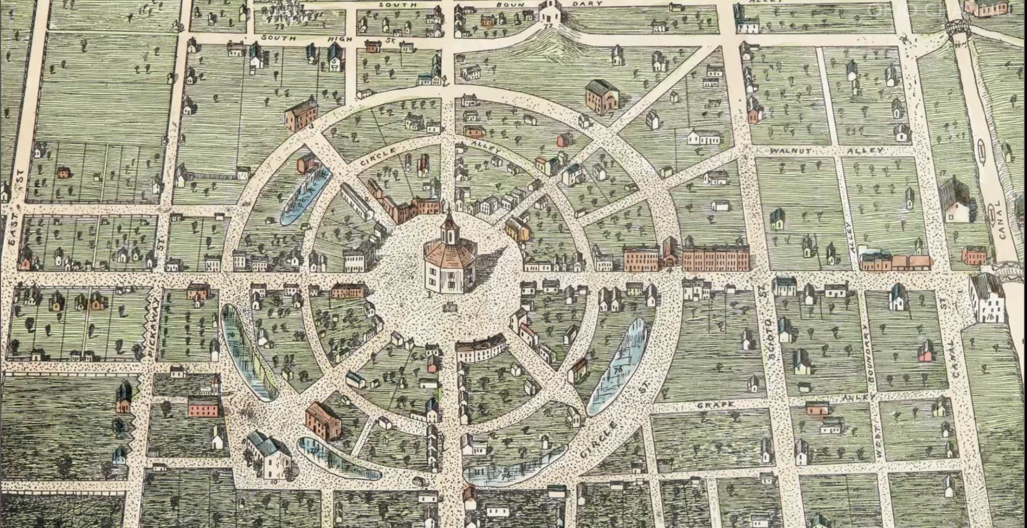
Circleville is a city in Pickaway County, Ohio, United States, and its county seat. The city is situated along the Scioto River 25 miles (40 km) south of Columbus, Ohio, Columbus. The population was 13,927 at the 2020 United States census, 2020 census. Circleville is named after its original layout created in 1810, which was based upon the circular Hopewell tradition Earthworks (engineering), earthwork within which the city was built. This earthwork measured in diameter, and was constructed in the early centuries of the Common Era. The county courthouse was built in the center of the innermost circle. In the late 1830s, for various reasons, residents requested authorisation from the state legislature to change Circleville's layout to a standard grid format. This was accomplished by the mid-1850s. All traces of the Hopewell earthwork were destroyed, although hundreds of other monuments of its kind still remain in the Ohio Valley. History Early history By the mid-18th centu ... [...More Info...] [...Related Items...] OR: [Wikipedia] [Google] [Baidu] |
United Methodist Church
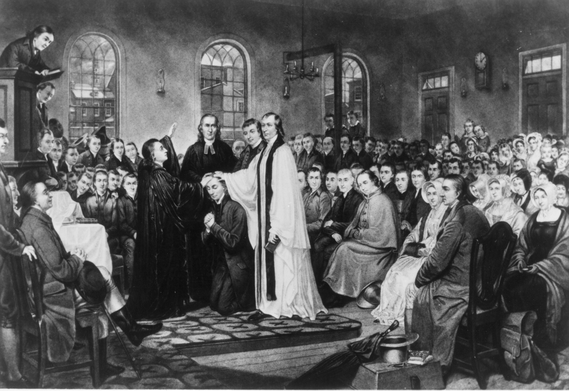
The United Methodist Church (UMC) is a worldwide mainline Protestant Christian denomination, denomination based in the United States, and a major part of Methodism. In the 19th century, its main predecessor, the Methodist Episcopal Church, was a leader in evangelicalism. The present denomination was founded in 1968 in Dallas by union of the Methodist Church (USA), Methodist Church and the Evangelical United Brethren Church. The UMC traces its roots back to the Christian revival, revival movement of John Wesley, John and Charles Wesley in England, as well as the First Great Awakening, Great Awakening in the United States. As such, the church's theological orientation is decidedly Wesleyan theology, Wesleyan. It embraces Christian liturgy, liturgical worship, Holiness movement, holiness, and evangelical elements. The United Methodist Church has a Connectionalism, connectional polity, a typical feature of a number of Methodist denominations. It is organized into Conferences in Meth ... [...More Info...] [...Related Items...] OR: [Wikipedia] [Google] [Baidu] |
Unincorporated Communities In Pickaway County, Ohio
Unincorporated may refer to: * Unincorporated area, land not governed by a local municipality * Unincorporated entity, a type of organization * Unincorporated territories of the United States, territories under U.S. jurisdiction, to which Congress has determined that only select parts of the U.S. Constitution apply * Unincorporated association Unincorporated association refers to a group of people in common law jurisdictions—such as the United Kingdom, Canada, and New Zealand—who organize around a shared purpose without forming a corporation or similar legal entity. Unlike in some ..., also known as voluntary association, groups organized to accomplish a purpose * ''Unincorporated'' (album), a 2001 album by Earl Harvin Trio {{disambig ... [...More Info...] [...Related Items...] OR: [Wikipedia] [Google] [Baidu] |


