|
Mastodon Township, Michigan
Mastodon Township is a civil township of Iron County in the U.S. state of Michigan. As of the 2000 census, the township population was 668, and by 2020 its population was 576. Mastodon was so named from the fact mastodon bones were discovered when sinking a mine shaft. Mastodon may have also been named for the size of the large, iron ore body which was struck at the mine site; as "Mastodon" at that time, being a relatively new discovery, was also being used as a slang adjective, meaning large/huge. Geography The Brule River forms the southern boundary of the township, with the Town of Florence in Florence County, Wisconsin on the other side of the river. According to the United States Census Bureau, the township has a total area of , of which is land and (6.47%) is water. Communities *The village of Alpha Alpha (uppercase , lowercase ) is the first letter of the Greek alphabet. In the system of Greek numerals, it has a value of one. Alpha is derived from the ... [...More Info...] [...Related Items...] OR: [Wikipedia] [Google] [Baidu] |
Civil Township
A civil township is a widely used unit of local government in the United States that is subordinate to a County (United States), county, most often in the northern and midwestern parts of the country. The term town is used in New England town, New England, Political subdivisions of New York State#Town, New York, as well as Political subdivisions of Wisconsin#Town, Wisconsin to refer to the equivalent of the civil township in these states; Minnesota uses "town" officially but often uses it and "township" interchangeably. Specific responsibilities and the degree of Wiktionary:autonomy, autonomy vary in each U.S. state, state. Civil townships are distinct from survey townships, but in states that have both, the boundaries often coincide, especially in Indiana, Ohio, and Illinois, and may completely geographically subdivide a county. The United States Census Bureau, U.S. Census Bureau classifies civil townships as minor civil divisions. Currently, there are 20 states with civil townshi ... [...More Info...] [...Related Items...] OR: [Wikipedia] [Google] [Baidu] |
Wisconsin
Wisconsin ( ) is a U.S. state, state in the Great Lakes region, Great Lakes region of the Upper Midwest of the United States. It borders Minnesota to the west, Iowa to the southwest, Illinois to the south, Lake Michigan to the east, Michigan to the northeast, and Lake Superior to the north. With a population of about 6 million and an area of about 65,500 square miles, Wisconsin is the List of U.S. states and territories by population, 20th-largest state by population and the List of U.S. states and territories by area, 23rd-largest by area. It has List of counties in Wisconsin, 72 counties. Its List of municipalities in Wisconsin by population, most populous city is Milwaukee; its List of capitals in the United States, capital and second-most populous city is Madison, Wisconsin, Madison. Other urban areas include Green Bay, Wisconsin, Green Bay, Kenosha, Wisconsin, Kenosha, Racine, Wisconsin, Racine, Eau Claire, Wisconsin, Eau Claire, and the Fox Cities. Geography of Wiscon ... [...More Info...] [...Related Items...] OR: [Wikipedia] [Google] [Baidu] |
Florence County, Wisconsin
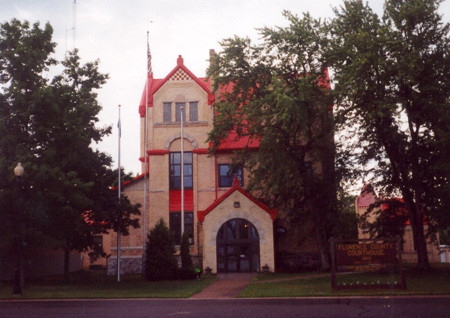
Florence County is a county (United States), county located in the U.S. state of Wisconsin. As of the 2020 United States census, 2020 census, the population was 4,558, making it the second-least populous county in Wisconsin after Menominee County, Wisconsin, Menominee County. Its county seat is Florence (CDP), Wisconsin, Florence. The county is considered a high-recreation retirement destination by the U.S. Department of Agriculture. Florence County is part of the Iron Mountain, Michigan, Iron Mountain, Michigan, MI–WI Iron Mountain micropolitan area, Micropolitan Statistical Area. History Florence County was created by the legislature of 1882 from portions of Marinette County, Wisconsin, Marinette County and Oconto County, Wisconsin, Oconto County. The first white man to document his journey through Florence County was Thomas J. Cram, who surveyed northeast Wisconsin in 1840 and 1841. The region belonged to the Menominee tribe, who mingled with the Chippewa there. Florence C ... [...More Info...] [...Related Items...] OR: [Wikipedia] [Google] [Baidu] |
Florence (town), Wisconsin
Florence is a town in Florence County, Wisconsin, Florence County, Wisconsin, United States. The population was 2,319 at the 2000 census. The ZIP code is 54121. Florence (CDP), Wisconsin, Florence is also the name of a census-designated place within the town about northwest of Iron Mountain, Michigan, Iron Mountain, Michigan; the community is the county seat of Florence County. The unincorporated communities of Hematite, Wisconsin, Hematite, Pulp, Wisconsin, Pulp, Ridgetop, Wisconsin, Ridgetop, Spread Eagle, Wisconsin, Spread Eagle, and Tyran, Wisconsin, Tyran are also located in the town. History Florence and the area surrounding belonged to the Menominee and was a hunting and trapping region until iron was discovered there in the 1870s. The Florence Mine was discovered in October 1874 by H. D. Fisher. The mine was named in 1879 after the wife of Nelson Powell Hulst, Florence Terry Hulst. The county subsequently took on the same name. Geography According to the United States ... [...More Info...] [...Related Items...] OR: [Wikipedia] [Google] [Baidu] |
Brule River
The Brule River is a U.S. Geological Survey. National Hydrography Dataset high-resolution flowline dataThe National Map, accessed December 19, 2011 river in the U.S. states of Michigan and Wisconsin. Nearly, almost all of the course forms a portion of the boundary between the two states. The Brule begins at Brule Lake, just inside the Michigan border, at . It winds east and southeast until joining with the Michigamme River at to form the Menominee River and on into Lake Michigan Lake Michigan ( ) is one of the five Great Lakes of North America. It is the second-largest of the Great Lakes by volume () and depth () after Lake Superior and the third-largest by surface area (), after Lake Superior and Lake Huron. To the .... The Brule River is stocked with many types of trout. These include Brook, and Brown trout The Brule is popular for canoeing, spanning about with several stop/start points somewhat evenly spread out. The Brule's flow is much more reliable compar ... [...More Info...] [...Related Items...] OR: [Wikipedia] [Google] [Baidu] |
Mastodon
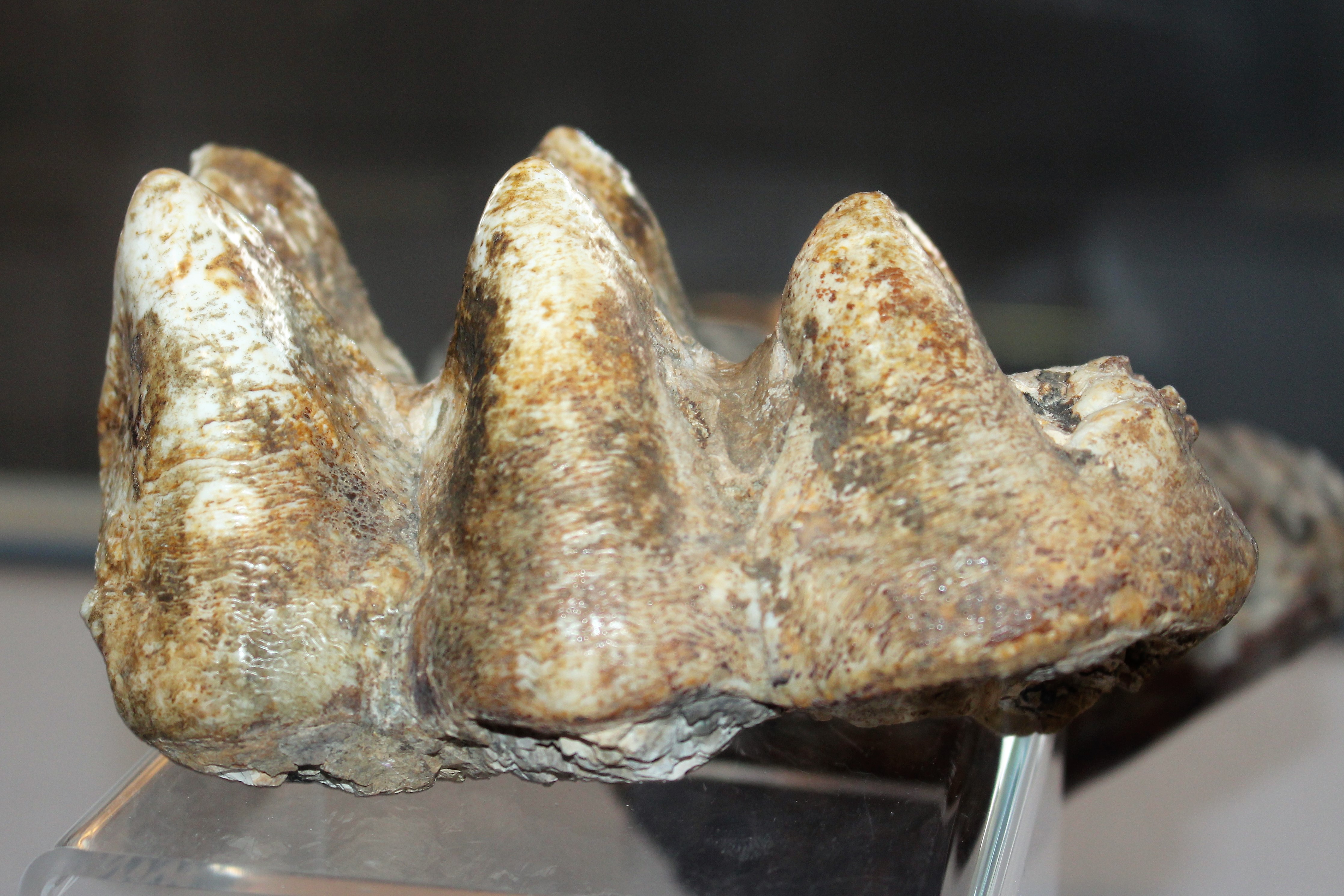
A mastodon, from Ancient Greek μαστός (''mastós''), meaning "breast", and ὀδούς (''odoús'') "tooth", is a member of the genus ''Mammut'' (German for 'mammoth'), which was endemic to North America and lived from the late Miocene to the early Holocene. Mastodons belong to the order Proboscidea, the same order as elephants and mammoths (which belong to the family Elephantidae). ''Mammut'' is the type genus of the extinct family Mammutidae, which diverged from the ancestors of modern elephants at least 27–25 million years ago, during the Oligocene. Like other members of Mammutidae, the molar (tooth), molar teeth of mastodons have zygodont morphology (where parallel pairs of cusp (anatomy), cusps are merged into sharp ridges), which strongly differ from those of elephantids. In comparison to its likely ancestor ''Zygolophodon'', ''Mammut'' is characterized by particularly long and upward curving upper tusks, reduced or absent tusks on the lower jaw, as well a ... [...More Info...] [...Related Items...] OR: [Wikipedia] [Google] [Baidu] |
Geographic Names Information System
The Geographic Names Information System (GNIS) is a database of name and location information about more than two million physical and cultural features, encompassing the United States and its territories; the Compact of Free Association, associated states of the Marshall Islands, Federated States of Micronesia, and Palau; and Antarctica. It is a type of gazetteer. It was developed by the United States Geological Survey (USGS) in cooperation with the United States Board on Geographic Names (BGN) to promote the standardization of feature names. Data were collected in two phases. Although a third phase was considered, which would have handled name changes where local usages differed from maps, it was never begun. The database is part of a system that includes topographic map names and bibliographic references. The names of books and historic maps that confirm the feature or place name are cited. Variant names, alternatives to official federal names for a feature, are also recor ... [...More Info...] [...Related Items...] OR: [Wikipedia] [Google] [Baidu] |
Iron County, Michigan
Iron County is one of two landlocked County (United States), counties in the Upper Peninsula of Michigan, Upper Peninsula of the U.S. state of Michigan. As of the 2020 United States census, 2020 census, the population was 11,631. The county seat is Crystal Falls, Michigan, Crystal Falls. History Iron County was organized in 1885, with territory partitioned from Marquette County, Michigan, Marquette and Menominee County, Michigan, Menominee counties. In 1890, the county's population was 4,432. It was named for the valuable iron ore found within its borders. Geography According to the United States Census Bureau, U.S. Census Bureau, the county has an area of , of which is land and (3.7%) is water. Along with its southeastern neighbor Dickinson County, Michigan, Dickinson County, it is one of only two landlocked counties in the Upper Peninsula of Michigan, Upper Peninsula. Major highways * – runs east–west through lower part of county. Enters west line at above SW corner ... [...More Info...] [...Related Items...] OR: [Wikipedia] [Google] [Baidu] |
United States Census Bureau
The United States Census Bureau, officially the Bureau of the Census, is a principal agency of the Federal statistical system, U.S. federal statistical system, responsible for producing data about the American people and American economy, economy. The U.S. Census Bureau is part of the United States Department of Commerce, U.S. Department of Commerce and its Director of the United States Census Bureau, director is appointed by the president of the United States. Currently, Ron S. Jarmin is the acting director of the U.S. Census Bureau. The Census Bureau's primary mission is conducting the United States census, U.S. census every ten years, which allocates the seats of the United States House of Representatives, U.S. House of Representatives to the U.S. state, states based on their population. The bureau's various censuses and surveys help allocate over $675 billion in federal funds every year and it assists states, local communities, and businesses in making informed decisions. T ... [...More Info...] [...Related Items...] OR: [Wikipedia] [Google] [Baidu] |
Federal Information Processing Standard
The Federal Information Processing Standards (FIPS) of the United States are a set of publicly announced standards that the National Institute of Standards and Technology (NIST) has developed for use in computer systems of non-military United States government agencies and contractors. FIPS standards establish requirements for ensuring computer security and interoperability, and are intended for cases in which suitable industry standards do not already exist. Many FIPS specifications are modified versions of standards the technical communities use, such as the American National Standards Institute (ANSI), the Institute of Electrical and Electronics Engineers (IEEE), and the International Organization for Standardization (ISO). Specific areas of FIPS standardization The U.S. government has developed various FIPS specifications to standardize a number of topics including: * Codes, e.g., FIPS county codes or codes to indicate weather conditions or emergency indications. In 1994, ... [...More Info...] [...Related Items...] OR: [Wikipedia] [Google] [Baidu] |


