|
Massereene Lower
Massereene Lower is a barony in County Antrim, Northern Ireland. To its west lies Lough Neagh, and it is bordered by four other baronies: Massereene Upper to the south; Belfast Upper to the east; Antrim Upper to the north; and Toome Upper to the north-west. List of settlements Below is a list of settlements in Massereene Lower: Towns * Muckamore Population centres * Aldergrove *Diamond * Killead * Loanends * Nutt's Corner List of civil parishes Below is a list of civil parishes in Massereene Lower: *Grange of Muckamore * Killead Archaeology The barony contains the largest concentration of ringforts in Ireland Ireland (, ; ; Ulster Scots dialect, Ulster-Scots: ) is an island in the North Atlantic Ocean, in Northwestern Europe. Geopolitically, the island is divided between the Republic of Ireland (officially Names of the Irish state, named Irelan ..., with three ringforts per square kilometre. References Archaeological sites in County Antrim Clandeboye [...More Info...] [...Related Items...] OR: [Wikipedia] [Google] [Baidu] |
Irish Language
Irish (Standard Irish: ), also known as Irish Gaelic or simply Gaelic ( ), is a Celtic language of the Indo-European language family. It is a member of the Goidelic languages of the Insular Celtic sub branch of the family and is indigenous language, indigenous to the island of Ireland. It was the majority of the population's first language until the 19th century, when English (language), English gradually became dominant, particularly in the last decades of the century, in what is sometimes characterised as a result of linguistic imperialism. Today, Irish is still commonly spoken as a first language in Ireland's Gaeltacht regions, in which 2% of Ireland's population lived in 2022. The total number of people (aged 3 and over) in Ireland who declared they could speak Irish in April 2022 was 1,873,997, representing 40% of respondents, but of these, 472,887 said they never spoke it and a further 551,993 said they only spoke it within the education system. Linguistic analyses o ... [...More Info...] [...Related Items...] OR: [Wikipedia] [Google] [Baidu] |
Toome Upper
Toome Upper is a barony in County Antrim, Northern Ireland. To its south lies Lough Neagh, and it is bordered by five other baronies: Toome Lower to the north; Antrim Lower to the north-east; Antrim Upper to the east; Massereene Lower to the south-east; and Loughinsholin to the south-east. Toome Upper also formed part of the medieval territories known as the Route and Clandeboye. History List of settlements Below is a list of settlements in Toome Upper: Towns *Ahoghill (also part of baronies of Toome Lower and Antrim Lower) * Antrim (also part of barony of Toome Lower) *Milltown *Randalstown Population centres *Crosskeys *Toome *Newferry *Whiteside's Corner List of civil parishes Below is a list of civil parishes in Toome Upper: *Antrim (split with barony of Antrim Upper) *Ballyscullion (split with barony of Loughinsholin) *Cranfield *Drummaul Drummaul is a townland and Civil parishes in Ireland, civil parish in County Antrim, Northern Ireland. It is situated in the his ... [...More Info...] [...Related Items...] OR: [Wikipedia] [Google] [Baidu] |
Barony Of Massereene Lower
Massereene Lower is a barony in County Antrim, Northern Ireland. To its west lies Lough Neagh, and it is bordered by four other baronies: Massereene Upper to the south; Belfast Upper to the east; Antrim Upper to the north; and Toome Upper to the north-west. List of settlements Below is a list of settlements in Massereene Lower: Towns * Muckamore Population centres * Aldergrove *Diamond * Killead * Loanends * Nutt's Corner List of civil parishes Below is a list of civil parishes in Massereene Lower: *Grange of Muckamore * Killead Archaeology The barony contains the largest concentration of ringforts in Ireland Ireland (, ; ; Ulster Scots dialect, Ulster-Scots: ) is an island in the North Atlantic Ocean, in Northwestern Europe. Geopolitically, the island is divided between the Republic of Ireland (officially Names of the Irish state, named Irelan ..., with three ringforts per square kilometre. References Archaeological sites in County Antrim Clandeboye ... [...More Info...] [...Related Items...] OR: [Wikipedia] [Google] [Baidu] |
Ireland
Ireland (, ; ; Ulster Scots dialect, Ulster-Scots: ) is an island in the North Atlantic Ocean, in Northwestern Europe. Geopolitically, the island is divided between the Republic of Ireland (officially Names of the Irish state, named Irelanda sovereign state covering five-sixths of the island) and Northern Ireland (part of the United Kingdomcovering the remaining sixth). It is separated from Great Britain to its east by the North Channel (Great Britain and Ireland), North Channel, the Irish Sea, and St George's Channel. Ireland is the List of islands of the British Isles, second-largest island of the British Isles, the List of European islands by area, third-largest in Europe, and the List of islands by area, twentieth-largest in the world. As of 2022, the Irish population analysis, population of the entire island is just over 7 million, with 5.1 million in the Republic of Ireland and 1.9 million in Northern Ireland, ranking it the List of European islands by population, ... [...More Info...] [...Related Items...] OR: [Wikipedia] [Google] [Baidu] |
Ringfort
Ringforts or ring forts are small circular fortification, fortified settlements built during the Bronze Age, Iron Age and early Middle Ages up to about the year 1000 AD. They are found in Northern Europe, especially in Ireland. There are also many in South Wales and in Cornwall, where they are called rounds. Ringforts come in many sizes and may be made of stone or earth. Earthen ringforts would have been marked by a circular rampart (a bank and ditch), often with a palisade, stakewall. Both stone and earthen ringforts would generally have had at least one building inside. Distribution Ireland In Irish language sources they are known by a number of names: ' (anglicised ''rath'', also Welsh ), ' (anglicised ''lis''; cognate with Cornish language, Cornish '), ' (anglicised ''cashel''), ' (anglicised ''caher'' or ''cahir''; cognate with Welsh language, Welsh ', Cornish and Breton language, Breton ') and ' (anglicised ''dun'' or ''doon''; cognate with Welsh and Cornish ') ... [...More Info...] [...Related Items...] OR: [Wikipedia] [Google] [Baidu] |
Nutt's Corner
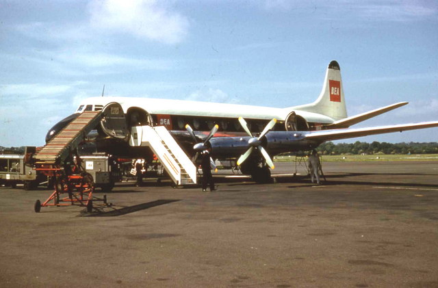
Royal Air Force Nutts Corner, or more simply RAF Nutts Corner, is a former Royal Air Force (RAF) station located east of Crumlin, County Antrim, Northern Ireland and north west of Belfast. Second World War The site was selected for use as an Royal Air Force (RAF) airfield in mid-1940 and within months construction was accorded high priority, enabling No. 120 Squadron RAF flying Consolidated Liberator to begin operations there when the station opened on 2 June 1941. No. 220 Squadron arrived from RAF Wick in January 1942 with Lockheed Hudsons and soon began converting to Boeing Fortress I, flying the first sortie with the type on 29 April before transferring to Ballykelly on 20 June. As Nutts Corner had been selected as trans-Atlantic reception centre 120 Squadron moved to Ballykelly in July 1942 and the following year the first USAAF United States Army Air Forces Boeing B-17 Flying Fortresses began to arrive. Although the airfield remained under overall RAF control an Am ... [...More Info...] [...Related Items...] OR: [Wikipedia] [Google] [Baidu] |
Loanends
Loanends is a Hamlet (place), hamlet located in the townlands of Grange of Carmavy and Ballymather Lower, near Antrim, County Antrim, Antrim in County Antrim, Northern Ireland. The settlement's name derives from the term 'loan-end', which translates to 'lane-end', and there are three minor roads that are quite close to each other that form Loanends. The hamlet has a Presbyterian Church, a church hall, a primary school and an Orange Order, Orange hall. References Geography of County Antrim {{NorthernIreland-geo-stub ... [...More Info...] [...Related Items...] OR: [Wikipedia] [Google] [Baidu] |
Killead
Killead () is a hamlet and civil parish in County Antrim, Northern Ireland. It is near Aldergrove and Antrim and is accessed from the A26 Tully Road. It had a population of 81 people (32 households) in the 2011 Census. (2001 Census: 78 people) People *James Molyneaux, Baron Molyneaux of Killead (27 August 1920 – 9 March 2015) was born in the village. He was a Northern Irish Unionist politician and was leader of the Ulster Unionist Party from 1979 to 1995. *Reverend Arthur Bell Nicholls, who was the Reverend Patrick Brontë's curate, and husband of Charlotte Brontë, was born in Killead on 6 January 1819. * James Gordon was born in the parish of Killead on 31 October 1739, attended local schools and emigrated to the United States in 1758, settling in Schenectady, New York. He served in Congress from 1791 to 1795 and in the State senate from 1797 to 1804. *Rev James Alexander Hamilton Irwin (1876–1954) ministered at the Presbyterian Church at Killead from 1903 to 1926. He ... [...More Info...] [...Related Items...] OR: [Wikipedia] [Google] [Baidu] |
Aldergrove, County Antrim
Aldergrove is a hamlet and townland sub-division in County Antrim, Northern Ireland. It is within the townland of Seacash and parish of Killead – south of Antrim and west of Belfast. It is part of the Borough of Antrim and Newtownabbey. The name Aldergrove is more commonly used to describe the major airfield to the north east of the hamlet. Two long runways serve both the civil Belfast International Airport and the British Army's Aldergrove Flying Station (formerly the RAF base RAF Aldergrove). The first jet aircraft to make a non-stop transatlantic flight flew from Aldergrove on 21 February 1951: An RAF English Electric Canberra B Mk 2 (serial number WD932) flown by Squadron Leader A Callard of the A&AEE flew to Gander, Newfoundland, Canada. The flight covered almost 1,800 nautical miles (3,300 km) in four hours and 37 minutes. The aircraft was being flown to the United States to act as a pattern aircraft for the Martin B-57 Canberra. Aldergrove railway stati ... [...More Info...] [...Related Items...] OR: [Wikipedia] [Google] [Baidu] |
Antrim Upper
Antrim Upper is a barony in County Antrim, Northern Ireland. It is bordered by six other baronies: Antrim Lower to the north; Toome Upper to the west; Massereene Lower to the south-west; Belfast Upper to the south; Belfast Lower to the south-east; and Glenarm Upper to the east. List of settlements Below is a list of settlements in Antrim Upper: Towns * Antrim (split with barony of Toome Upper) *Ballyclare (split with barony of Belfast Lower) Villages *Doagh *Dunadry * Parkgate List of civil parishes Below is a list of civil parishes in Antrim Upper: *Antrim (split with barony of Toome Upper) * Ballycor *Doagh Grange *Donegore *Kilbride *Grange of Nilteen Grange of Nilteen is a civil parish in County Antrim, Northern Ireland. It is situated in the historic barony of Antrim Upper. It is 3.5 miles east of Antrim on the Six Mile Water River. Civil parish of Grange of Nilteen The civil parish includ ... *Rashee References Clandeboye {{Antrim-geo-stub ... [...More Info...] [...Related Items...] OR: [Wikipedia] [Google] [Baidu] |
County Antrim
County Antrim (named after the town of Antrim, County Antrim, Antrim, ) is one of the six counties of Northern Ireland, located within the historic Provinces of Ireland, province of Ulster. Adjoined to the north-east shore of Lough Neagh, the county covers an area of and has a population of 651,321, as of the 2021 United Kingdom census, 2021 census. County Antrim has a population density of 211 people per square kilometre or 546 people per square mile. It is also one of the thirty-two traditional Counties of Ireland, counties of Ireland. The Glens of Antrim offer isolated rugged landscapes, the Giant's Causeway is a unique landscape and a UNESCO World Heritage Site, Bushmills, County Antrim, Bushmills produces whiskey, and Portrush is a popular seaside resort and night-life area. The majority of Belfast, the capital city of Northern Ireland, is in County Antrim, with the remainder being in County Down. According to the United Kingdom Census 2001, 2001, United Kingdom Census 20 ... [...More Info...] [...Related Items...] OR: [Wikipedia] [Google] [Baidu] |


