|
Mahendragarh, Haryana
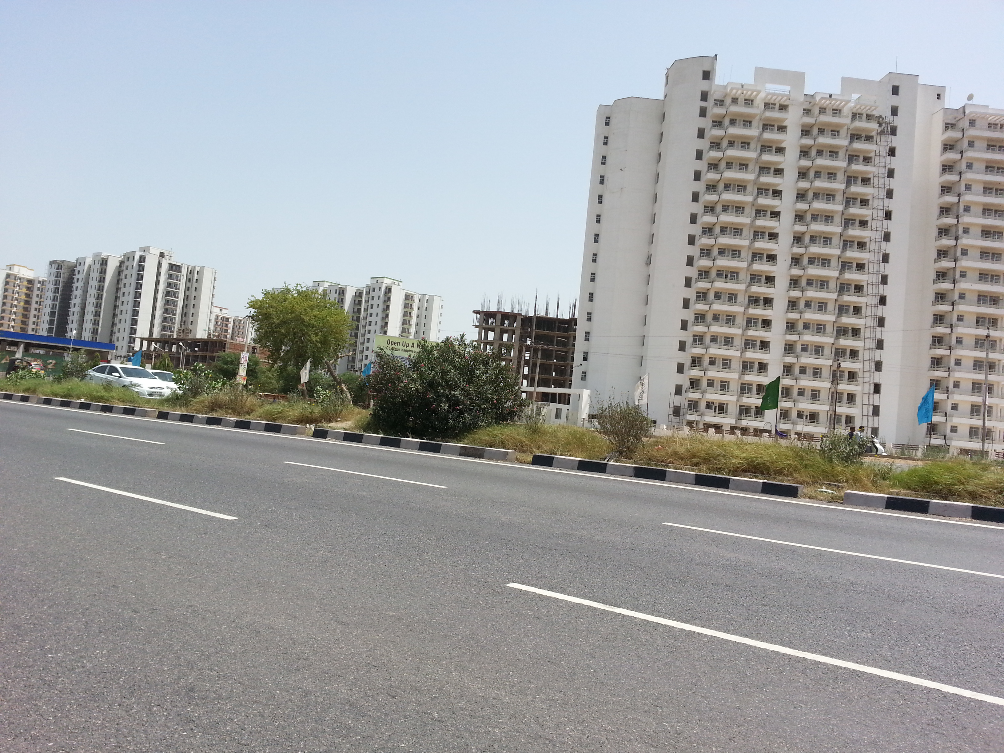
Mahendragarh is a city and a municipal committee in Mahendragarh district in the Indian state of Haryana. It is nearly from Gurgaon and comes under National Capital Region (India). Etymology Earlier earlier was known as Kanaud because its was founded and inhabited by Kanaudia Brahmins. In 1860s it was renamed after Maharaja Mahendra Singh (r. 1721-1748 CE) of Patiala State who was gifted this area by the British East India Company rule for his help in crushing the Indian Rebellion of 1857 in this area.Magnificent havelis of Nangal-Sirohi , 22 June 2002. Geography Mahendragarh is located at . It has an average elevati ...[...More Info...] [...Related Items...] OR: [Wikipedia] [Google] [Baidu] |
WikiProject Indian Cities
A WikiProject, or Wikiproject, is an affinity group for contributors with shared goals within the Wikimedia movement. WikiProjects are prevalent within the largest wiki, Wikipedia, and exist to varying degrees within Wikimedia project, sibling projects such as Wiktionary, Wikiquote, Wikidata, and Wikisource. They also exist in different languages, and translation of articles is a form of their collaboration. During the COVID-19 pandemic, CBS News noted the role of Wikipedia's WikiProject Medicine in maintaining the accuracy of articles related to the disease. Another WikiProject that has drawn attention is WikiProject Women Scientists, which was profiled by ''Smithsonian Magazine, Smithsonian'' for its efforts to improve coverage of women scientists which the profile noted had "helped increase the number of female scientists on Wikipedia from around 1,600 to over 5,000". On Wikipedia Some Wikipedia WikiProjects are substantial enough to engage in cooperative activities with outsi ... [...More Info...] [...Related Items...] OR: [Wikipedia] [Google] [Baidu] |
The Tribune (Chandigarh)
''The Tribune'' is an Indian English-language daily newspaper published from Amritsar, Jalandhar, Ludhiana, Bathinda, Chandigarh and Gurgaon, Gurugram. It was founded on 2 February 1881, in Lahore, Punjab Province (British India), Punjab (now in Pakistan), by Sardar Dyal Singh Majithia, a philanthropist, and is run by a trust comprising five persons as trustees. It is a major Indian newspaper with a worldwide circulation. In India, it is among the leading English daily for Punjab, India, Punjab, Haryana, Himachal Pradesh, and the Chandigarh, Union Territory of Chandigarh. Overview The present Editor-in-Chief of ''The Tribune'' is Jyoti Malhotra. ''The Tribune'' has two sister publications: ''Dainik Tribune'' (in Hindi) and ''Punjabi Tribune'' (in Punjabi language, Punjabi). Naresh Kaushal is the Editor of ''Dainik Tribune'' and Arvinder Kaur Johal is the Officiating Editor of the ''Punjabi Tribune''. The online edition of ''The Tribune'' was launched in July 1998, and the onlin ... [...More Info...] [...Related Items...] OR: [Wikipedia] [Google] [Baidu] |
Dohan River
The Dohan river (), is a rain-fed river that originates at Mandholi village near Neem Ka Thana in Sikar district of Rajasthan and then disappears in Mahendragarh district in Haryana where it used to be a tributary of Sahibi River, which in turn is a still flowing tributary of Yamuna. Its canalised portion in one of its paleochannel in Haryana is called the "Outfall Drain No 8". At Mandholi there is a small gomukh from where the river begins.Cultural Contours of India: Dr. Satya Prakash Felicitation Volume, Vijai Shankar Śrivastava, 1981 Several Ochre Coloured Pottery culture sites (also identified as late Harappan pha ... [...More Info...] [...Related Items...] OR: [Wikipedia] [Google] [Baidu] |
Mahendergarh
Mahendragarh is a city and a municipal committee in Mahendragarh district in the Indian state of Haryana. It is nearly from Gurgaon and comes under National Capital Region (India). Etymology Earlier earlier was known as Kanaud because its was founded and inhabited by Kanaudia Brahmins. In 1860s it was renamed after Maharaja Mahendra Singh (r. 1721-1748 CE) of Patiala State who was gifted this area by the British East India Company rule for his help in crushing the Indian Rebellion of 1857 in this area.Magnificent havelis of Nangal-Sirohi The Tribune, 22 June 2002. Geography Mahendragarh is located at . It has an average elevation of 262 metres (859&nb ...[...More Info...] [...Related Items...] OR: [Wikipedia] [Google] [Baidu] |
Ateli
Ateli is a small town and a municipal committee near Narnaul in Mahendragarh district in the north Indian state of Haryana Haryana () is a States and union territories of India, state located in the northern part of India. It was carved out after the linguistic reorganisation of Punjab, India, Punjab on 1 November 1966. It is ranked 21st in terms of area, with les .... 8 villages are in Ateli tehsil. Geography Ateli has an average elevation of 299 m (980 feet). Demographics India census, Ateli had a population of 8678. Males constitute 52% of the population and females 48%. Ateli has an average literacy rate of 78%, higher than the national average of 59.5%; with 58% of the males and 42% of females being literate. Thirteen percent of the population is under six years of age. Transportation Railways Ateli railway station lies on the Rewari-Narnaul route. Only slow passenger trains Chetak Express (12982) Delhi sarai rohilla- ajmer (02066) Mumbai Bandra Bi-weekly (22 ... [...More Info...] [...Related Items...] OR: [Wikipedia] [Google] [Baidu] |
Narnaul
Narnaul is a city, a Municipal Council, and location of headquarters of the Mahendragarh district in the Indian state of Haryana. It is located in the National Capital Region of India. History & etymology During the early vedic period of Rigveda, this area was called the ''Nandigram'' where rishi Chyavana lived in his ashram. During the later vedic period of mahabharta, this area was called the ''Nara Rashtra'' which later became corrupted to Narnaul. During the mahabharta period, the Nara Rashtra, on the Hastinapur to Chambal route, was conquered by the youngest Pandava brother Sahdev. During medieval period, the native Nuniwal Kshatriyas ruled the area. In 1137 CE, foreign-origin muslim invader Hazrat Turkman, also known as Shah Wilayat, was killed by the native Nuniwal .Monuments & Sites in Haryana, Archaeological Survey Of India, page 35. Narnaul is built on a prominent tell, but the tell has never been excavated so the site's earliest history is unknown. The Mu ... [...More Info...] [...Related Items...] OR: [Wikipedia] [Google] [Baidu] |
Rajasthan
Rajasthan (; Literal translation, lit. 'Land of Kings') is a States and union territories of India, state in northwestern India. It covers or 10.4 per cent of India's total geographical area. It is the List of states and union territories of India by area, largest Indian state by area and the List of states and union territories of India by population, seventh largest by population. It is on India's northwestern side, where it comprises most of the wide and inhospitable Thar Desert (also known as the Great Indian Desert) and shares a border with the Pakistani provinces of Punjab, Pakistan, Punjab to the northwest and Sindh to the west, along the Sutlej-Indus River valley. It is bordered by five other Indian states: Punjab, India, Punjab to the north; Haryana and Uttar Pradesh to the northeast; Madhya Pradesh to the southeast; and Gujarat to the southwest. Its geographical location is 23°3' to 30°12' North latitude and 69°30' to 78°17' East longitude, with the Tropic of Can ... [...More Info...] [...Related Items...] OR: [Wikipedia] [Google] [Baidu] |
Jhunjhunu District
Jhunjhunu district is a district of the Indian state of Rajasthan in northern India. The city of Jhunjhunu is the district headquarters. Jhunjhunu is an old and historical town having its own district headquarters. The district is famous for the frescos on its grand Havelis. It is also famous for providing considerable representation to Indian defense forces. The district falls within Shekhawati region, and is bounded on the North-East and East by Haryana state, on the South-East, South & South-West by Sikar District & on the North-West and North by Churu District. Demographics According to the 2011 census Jhunjhunu district has a population of 2,139,658, roughly equal to the nation of Namibia or the US state of New Mexico. This gives it a ranking of 214th in India (out of a total of 640). The district has a population density of . Its population growth rate over the decade 2001-2011 was 11.81%. Jhunjhunu has a sex ratio of 950 females for every 1000 males, It also has a l ... [...More Info...] [...Related Items...] OR: [Wikipedia] [Google] [Baidu] |
Sikar District
Sikar district is a district of the Indian state Rajasthan in northern India. It is a part of the Shekhawati region of Rajasthan. Rao Daulat Singh laid down the foundation stone of Thikana Sikar in 1687. District Collector of Sikar is Shri Mukul Sharma while Member of Parliament is Shri Amra Ram. Cities and towns Cities * Sikar * Laxmangarh * Fatehpur * Khandela Large towns * Laxmangarh * Reengus * Losal *Khatu * Ramgarh Location The district is located in the north-eastern part of the state of Rajasthan. It is bounded on the north by Jhunjhunu district, in the north-west by Churu district, in the south-west by Didwana Kuchaman district,in the south-east by Jaipur Rural district. The district has an area of 5191.44 km2 and a population of 16,94,094 (2011 census, excluding NeemKaThana and Sri Madhopur). Sikar, Churu district and Jhunjhunu district's comprise the Shekhawati region of Rajasthan. The old name of Sikar was "Veer Bhan Ka Bas". Demographics Acc ... [...More Info...] [...Related Items...] OR: [Wikipedia] [Google] [Baidu] |
Jaipur District
Jaipur District is a district in the state of Rajasthan in Northern India.the city of Jaipur, which is Rajasthan's capital and the largest city, is the district headquarters. It is the tenth most populous district in India (out of 640). Etymology The district derives its name from its administrative headquarters, the city of Jaipur. The city was established in 1727 by Maharaja Sawai Jai Singh II (1693–1744), the ruler of Amber, and named in his honour. In Sanskrit, the suffix "pur" or "pura" is commonly used to denote a city or town. Thus, the name "Jaipur" translates to "The City of Jai," commemorating its founder, Jai Singh II. Geography The district is located between 26°23' and 27°51' north latitude, and 74°55' and 76°50' east longitude. It covers an area of , accounting for approximately 3.26% of the state's total area, and ranks 9th in size among the districts of the state. The district stretches about from east to west, while its north to south length is appr ... [...More Info...] [...Related Items...] OR: [Wikipedia] [Google] [Baidu] |
Alwar District
Alwar is a district in the States and territories of India, state of Rajasthan in northern India, whose district headquarters is Alwar, Alwar city. The district covers 8,337 km2. It is bound on the north by Rewari district of Haryana, on the east by Bharatpur district of Rajasthan and Nuh district of Haryana, on the south by Dausa district, and on the west by Jaipur district. As of 2011 it is the third most populous district of Rajasthan (out of Districts of Rajasthan, 33) after Jaipur district, Jaipur and Jodhpur district, Jodhpur. Administration Alwar district has 12 tehsils: Alwar, Govindgarh, Rajasthan, Govindgarh, Kathumar,Laxmangarh, Rajgarh, Alwar, Rajgarh, Pratapgarh,Tehla,Ramgarh,Alwar, Ramgarh,Thanagazi, Reni, Alwar, Reni, Malakhera, Naugawan. It has only one Lok Sabha constituency, Alwar (Lok Sabha constituency), Alwar. Industry The district has industrial estates such as Alwar, Bhiwadi, Shahjahanpur, Neemrana, Behror where companies such as G. S. Pharmbuto ... [...More Info...] [...Related Items...] OR: [Wikipedia] [Google] [Baidu] |


