|
M27 Motorway
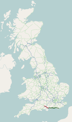
The M27 is a motorway in Hampshire, England. It is long and runs between Cadnam and Portsmouth. It was opened in stages between 1975 and 1983, providing the largest two urban areas in Hampshire (Southampton and Portsmouth) with a direct motorway link. An extension into the county of West Sussex was planned but never constructed. A number of smaller motorways were proposed, connecting the city centres of Southampton and Portsmouth to the motorway; of these only the M271 motorway, M271 and M275 motorway, M275 were built. Three sections of the M27 have since been widened to four lanes each way, the first between junctions 7 and 8, the second between junctions 3 and 4, and the third begins at the slip road where junction 11 joins until mid-way to junction 12. Route Running approximately parallel both to the coast of the Solent and to the A27 road, A27, the M27 starts as an eastwards continuation of the A31 road, A31 from Bournemouth and Poole, at Cadnam in the New Forest. The mot ... [...More Info...] [...Related Items...] OR: [Wikipedia] [Google] [Baidu] |
National Highways
National Highways (NH), formerly Highways England and before that the Highways Agency, is a State-owned enterprise, government-owned company charged with operating, maintaining and improving Roads in England, motorways and major A roads in England. It also sets highways standards used by all four UK administrations, through the Design Manual for Roads and Bridges. Within England, it operates information services through the provision of on-road signage and its Traffic England website, provides National Highways traffic officer, traffic officers to deal with incidents on its network, and manages the delivery of improvement schemes to the network. Founded as an executive agency, it was converted into a government-owned company, Highways England, on 1 April 2015. As part of this transition, the Government of the United Kingdom, UK government set out its vision for the future of the English strategic road network in its Road Investment Strategy. A second Road Investment Strategy w ... [...More Info...] [...Related Items...] OR: [Wikipedia] [Google] [Baidu] |
M3 Motorway (Great Britain)
The M3 is a controlled-access highway, motorway in England, from Sunbury-on-Thames, Surrey, to Eastleigh, Hampshire; a distance of approximately . The route includes the Aldershot Urban Area, Basingstoke, Winchester, and Southampton. It was constructed as a dual three-lane motorway except for its two-lane section between junction 8 (A303 road, A303) and junction 9. The motorway was opened in phases, ranging from Lightwater/Bagshot to Popham, Hampshire, Popham in 1971 to Winchester to Otterbourne Hill in 1995. The latter stages attracted opposition from environmental campaigns across Britain due to its large cutting (transportation), cutting through wooded Twyford Down; numerous Road protest in the United Kingdom#1979.E2.80.931997, road protests were held which delayed its opening. Similar protests were avoided on the near-parallel A3 road, A3 by the construction of the Hindhead Tunnel. Since completion, the motorway has been an artery to the west and midsections of the Southern ... [...More Info...] [...Related Items...] OR: [Wikipedia] [Google] [Baidu] |
Wessex Main Line
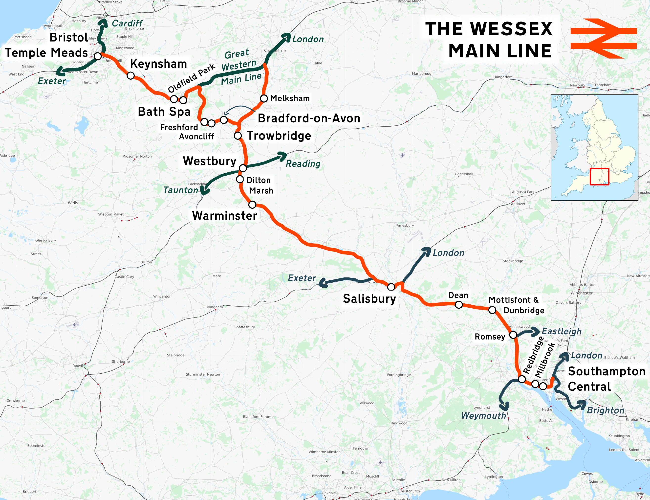
The Wessex Main Line is the railway line from Bristol Temple Meads to Southampton Central. Diverging from this route is the Heart of Wessex Line from Westbury to Weymouth. The Wessex Main Line intersects the Reading to Taunton Line at and the West of England Main Line at . Stations served The stations served are listed below. * * * Oldfield Park * **Great Western Main Line diverges to , and London Paddington * * * **TransWilts Line joins from , and * * ** Heart of Wessex Line diverges to , and * * * * * Mottisfont & Dunbridge * ** Eastleigh to Romsey Line diverges to and ** South Western Main Line joins from , and * * Millbrook * Passenger services are currently operated by Great Western Railway services between and , supplemented by South Western Railway between and with their service between Salisbury and via Southampton Central, and by Great Western Railway intercity services between Bristol Temple Meads and Bath Spa that operate between and Bristol T ... [...More Info...] [...Related Items...] OR: [Wikipedia] [Google] [Baidu] |
A36 Road
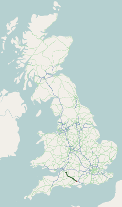
The A36 is a trunk road and primary route in southwest England that links the port city of Southampton to the city of Bath. At Bath, the A36 connects with the A4 to Bristol, thus providing a road link between the major ports of Southampton and Bristol. It also provides a link between Bristol and London via the A303. Route Originally, the A36 continued to Avonmouth, beyond Bristol, but this section was renumbered to the A4. Within Bath the A36 acts as a ring road on the southern side of the river, from the junction with the A4 at Newbridge to the west of the city. From here traffic can continue to Bristol on the A4 or to Wells and Weston-super-Mare via the A39 and A368 roads. Another link to the A4 on the eastern side at Cleveland Bridge, which provides a route to the M4 motorway via the A46, is highly congested. Plans for a direct link road connecting the A36 with the A46 have been under consideration for a number of years. The A36 leaves Bath in an easterly direc ... [...More Info...] [...Related Items...] OR: [Wikipedia] [Google] [Baidu] |
New Forest
The New Forest is one of the largest remaining tracts of unenclosed pasture land, heathland and forest in Southern England, covering southwest Hampshire and southeast Wiltshire. It was proclaimed a royal forest by William the Conqueror, featuring in the Domesday Book. It is the home of the New Forest Commoners, whose ancient rights of common pasture are still recognised and exercised, enforced by official Verderer (New Forest), verderers and Agister (New Forest), agisters. In the 18th century, the New Forest became a source of timber for the Royal Navy. It remains a habitat for many rare birds and mammals. The boundaries of the forest have varied over time and depend on the purpose of delimiting them. It is a biological and geological Site of Special Scientific Interest. Several areas are Geological Conservation Review sites, including Mark Ash Wood, Shepherd’s Gutter, Cranes Moor, Studley Wood, and Wood Green. There are also a number of Nature Conservation Review sites. I ... [...More Info...] [...Related Items...] OR: [Wikipedia] [Google] [Baidu] |
A31 Road
The A31 is a major trunk road in southern England that runs from Guildford in Surrey to Bere Regis in Dorset. Its best-known section is the Hog's Back, a ridge forming part of the North Downs between Guildford and Farnham in Surrey. Route description Some of the ancient route from London to Winchester is used by the A31. The road begins near Guildford station at the start of Farnham Road, coming out of the town and passing over the A3, then becoming a dual carriageway running west along the Hog's Back escarpment of the North Downs. This dual carriageway section has a speed limit of 60 mph. At Tongham it leaves the older Hog's Back route to join the A331 and follow a modern bypass round Farnham, rejoining the older route at the roundabout junction with the A325 where it follows Alton Road toward Alton which it bypasses, rejoining the older route near Jane Austen's house, then continuing to Alresford before joining the route of the M3 motorway at its junction on the eas ... [...More Info...] [...Related Items...] OR: [Wikipedia] [Google] [Baidu] |
A27 Road
The A27 is a major road in England. It runs from its junction with the A36 road, A36 at Whiteparish (near Salisbury, England, Salisbury) in the county of Wiltshire, follows the south coast of Hampshire and West Sussex, and terminates at Pevensey (near Eastbourne and Bexhill-on-Sea, Bexhill) in East Sussex. It is the westernmost road in Zone 2 roads in the UK, Zone 2 in the UK road numbering system. Between Portsmouth and Lewes, it is one of the busiest trunk roads in the UK. History Historically, for longer distance movement along the south coast, the M25 in combination with the M2, M20, M23 / A23, A3 / A3(M) and M3 has provided an attractive alternative to the actual south coast route of A259, A27 and M27. In 2002 an offpeak journey between Margate and Southampton via the M25 took 2 hours 30 minutes, and via the coastal route using the A259, A27 and M27 took 3 hours 50 minutes. The reason the coastal route is so much slower than the M25 alternative is largely due to a series ... [...More Info...] [...Related Items...] OR: [Wikipedia] [Google] [Baidu] |
Solent
The Solent ( ) is a strait between the Isle of Wight and mainland Great Britain; the major historic ports of Southampton and Portsmouth lie inland of its shores. It is about long and varies in width between , although the Hurst Spit which projects into the Solent narrows the sea crossing between Hurst Castle and Colwell Bay to just over . The Solent is a major shipping lane for passenger, freight and military vessels. It is also an important recreational area for water sports, particularly yachting, hosting the Cowes Week sailing event annually. It is sheltered by the Isle of Wight and has a complex tidal pattern, which has benefited Southampton's success as a port, providing a "double high tide" that extends the tidal window during which deep-draught ships can be handled. Spithead, an area off Gilkicker Point near Gosport, is known as the place where the Royal Navy is traditionally reviewed by the monarch of the day. The area is of great ecological and landscap ... [...More Info...] [...Related Items...] OR: [Wikipedia] [Google] [Baidu] |
West Sussex
West Sussex is a Ceremonial counties of England, ceremonial county in South East England. It is bordered by Surrey to the north, East Sussex to the east, the English Channel to the south, and Hampshire to the west. The largest settlement is Crawley, and the county town is the city of Chichester. The county has a land area of and a population of . Along the south coast is a near-continuous urban area which includes the towns of Bognor Regis (63,855), Littlehampton (55,706), and Worthing (111,338); the latter two are part of the Brighton and Hove built-up area, which extends into East Sussex and has a total population of 474,485. The interior of the county is generally rural; the largest towns are Crawley (118,493) and Horsham (50,934), both located in the north-east; Chichester is in the south-west and has a population of 26,795. West Sussex contains seven local government Non-metropolitan district, districts, which are part of a two-tier non-metropolitan county administered by ... [...More Info...] [...Related Items...] OR: [Wikipedia] [Google] [Baidu] |
Hampshire
Hampshire (, ; abbreviated to Hants.) is a Ceremonial counties of England, ceremonial county in South East England. It is bordered by Berkshire to the north, Surrey and West Sussex to the east, the Isle of Wight across the Solent to the south, Dorset to the west, and Wiltshire to the north-west. Southampton is the largest settlement, while Winchester is the county town. Other significant settlements within the county include Portsmouth, Basingstoke, Andover, Hampshire, Andover, Gosport, Fareham and Aldershot. The county has an area of and a population of 1,844,245, making it the Counties in England by population, 5th-most populous in England. The South Hampshire built-up area in the south-east of the county has a population of 855,569 and contains the cities of Southampton (269,781) and Portsmouth (208,100). In the north-east, the Farnborough, Hampshire, Farnborough/Aldershot Farnborough/Aldershot built-up area, conurbation extends into Berkshire and Surrey and has a populati ... [...More Info...] [...Related Items...] OR: [Wikipedia] [Google] [Baidu] |
Motorway
A controlled-access highway is a type of highway that has been designed for high-speed vehicular traffic, with all traffic flow—ingress and egress—regulated. Common English terms are freeway, motorway, and expressway. Other similar terms include ''wikt:throughway, throughway'' or ''thruway'' and ''parkway''. Some of these may be limited-access highways, although this term can also refer to a class of highways with somewhat less isolation from other traffic. In countries following the Vienna Convention on Road Signs and Signals, Vienna convention, the motorway qualification implies that walking and parking are forbidden. A fully controlled-access highway provides an unhindered flow of traffic, with no traffic signals, Intersection (road), intersections or frontage, property access. They are free of any at-grade intersection, at-grade crossings with other roads, railways, or pedestrian paths, which are instead carried by overpasses and underpasses. Entrances and exits to t ... [...More Info...] [...Related Items...] OR: [Wikipedia] [Google] [Baidu] |
M27 From Portsdown Hill - Geograph
M, or m, is the thirteenth letter of the Latin alphabet, used in the modern English alphabet, the alphabets of several western European languages and others worldwide. Its name in English is ''em'' (pronounced ), plural ''ems''. History The letter M is derived from the Phoenician Mem via the Greek Mu (Μ, μ). Semitic Mem is most likely derived from a " Proto-Sinaitic" (Bronze Age) adoption of the "water" ideogram in Egyptian writing. The Egyptian sign had the acrophonic value , from the Egyptian word for "water", ''nt''; the adoption as the Semitic letter for was presumably also on acrophonic grounds, from the Semitic word for "water", '' *mā(y)-''. Use in writing systems English In English, represents the voiced bilabial nasal . The Oxford English Dictionary (first edition) says that is sometimes a vowel, such as in words like ''spasm'' and in the suffix ''-ism''. In modern terminology, this is described as a syllabic consonant (IPA: ). M is the ... [...More Info...] [...Related Items...] OR: [Wikipedia] [Google] [Baidu] |


