|
Lacrosse Island
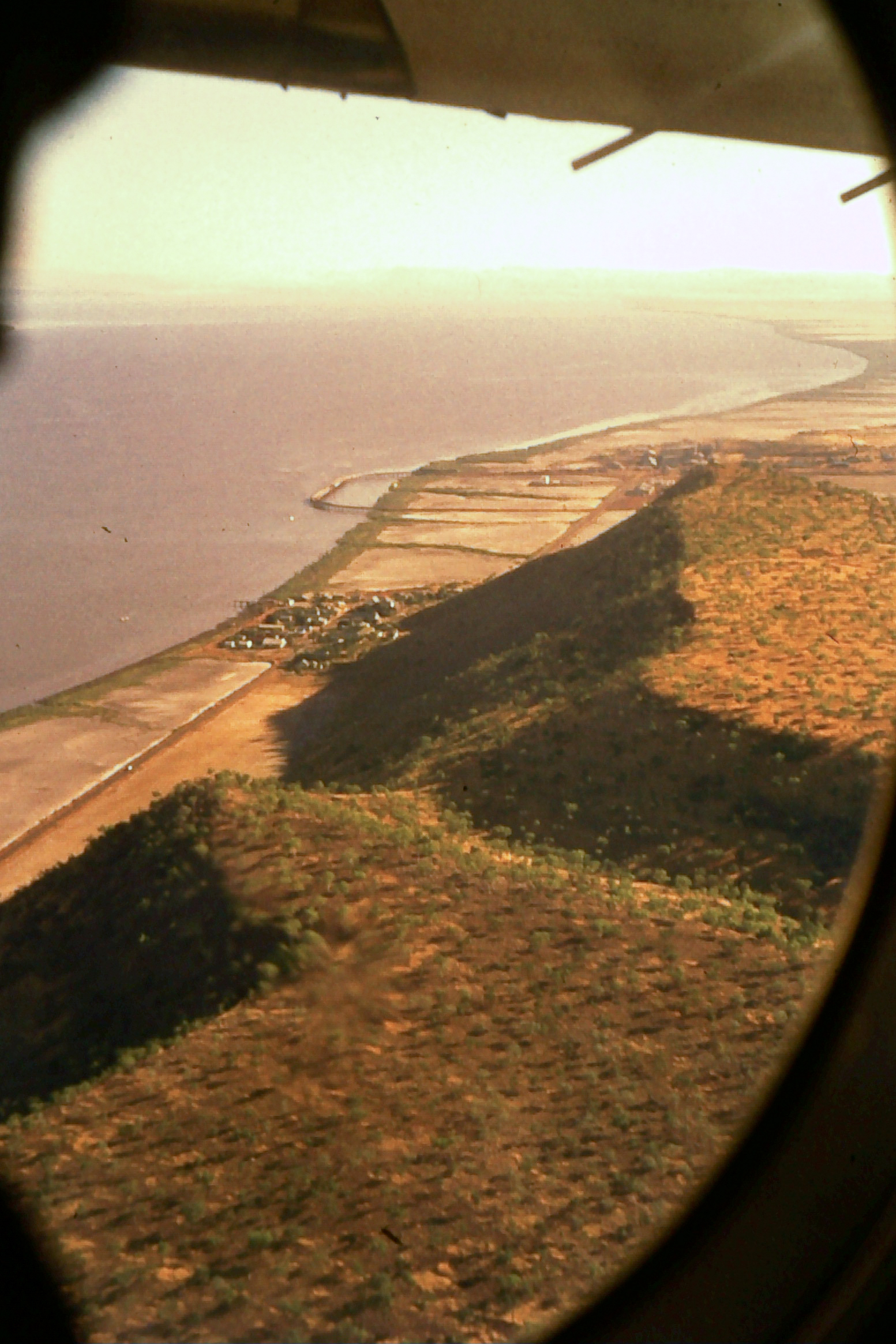
Lacrosse Island is an island in the Cambridge Gulf in the Kimberley region of Western Australia, located between Cape Domett on the eastern shore and Cape Dussejour on the western. The island is in the local government area of the Shire of Wyndham-East Kimberley. It lies at the point where Cambridge Gulf and Joseph Bonaparte Gulf meet at the Medusa Banks, just north of the island. The south eastern end of the island is named "White Stone Point", with the north western end named "West Bluff". During the Kimberley gold rush of the 1880s, a boat utilised Lacrosse Island as the staging point for the "Bendigo Party" to proceed to the Kimberley goldfield. Due to tidal ranges in the approach to Cambridge Gulf, careful note of the Lacrosse tidal range is needed. In the 1920s visitors to the island sought out turtle eggs. Fauna Lacrosse Island is an important nesting area for the flatback sea turtle The Australian flatback sea turtle (''Natator depressus'') is a species of se ... [...More Info...] [...Related Items...] OR: [Wikipedia] [Google] [Baidu] |
Cambridge Gulf
Cambridge Gulf is a gulf on the north coast of the Kimberley region of Western Australia. Many rivers flow into the gulf, including the Ord River, Pentecost River, Durack River, King River and the Forrest River, making the environment an estuarine one. The gulf experiences two large tidal flows each day between . The town of Wyndham, the area's principal port, lies on its eastern bank at the lower part of the gulf and is approximately by road west-north-west of Kununurra. Cambridge Gulf is a gulf within a gulf, being at the southern extremity of the Joseph Bonaparte Gulf, in the Timor Sea. The entrance of the Gulf is defined by Cape Domett on the eastern shore, Lacrosse Island in the middle, and the Cape Dussejour on the western shore, with King Shoals and Medusa Banks out in Joseph Bonaparte Gulf beyond Lacrosse Island. The conjunction between the gulf and the lower regions of the Ord River (the eastern arm), and the Durack and Pentecost Rivers (the western arm) are t ... [...More Info...] [...Related Items...] OR: [Wikipedia] [Google] [Baidu] |
Kimberley (Western Australia)
The Kimberley is the northernmost of the nine regions of Western Australia. It is bordered on the west by the Indian Ocean, on the north by the Timor Sea, on the south by the Great Sandy Desert, Great Sandy and Tanami Desert, Tanami deserts in the region of the Pilbara, and on the east by the Northern Territory. The region was named in 1879 by government surveyor Alexander Forrest after Secretary of State for the Colonies John Wodehouse, 1st Earl of Kimberley. History The Kimberley was one of the earliest settled parts of Australia, with the first humans landing about 65,000 years ago. They created a complex culture that developed over thousands of years. Yam (vegetable), Yam (''Dioscorea hastifolia'') agriculture was developed, and rock art suggests that this was where some of the earliest boomerangs were invented. The worship of Wandjina deities was most common in this region, and a complex theology dealing with the transmigration of souls was part of the local people's r ... [...More Info...] [...Related Items...] OR: [Wikipedia] [Google] [Baidu] |
Western Australia
Western Australia (commonly abbreviated as WA) is a state of Australia occupying the western percent of the land area of Australia excluding external territories. It is bounded by the Indian Ocean to the north and west, the Southern Ocean to the south, the Northern Territory to the north-east, and South Australia to the south-east. Western Australia is Australia's largest state, with a total land area of . It is the second-largest country subdivision in the world, surpassed only by Russia's Sakha Republic. the state has 2.76 million inhabitants percent of the national total. The vast majority (92 percent) live in the south-west corner; 79 percent of the population lives in the Perth area, leaving the remainder of the state sparsely populated. The first Europeans to visit Western Australia belonged to the Dutch Dirk Hartog expedition, who visited the Western Australian coast in 1616. The first permanent European colony of Western Australia occurred following the ... [...More Info...] [...Related Items...] OR: [Wikipedia] [Google] [Baidu] |
Cape Domett
Cape Domett is at the eastern side of the mouth of the Cambridge Gulf in the Kimberley region of Western Australia Western Australia (commonly abbreviated as WA) is a state of Australia occupying the western percent of the land area of Australia excluding external territories. It is bounded by the Indian Ocean to the north and west, the Southern Ocean to th .... It is opposite Cape Dussejour, which lies to the north west of Cape Domett, with Lacrosse Island located between the capes. In 1975 it was considered for the location of a bulk sugar terminal for the Ord River sugar industry. Notes {{coord, 14, 49, S, 128, 23, E, type:landmark_region:AU-WA_dim:20000, display=title Headlands of Western Australia, Domett Cambridge Gulf ... [...More Info...] [...Related Items...] OR: [Wikipedia] [Google] [Baidu] |


