|
Lötschental Gesamtansicht Mit Wolken
The Lötschental () is the largest valley on the northern side of the Rhône valley in the canton of Valais in Switzerland. It lies in the Bernese Alps, with the running down the length of the valley from its source within the Langgletscher (lit.: Long Glacier). Geography The valley extends about from the Lötschenlücke (3178 m) at the top of the Langgletscher to the mouth of the valley at Steg/Gampel (630 m). It is surrounded by 3,000 meter high mountains, including the Bietschhorn (3,934 m), the Hockenhorn (3,293 m), the Wilerhorn (Bernese Alps), Wilerhorn (3,307 m) and the Petersgrat (3,205 m). The Jungfrau-Aletsch Protected Area is the most glaciated area in the Swiss Alps, and was declared a Natural World Heritage Site by decision of UNESCO on December 13, 2001, along with southern and eastern parts of the Lötschental. The main villages of the Lötschental are Wiler and Kippel, with 538 and 383 inhabitants respectively. Other villages in the valley ... [...More Info...] [...Related Items...] OR: [Wikipedia] [Google] [Baidu] |
Kippel
Kippel is a Municipalities of Switzerland, municipality in the district of Raron (district), Raron in the Cantons of Switzerland, canton of Valais in Switzerland. History Kippel is first mentioned in 1437 as ''Kypil''. Geography Kippel has an area, , of . Of this area, or 23.4% is used for agricultural purposes, while or 35.3% is forested. Of the rest of the land, or 1.7% is settled (buildings or roads), or 0.8% is either rivers or lakes and or 38.9% is unproductive land.Swiss Federal Statistical Office-Land Use Statistics 2009 data accessed 25 March 2010 Of the built up area, housing and buildings made up 0.8% and transportation infrastructure made up 0.4%. Out of the forested land, 30.6% of the total land area is heavily forested and 3.9% is co ... [...More Info...] [...Related Items...] OR: [Wikipedia] [Google] [Baidu] |
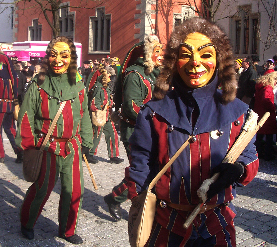
Mask
A mask is an object normally worn on the face, typically for protection, disguise, performance, or entertainment, and often employed for rituals and rites. Masks have been used since antiquity for both ceremonial and practical purposes, as well as in the performing arts and for entertainment. They are usually worn on the face, although they may also be positioned for effect elsewhere on the wearer's body. In art history, especially sculpture, "mask" is the term for a face without a body that is not modelled in the round (which would make it a "head"), but for example appears in low relief. Etymology The word "mask" appeared in English in the 1530s, from Middle French ''masque'' "covering to hide or guard the face", derived in turn from Italian ''maschera'', from Medieval Latin ''masca'' "mask, specter, nightmare". This word is of uncertain origin, perhaps from Arabic ''maskharah'' مَسْخَرَۃٌ "buffoon", from the verb ''sakhira'' "to ridicule". However, it ... [...More Info...] [...Related Items...] OR: [Wikipedia] [Google] [Baidu] |
2025 Blatten Glacier Collapse
The Blatten glacier collapse was a natural disaster that occurred on 28 May 2025, affecting the village of Blatten (Lötschen), Blatten in the Lötschental valley in the canton of Valais, Switzerland. A glacier collapse in the Bietschhorn region caused a landslide which buried and destroyed large parts of the village. The main village had been evacuated since 19 May 2025. Events Initial rockfall at Kleines Nesthorn Unlike the general retreat of glaciers since 1850, the lower had advanced about in the five years prior to the landslide, likely due to accumulation of weathered rock from repeated rockfalls onto the glacier.Permafrost expert: Climate change caused the Blatten landslide Watson.ch, 30 May 2025. Acco ... [...More Info...] [...Related Items...] OR: [Wikipedia] [Google] [Baidu] |


