|
London Ringways
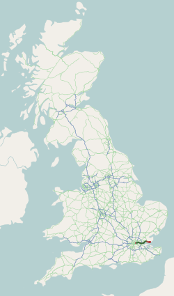
The London Ringways were a series of four ring roads planned in the 1960s to circle London at various distances from the city centre. They were part of a comprehensive scheme developed by the Greater London Council (GLC) to alleviate traffic congestion on the city's road system by providing high-speed motorway-standard roads within the capital, linking a series of radial roads taking traffic into and out of the city. There had been plans to construct new roads around London to help traffic since at least the 17th century. Several were built in the early 20th century such as the North Circular Road, Western Avenue, London, Western Avenue and Eastern Avenue, London, Eastern Avenue, and further plans were put forward in 1937 with ''The Highway Development Survey'', followed by the ''County of London Plan'' in 1943. The Ringways originated from these earlier plans, and consisted of the main four ring roads and other developments. Certain sections were upgrades of existing earlier pr ... [...More Info...] [...Related Items...] OR: [Wikipedia] [Google] [Baidu] |
London Ringways Plan
London is the Capital city, capital and List of urban areas in the United Kingdom, largest city of both England and the United Kingdom, with a population of in . London metropolitan area, Its wider metropolitan area is the largest in Western Europe, with a population of 14.9 million. London stands on the River Thames in southeast England, at the head of a tidal estuary down to the North Sea, and has been a major settlement for nearly 2,000 years. Its ancient core and financial centre, the City of London, was founded by the Roman Empire, Romans as Londinium and has retained its medieval boundaries. The City of Westminster, to the west of the City of London, has been the centuries-long host of Government of the United Kingdom, the national government and Parliament of the United Kingdom, parliament. London grew rapidly 19th-century London, in the 19th century, becoming the world's List of largest cities throughout history, largest city at the time. Since the 19th cen ... [...More Info...] [...Related Items...] OR: [Wikipedia] [Google] [Baidu] |
Brentford
Brentford is a suburban town in West (London sub region), West London, England and part of the London Borough of Hounslow. It lies at the confluence of the River Brent and the River Thames, Thames, west of Charing Cross. Its economy has diverse company headquarters buildings which mark the start of the M4 corridor; in transport it also has two railway stations and Boston Manor tube station, Boston Manor Underground station on its northwest border with Hanwell. Brentford has a convenience shopping and dining venue grid of streets at its centre. Brentford at the start of the 21st century attracted regeneration of its little-used warehouse premises and docks including the remodelling of the waterfront to provide more economically active shops, townhouses and apartments, some of which comprise Brentford Dock. A 19th- and 20th-century mixed social and private housing locality, New Brentford is contiguous with the Osterley neighbourhood of Isleworth and Syon Park and the Great Wes ... [...More Info...] [...Related Items...] OR: [Wikipedia] [Google] [Baidu] |
London County Council
The London County Council (LCC) was the principal local government body for the County of London throughout its existence from 1889 to 1965, and the first London-wide general municipal authority to be directly elected. It covered the area today known as Inner London and was replaced by the Greater London Council. The LCC was the largest, most significant and most ambitious English municipal authority of its day. History By the 19th century, the City of London Corporation covered only a small fraction of the metropolis. From 1855, the Metropolitan Board of Works (MBW) had certain powers across what is now Inner London, but it was appointed rather than elected. Many powers remained in the hands of traditional bodies such as parishes and the counties of Middlesex, Surrey, and Kent. The Local Government Act 1888 created a new County of London, with effect from 1889, and the English County council#England, county councils, of which LCC was one. This followed a succession of scandal ... [...More Info...] [...Related Items...] OR: [Wikipedia] [Google] [Baidu] |
Westway, London
The Westway is a elevated dual carriageway section of the A40 road, A40 trunk road in West London running from Paddington in the east to North Kensington in the west. It connects the London Inner Ring Road to the West London suburbs. The road was constructed between 1962 and 1970 to connect the proposed London Ringways motorway scheme to Paddington, and opened as the A40(M). It was the first urban motorway project in London and attracted criticism for the lack of care over the environment, the well-being of local residents and communities, and the handling of those whose homes would be demolished. Road protest in the United Kingdom, Road protests increased following its opening. In 2000, the Westway was downgraded to an special road, all-purpose road after the formation of Transport for London. The road has become a significant London landmark and has been noted in several works of popular culture. Route The road is long and is located in the City of Westminster and the Roy ... [...More Info...] [...Related Items...] OR: [Wikipedia] [Google] [Baidu] |
Parkway
A parkway is a landscaped thoroughfare. The term is particularly used for a roadway in a park or connecting to a park from which trucks and other heavy vehicles are excluded. Over the years, many different types of roads have been labeled parkways. The term may be used to describe city streets as narrow as two lanes with a landscaped median, wide landscaped setbacks, or both. The term has also been applied to scenic highways and to limited-access roads more generally. Many parkways originally intended for scenic, recreational driving have evolved into major urban and commuter routes. United States Scenic roads The first parkways in the United States were developed during the late 19th century by landscape architects Frederick Law Olmsted and Calvert Vaux as roads that separated pedestrians, bicyclists, equestrians, and horse carriages, such as Eastern Parkway, which is credited as the world's first parkway, and Ocean Parkway in the New York City borough of Brooklyn. ... [...More Info...] [...Related Items...] OR: [Wikipedia] [Google] [Baidu] |
Department For Transport
The Department for Transport (DfT) is a Departments of the Government of the United Kingdom, ministerial department of the Government of the United Kingdom. It is responsible for the English transport network and a limited number of transport matters in Scotland, Wales, and Northern Ireland that have not been Devolution#United Kingdom, devolved. The department is led by the Secretary of State for Transport. The expenditure, administration, and policy of the Department of Transport are scrutinised by the Transport Committee. Responsibilities The Department for Transport has six strategic objectives: * Support the creation of a stronger, cleaner, more productive economy * Help to connect people and places, balancing investment across the country * Make journeys easier, modern and reliable * Make sure transport is safe, secure and sustainable * Prepare the transport system for technological progress and a prosperous future outside the EU * Promote a culture of efficiency and pro ... [...More Info...] [...Related Items...] OR: [Wikipedia] [Google] [Baidu] |
Edwin Lutyens
Sir Edwin Landseer Lutyens ( ; 29 March 1869 – 1 January 1944) was an English architect known for imaginatively adapting traditional architectural styles to the requirements of his era. He designed many English country houses, war memorials and public buildings. In his biography, the writer Christopher Hussey (historian), Christopher Hussey wrote, "In his lifetime (Lutyens) was widely held to be our greatest architect since Christopher Wren, Wren if not, as many maintained, his superior". The architectural historian Gavin Stamp described him as "surely the greatest British architect of the twentieth (or of any other) century". Lutyens played an instrumental role in the construction of New Delhi, which would later on serve as the seat of the Government of India. In recognition of his contribution, New Delhi is also known as "Lutyens' Delhi". In collaboration with Sir Herbert Baker, he was also the main architect of several monuments in New Delhi such as the India Gate; he als ... [...More Info...] [...Related Items...] OR: [Wikipedia] [Google] [Baidu] |
Charles Bressey
Sir Charles Herbert Bressey, CB, CBE (3 January 1874 – 14 April 1951) was an English civil engineer and surveyor who specialised in road design. Bressey was Chief Engineer for Roads at the Ministry of Transport from 1921 to 1938. Between 1935 and 1938 he carried out research on road planning and motorway design in preparation for his ''Highway Development Survey, 1937'' for Greater London published in 1938. He served as President of the Institution of Chartered Surveyors in 1938–39. Early life Bressey was born in Wanstead, Essex (now in the London Borough of Redbridge), the son of architect John Thomas Bressey and Elizabeth Bressey (née Farrow). He was educated at Forest School, Walthamstow and in France and Germany before starting work in his father's practice in the City of London, becoming a partner in 1896. When his father retired, he succeeded him as surveyor to the Wanstead Urban District and continued the practice. Bressey married Margeret Francis Hill in 1902 an ... [...More Info...] [...Related Items...] OR: [Wikipedia] [Google] [Baidu] |
Essex
Essex ( ) is a Ceremonial counties of England, ceremonial county in the East of England, and one of the home counties. It is bordered by Cambridgeshire and Suffolk to the north, the North Sea to the east, Kent across the Thames Estuary to the south, Greater London to the south-west, and Hertfordshire to the west. The largest settlement is Southend-on-Sea, and the county town is Chelmsford. The county has an area of and a population of 1,832,751. After Southend-on-Sea (182,305), the largest settlements are Colchester (130,245), Basildon (115,955) and Chelmsford (110,625). The south of the county is very densely populated, and the remainder, besides Colchester and Chelmsford, is largely rural. For local government purposes Essex comprises a non-metropolitan county, with twelve districts, and two unitary authority areas: Thurrock Council, Thurrock and Southend-on-Sea City Council, Southend-on-Sea. The districts of Chelmsford, Colchester and Southend have city status. The county H ... [...More Info...] [...Related Items...] OR: [Wikipedia] [Google] [Baidu] |
A13 Road (England)
The A13 is a major road in England linking Central London with east London and south Essex. Its route is similar to that of the London, Tilbury and Southend line via Rainham, Grays, Tilbury, Stanford-Le-Hope & Pitsea, and runs the entire length of the northern Thames Gateway area, terminating on the Thames Estuary at Shoeburyness. It is a trunk road between London and the Tilbury junction, a primary route between there and Sadlers Hall Farm near South Benfleet, and a non-primary route between there and Shoeburyness. Route London The A13 used to start at Aldgate Pump; but now begins at the junction with the A11 at what used to be the Aldgate one way system in east London and heads eastwards through the boroughs of Tower Hamlets, Newham, Barking & Dagenham and Havering before reaching the Greater London boundary. Commercial Road and East India Dock Road At the central London end, Commercial Road and East India Dock Road form one of two main arteries through the historic E ... [...More Info...] [...Related Items...] OR: [Wikipedia] [Google] [Baidu] |
Colnbrook
Colnbrook is a village in the Borough of Slough, Slough district in Berkshire, England. It lies within the historic counties of England, historic boundaries of Buckinghamshire, and straddles two distributaries of the River Colne, Hertfordshire, Colne, the Colne Brook and Wraysbury River. These two streams have their confluence just to the southeast of the village. Colnbrook is centred southeast of the Slough town centre, east of Windsor, Berkshire, Windsor, and west of central London. Colnbrook forms the greater part of the civil parishes in England, civil parish of Colnbrook with Poyle (see also Poyle). Junctions of the M4 motorway, M4 and M25 motorway, M25 are near the village. To the east is Longford, London, Longford, London, and Bedfont and Stanwell which abut the south of London Heathrow Airport. Colnbrook with Poyle is a suburban parish with significant industrial units, logistical premises and open land. The parish was created on 1 April 1995 as an amalgamation of C ... [...More Info...] [...Related Items...] OR: [Wikipedia] [Google] [Baidu] |
Chipping Barnet
Chipping Barnet or High Barnet is a suburban market town in north London, forming part of the London Borough of Barnet, England. It is a suburban development built around a 12th-century settlement, and is located north-northwest of Charing Cross, east from Borehamwood, west from Enfield Town, Enfield and south from Potters Bar. Its population, including its localities East Barnet, New Barnet, Hadley Wood, Monken Hadley, Cockfosters and Arkley, was 47,359 in 2011. Its name is very often abbreviated to just Barnet, which is also the name of the borough of which it forms a part; the town has been part of Greater London since 1965 after the abolition of Barnet Urban District then in Hertfordshire. Chipping Barnet (UK Parliament constituency), Chipping Barnet is also the name of the Parliamentary constituency covering the local area – the word "Chipping" denotes the presence of a Marketplace, market, one that was established here at the end of the 12th century and persists to ... [...More Info...] [...Related Items...] OR: [Wikipedia] [Google] [Baidu] |


