|
Littlethorpe, Leicestershire
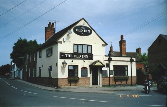
Littlethorpe is a small village approximately south of Leicester, separated from the village of Narborough, Leicestershire, Narborough by the Leicester to Birmingham railway line, and the River Soar of which it is the true discharge. The village has expanded since the Second World War most noticeably through the creation of two housing estates, the Jelson estate and Barratt estate. Housing continues to be built, Parnell Close being completed during 2005. Services The village has two pubs, the Plough Inn and the Old Inn. Other services include a garden centre, funeral directors and a beauty salon. Narborough railway station is situated close to Littlethorpe, on the edge of Narborough, and services run between Leicester and Birmingham. Littlethorpe Community Association The Littlethorpe Community Association meets in the skittle alley of one of the pubs. The Association organises the annual gala on Littlethorpe Park and Thorpe meadows, as well as holding monthly coffee mo ... [...More Info...] [...Related Items...] OR: [Wikipedia] [Google] [Baidu] |
Narborough, Leicestershire
Narborough is a large village and civil parish in the Blaby district of Leicestershire, England, around southwest of Leicester. The population of the civil parish (including Littlethorpe) was 8,498. The name is derived from the Old English ''north burh'', meaning "north fort or stronghold". At the 2001 Census, the parish had a population of 8,402. Surrounding villages include Enderby, Whetstone, Littlethorpe, Cosby, and Huncote. Location Narborough is situated on or near several major transport corridors. The M1 motorway passes through the east of Narborough, and the Leicester to Birmingham railway line runs beside the River Soar on its way through the village. Coventry Road in the village centre runs along the course of the Fosse Way (Roman road), which then joins back onto the present course of the B4114 link from Birmingham to Leicester. Narborough is often split into two distinct parts, the (old) village core to the South and the newer Pastures estate to the nor ... [...More Info...] [...Related Items...] OR: [Wikipedia] [Google] [Baidu] |
Blaby District
Blaby is a Non-metropolitan district, local government district in Leicestershire, England. The district is named after the village of Blaby, although the council is based in Narborough, Leicestershire, Narborough. The district covers an area lying south-west of the city of Leicester. Several of the district's settlements form part of the wider Leicester Urban Area, including Glenfield, Leicestershire, Glenfield, where Leicestershire County Council has its headquarters at County Hall, Glenfield, County Hall, and the town of Braunstone Town, Braunstone. The neighbouring districts are Hinckley and Bosworth, Borough of Charnwood, Charnwood, Leicester, Oadby and Wigston, Harborough District, Harborough and Borough of Rugby, Rugby. History The district traces its origins to the Blaby Poor Law Union, which had been created in 1836. Although named after Blaby, the union built its workhouse in Enderby, Leicestershire, Enderby. In 1872 sanitary districts were established, giving public hea ... [...More Info...] [...Related Items...] OR: [Wikipedia] [Google] [Baidu] |
Leicestershire
Leicestershire ( ) is a Ceremonial counties of England, ceremonial county in the East Midlands of England. It is bordered by Derbyshire, Nottinghamshire and Lincolnshire to the north, Rutland to the east, Northamptonshire to the south-east, Warwickshire to the south-west, and Staffordshire to the west. The city of Leicester is the largest settlement and the county town. The county has an area of and a population of one million according to 2022 estimates. Leicester is in the centre of the county and is by far the largest settlement, with a Leicester urban area, built-up area population of approximately half a million. The remainder of the county is largely rural, and the next-largest settlements are Loughborough in the north, Hinckley in the south-west, and Wigston south-east of Leicester. For Local government in England, local government purposes Leicestershire comprises a non-metropolitan county, with seven districts, and the Unitary authorities of England, unitary authority a ... [...More Info...] [...Related Items...] OR: [Wikipedia] [Google] [Baidu] |
South Leicestershire (UK Parliament Constituency)
South Leicestershire is a constituency represented in the House of Commons of the UK Parliament since 2015 by Alberto Costa, a member of the Conservative Party. The current constituency has similar boundaries to the previous Blaby constituency. Historically the "Southern Division of Leicestershire", was a county constituency, less formally known as South Leicestershire. From 1832 to 1885 it elected two Members of Parliament (MPs) by the bloc vote system of election. Boundaries Historic 1832–1885: The Hundreds of Gartree (excluding the parishes of Baggrave, Burrough, Knossington, Marefield, Pickwell-cum-Leesthorpe, Ouston, and Newbold-Saucey), Sparkenhoe and Guthlaxton, and the Borough of Leicester and the Liberties thereof. 2010–2024 Following its review of parliamentary representation in Leicestershire, the Boundary Commission for England recommended replacing the Blaby constituency with a new South Leicestershire seat, with some boundary changes. This c ... [...More Info...] [...Related Items...] OR: [Wikipedia] [Google] [Baidu] |
Leicester
Leicester ( ) is a city status in the United Kingdom, city, Unitary authorities of England, unitary authority area, and the county town of Leicestershire in the East Midlands of England. It is the largest city in the East Midlands with a population of in . The greater Leicester urban area had a population of 559,017 in 2021, making it the 11th most populous in England, and the List of urban areas in the United Kingdom, 13th most populous in the United Kingdom. A 2023 report ranked Leicester 16th out of the 50 largest UK cities on a range of economic measures, and the first of seven East Midlands cities. The city lies on the River Soar and is approximately north-northwest of London, east-northeast of Birmingham and northeast of Coventry. Nottingham and Derby lie around to the north and northwest respectively, whilst Peterborough is located to the east. Leicester is close to the eastern end of the National Forest, England, National Forest. Leicester has a long history exten ... [...More Info...] [...Related Items...] OR: [Wikipedia] [Google] [Baidu] |
Old Inn Littlethorpe 2
Old or OLD may refer to: Places *Old, Baranya, Hungary *Old, Northamptonshire, England *Old Street station, a railway and tube station in London (station code OLD) *OLD, IATA code for Old Town Municipal Airport and Seaplane Base, Old Town, Maine, United States People *Old (surname) Music *OLD (band), a grindcore/industrial metal group * ''Old'' (Danny Brown album), a 2013 album by Danny Brown * ''Old'' (Starflyer 59 album), a 2003 album by Starflyer 59 * "Old" (song), a 1995 song by Machine Head *"Old", a 1982 song by Dexys Midnight Runners from ''Too-Rye-Ay'' Other uses * ''Old'' (film), a 2021 American thriller film *''Oxford Latin Dictionary'' *Online dating *Over-Locknut Distance (or Dimension), a measurement of a bicycle wheel and frame See also *Old age *List of people known as the Old *''Old LP'', a 2019 album by That Dog * * *Olde, a list of people with the surname *Olds (other) Olds may refer to: People * The olds, a jocular and irreverent online nick ... [...More Info...] [...Related Items...] OR: [Wikipedia] [Google] [Baidu] |
Farm Riddington
A farm (also called an agricultural holding) is an area of land that is devoted primarily to agricultural processes with the primary objective of producing food and other crops; it is the basic facility in food production. The name is used for specialized units such as arable farms, vegetable farms, fruit farms, dairy, pig and poultry farms, and land used for the production of natural fiber, biofuel, and other biobased products. It includes ranches, feedlots, orchards, plantations and estates, smallholdings, and hobby farms, and includes the farmhouse and agricultural buildings as well as the land. In modern times, the term has been extended to include such industrial operations as wind farms and fish farms, both of which can operate on land or at sea. There are about 570 million farms in the world, most of which are small and family-operated. Small farms with a land area of fewer than 2 hectares operate on about 12% of the world's agricultural land, and family farms comprise ... [...More Info...] [...Related Items...] OR: [Wikipedia] [Google] [Baidu] |
River Soar
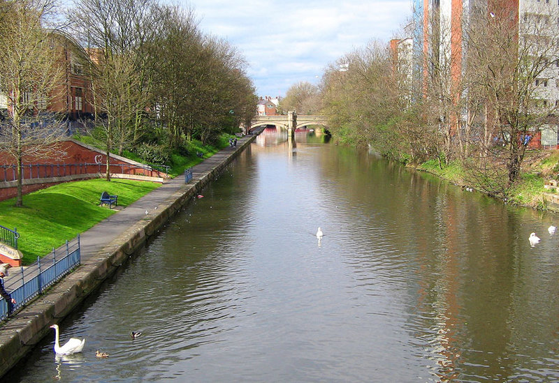
The River Soar () is a major tributary of the River Trent in the East Midlands as well as the principal river of Leicestershire, England. The source of the river is midway between Hinckley and Lutterworth. The river then flows north through Leicester, where it is joined by the Grand Union Canal. Continuing on through the Leicestershire Soar Valley, it passes Loughborough and Kegworth until it reaches the Trent at the county boundary. In the 18th century, the Soar was made navigable, initially between Loughborough and the Trent, and then through to Leicester. It was not until the early 19th century that it was linked by the Grand Union Canal to the wider network to the south and to London. Name The name of the ''Soar'' is included in a family of old river-names derived from a root ''*ser-'' "to flow", alongside (among others) ''Saravus'' (''Soar'', a tributary of the Moselle in Belgium), ''Sera'' (''la Serre'', ''la Cère'' and ''le Séran'', three rivers in France), ... [...More Info...] [...Related Items...] OR: [Wikipedia] [Google] [Baidu] |
Narborough Railway Station
Narborough railway station serves the large village of Narborough and the small village of Littlethorpe in Leicestershire. It is on the Birmingham to Peterborough Line about southwest of . The station is owned by Network Rail and managed by East Midlands Railway, who do not serve the station. Only CrossCountry trains serve the station. A full range of tickets for travel is available from the station ticket office, which is open from 0640 to 1300 Mondays to Saturdays, or at other times from the guard on the train at no extra cost. History The station was opened in 1864 by the South Leicestershire Railway, which was taken over by the London and North Western Railway in 1867. British Railways closed the station on 4 March 1968, but public objections led BR to reopen it on 5 January 1970. Restoration of the station after 21 months of disuse cost £3,250, which was paid for by the then Blaby Rural District Council and Narborough Parish Council. Next to the station is a level ... [...More Info...] [...Related Items...] OR: [Wikipedia] [Google] [Baidu] |
Cosby, Leicestershire
Cosby is a village in the England, English county of Leicestershire. Cosby is located in the south of the county near the larger villages and towns of Whetstone, Leicestershire, Whetstone, Blaby, Wigston and Oadby. Its proximity to the city of Leicester means it is part of the Leicester Urban Area. The village is administered by Blaby District Council. Cosby has a brook which runs through the village and eventually serves as a tributary to the River Soar, then runs into the river Humber and then into the North Sea. Even though The Wash is 59 miles away there is no source of the river in Cosby. London is 80 miles away, and the closest airports are East Midlands Airport (EMA) and Birmingham Airport (BHX) The village's name probably means 'farm/settlement of Cossa'. 'Farm/settlement of Kofsi' has also been suggested. History Cosby's 'Scandinavian' place name indicates that the village existed here several hundred years earlier, dating to the time of the Danish invasion in the ... [...More Info...] [...Related Items...] OR: [Wikipedia] [Google] [Baidu] |
Flag Of Belgium
The national flag of the Kingdom of Belgium is a Tricolour (flag), tricolour consisting of three equal vertical bands displaying the national colours: black, yellow, and red. The colours were taken from the coat of arms of the Duchy of Brabant, and the vertical design may be based on the flag of France. When flown, the black band is nearest the pole (at the hoist side). It has the unusual proportions of 1315, and therefore, unlike the flags of Switzerland and the Vatican City, it is not a perfect square. In 1830, the flag, at that time non-officially, consisted of three horizontal bands, with the colors red, yellow and black. On 23 January 1831, the National Congress of Belgium, National Congress enshrined the tricolor in the Constitution of Belgium, Constitution, but did not determine the direction and order of the color bands. As a result, the "official" flag was given vertical stripes with the colors black, yellow and red. Previous flags After the death of Charlemagne, the p ... [...More Info...] [...Related Items...] OR: [Wikipedia] [Google] [Baidu] |
Genappe
Genappe (; , ; ) is a municipality and city of Wallonia located in the Belgian province of Walloon Brabant. Demographics As of 2023, the municipality of Genappe boasted a population of 14,266 residents. Spanning a total area of 89.57 km2 , the region has a population density of 15,26 inhabitants per km2. History Although his birthplace was probably Boulogne-sur-Mer, one 13th-century chronicler cites Baisy (now Baisy-Thy in Genappe), as the birthplace of Godfrey of Bouillon, the best-known leader of the First Crusade The First Crusade (1096–1099) was the first of a series of religious wars, or Crusades, initiated, supported and at times directed by the Latin Church in the Middle Ages. The objective was the recovery of the Holy Land from Muslim conquest ... (1096-1099). Postal history The Genappe post-office opened before 1830. It used a postal code 48 with bars (before 1864), and 145 with points before 1870. BOUSVAL opened on 8 April 1880. Postal codes in 1969 (b ... [...More Info...] [...Related Items...] OR: [Wikipedia] [Google] [Baidu] |


