|
Litovelské Pomoraví Protected Landscape Area
Litovelské Pomoraví Protected Landscape Area (, usually abbreviated as ''CHKO Litovelské Pomoraví'') is a protected landscape area in the floodplain of the Morava River, north of Olomouc in the Czech Republic. It was established on 15 November 1990 on an area of . In the centre of the area lies the town of Litovel, from which the protected area has derived its name. The ecological backbone of the protected landscape area is the naturally meandering Morava, in floodplain forests branching out and forming a complex system of permanent and temporary river arms, a so-called anastomosing river system. The uncontrollability and power of regular floods in the Middle Ages led Hanakian farmers to building a wreath of dikes around the forest where it meets agricultural land. Thanks to these the floodplain forests of Litovelské Pomoraví have within living memory offered significant flood protection to surrounding villages and the cities of Olomouc and Litovel, as they form an enormou ... [...More Info...] [...Related Items...] OR: [Wikipedia] [Google] [Baidu] |
Litovel
Litovel (; ) is a town in Olomouc District in the Olomouc Region of the Czech Republic. It has about 9,500 inhabitants. The historic town centre is well preserved and is protected as an Cultural monument (Czech Republic)#Monument zones, urban monument zone. Administrative division Litovel consists of 11 municipal parts (in brackets population according to the 2021 census): *Litovel (6,910) *Březové (205) *Chudobín (213) *Myslechovice (394) *Nasobůrky (438) *Nová Ves (204) *Rozvadovice (243) *Savín (129) *Tři Dvory (254) *Unčovice (378) *Víska (91) Geography Litovel is located about northwest of Olomouc. It lies in a flat agricultural landscape of the Upper Morava Valley lowland. The highest point is the hill Šumina at above sea level. The Morava (river), Morava River and six its branches flow through the town, which gave it the nickname "Moravian Venice". The northern part of the municipal territory lies in the Litovelské Pomoraví Protected Landscape Area, named af ... [...More Info...] [...Related Items...] OR: [Wikipedia] [Google] [Baidu] |
Mladeč
Mladeč () is a municipality and village in Olomouc District in the Olomouc Region of the Czech Republic. It has about 700 inhabitants. Administrative division Mladeč consists of three municipal parts (in brackets population according to the 2021 census): *Mladeč (421) *Nové Zámky (102) *Sobáčov (231) Geography Mladeč is located about northwest of Olomouc. It extends into three geomorphological regions. The southern part of the municipal territory with the Mladeč and Sobáčov villages lies in the Zábřeh Highlands. The central part lies in the Upper Morava Valley. The northern part with the Nové Zámky village lies in the Hanušovice Highlands. The Morava River flows through the central area of the municipality. The brook of Mlýnský potok, a tributary of the Morava, also flows through the municipality and is divided here into two branches. There are two fishponds in the municipality: Sobáčovský and Zámecký. Most of the municipality is located in the Litove ... [...More Info...] [...Related Items...] OR: [Wikipedia] [Google] [Baidu] |
Geography Of The Olomouc Region
Geography (from Ancient Greek ; combining 'Earth' and 'write', literally 'Earth writing') is the study of the lands, features, inhabitants, and phenomena of Earth. Geography is an all-encompassing discipline that seeks an understanding of Earth and world, its human and natural complexities—not merely where objects are, but also how they have changed and come to be. While geography is specific to Earth, many concepts can be applied more broadly to other Astronomical object, celestial bodies in the field of planetary science. Geography has been called "a bridge between natural science and social science disciplines." Origins of many of the concepts in geography can be traced to Greek Eratosthenes of Cyrene, who may have coined the term "geographia" (). The first recorded use of the word Geography (Ptolemy), γεωγραφία was as the title of a book by Greek scholar Claudius Ptolemy (100 – 170 AD). This work created the so-called "Ptolemaic tradition" of geography, w ... [...More Info...] [...Related Items...] OR: [Wikipedia] [Google] [Baidu] |
Protected Areas Established In 1900
Protection is any measure taken to guard something against damage caused by outside forces. Protection can be provided to physical objects, including organisms, to systems, and to intangible things like civil and political rights. Although the mechanisms for providing protection vary widely, the basic meaning of the term remains the same. This is illustrated by an explanation found in a manual on electrical wiring: Some kind of protection is a characteristic of all life, as living things have evolved at least some protective mechanisms to counter damaging environmental phenomena, such as ultraviolet light. Biological membranes such as bark on trees and skin on animals offer protection from various threats, with skin playing a key role in protecting organisms against pathogens and excessive water loss. Additional structures like scales and hair offer further protection from the elements and from predators, with some animals having features such as spines or camouflage servi ... [...More Info...] [...Related Items...] OR: [Wikipedia] [Google] [Baidu] |
Úsov
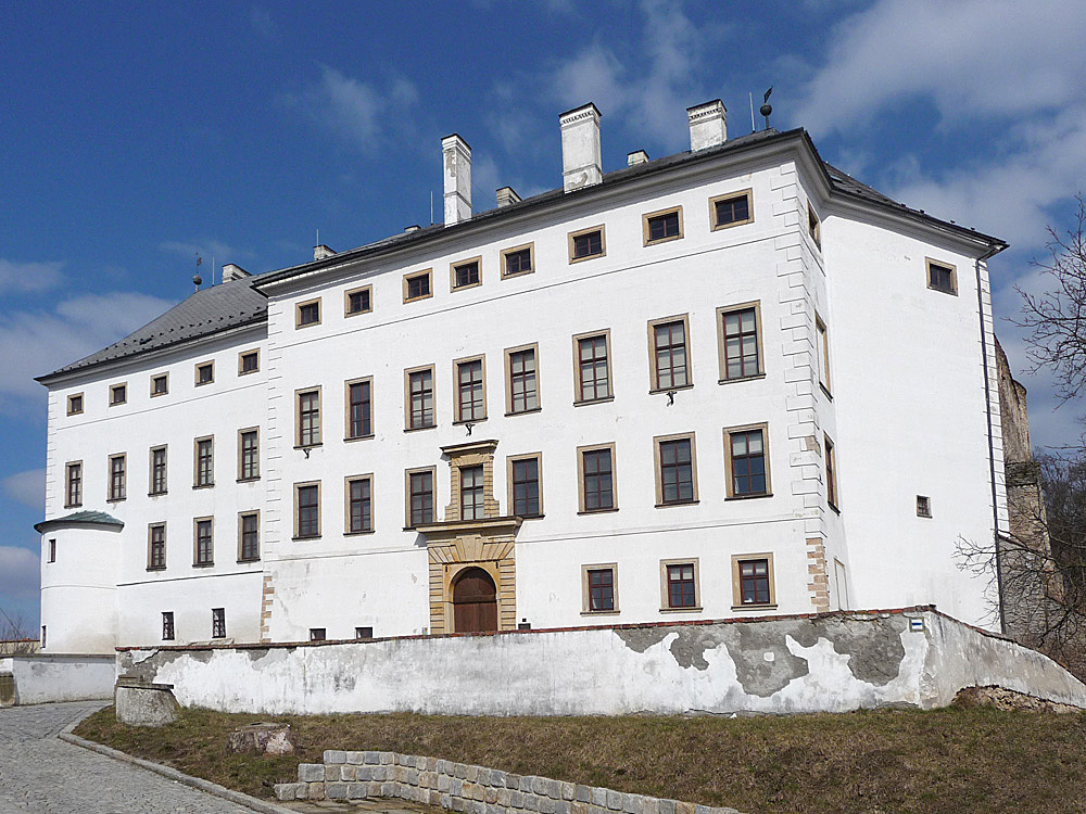
Úsov () is a town in Šumperk District in the Olomouc Region of the Czech Republic. It has about 1,200 inhabitants. Administrative division Úsov consists of two municipal parts (in brackets population according to the 2021 census): *Úsov (1,015) *Bezděkov u Úsova (72) Bezděkov u Úsova forms an Enclave and exclave, exclave of the municipal territory. Etymology The name was probably derived from the personal name Ús. The personal name arose from the old Czech word ''vús'' (in modern Czech ''vous''), meaning 'beard'. The German name Aussee was created by transcription of the Czech name. In the first half of the 20th century, the name Mährisch Aussee ('Moravian Aussee') was used in German. The Jewish community called the town (Ojsa). Geography Úsov is located about south of Šumperk and northwest of Olomouc. It lies in the Hanušovice Highlands. The highest point, located in the territory's exclave, is at above sea level. The Doubravka Stream flows through the villag ... [...More Info...] [...Related Items...] OR: [Wikipedia] [Google] [Baidu] |
Mladeč Caves
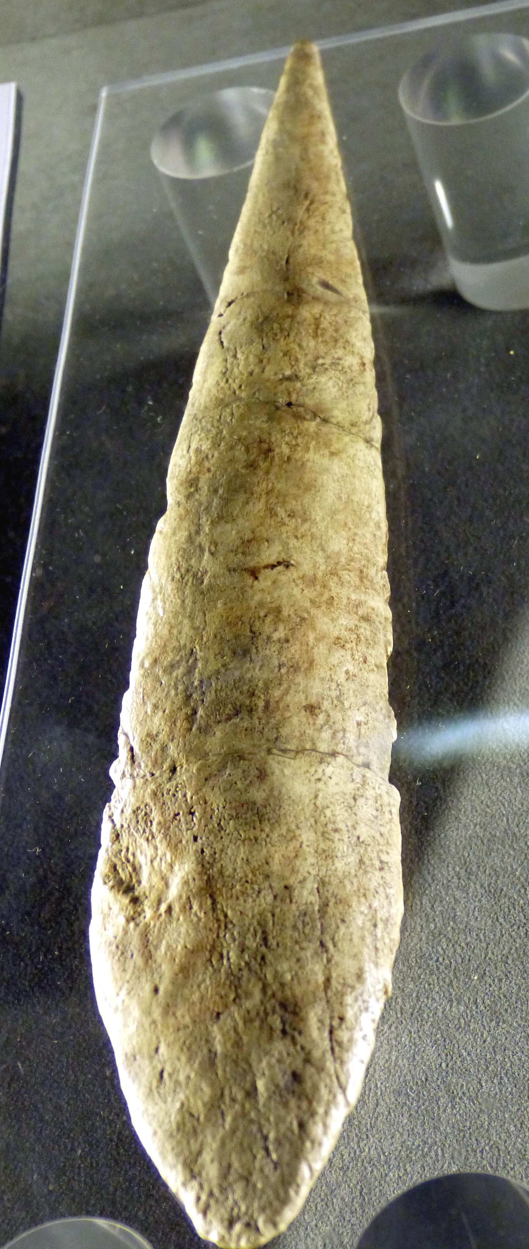
The Mladečské Caves () are a cave complex in the municipality of Mladeč in the Czech Republic. It is located in the Třesín National Nature Monument within the Litovelské Pomoraví Protected Landscape Area. The complex labyrinth of Fracture (geology), fissure Stream corridor, corridors and caves can be found inside the calcite hill of Třesín. The underground spaces are decorated with stalactites, stalagmites and Calcareous sinter, sinters. Its highlights include "Nature's Temple" and the "Virgin Cave". Caves The islets of limestones in Mladeč Karst belong geologically to one of the belts of the Devonian rocks in the Central Moravian part of the Bohemian Massif (the Konice-Mladeč Devonian). These caves represent a predominantly horizontal and very broken labyrinth of corridors, domes and high chimneys with remarkable modelling of walls and ceilings, with stalactite and stalagmite decoration and with numerous block cave-ins, with some steep corridors which extend even belo ... [...More Info...] [...Related Items...] OR: [Wikipedia] [Google] [Baidu] |
Limestone
Limestone is a type of carbonate rock, carbonate sedimentary rock which is the main source of the material Lime (material), lime. It is composed mostly of the minerals calcite and aragonite, which are different Polymorphism (materials science), crystal forms of calcium carbonate . Limestone forms when these minerals Precipitation (chemistry), precipitate out of water containing dissolved calcium. This can take place through both biological and nonbiological processes, though biological processes, such as the accumulation of corals and shells in the sea, have likely been more important for the last 540 million years. Limestone often contains fossils which provide scientists with information on ancient environments and on the evolution of life. About 20% to 25% of sedimentary rock is carbonate rock, and most of this is limestone. The remaining carbonate rock is mostly Dolomite (rock), dolomite, a closely related rock, which contains a high percentage of the mineral Dolomite (mine ... [...More Info...] [...Related Items...] OR: [Wikipedia] [Google] [Baidu] |
Polder
A polder () is a low-lying tract of land that forms an artificial hydrology, hydrological entity, enclosed by embankments known as levee, dikes. The three types of polder are: # Land reclamation, Land reclaimed from a body of water, such as a lake or the seabed # Floodplain, Flood plains separated from the sea or river by a dike # Marshes separated from the surrounding water by a dike and subsequently drained; these are also known as ''koogs'', especially in Germany The ground level in drained marshes subsidence, subsides over time. All polders will eventually be below the surrounding water level some or all of the time. Water enters the low-lying polder through infiltration (hydrology), infiltration and water pressure of groundwater, or rainfall, or transport of water by rivers and canals. This usually means that the polder has an excess of water, which is pumped out or drained by opening sluices at low tide. Care must be taken not to set the internal water level too low. Pold ... [...More Info...] [...Related Items...] OR: [Wikipedia] [Google] [Baidu] |
Floodplain
A floodplain or flood plain or bottomlands is an area of land adjacent to a river. Floodplains stretch from the banks of a river channel to the base of the enclosing valley, and experience flooding during periods of high Discharge (hydrology), discharge.Goudie, A. S., 2004, ''Encyclopedia of Geomorphology'', vol. 1. Routledge, New York. The soils usually consist of clays, silts, sands, and gravels deposited during floods. Because of regular flooding, floodplains frequently have high soil fertility since nutrients are deposited with the flood waters. This can encourage farming; some important agricultural regions, such as the Nile and Mississippi Basin, Mississippi Drainage basin, river basins, heavily exploit floodplains. Agricultural and urban regions have developed near or on floodplains to take advantage of the rich soil and freshwater. However, the Flood risk, risk of inundation has led to increasing efforts to Flood control, control flooding. Formation Most floodplai ... [...More Info...] [...Related Items...] OR: [Wikipedia] [Google] [Baidu] |
Dyke (construction)
A levee ( or ), dike (American English), dyke (British English; see spelling differences), embankment, floodbank, or stop bank is an elevated ridge, natural or artificial, alongside the banks of a river, often intended to protect against flooding of the area adjoining the river. It is usually earthen and often runs parallel to the course of a river in its floodplain or along low-lying coastlines. Naturally occurring levees form on river floodplains following flooding. Sediment and alluvium are deposited on the banks and settle, forming a ridge that increases the river channel's capacity. Alternatively, levees can be artificially constructed from fill, designed to regulate water levels. In some circumstances, artificial levees can be environmentally damaging. Ancient civilizations in the Indus Valley, ancient Egypt, Mesopotamia and China all built levees. Today, levees can be found around the world, and failures of levees due to erosion or other causes can be major disa ... [...More Info...] [...Related Items...] OR: [Wikipedia] [Google] [Baidu] |
Haná
Haná or Hanakia ( or ''Hanácko'', or ''Hanakei'') is an ethnographic region in central Moravia in the Czech Republic. Etymology The region was named after the Haná (river), Haná River. Description Its core area is located along the eponymous river of Haná (river), Haná, around the city of Prostějov and the town of Vyškov, but in common perception it roughly corresponds to the whole Upper Morava Valley, with Olomouc as its natural centre. In terms of the Regions of the Czech Republic, actual administrative division, Haná covers the most of Olomouc Region and adjacent parts of South Moravian Region and Zlín Region. The so-called ''Malá Haná'' ("Lesser Hanakia") is located in the Boskovice Furrow, west of Haná proper. Haná is known for its agricultural fertility, rich costumes, and traditional customs. The Haná dialect (Hanakian dialect, ) is spoken in the region, and is part of the Central Moravian dialect group (which is even often referred to as the "Hanaki ... [...More Info...] [...Related Items...] OR: [Wikipedia] [Google] [Baidu] |


