|
Litchfield, Connecticut
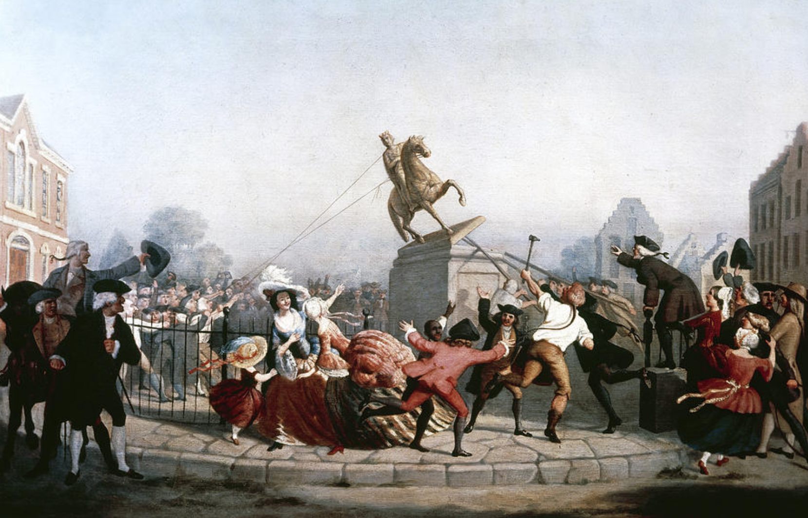
Litchfield is a town in and former county seat of Litchfield County, Connecticut, United States. The population was 8,192 at the 2020 census. The town is part of the Northwest Hills Planning Region. The boroughs of Bantam and Litchfield are located within the town. There are also three unincorporated villages: East Litchfield, Milton, and Northfield. Northfield, located in the southeastern corner of Litchfield, is home to a high percentage of the Litchfield population. History Originally called Bantam township, Litchfield incorporated in 1719. The town derives its name from Lichfield, in England. In 1751 it became the county seat of Litchfield County, and at the same time the borough of Litchfield (incorporated in 1879) was laid out. From 1776 to 1780, two depots for military stores and a workshop for the Continental army were maintained, and the leaden statue of George III., erected in Bowling Green (New York City), in 1770, and torn down by citizens on July 9, 1776, wa ... [...More Info...] [...Related Items...] OR: [Wikipedia] [Google] [Baidu] |
New England Town
The town is the basic unit of Local government in the United States, local government and local division of state authority in the six New England states. Most other U.S. states lack a direct counterpart to the New England town. New England towns overlie the entire area of a state, similar to civil townships in other states where they exist, but they are fully functioning Incorporation (municipal government), municipal corporations, possessing powers similar to city, cities and county, counties in other states. Local government in New Jersey, New Jersey's system of equally powerful townships, boroughs, towns, and cities is the system which is most similar to that of New England. New England towns are often governed by a town meeting, an assembly of eligible town residents. The great majority of municipal corporations in New England are based on the town model; there, statutory forms based on the concept of a Place (United States Census Bureau), compact populated place are uncommon ... [...More Info...] [...Related Items...] OR: [Wikipedia] [Google] [Baidu] |
US 202
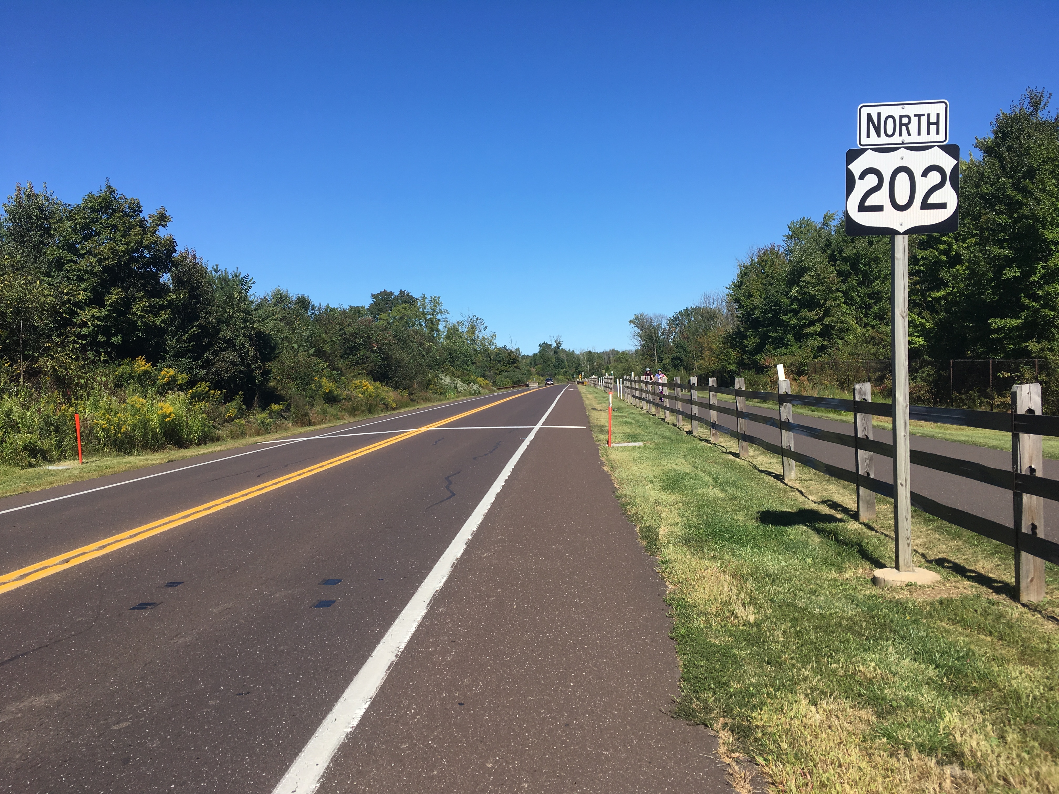
U.S. Route 202 (US 202) is a spur route of US 2. It follows a northeasterly and southwesterly direction stretching from Delaware in the south to Maine in the north and traveling through the states of Pennsylvania, New Jersey, New York, Connecticut, Massachusetts, and New Hampshire. The highway has borne the number 202 since at least 1936. Before this, sections of the highway were designated U.S. Route 122, as it intersected US 22 in New Jersey. It intersects its parent route, US 2, in Bangor, Maine. This highway is considerably longer than the eastern segment of US 2 (although considerably shorter than the combined segments of US 2), making it one of several three-digit U.S. highways to be longer than their parent routes. Route description , - , DE , , - , PA , , - , NJ , , - , NY , , - , CT , , - , MA , , - , NH , , - , ME , , - class="sortbottom" , Total , Delaware US 202 begins at an interchange with US&nb ... [...More Info...] [...Related Items...] OR: [Wikipedia] [Google] [Baidu] |
Benjamin Franklin
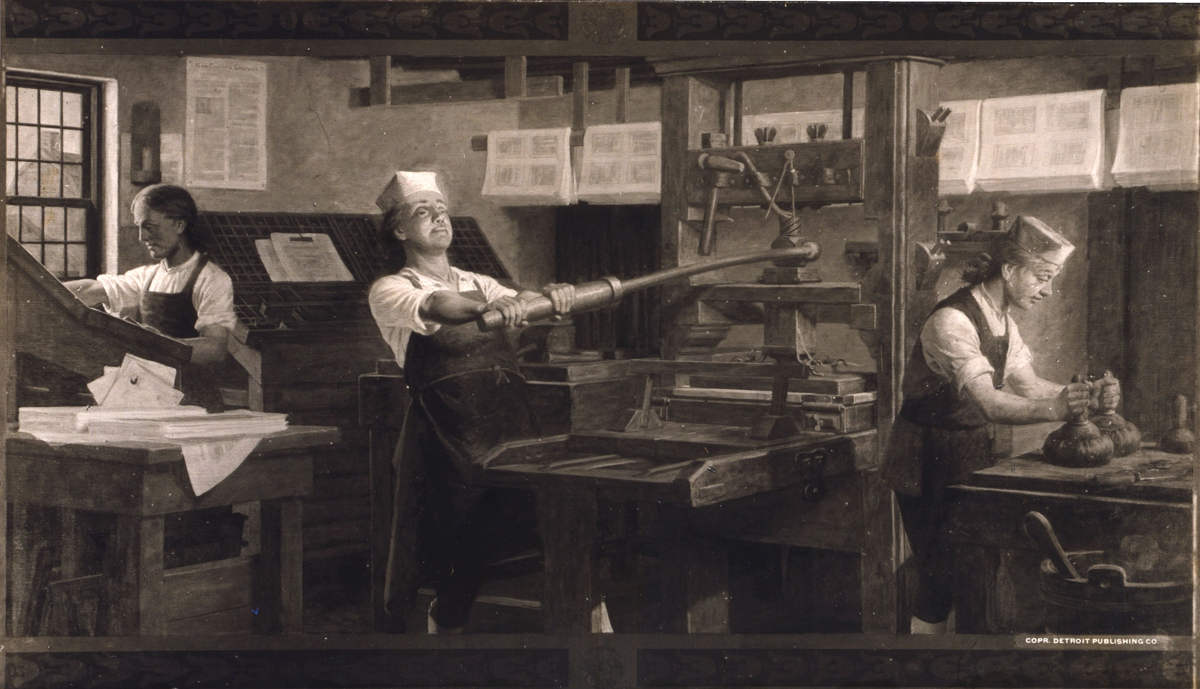
Benjamin Franklin (April 17, 1790) was an American polymath: a writer, scientist, inventor, statesman, diplomat, printer, publisher and Political philosophy, political philosopher.#britannica, Encyclopædia Britannica, Wood, 2021 Among the most influential intellectuals of his time, Franklin was one of the Founding Fathers of the United States; a Committee of Five, drafter and signer of the United States Declaration of Independence, Declaration of Independence; and the first United States Postmaster General, postmaster general. Born in the Province of Massachusetts Bay, Franklin became a successful Early American publishers and printers, newspaper editor and printer in Philadelphia, the leading city in the colonies, publishing ''The Pennsylvania Gazette'' at age 23. He became wealthy publishing this and ''Poor Richard's Almanack'', which he wrote under the pseudonym "Richard Saunders". After 1767, he was associated with the ''Pennsylvania Chronicle'', a newspaper known for it ... [...More Info...] [...Related Items...] OR: [Wikipedia] [Google] [Baidu] |
William Franklin
William Franklin (22 February 1730 – 17 November 1813) was an American-born attorney, soldier, politician, and colonial administrator. He was the acknowledged extra-marital son of Benjamin Franklin. William Franklin was the last colonial Governor of New Jersey (1763–1776), and a steadfast British Empire Loyalist throughout the American Revolutionary War. In contrast, his father Benjamin was, in later life, one of the most prominent of the Patriot leaders of the American Revolution and a Founding Father of the United States. Following imprisonment by Patriots in 1776 to 1778, William became the chief leader of the Loyalists. From his base in New York City, he organized military units to fight on the British side. In 1782, he went into exile in Britain. He lived in London until his death. Early life William Franklin was born in Philadelphia, Pennsylvania, then a colony in British America. He was the extra-marital son of Benjamin Franklin, a leading figure in the city. His ... [...More Info...] [...Related Items...] OR: [Wikipedia] [Google] [Baidu] |
American Revolutionary War
The American Revolutionary War (April 19, 1775 – September 3, 1783), also known as the Revolutionary War or American War of Independence, was the armed conflict that comprised the final eight years of the broader American Revolution, in which American Patriot (American Revolution), Patriot forces organized as the Continental Army and commanded by George Washington defeated the British Army during the American Revolutionary War, British Army. The conflict was fought in North America, the Caribbean, and the Atlantic Ocean. The war's outcome seemed uncertain for most of the war. However, Washington and the Continental Army's decisive victory in the Siege of Yorktown in 1781 led King George III and the Kingdom of Great Britain to negotiate an end to the war in the Treaty of Paris (1783), Treaty of Paris two years later, in 1783, in which the British monarchy acknowledged the independence of the Thirteen Colonies, leading to the establishment of the United States as an independent and ... [...More Info...] [...Related Items...] OR: [Wikipedia] [Google] [Baidu] |
Bowling Green (New York City)
Bowling Green is a small, historic, public park in the Financial District of Lower Manhattan, New York City, at the southern end and address origin of Broadway. Located in the 18th century next to the site of the original Dutch fort of New Amsterdam, it served as a public gathering place and under the English was designated as a park in 1733. It is the oldest public park in New York City and is surrounded by its original 18th-century cast iron fence. The park included an actual bowling green and a monumental equestrian statue of King George III prior to the American Revolutionary War. Pulled down in 1776, the 4000-pound statue is said to have been melted for ammunition to fight the British. Bowling Green is adjacent to another historic park, the Battery, located to the southwest. It is surrounded by several buildings, including the Alexander Hamilton U.S. Custom House (with the NYC office of the National Archives), the International Mercantile Marine Company Building, Bowli ... [...More Info...] [...Related Items...] OR: [Wikipedia] [Google] [Baidu] |
Lichfield
Lichfield () is a city status in the United Kingdom, cathedral city and Civil parishes in England, civil parish in Staffordshire, England. Lichfield is situated south-east of the county town of Stafford, north-east of Walsall, north-west of Tamworth, Staffordshire, Tamworth, south-west of Burton upon Trent and 14 miles (22.5 km) north of Birmingham. At the time of the 2021 Census, the population was 34,738 and the population of the wider Lichfield District was 106,400. Notable for its three-spired medieval Lichfield Cathedral, cathedral, Lichfield was the birthplace of Samuel Johnson, the writer of the first authoritative ''A Dictionary of the English Language, Dictionary of the English Language''. The city's recorded history began when Chad of Mercia arrived to establish his Diocese of Lichfield, bishopric in 669 AD and the settlement grew as the ecclesiastical centre of Mercia. In 2009, the Staffordshire Hoard, the largest hoard of Anglo-Saxons, Anglo-Saxon gold and s ... [...More Info...] [...Related Items...] OR: [Wikipedia] [Google] [Baidu] |
Northfield, Connecticut
Northfield is an unincorporated village in the town of Litchfield, Litchfield County, Connecticut, United States. The village of Northfield is located in the southeastern corner of Litchfield. Northfield shares an undefined northern boundary with the rest of Litchfield proper; this boundary is roughly coterminous with that of the Northfield Fire District. The village is bordered on the east by the town of Harwinton, on the south by the town of Thomaston, and on the west by the town of Morris. As of the 2010 Census, 1,378 residents reside in the village of Northfield. As part of the town of Litchfield, students in Northfield attend Litchfield Public Schools. It is the home of the former Northfield Knife Company, which was founded in 1858 and ceased operations in 1926. The factory was based directly across the street from what is known as Knife Shop Dam. The foundations of the original knife factory still remain, and were listed on the National Register of Historic Places i ... [...More Info...] [...Related Items...] OR: [Wikipedia] [Google] [Baidu] |
Milton (Litchfield)
The Milton Center Historic District encompasses the historic 19th-century village center of Milton in the northwestern part of the town of Litchfield, Connecticut, United States. Basically linear, it stretches from Milton Cemetery in the west to the junction of Milton and Shearshop Roads in the east, including houses, churches, schools, and the remains of industrial sites. The district was listed on the National Register of Historic Places in 1986. Description and history The village of Milton was settled around 1740, and was first known as West Farms. David Welch, one of the early arrivals, built a house in about 1756 that still stands near the eastern end of the village. He was a merchant who also processed iron on his property. Other early residents dammed the branches of the Shepaug River to operate sawmills, gristmills, and other water-powered industry. The small settlement was formally granted parish status by the town in 1768, and its first church was built in 179 ... [...More Info...] [...Related Items...] OR: [Wikipedia] [Google] [Baidu] |
East Litchfield Village, Connecticut
East Litchfield is an Unincorporated area, unincorporated village in the town of Litchfield, Connecticut, Litchfield, Litchfield County, Connecticut, United States. The village of East Litchfield sits at the crossroads of the highways that connect Waterbury and Torrington; Hartford and Litchfield and the Naugatuck River that connects communities from Bridgeport to Winsted. East Litchfield, like Bantam, Milton and Northfield are parts of the town of Litchfield and have been since the town was settled in 1721. Over 3,000 years ago Native Americans found East Litchfield to be a hunting ground rich with wild game. They used the outcroppings of soapstone to make various vessels for food and drink. The area was also rich with quartz that was used for arrowheads and centuries later sent to Massachusetts for sandpaper production. When Europeans settled in the area, it became a community of farmers and mill workers. Naugatuck Valley Railroad built a depot in 1849 and extended the trai ... [...More Info...] [...Related Items...] OR: [Wikipedia] [Google] [Baidu] |
Litchfield (borough), Connecticut
Litchfield is a borough (Connecticut), borough in, and the village center of, the New England town, town of Litchfield, Connecticut, Litchfield in Litchfield County, Connecticut, Litchfield County, Connecticut, United States. The population was 1,258 at the 2010 United States Census, 2010 census. The entire borough was designated a Connecticut historic district (United States), historic district in 1959 by special act of the Connecticut General Assembly, state General Assembly and is listed on the National Register of Historic Places. Part of the borough is also a National Historic Landmark, the Litchfield Historic District.Borough of Litchfield Historic District Commission Town of Litchfield website, accessed January 28, 2010 History [...More Info...] [...Related Items...] OR: [Wikipedia] [Google] [Baidu] |
Bantam, Connecticut
Bantam is a borough in Litchfield County, Connecticut, United States. The population was 720 at the 2020 census. It is part of the town of Litchfield. On July 10, 1989, many of the buildings in Bantam were heavily damaged by a tornado that ripped through Litchfield and New Haven Counties. The storm also caused considerable damage to the Litchfield County town of Thomaston, and to the New Haven County towns of Waterbury, Hamden and North Haven. Geography According to the United States Census Bureau, the borough has a total area of , all land. Climate This climatic region is typified by large seasonal temperature differences, with warm to hot (and often humid) summers and cold (sometimes severely cold) winters. According to the Köppen Climate Classification system, Bantam has a humid continental climate, abbreviated "Dfb" on climate maps. Demographics As of the 2010 census Bantam had a population of 759. The racial composition of the population was 96.6% white, 1.2% ... [...More Info...] [...Related Items...] OR: [Wikipedia] [Google] [Baidu] |


