|
List Of Road–rail Bridges
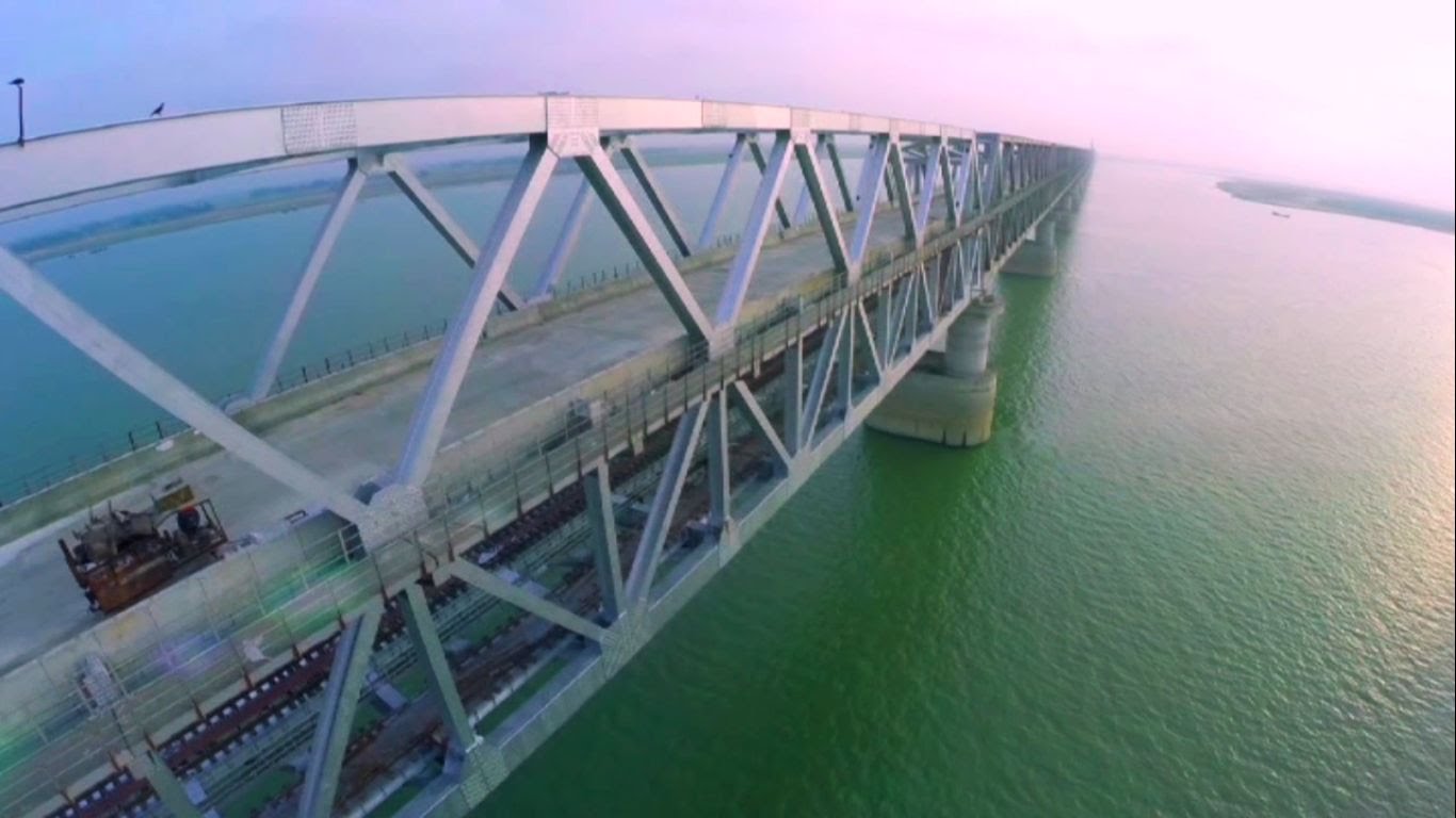
Road–rail bridges are bridges shared by road and rail lines. Road and rail may be segregated so that trains may operate at the same time as cars (e.g., the Sydney Harbour Bridge). The rail track can be above the roadway or vice versa with truss bridges. Road and rail may share the same carriageway so that road traffic must stop when the trains operate (like a level crossing), or operate together like a tram in a street (street running). Road–rail bridges are sometimes called combined bridges. Afghanistan * Afghanistan–Uzbekistan Friendship Bridge between Termez and Jeyretan. Argentina * Transandine Railway rail tunnel converted to road use for time being, albeit single lane. *Zárate–Brazo Largo Bridge *San Roque González de Santa Cruz Bridge, between Posadas, Misiones, Posadas, Argentina, and Encarnación (Paraguay), Encarnación, Paraguay. Australia Current * Sydney Harbour Bridge, Sydney, carried further two rail tracks as tram tracks from 1932 until 1958 ... [...More Info...] [...Related Items...] OR: [Wikipedia] [Google] [Baidu] |
Sydney Harbour Bridge
The Sydney Harbour Bridge is a steel through arch bridge in Sydney, New South Wales, Australia, spanning Port Jackson, Sydney Harbour from the Sydney central business district, central business district (CBD) to the North Shore (Sydney), North Shore. The view of the bridge, the Harbour, and the nearby Sydney Opera House is widely regarded as an iconic image of Sydney, and of Australia itself. Nicknamed "the Coathanger" because of its arch-based design, the bridge carries rail, vehicular, bicycle and pedestrian traffic. Under the direction of John Bradfield (engineer), John Bradfield of the NSW Public Works, New South Wales Department of Public Works, the bridge was designed and built by British firm Dorman Long of Middlesbrough, and opened in 1932. The bridge's general design, which Bradfield tasked the NSW Department of Public Works with producing, was a rough copy of the Hell Gate Bridge in New York City. The design chosen from the tender responses was original work created by ... [...More Info...] [...Related Items...] OR: [Wikipedia] [Google] [Baidu] |
Narrows Bridge, Perth
The Narrows Bridge is a freeway and railway crossing of the Swan River in Perth, Western Australia. Made up of two road bridges and a railway bridge constructed at a part of the river known as ''the Narrows'', located between Mill Point and Point Lewis, it connects the Mitchell and Kwinana freeways, linking the city's northern and southern suburbs. The original road bridge was opened in 1959 and was the largest precast prestressed concrete bridge in the world. Construction of the northern interchange for this bridge necessitated the reclamation of a large amount of land from the river. The bridge formed part of the Kwinana Freeway which originally ran for only to Canning Bridge. Over the following decades, the freeway system was expanded to the north and south, greatly increasing the volume of traffic using the bridge. As a result, in 2001, a second road bridge was opened to the west of the original bridge, and in 2005, the railway bridge was constructed in the gap betwee ... [...More Info...] [...Related Items...] OR: [Wikipedia] [Google] [Baidu] |
North Coast Railway Line, New South Wales
The North Coast railway line is the primary rail route in the Mid North Coast and Northern Rivers regions of New South Wales, Australia, and forms a major part of the Sydney–Brisbane rail corridor. The line begins at Maitland, New South Wales, Maitland and ends at Roma Street railway station in Brisbane, although freight services terminate at the yard at Acacia Ridge, Queensland, Acacia Ridge on the outskirts of Brisbane. Along the way, the railway passes through the towns of Dungog railway station, Dungog, Gloucester railway station, New South Wales, Gloucester, Wingham railway station, New South Wales, Wingham, Taree railway station, Taree, Kendall railway station, Kendall, Wauchope railway station, Wauchope, Kempsey railway station, Kempsey, Macksville railway station, Macksville, Nambucca Heads railway station, Nambucca Heads, Urunga railway station, Urunga, Sawtell railway station, Sawtell, Coffs Harbour railway station, Coffs Harbour, Grafton railway station, New South W ... [...More Info...] [...Related Items...] OR: [Wikipedia] [Google] [Baidu] |
Grafton, New South Wales
Grafton ( Bundjalung: ''Gumbin Gir'') is a city in the Northern Rivers region of the Australian state of New South Wales. It is located on the Clarence River, on a floodplain, approximately by road north-northeast of the state capital Sydney. The closest major cities, Brisbane and the Gold Coast, are located across the border in South East Queensland. At the 2021 census, Grafton had a population of 19,255. The city is the largest settlement and, with Maclean, the shared administrative centre of the Clarence Valley Council local government area, which is home to over 50,000 people in all. History Before European settlement, the Clarence River marked the border between the BundjalungTindale, Norman (1974) "Badjalang" in his ... [...More Info...] [...Related Items...] OR: [Wikipedia] [Google] [Baidu] |
Grafton Bridge, New South Wales
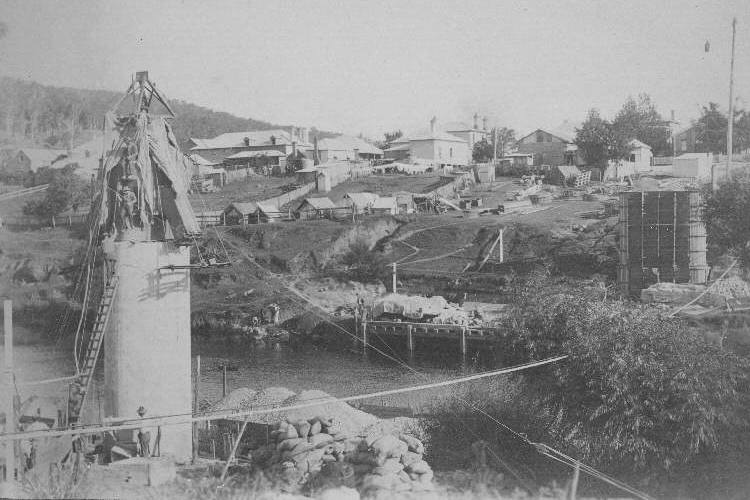
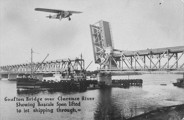
The Grafton Bridge is a heritage-listed Bascule bridge, bascule truss bridge that carries Bent Street (formerly the Summerland Way) and North Coast railway line, New South Wales, North Coast railway line across the Clarence River (New South Wales), Clarence River in Grafton, New South Wales, Australia. The bridge links the Grafton central business district with South Grafton, New South Wales, South Grafton, and was added to the New South Wales State Heritage Register on 2 April 1999. A parallel Balun Bindarray Bridge, located east of the original bridge and initially consisting of two lanes, opened to traffic on 12 December 2019. History A bridge over the Clarence River in Grafton was first conceived in 1915. The original design called for a railway bridge with a footway, but in 1922 the design was changed to accommodate vehicular traffic as well. The bridge was built from 1927 to 1932, although planning for the bridge had been under way as early as 1921. The bridge was desig ... [...More Info...] [...Related Items...] OR: [Wikipedia] [Google] [Baidu] |
Dickabram Bridge
Dickabram Bridge is a heritage-listed road-and-rail bridge over the Mary River between Miva and Theebine, both in the Gympie Region, Queensland, Australia. It was the major bridge on the Kingaroy railway line. It was designed by Henry Charles Stanley and built from 1885 to 1886 by Messrs Michael McDermott, Owens & Co. It is also known as Mary River Bridge (Miva). The bridge was registered on the former Register of the National Estate in 1988. The bridge is one of three remaining road-and-rail bridges in Australia and the only one in South East Queensland following the completion of the Burdekin Bridge in 1957. It is the oldest remaining large steel truss bridge constructed in Queensland. History The Dickabram Bridge over the Mary River was the major bridge on the Kingaroy branch railway line. The contract for construction of the line to Kilkivan was awarded to McDermott, Owens & Company on 8 August 1884, the contract to be completed by the 1st June 1886. This ... [...More Info...] [...Related Items...] OR: [Wikipedia] [Google] [Baidu] |
Continental Railway Journal
Continental may refer to: Places * Continental, Arizona, a small community in Pima County, Arizona, US * Continental, Ohio, a small town in Putnam County, US Arts and entertainment * ''Continental'' (album), an album by Saint Etienne * Continental (card game), a rummy-style card game * ''Continental'' (film), a 2013 film * Continental Singers, a Christian music organization Companies * ContiGroup Companies or Continental Grain * Continental AG, a German automotive parts and technologies manufacturer * Continental Airlines, a former American airline * Continental Electronics, an American radio transmitter manufacturer * Continental Films, a German-controlled French film company during the Nazi occupation of France * Continental Illinois, a defunct large bank * Continental Mortgage and Loan Company (later known as Continental, Inc.), the former name of HomeStreet Bank * Continental Motors, Inc., a Chinese manufacturer of aircraft engines * Continental Oil Company, the original na ... [...More Info...] [...Related Items...] OR: [Wikipedia] [Google] [Baidu] |
Moreton Central Sugar Mill Cane Tramway
Moreton Central Sugar Mill Cane Tramway is a heritage-listed tramway at Mill Street, Currie Street, and Howard Street, in Nambour, Queensland, Nambour, Sunshine Coast Region, Queensland, Australia. It was built . It was added to the Queensland Heritage Register on 7 February 2005. History The Moreton Central Sugar Mill opened for crushing in 1897. The tramway network that connected the mill with cane farms developed over many years and was in use until late 2003. It was a key factor in the success of the mill and the development of Nambour. Sugar cane was first brought to Australia in 1788, but subsequent plantings at Sydney, Port Macquarie and Norfolk Island failed to be commercially viable. Captain Louis Hope grew a cane crop successfully in Queensland in 1862. By 1864 the first commercial sugar mill in Australia had been established by him at Ormiston, Queensland, Ormiston and interest in growing sugar cane spread rapidly, encouraged by the Queensland Government. By 1867 ... [...More Info...] [...Related Items...] OR: [Wikipedia] [Google] [Baidu] |
Maroochy River
The Maroochy River is a river in South East Queensland, Australia. The river rises from the eastern slopes of the Blackall Range and flows east through Eumundi before entering the sea at Cotton Tree, Maroochydore. Other populated centres in the catchment include Nambour, Eudlo, Yandina and Coolum. The suburb south of the Airport, and North of the River and west of the Motorway is known as Maroochy River. Course The watershed of the Maroochy River encompasses of undulating hills, which have been cleared for agriculture and urban uses. There are three dams in the catchment area, including Wappa Dam, Cooloolabin Dam and Poona Dam, which total of capacity. There are two main arms: North and South Maroochy Rivers. Tributaries of the river include Petrie Creek and its major tributary, Paynter Creek, Eudlo Creek, Coolum Creek, Doonan Creek and Yandina Creek. There is one Canal system open to the river Maroochy Waters and a second Canal system with restricted access to th ... [...More Info...] [...Related Items...] OR: [Wikipedia] [Google] [Baidu] |
David Low Way
David Low Way is a Australian road connecting the many coastal townships of the Sunshine Coast with the two large city centres of Maroochydore in the south and Noosa Heads in the north. The route is an alternative coastal route to the Sunshine Motorway and passes through the sugar and fruit growing town of Bli Bli and then crosses the Sunshine Motorway. The road then travels north along the coast, through many coastal towns to the terminus at Noosa Heads. It is named after David Low, a local Member of the Queensland Legislative Assembly. The first stage of the road was opened between Sunshine Beach and Peregian Beach on April 2, 1960, by the Queensland Premier of the time, Frank Nicklin Sir George Francis Reuben Nicklin, (6 August 1895 – 29 January 1978) was an Australian politician. He was the Premier of Queensland from 1957 to 1968, the first non- Labor Party premier since 1932. Early life and career Nicklin was born in M .... Upgrade Cycle facility A project to pr ... [...More Info...] [...Related Items...] OR: [Wikipedia] [Google] [Baidu] |
Bli Bli
Bli Bli ( ) is a rural town and Suburbs and localities (Australia), locality in the Sunshine Coast Region, Queensland, Australia. In the , the locality of Bli Bli had a population of 10,138 people. Geography A few kilometres inland from the Maroochydore urban area, Bli Bli rises above the wetlands which were, for many years, the home of the Sunshine Coast, Queensland, Sunshine Coast sugarcane industry. Whilst this industry is all but gone, state government legislation ensures the wetlands will remain an undeveloped Green Space. The Maroochy River flows through the locality from north-east (Marcoola, Queensland, Marcoola) to south-east (Pacific Paradise, Queensland, Pacific Paradise/Maroochydore). The Yandina-Bli Bli Road enters from the north and the Nambour–Bli Bli Road enters from the west. History The name ''Bli Bli'' is believed to be derived from the Gubbi Gubbi people, Kabi word ''bilai'' meaning ''sheoak tree'' (Casuarina glauca). Bli Bli Provisional School o ... [...More Info...] [...Related Items...] OR: [Wikipedia] [Google] [Baidu] |
Burdekin Bridge
The Burdekin Bridge (known as the Burdekin River Bridge or Silver Link) spans the Burdekin River between the towns of Ayr, Queensland, Ayr (locality of McDesme, Queensland, McDesme) to the north and Home Hill, Queensland, Home Hill to the south, both in the Shire of Burdekin, Queensland, Australia. Located on the Bruce Highway which is part of Highway 1 (Australia), Highway 1, it is an important link in the national road network. It is a road-rail bridge which provides high flood immunity link between north and south Queensland. The Bridge was completed in 1957. Construction began 10 years earlier in 1947. At in length, it is one of the longest multi-span bridges in Australia and longer than Brisbane's Story Bridge or New South Wales's Hawkesbury River Railway Bridge. It is 46 metres shorter than Sydney's Sydney Harbour Bridge, Harbour Bridge. It is the only bridge in Australia to be built on sand. History Prior to the construction of the high-level Burdekin Bridge, there ... [...More Info...] [...Related Items...] OR: [Wikipedia] [Google] [Baidu] |


