|
Line Islands
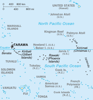
The Line Islands, Teraina Islands or Equatorial Islands () are a chain of 11 atolls (with partly or fully enclosed lagoons, except Vostok and Jarvis) and coral islands (with a surrounding reef) in the central Pacific Ocean, south of the Hawaiian Islands. Eight of the atolls are parts of Kiribati. The remaining three— Jarvis Island, Kingman Reef, and Palmyra Atoll—are territories of the United States grouped with the United States Minor Outlying Islands. The Line Islands, all of which were formed by volcanic activity, are one of the longest island chains in the world, stretching from northwest to southeast. One of them, Starbuck Island, is near the geographic center of the Pacific Ocean (). Another, Kiritimati, has the largest land area of any atoll in the world. Only Kiritimati, Tabuaeran, and Teraina have a permanent population. Besides the 11 confirmed atolls and islands, Filippo Reef is shown on some maps, but its existence is doubted. The International Date L ... [...More Info...] [...Related Items...] OR: [Wikipedia] [Google] [Baidu] |
Pacific Ocean
The Pacific Ocean is the largest and deepest of Earth's five Borders of the oceans, oceanic divisions. It extends from the Arctic Ocean in the north to the Southern Ocean, or, depending on the definition, to Antarctica in the south, and is bounded by the continents of Asia and Australia in the west and the Americas in the east. At in area (as defined with a southern Antarctic border), the Pacific Ocean is the largest division of the World Ocean and the hydrosphere and covers approximately 46% of Earth's water surface and about 32% of the planet's total surface area, larger than its entire land area ().Pacific Ocean . ''Encyclopædia Britannica, Britannica Concise.'' 2008: Encyclopædia Britannica, Inc. The centers of both the Land and water hemispheres, water hemisphere and the Western Hemisphere, as well as the Pole of inaccessi ... [...More Info...] [...Related Items...] OR: [Wikipedia] [Google] [Baidu] |
Tabuaeran
Tabuaeran, also known as Fanning Island, is an atoll that is part of the Line Islands of the central Pacific Ocean and part of the island nation of Kiribati. The land area is , and the population in 2015 was 2,315. The maximum elevation is about 3 m (10 ft) above high tide. The lagoon has an area of . The deepest water in the lagoon is about , but most of it is very shallow. History Tabuaeran was first inhabited by Polynesian people. Archaeological evidence points to a single large village being maintained for several hundred years on the west side of the atoll with other scattered production and agricultural sites across the atoll. Radiometric dates range from 1100 AD to 1425 AD (Cal. 810 ±50 BP and 620 ± 60 BP at 2 sigma). Continuous habitation is likely as stratigraphic cultural layers are uninterrupted and quite deep. Some archaeologists have argued that Tabuaeran and Kiritimati were one community living across a matched set of islands as despite their relat ... [...More Info...] [...Related Items...] OR: [Wikipedia] [Google] [Baidu] |
All Red Line
The All Red Line was a system of electrical telegraphs that linked much of the British Empire. It was inaugurated on 31 October 1902. The informal name derives from the common practice of colouring the territory of the British Empire red or pink on political maps. Construction The first Transatlantic telegraph cable, transatlantic cable connected Ireland and Colony of Newfoundland, Newfoundland in 1858, although it later failed. In 1866, the laid out a lasting link from Waterville, County Kerry and nearby Valentia Island, in Ireland, to Heart's Content, Newfoundland and Labrador, Heart's Content, Newfoundland. By 1870, Suez was linked to Bombay, and from there to Madras, Penang, and Singapore. Australia was linked to British telegraph cables directly in 1871, by extending a line from Singapore to Port Darwin, although it ran through the Dutch territory of Java. By 1872, messages could be sent direct from London to Adelaide and Sydney. Australia was linked to New Zealand by ... [...More Info...] [...Related Items...] OR: [Wikipedia] [Google] [Baidu] |
Whaling
Whaling is the hunting of whales for their products such as meat and blubber, which can be turned into a type of oil that was important in the Industrial Revolution. Whaling was practiced as an organized industry as early as 875 AD. By the 16th century, it had become the principal industry in the Basque coastal regions of Spain and France. The whaling industry spread throughout the world and became very profitable in terms of trade and resources. Some regions of the world's oceans, along the animals' migration routes, had a particularly dense whale population and became targets for large concentrations of whaling ships, and the industry continued to grow well into the 20th century. The depletion of some whale species to near extinction led to the banning of whaling in many countries by 1969 and to an international cessation of whaling as an industry in the late 1980s. Archaeological evidence suggests the earliest known forms of whaling date to at least 3000 BC, practiced by the ... [...More Info...] [...Related Items...] OR: [Wikipedia] [Google] [Baidu] |
Marae
A ' (in Māori language, New Zealand Māori, Cook Islands Māori, Tahitian language, Tahitian), ' (in Tongan language, Tongan), ' (in Marquesan language, Marquesan) or ' (in Samoan language, Samoan) is a communal or sacred place that serves religious and social purposes in Polynesian culture, Polynesian societies. In all these languages, the term also means cleared and free of weeds or trees. generally consist of an area of cleared land roughly rectangular (the itself), bordered with stones or wooden posts (called ' in Tahitian and Cook Islands Māori) perhaps with ' (terraces) which were traditionally used for ceremonial purposes; and in some cases, such as Easter Island, a central stone ' or ''a'u'' is placed. In the Easter Island Rapa Nui people, Rapa Nui culture, the term ''ahu'' or ''a'u'' has become a synonym for the whole marae complex. In some modern Polynesian societies, notably that of the Māori people, Māori of New Zealand, the marae is still a vital part of everyd ... [...More Info...] [...Related Items...] OR: [Wikipedia] [Google] [Baidu] |
Map Of Kiribati CIA WFB
A map is a symbolic depiction of interrelationships, commonly spatial, between things within a space. A map may be annotated with text and graphics. Like any graphic, a map may be fixed to paper or other durable media, or may be displayed on a transitory medium such as a computer screen. Some maps change interactively. Although maps are commonly used to depict geographic elements, they may represent any space, real or fictional. The subject being mapped may be two-dimensional such as Earth's surface, three-dimensional such as Earth's interior, or from an abstract space of any dimension. Maps of geographic territory have a very long tradition and have existed from ancient times. The word "map" comes from the , wherein ''mappa'' meant 'napkin' or 'cloth' and ''mundi'' 'of the world'. Thus, "map" became a shortened term referring to a flat representation of Earth's surface. History Maps have been one of the most important human inventions for millennia, allowing humans t ... [...More Info...] [...Related Items...] OR: [Wikipedia] [Google] [Baidu] |
Fishkeeping
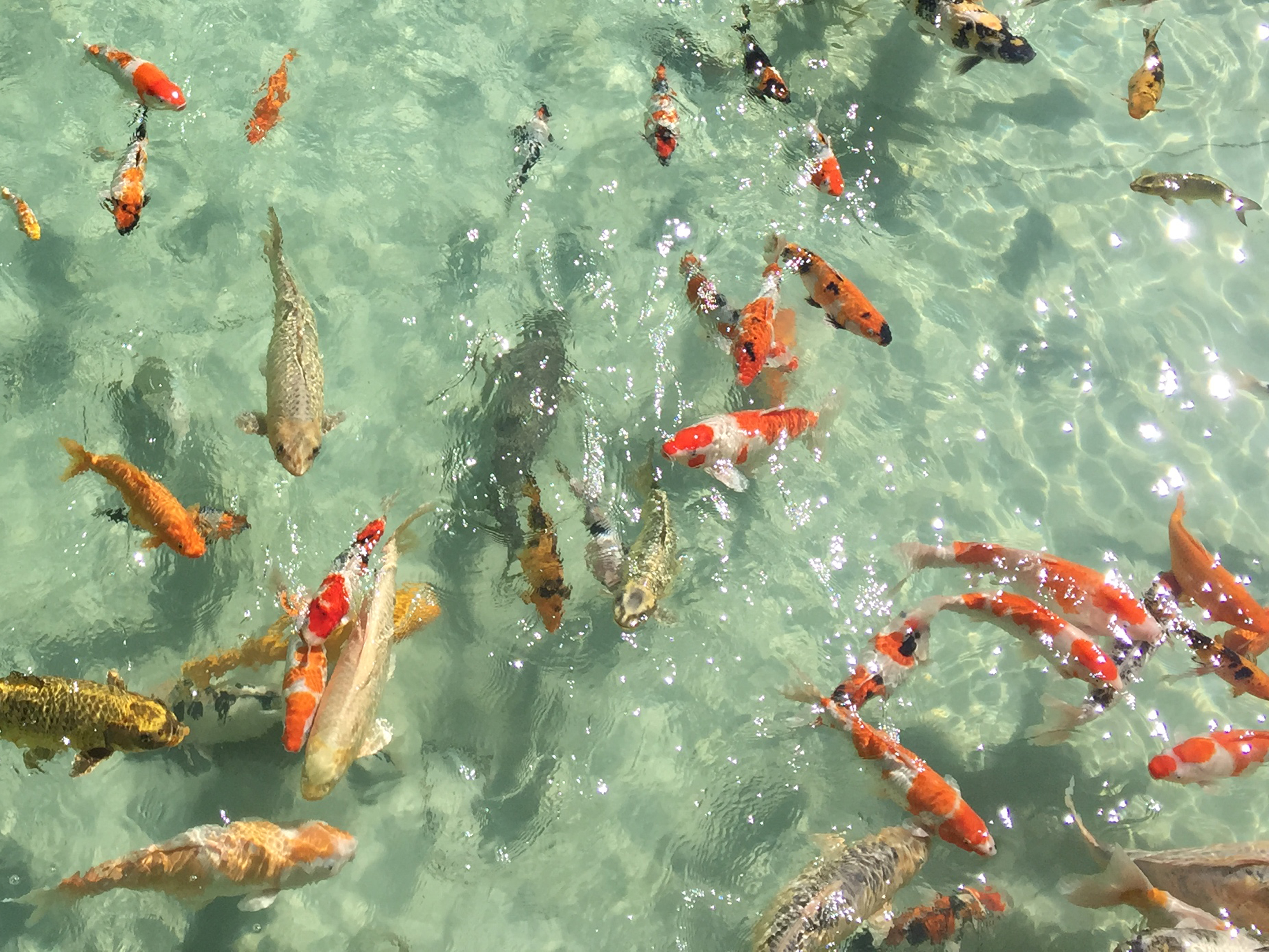
Fishkeeping is a popular hobby, practiced by aquarists, concerned with keeping fish in a home aquarium or garden pond. It is a practice that encompasses the art of maintaining one's own aquatic ecosystem, featuring a lot of variety with various water systems, all of which have their own unique features and requirements. Fishkeeping primarily serves as a token of appreciation and fascination for marine life and the environment that surrounds such, along with other purposes such as the pisciculture, piscicultural fishkeeping industry, serving as a branch of agriculture, being one of the most widespread methods of cultivating fish for commercial profit. Origins of fishkeeping Fish have been raised as food in pools and ponds for thousands of years. Brightly colored or tame specimens of fish in these pools have sometimes been valued as pets rather than food. Many cultures, ancient and modern, have kept fish for both functional and decorative purposes. Ancient Sumerians kept wild-c ... [...More Info...] [...Related Items...] OR: [Wikipedia] [Google] [Baidu] |
Copra
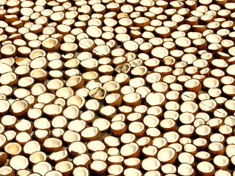
Copra (from ; ; ; ) is the dried, white flesh of the coconut from which coconut oil is extracted. Traditionally, the coconuts are sun-dried, especially for export, before the oil, also known as copra oil, is pressed out. The oil extracted from copra is rich in lauric acid, making it an important commodity in the preparation of lauryl alcohol, soaps, fatty acids, cosmetics, etc. and thus a lucrative product for many coconut-producing countries. The palatable oil cake, known as copra cake, obtained as a residue in the production of copra oil is used in animal feeds. The ground cake is known as coconut or copra meal. Production Copra has traditionally been grated and ground, then boiled in water to extract coconut oil. It was used by Pacific island cultures and became a valuable commercial product for merchants in the South Seas and South Asia in the 1860s. Nowadays, coconut oil (70%) is extracted by crushing copra; the by-product is known as copra cake or copra meal (30 ... [...More Info...] [...Related Items...] OR: [Wikipedia] [Google] [Baidu] |
Baker Island
Baker Island, once known as New Nantucket in the early 19th century, is a small, uninhabited atoll located just north of the Equator in the central Pacific Ocean, approximately southwest of Honolulu. Positioned almost halfway between Hawaii and Australia, its closest neighbor is Howland Island, situated to the north-northwest. Both Baker and Howland Islands have been claimed as territories of the United States since 1857, though the United Kingdom regarded them as part of the British Empire between 1897 and 1936 but did not actually annex them. They were not being used when a U.S. Colonization attempt was started in 1935, and the next year formal reassertion of U.S. sovereignty was issued. During WWII the Japanese Empire attacked the island, and it was evacuated and a small military base was established. The island was an important navigation beacon in the remote Pacific waters during and after WWII. In the 1970s it was made into a nature preserve and has remained so into the ... [...More Info...] [...Related Items...] OR: [Wikipedia] [Google] [Baidu] |
Oceania
Oceania ( , ) is a region, geographical region including Australasia, Melanesia, Micronesia, and Polynesia. Outside of the English-speaking world, Oceania is generally considered a continent, while Mainland Australia is regarded as its continental landmass. Spanning the Eastern Hemisphere, Eastern and Western Hemisphere, Western hemispheres, at the centre of the land and water hemispheres, water hemisphere, Oceania is estimated to have a land area of about and a population of around 46.3 million as of 2024. Oceania is the smallest continent in land area and the list of continents and continental subregions by population, second-least populated after Antarctica. Oceania has a diverse mix of economies from the developed country, highly developed and globally competitive market economy, financial markets of Australia, French Polynesia, Hawaii, New Caledonia, and New Zealand, which rank high in quality of life and Human Development Index, to the much least developed countries ... [...More Info...] [...Related Items...] OR: [Wikipedia] [Google] [Baidu] |
Hawaii
Hawaii ( ; ) is an island U.S. state, state of the United States, in the Pacific Ocean about southwest of the U.S. mainland. One of the two Non-contiguous United States, non-contiguous U.S. states (along with Alaska), it is the only state not on the North American mainland, the only state that is an archipelago, and the only state in the tropics. Hawaii consists of 137 volcanic islands that comprise almost the entire Hawaiian Islands, Hawaiian archipelago (the exception, which is outside the state, is Midway Atoll). Spanning , the state is Physical geography, physiographically and Ethnology, ethnologically part of the Polynesian subregion of Oceania. Hawaii's ocean coastline is consequently the List of U.S. states and territories by coastline, fourth-longest in the U.S., at about . The eight main islands, from northwest to southeast, are Niihau, Niihau, Kauai, Kauai, Oahu, Oahu, Molokai, Molokai, Lanai, Lānai, Kahoʻolawe, Kahoolawe, Maui, and Hawaii (island), Hawaii, a ... [...More Info...] [...Related Items...] OR: [Wikipedia] [Google] [Baidu] |
Time Zone
A time zone is an area which observes a uniform standard time for legal, Commerce, commercial and social purposes. Time zones tend to follow the boundaries between Country, countries and their Administrative division, subdivisions instead of strictly following longitude, because it is convenient for areas in frequent communication to keep the same time. Each time zone is defined by a standard offset from Coordinated Universal Time (UTC). The offsets range from UTC−12:00 to UTC+14:00, and are usually a whole number of hours, but a few zones are offset by an additional 30 or 45 minutes, such as in Indian Standard Time, India and Nepal Time, Nepal. Some areas in a time zone may use a different offset for part of the year, typically one hour ahead during spring (season), spring and summer, a practice known as daylight saving time (DST). List of UTC offsets In the table below, the locations that use daylight saving time (DST) are listed in their UTC offset when DST is ' ... [...More Info...] [...Related Items...] OR: [Wikipedia] [Google] [Baidu] |


