|
Liberty City, Miami, Florida
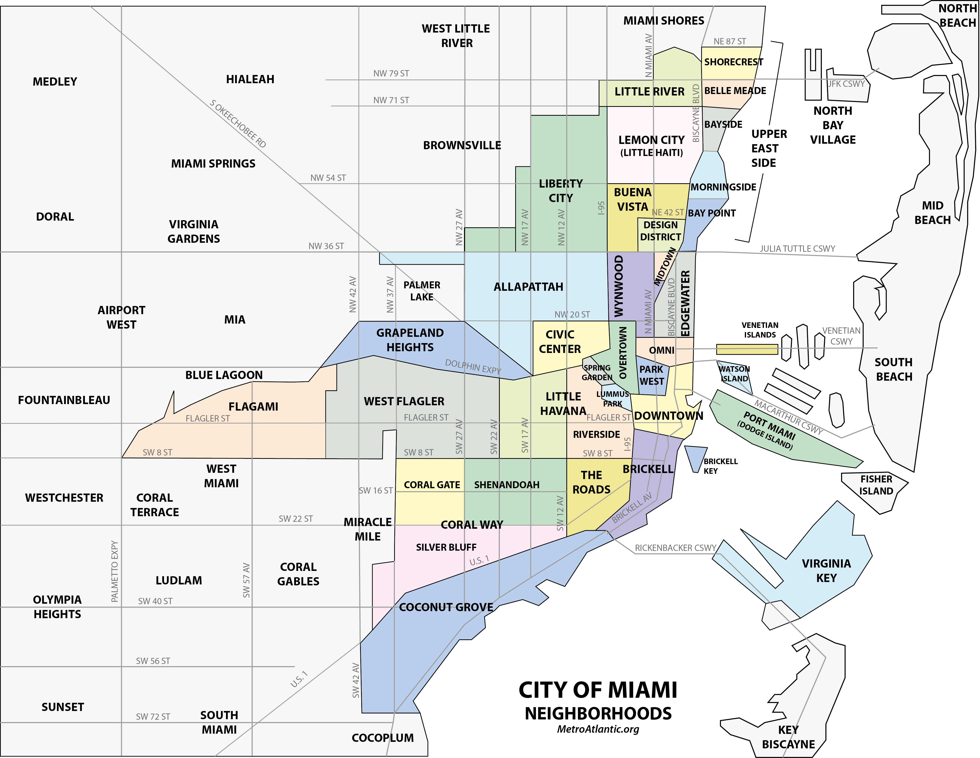
Liberty City is a neighborhood in Miami, Florida, United States. The area is roughly bound by NW 79th Street to the north, NW 27th Avenue to the west, the Airport Expressway to the South, and Interstate 95 to the east. The neighborhood is home to one of the largest concentrations of African Americans in South Florida, as of the 2000 census. Although it was often known as "Model City" both historically and by the City of Miami government, residents more commonly call it Liberty City. It is serviced by the Miami Metrorail at Dr. Martin Luther King Jr. Plaza and Brownsville stations along NW 27th Avenue. History Once part of the sparsely populated outskirts of northern Miami, what became Liberty City developed during the Great Depression of the 1930s when President Franklin D. Roosevelt authorized the construction of the Liberty Square housing project in 1933, the first of its kind in the Southern United States. Built as a response to the deteriorating housing conditions ... [...More Info...] [...Related Items...] OR: [Wikipedia] [Google] [Baidu] |
Neighborhoods In Miami
This is a list of neighborhoods in Miami in Miami-Dade County, Florida, United States. Many of the city's neighborhoods have been renamed, redefined and changed since the city's founding in 1896. As such, the exact extents of some neighborhoods can differ from person to person. The following is the list of all the city's major neighborhoods, including any corresponding sub-neighborhoods within them. Brickell is at the center of the Miami core. Its borders are Interstate 95 to the west, Brickell Bay to the east, the Miami River to the north, and Rickenbacker Causeway to the south. Coconut Grove is an example of a neighborhood whose size and name has stayed relatively the same since its settlement in 1825. Having been settled originally as "Cocoanut Grove", its character has stayed almost intact from its early days.Planning Your Vacation in Florida, Miami and Dade County [WPA Guide to Miami], Northport, NY: Bacon, Percy & Daggett, 1941, page 49. In contrast, other neighborhoods h ... [...More Info...] [...Related Items...] OR: [Wikipedia] [Google] [Baidu] |
Florida State Road 9
Florida State Road 9 (SR 9) is a state road in the U.S. state of Florida. While SR 9 is mainly used as a state designation for Interstate 95 in Florida from the Golden Glades Interchange in Miami Gardens to the Georgia border (near Yulee, Florida), a signed SR 9, which is locally known in the Miami area as West 27th Avenue, Unity Boulevard, and historically Grapeland Boulevard, extends from the Coconut Grove section of Miami to the Golden Glades Interchange (where the unsigned portion continues northward along I-95). The segment of I-95 south of the Golden Glades Interchange carries the designation of State Road 9A. Route description Southwest 27th Avenue begins locally at Bayshore Drive in the Coconut Grove neighborhood in Miami. The road heads north until it intersects Dixie Highway ( US 1). SR 9 begins at this intersection, located between the Coral Way and Coconut Grove neighborhoods. SR 9 then makes its way north, cutting through a ... [...More Info...] [...Related Items...] OR: [Wikipedia] [Google] [Baidu] |
Black American
African Americans, also known as Black Americans and formerly also called Afro-Americans, are an Race and ethnicity in the United States, American racial and ethnic group that consists of Americans who have total or partial ancestry from any of the Black people, Black racial groups of Africa. African Americans constitute the second largest ethno-racial group in the U.S. after White Americans. The term "African American" generally denotes descendants of Slavery in the United States, Africans enslaved in the United States. In 2023, an estimated 48.3 million people self-identified as Black, making up 14.4% of the country’s population. This marks a 33% increase since 2000, when there were 36.2 million Black people living in the U.S. African-American history began in the 16th century, with Africans being sold to Atlantic slave trade, European slave traders and Middle Passage, transported across the Atlantic to Slavery in the colonial history of the United States, the Western He ... [...More Info...] [...Related Items...] OR: [Wikipedia] [Google] [Baidu] |
Brownsville, Florida
Brownsville (also known as Brown Sub) is an unincorporated community and census-designated place (CDP) that is part of the Miami metropolitan area of South Florida. As of the 2020 US census, the population was 16,583, up from 15,313 in 2010. After three decades of population loss, Brownsville gained population for the first time in over 40 years in the 2010 US Census. History Brownsville was originally a settlement for white families in the 1920s. Black families began moving into the neighborhood between the late 1940s and early 1960s as the population surrounding nearby Liberty Square expanded and many inner-city whites moved to newly built suburban subdivisions surrounding Miami city proper in the wake of World War II. In 1945, two black couples who lived in Brownsville were arrested and jailed for allegedly mishandling their garbage disposal. That same year, members of the Ku Klux Klan burned crosses in lawns and marched against black home ownership in the area. By the mi ... [...More Info...] [...Related Items...] OR: [Wikipedia] [Google] [Baidu] |
Overtown (Miami)
Overtown is a neighborhood of Miami, Florida, United States, just northwest of Greater Downtown Miami, Downtown Miami. Originally called Colored Town in the Jim Crow laws, Jim Crow era of the late 19th through the mid-20th century, the area was once the preeminent and is the historic center for commerce in the African American, black community in Miami and South Florida metropolitan area, South Florida. The Overtown Historic Folklife Village is in the area. It is bound by NW 20th Street to the north, NW 5th Street to the south, the Miami River (Florida), Miami River, Florida State Road 836, Dolphin Expressway (SR 836), and Interstate 95 in Florida, I-95 (north of the Midtown Interchange) to the west, and the Florida East Coast Railway (FEC) and NW 1st Avenue to the east. Local residents often go by the demonym "Towners". History A part of the historic heart of Miami, it was designated as a "colored" neighborhood after the creation and municipal corporation, incorporation of Mia ... [...More Info...] [...Related Items...] OR: [Wikipedia] [Google] [Baidu] |
Restrictive Covenant
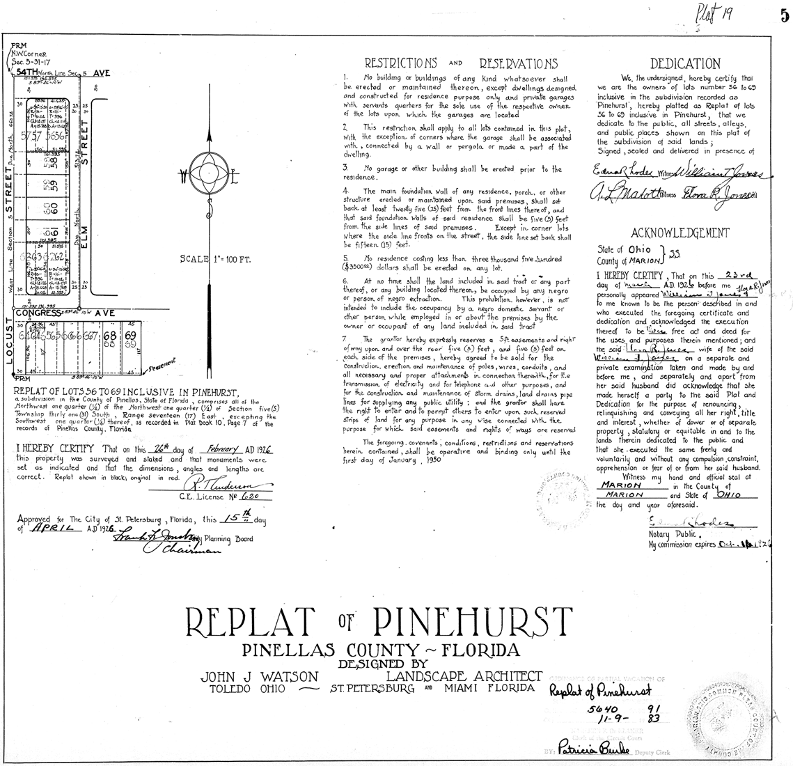
A covenant, in its most general and covenant (historical), historical sense, is a solemn promise to engage in or refrain from a specified action. Under historical English common law, a covenant was distinguished from an ordinary contract by the presence of a Seal (emblem), seal. Because the presence of a seal indicated an unusual solemnity in the promises made in a covenant, the common law would enforce a covenant even in the absence of consideration. In United States contract law, an good faith (law), implied ''covenant'' of good faith is presumed. A covenant is an agreement like a contract. A covenantor makes a promise to a covenantee to perform an action ''(affirmative covenant'' in the United States or ''positive covenant'' in England and Wales) or to refrain from an action (negative covenant). In real property law, the term real covenants means that conditions are tied to the ownership or use of land. A "covenant running with the land", meeting tests of wording and circumsta ... [...More Info...] [...Related Items...] OR: [Wikipedia] [Google] [Baidu] |
Liberty Square (Miami)
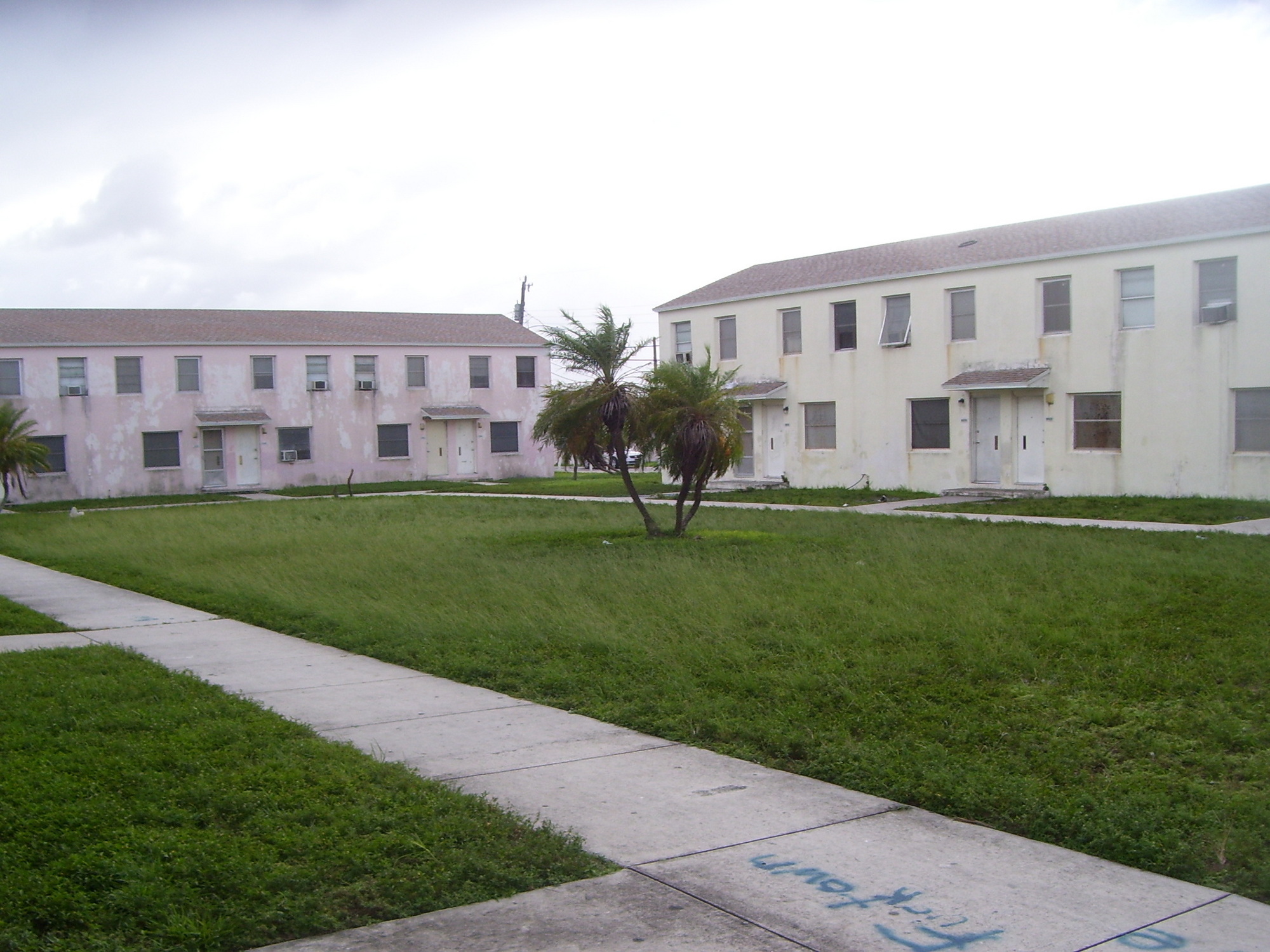
Liberty Square, often referred to as the Pork & Beans, is a 753-unit Miami-Dade County, Florida, Miami-Dade public housing apartment complex in the Liberty City (Miami), Liberty City neighborhood of Miami, Florida. It is bordered at List of streets named after Martin Luther King Jr.#Florida, Martin Luther King Jr. Boulevard/North 62nd Street to the south, North 67th Street to the north, Florida State Road 933, State Road 933 (Northwest 12th Avenue) to the east, and Northwest 15th Avenue to the west. Constructed as a part of the New Deal by the Public Works Administration and opening in 1937, it was the first public housing project for African Americans in the Southern United States. It is featured in the 2023 documentary film, ''Razing Liberty Square.'' History As development flourished in South Florida metropolitan area, South Florida from the early 20th century through the Florida land boom of the 1920s, 1920s, restrictive covenants and Jim Crow laws barred African American, bla ... [...More Info...] [...Related Items...] OR: [Wikipedia] [Google] [Baidu] |
Franklin D
Franklin may refer to: People and characters * Franklin (given name), including list of people and characters with the name * Franklin (surname), including list of people and characters with the name * Franklin (class), a member of a historical English social class Places * Franklin (crater), a lunar impact crater * Franklin County (other), in a number of countries * Mount Franklin (other), including Franklin Mountain Australia * Franklin, Tasmania, a township * Division of Franklin, federal electoral division in Tasmania * Division of Franklin (state), state electoral division in Tasmania * Franklin, Australian Capital Territory, a suburb in the Canberra district of Gungahlin * Franklin River, river of Tasmania * Franklin Sound, waterway of Tasmania Canada * District of Franklin, a former district of the Northwest Territories * Franklin, Quebec, a municipality in the Montérégie region * Rural Municipality of Franklin, Manitoba * Franklin, Manitoba, ... [...More Info...] [...Related Items...] OR: [Wikipedia] [Google] [Baidu] |
Great Depression
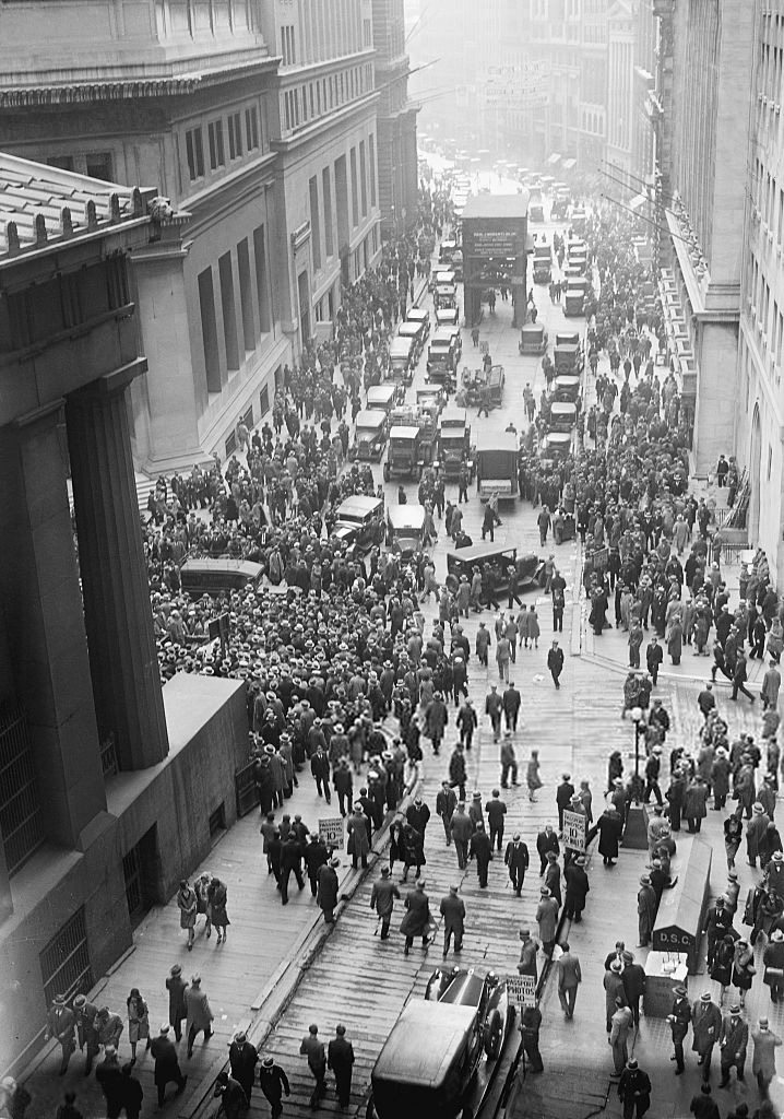
The Great Depression was a severe global economic downturn from 1929 to 1939. The period was characterized by high rates of unemployment and poverty, drastic reductions in industrial production and international trade, and widespread bank and business failures around the world. The economic contagion began in 1929 in the United States, the largest economy in the world, with the devastating Wall Street stock market crash of October 1929 often considered the beginning of the Depression. Among the countries with the most unemployed were the U.S., the United Kingdom, and Weimar Republic, Germany. The Depression was preceded by a period of industrial growth and social development known as the "Roaring Twenties". Much of the profit generated by the boom was invested in speculation, such as on the stock market, contributing to growing Wealth inequality in the United States, wealth inequality. Banks were subject to laissez-faire, minimal regulation, resulting in loose lending and wides ... [...More Info...] [...Related Items...] OR: [Wikipedia] [Google] [Baidu] |
Brownsville (Metrorail Station)
Brownsville station is a Metrorail (Miami-Dade County), Metrorail station in Brownsville, Florida. It is located at the intersection of Northwest 27th Avenue (Florida State Road 9, SR 9) and 52nd Street, opening to service May 19, 1985. Places of interest *Brownsville *Joseph Caleb Community Center *Family Health Center *Brownsville Renaissance (Retail shops, Movie theater) *Historic Hampton House Hotel Brownsville Transit Village Adjacent to the Brownsville Metrorail station is the construction of a new housing project, "Brownsville Transit Village." The project is composed of 5 mid-rise residential towers (467 apartments) with ground floor retail. The buildings are considered transit-oriented development, and are being designed around the metro station. The project was completed by 2012. However, as of 2016, Brownsville and Santa Clara station (Metrorail), Santa Clara (Santa Clara Apartments TOD), are the lowest ridership stations in the system. References External linksM ... [...More Info...] [...Related Items...] OR: [Wikipedia] [Google] [Baidu] |
Metrorail (Miami)
Metrorail is a rapid transit system in Miami and Miami-Dade County in the U.S. state of Florida. Metrorail is operated by Miami-Dade Transit (MDT), a departmental agency of Miami-Dade County. Opened in 1984, it is Florida's only rapid transit metro system, and is currently composed of two lines of 23 stations on of standard gauge track. Metrorail serves the urban core of Miami, connecting Miami International Airport, the Health District, Downtown Miami, and Brickell with the northern developed neighborhoods of Hialeah and Medley to the northwest, and to suburban The Roads, Coconut Grove, Coral Gables, and South Miami, ending at urban Dadeland in Kendall. Metrorail connects to the Metromover in Downtown, which provides metro service to the entirety of Downtown and Brickell. Additionally, it connects to South Florida's commuter rail system at Tri-Rail station, as well as Metrobus routes at all stations. In , the system had rides, and about per day in . In 2012, M ... [...More Info...] [...Related Items...] OR: [Wikipedia] [Google] [Baidu] |


