|
Leava
Leava is the largest village in the chiefdom of Sigave, on the French Pacific island of Futuna, part of the Wallis and Futuna Wallis and Futuna, officially the Territory of the Wallis and Futuna Islands (), is a French island territorial collectivity, collectivity in the Oceania, South Pacific, situated between Tuvalu to the northwest, Fiji to the southwest, Tonga t ... island group. It is also the administrative centre of Sigave. Overview Leava is located on the shore of Sigave Bay in the centre of the island's west coast, and has a population of 322. This makes it the largest village in the chiefdom. References Populated places in Wallis and Futuna {{WallisFutuna-geo-stub ... [...More Info...] [...Related Items...] OR: [Wikipedia] [Google] [Baidu] |
Wallis And Futuna
Wallis and Futuna, officially the Territory of the Wallis and Futuna Islands (), is a French island territorial collectivity, collectivity in the Oceania, South Pacific, situated between Tuvalu to the northwest, Fiji to the southwest, Tonga to the southeast, Samoa to the east, and Tokelau to the northeast. Mata Utu is its capital and largest city. The territory's land area is . It had a population of 11,151 at the July 2023 census (down from 14,944 at the 2003 census). The territory is made up of three main volcano, volcanic tropical islands and a number of tiny islets. It is divided into two island groups that lie about apart: the Wallis Islands (also known as Uvea (Wallis and Futuna), Uvea) in the northeast; and the Hoorn Islands (also known as the Futuna Islands) in the southwest, including Futuna Island, Wallis and Futuna, Futuna Island proper and the mostly uninhabited Alofi Island. Since 28 March 2003, Wallis and Futuna has been a Overseas collectivity, French overseas ... [...More Info...] [...Related Items...] OR: [Wikipedia] [Google] [Baidu] |
Sigave
Sigavé (also Singave or Sigave) is one of the three official chiefdoms of the France, French territory of Wallis and Futuna in Oceania in the South Pacific Ocean. (The other two chiefdoms are Uvea (Wallis and Futuna), Uvea and Alo (Wallis and Futuna), Alo.) Geography Overview Sigave encompasses the western third of Futuna Island, Wallis and Futuna, Futuna Island (30 km2 of Futuna Island's total area of 83 km2). Sigave has six villages, which together had a population of 1,275 as of the 2018 census. The Capital (political), capital and largest village is Leava (pop. 322). Administrative division The chiefdom of Sigave is coextensive with the district of the same name. Its six villages (or List of villages in Wallis and Futuna, municipalities) are as follows: History Education The junior high school in the area is Collège Fiua de Sigave. [...More Info...] [...Related Items...] OR: [Wikipedia] [Google] [Baidu] |
Sigave Bay
Sigavé (also Singave or Sigave) is one of the three official chiefdoms of the French territory of Wallis and Futuna in Oceania in the South Pacific Ocean. (The other two chiefdoms are Uvea and Alo.) Geography Overview Sigave encompasses the western third of Futuna Island (30 km2 of Futuna Island's total area of 83 km2). Sigave has six villages, which together had a population of 1,275 as of the 2018 census. The capital and largest village is Leava (pop. 322). Administrative division The chiefdom of Sigave is coextensive with the district of the same name. Its six villages (or municipalities) are as follows: History Education The junior high school in the area is Collège Fiua de Sigave. " Wallis and Futuna. June ... [...More Info...] [...Related Items...] OR: [Wikipedia] [Google] [Baidu] |
Futuna (Wallis And Futuna)
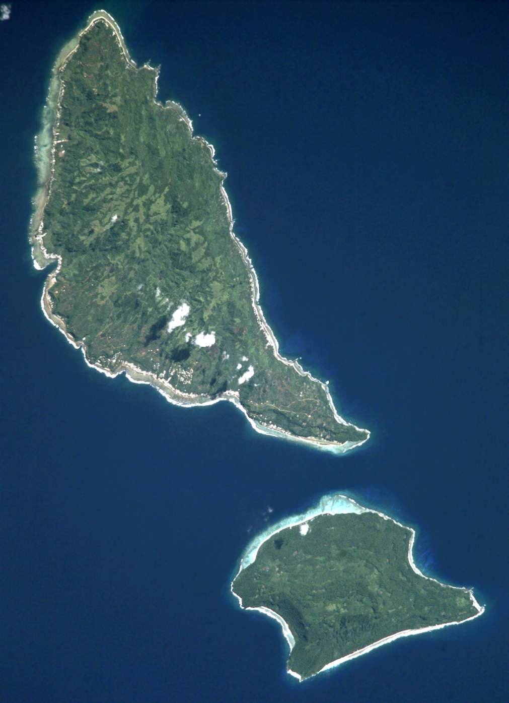
Futuna (; ) is the largest island in Hoorn Islands or Îles Horne, located in the Pacific Ocean, part of the French overseas collectivity (''collectivité d'outre-mer'') of Wallis and Futuna. The island occupies an area of and as of 2018 it has a population of 10,912. Futuna is a local name, the etymology of which is unknown. History Futuna and Alofi were first mapped by Europeans in 1616 by Willem Schouten and Jacob Le Maire during their circumnavigation of the globe on the ship ''Eendracht''. After sailing to Niuafoou, they suddenly changed course from west to northwest and discovered the two islands. The islands were named Hoorn Eylanden, after the city of Hoorn, Schouten's birthplace. This became ''Horne'' in French and English. They also discovered a natural harbor along the southwest coast of Futuna, which they named Eendrachts baai (Unity Bay) after their ship. It is thought that their landing place was the site of the Anse de Sigave near what is today called Leava. ... [...More Info...] [...Related Items...] OR: [Wikipedia] [Google] [Baidu] |
Futuna Island, Wallis And Futuna
Futuna (; ) is the largest island in Hoorn Islands or Îles Horne, located in the Pacific Ocean, part of the French overseas collectivity (''collectivité d'outre-mer'') of Wallis and Futuna. The island occupies an area of and as of 2018 it has a population of 10,912. Futuna is a local name, the etymology of which is unknown. History Futuna and Alofi were first mapped by Europeans in 1616 by Willem Schouten and Jacob Le Maire during their circumnavigation of the globe on the ship ''Eendracht''. After sailing to Niuafoou, they suddenly changed course from west to northwest and discovered the two islands. The islands were named Hoorn Eylanden, after the city of Hoorn, Schouten's birthplace. This became ''Horne'' in French and English. They also discovered a natural harbor along the southwest coast of Futuna, which they named Eendrachts baai (Unity Bay) after their ship. It is thought that their landing place was the site of the Anse de Sigave near what is today called Leav ... [...More Info...] [...Related Items...] OR: [Wikipedia] [Google] [Baidu] |


