|
Lawang Sewu
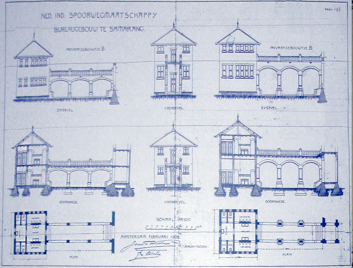
''Lawang Sewu'' () is a former office building in Kota Semarang, Semarang, Central Java, Indonesia. It was a head office of the Dutch East Indies Railway Co. (Nederlandsch-Indische Spoorweg Maatschappij/NIS) and is owned by the national railway company Kereta Api Indonesia (KAI). Its predecessor, Djawatan Kereta Api, was seized every rail transport infrastructures and offices from Dutch occupation. Today the building is used as a museum and heritage railway gallery, currently operated by Heritage Unit of KAI and its subsidiary KAI Wisata. Etymology The Javanese language, Javanese word ''lawang sewu'' is a nickname for the building, which means "a thousand doors". The name comes from its design, with numerous doors and arcs. The building has about 600 large windows. Layout The complex consists of several buildings, two main ones named A and B and two smaller ones named C and D, on Pemuda Street. The L-shaped A building faces the Tugu Muda roundabout. There are two identical towers ... [...More Info...] [...Related Items...] OR: [Wikipedia] [Google] [Baidu] [Amazon] |
Semarang
Semarang (Javanese script, Javanese: , ''Kutha Semarang'') is the capital and largest city of Central Java province in Indonesia. It was a major port during the Netherlands, Dutch Dutch East Indies, colonial era, and is still an important regional center and port today. The city has been named as the cleanest tourist destination in Southeast Asia by the ASEAN Clean Tourist City Standard (ACTCS) for 2020–2022. It has an area of and had a population of 1,555,984 at the 2010 censusBiro Pusat Statistik, Jakarta, 2011. and 1,653,524 at the 2020 census,Badan Pusat Statistik, Jakarta, 2021. making it Indonesia's ninth most populous city after Jakarta, Surabaya, Bekasi, Bandung, Medan, Depok, Tangerang and Palembang; the official population estimate as at mid-2023 was 1,694,740, comprising 838,440 males and 856,310 females.Badan Pusat Statistik, Jakarta, 28 February 2024, ''Kota Semarang Dalam Angka 2024'' (Katalog-BPS 1102001.3374) The built-up urban area had 3,183,516 inhabitants a ... [...More Info...] [...Related Items...] OR: [Wikipedia] [Google] [Baidu] [Amazon] |
Dutch East Indies
The Dutch East Indies, also known as the Netherlands East Indies (; ), was a Dutch Empire, Dutch colony with territory mostly comprising the modern state of Indonesia, which Proclamation of Indonesian Independence, declared independence on 17 August 1945. Following the Indonesian National Revolution, Indonesian War of Independence, Indonesia and the Netherlands Dutch–Indonesian Round Table Conference, made peace in 1949. In the Anglo-Dutch Treaty of 1824, the Dutch ceded the governorate of Dutch Malacca to Britain, leading to its eventual incorporation into Malacca, Malacca (state) of modern Malaysia. The Dutch East Indies was formed from the nationalised Factory (trading post), trading posts of the Dutch East India Company, which came under the administration of the Batavian Republic, Dutch government in 1800. During the 19th century, the Dutch fought Royal Netherlands East Indies Army, many wars against indigenous rulers and peoples, which caused hundreds of thousands of d ... [...More Info...] [...Related Items...] OR: [Wikipedia] [Google] [Baidu] [Amazon] |
Landmarks In Indonesia
A landmark is a recognizable natural or artificial feature used for navigation, a feature that stands out from its near environment and is often visible from long distances. In modern-day use, the term can also be applied to smaller structures or features that have become local or national symbols. Etymology In Old English, the word ''landmearc'' (from ''land'' + ''mearc'' (mark)) was used to describe a boundary marker, an "object set up to mark the boundaries of a kingdom, estate, etc." Starting around 1560, this interpretation of "landmark" was replaced by a more general one. A landmark became a "conspicuous object in a landscape". A ''landmark'' literally meant a geographic feature used by explorers and others to find their way back to their departure point, or through an area. For example, Table Mountain near Cape Town, South Africa, was used as a landmark to help sailors navigate around the southern tip of Africa during the Age of Exploration. Artificial structures are ... [...More Info...] [...Related Items...] OR: [Wikipedia] [Google] [Baidu] [Amazon] |


