|
Larsen Channel
Larsen Channel is a strait 1 to 3 miles wide between D'Urville Island and Joinville Island, off the northeastern end of the Antarctic Peninsula. Larsen Channel was discovered in 1902 by the Swedish Antarctic Expedition under Otto Nordenskiöld and named for Captain C. A. Larsen of the expedition ship ''Antarctic The Antarctic ( or , American English also or ; commonly ) is a polar region around Earth's South Pole, opposite the Arctic region around the North Pole. The Antarctic comprises the continent of Antarctica, the Kerguelen Plateau and o ...''. See also * Gaviotín Rock References Straits of Graham Land Landforms of the Joinville Island group {{JoinvilleIsland-geo-stub ... [...More Info...] [...Related Items...] OR: [Wikipedia] [Google] [Baidu] |
Strait
A strait is an oceanic landform connecting two seas or two other large areas of water. The surface water generally flows at the same elevation on both sides and through the strait in either direction. Most commonly, it is a narrow ocean channel that lies between two land masses. Some straits are not navigable, for example because they are either too narrow or too shallow, or because of an unnavigable reef or archipelago. Straits are also known to be loci for sediment accumulation. Usually, sand-size deposits occur on both the two opposite strait exits, forming subaqueous fans or deltas. Terminology The terms '' channel'', ''pass'', or ''passage'' can be synonymous and used interchangeably with ''strait'', although each is sometimes differentiated with varying senses. In Scotland, '' firth'' or ''Kyle'' are also sometimes used as synonyms for strait. Many straits are economically important. Straits can be important shipping routes and wars have been fought for contr ... [...More Info...] [...Related Items...] OR: [Wikipedia] [Google] [Baidu] |
D'Urville Island, Antarctica
D'Urville Island is an island of Antarctica. It is the northernmost island of the Joinville Island group, long, lying immediately north of Joinville Island, from which it is separated by Larsen Channel. The single island was charted in 1902 by the Swedish Antarctic Expedition under Otto Nordenskiöld, who named it for Captain Jules Dumont d'Urville, French explorer who discovered land in the Joinville Island group. Burden Passage separates D'Urville Island from Bransfield Island. See also * Composite Antarctic Gazetteer * List of Antarctic and sub-Antarctic islands * List of Antarctic islands south of 60° S * Medley Rocks * SCAR * Territorial claims in Antarctica Seven sovereign states – Argentina, Australia, Chile, France, New Zealand, Norway, and the United Kingdom – have made eight territorial claims in Antarctica. These countries have tended to place their Antarctic scientific observation and st ... References Islands of the Joinville Island group ... [...More Info...] [...Related Items...] OR: [Wikipedia] [Google] [Baidu] |
Joinville Island
Joinville Island is the largest island of the Joinville Island group, about long in an east-west direction and wide, lying off the northeastern tip of the Antarctic Peninsula, from which it is separated by the Antarctic Sound. Joinville Island was discovered and charted roughly during 1838 by a French expedition commanded by Captain Jules Dumont d'Urville, who named it for Prince François, Prince of Joinville (1818–1900), the third son of Louis-Philippe, Duke of Orléans. It is within the Argentine, British and Chilean Antarctic claims. Geography Joinville Island consists of a series of valleys and bays, including Suspiros Bay and Balaena Valley. See also * Composite Antarctic Gazetteer * List of Antarctic and sub-Antarctic islands * List of Antarctic islands south of 60° S * SCAR * Territorial claims in Antarctica * Williwaw Rocks Williwaw Rocks () is two small rocks lying 2 nautical miles (3.7 km) south of Moody Point, the east extremity of Joinville ... [...More Info...] [...Related Items...] OR: [Wikipedia] [Google] [Baidu] |
Antarctic Peninsula
The Antarctic Peninsula, known as O'Higgins Land in Chile and Tierra de San Martín in Argentina, and originally as Graham Land in the United Kingdom and the Palmer Peninsula in the United States, is the northernmost part of mainland Antarctica. The Antarctic Peninsula is part of the larger peninsula of West Antarctica, protruding from a line between Cape Adams (Weddell Sea) and a point on the mainland south of the Eklund Islands. Beneath the ice sheet that covers it, the Antarctic Peninsula consists of a string of bedrock islands; these are separated by deep channels whose bottoms lie at depths considerably below current sea level. They are joined by a grounded ice sheet. Tierra del Fuego, the southernmost tip of South America, is about away across the Drake Passage. The Antarctic Peninsula is in area and 80% ice-covered. The marine ecosystem around the western continental shelf of the Antarctic Peninsula (WAP) has been subjected to rapid climate change. Over the past ... [...More Info...] [...Related Items...] OR: [Wikipedia] [Google] [Baidu] |
Swedish Antarctic Expedition
The Swedish Antarctic Expedition of 1901–1903 was a scientific expedition led by Otto Nordenskjöld and Carl Anton Larsen. It was the first Swedish endeavour to Antarctica in the Heroic Age of Antarctic Exploration. Background Otto Nordenskjöld, a Swedish geologist and geographer, organized and led a scientific expedition of the Antarctic Peninsula. The expedition's overall command was placed under the Norwegian Carl Anton Larsen, an experienced Antarctic explorer who served as captain of , and who had previously commanded a whaling reconnaissance mission in 1892–1893. Seven other scientists, including archaeologist Johan Gunnar Andersson, botanist Carl Skottsberg, and zoologist Axel Ohlin, along with 16 officers and men joined them on the voyage. On 16 October 1901, the ''Antarctic'' left the Port of Gothenburg. Events Despite its end and the great hardships endured, the expedition would be considered a scientific success, with the parties having ex ... [...More Info...] [...Related Items...] OR: [Wikipedia] [Google] [Baidu] |
Otto Nordenskiöld
Otto is a masculine German given name and a surname. It originates as an Old High German short form (variants ''Audo'', '' Odo'', '' Udo'') of Germanic names beginning in ''aud-'', an element meaning "wealth, prosperity". The name is recorded from the 7th century ( Odo, son of Uro, courtier of Sigebert III). It was the name of three 10th-century German kings, the first of whom was Otto I the Great, the first Holy Roman Emperor, founder of the Ottonian dynasty. The Gothic form of the prefix was ''auda-'' (as in e.g. '' Audaþius''), the Anglo-Saxon form was ''ead-'' (as in e.g. '' Eadmund''), and the Old Norse form was '' auð-''. The given name Otis arose from an English surname, which was in turn derived from ''Ode'', a variant form of ''Odo, Otto''. Due to Otto von Bismarck, the given name ''Otto'' was strongly associated with the German Empire in the later 19th century. It was comparatively frequently given in the United States (presumably in German American fami ... [...More Info...] [...Related Items...] OR: [Wikipedia] [Google] [Baidu] |
Captain (nautical)
A sea captain, ship's captain, captain, master, or shipmaster, is a high-grade licensed mariner who holds ultimate command and responsibility of a merchant vessel.Aragon and Messner, 2001, p.3. The captain is responsible for the safe and efficient operation of the ship, including its seaworthiness, safety and security, cargo operations, navigation, crew management, and legal compliance, and for the persons and cargo on board. Duties and functions The captain ensures that the ship complies with local and international laws and complies also with company and flag state policies. The captain is ultimately responsible, under the law, for aspects of operation such as the safe navigation of the ship,Aragon and Messner, 2001, p.4. its cleanliness and seaworthiness,Aragon and Messner, 2001, p.5. safe handling of all cargo,Aragon and Messner, 2001, p.7. management of all personnel,Aragon and Messner, 2001, p.7-11. inventory of ship's cash and stores,Aragon and Messner, 2001, p.11-12. ... [...More Info...] [...Related Items...] OR: [Wikipedia] [Google] [Baidu] |
Carl Anton Larsen
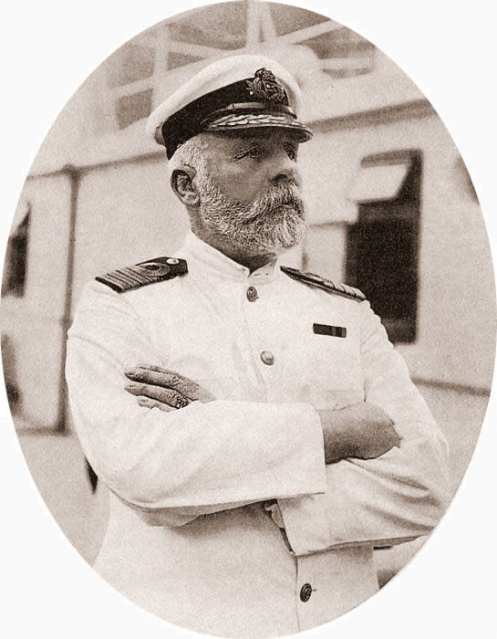
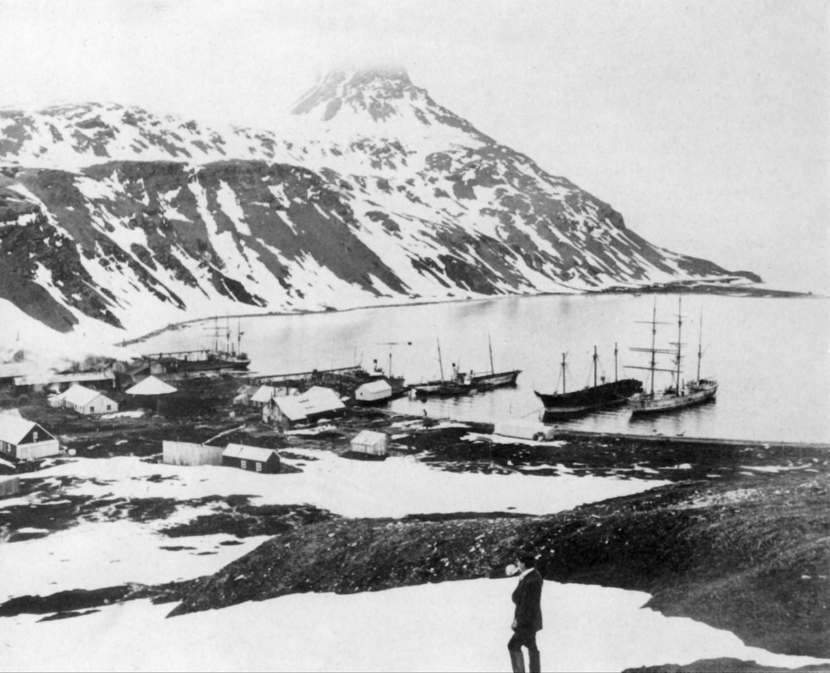
Carl Anton Larsen (7 August 1860 – 8 December 1924) was a Norwegian-born whaler and Antarctic explorer who made important contributions to the exploration of Antarctica, the most significant being the first discovery of fossils for which he received the Back Grant from the Royal Geographical Society. In December 1893 he became the first person to ski in Antarctica on the Larsen Ice Shelf which was subsequently named after him. In 1904, Larsen re-founded a whaling settlement at Grytviken on the island of South Georgia. In 1910, after some years' residence on South Georgia, he renounced his Norwegian citizenship and took British citizenship. The Norwegian whale factory ship was named after him. Early life Carl Anton Larsen was born in Østre Halsen, Tjolling, the son of Norwegian sea captain Ole Christian Larsen and his wife Ellen Andrea Larsen (née Thorsen). His family subsequently relocated to nearby Sandefjord, the home of the Norwegian whaling industry, where at the ... [...More Info...] [...Related Items...] OR: [Wikipedia] [Google] [Baidu] |
Antarctic (ship)
''Antarctic'' was a Swedish steamship built in Drammen, Norway, in 1871. She was used on several research expeditions to the Arctic region and to Antarctica from 1898 to 1903. In 1895 the first confirmed landing on the mainland of Antarctica was made from this ship. The ship ''Antarctic'' was a barque with three masts and equipped with a steam engine, built in 1871 at Holmen in Drammen in Norway under the name ''Cap Nor''. Alfred Nathorst, ”Två Somrar i Norra Ishafvet”, first part (in Swedish), 1900, accessdate=2010-12-10 Henrik Bull, ”The cruise of the "Antarctic" to the South Polar regions”, 1896, accessdate=2010-12-10 [...More Info...] [...Related Items...] OR: [Wikipedia] [Google] [Baidu] |
Gaviotín Rock
Gaviotín Rock () is a rock lying in Larsen Channel, about north of the coastal ice cliffs of Joinville Island, Antarctica, and north of Saxum Nunatak. The name Gaviotín (gull Gulls, or colloquially seagulls, are seabirds of the family Laridae in the suborder Lari. They are most closely related to the terns and skimmers and only distantly related to auks, and even more distantly to waders. Until the 21st century, ...) appears on an Argentine government chart of 1957. References Rock formations of the Joinville Island group {{JoinvilleIsland-geo-stub ... [...More Info...] [...Related Items...] OR: [Wikipedia] [Google] [Baidu] |
Straits Of Graham Land
A strait is an Ocean, oceanic landform connecting two Sea, seas or two other large areas of water. The surface water generally flows at the same elevation on both sides and through the strait in either direction. Most commonly, it is a narrow ocean Channel (geography), channel that lies between two land masses. Some straits are not navigable, for example because they are either too narrow or too shallow, or because of an unnavigable reef or archipelago. Straits are also known to be loci for sediment accumulation. Usually, sand-size deposits occur on both the two opposite strait exits, forming subaqueous fans or deltas. Terminology The terms ''channel (geography), channel'', ''pass'', or ''passage'' can be synonymous and used interchangeably with ''strait'', although each is sometimes differentiated with varying senses. In Scotland, ''firth'' or ''Kyle'' are also sometimes used as synonyms for strait. Many straits are economically important. Straits can be important shipping ... [...More Info...] [...Related Items...] OR: [Wikipedia] [Google] [Baidu] |


.jpg)


