|
Kruševlje
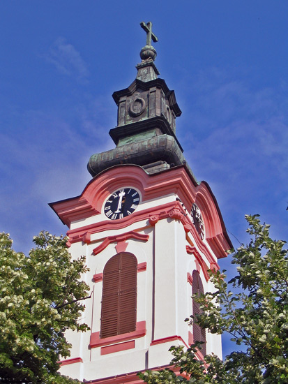
Kruševlje ( sr-Cyrl, Крушевље) is a small settlement (hamlet) in Serbia. It is situated in the Sombor municipality, West Bačka District, Vojvodina province. It is mostly populated by Serbs. Name In Serbian, the village is known as ''Kruševlje'' or Крушевље, in German as ''Kruschiwel'' or ''Kruschiwl'', and in Hungarian as ''Körtés'' or ''Bácskörtés''. Its name derived from Hungarian Körtés ("pear" in English). The Serb name translation of the original Hungarian name. There were also some other, less used names such as ''Kruschewlje'', ''Birndorf'' (German translation of its original Hungarian name), ''Krušovje'', ''Körtvélyes'', etc. Geography Officially, Kruševlje is not classified as a separate settlement, but as part of the village of Gakovo. It is located near the border with Hungary between Riđica, Stanišić, Gakovo and Rastina. It is about 2 miles northeast of the neighbouring village of Gakovo and about 2,5 miles west of Stanišić. ... [...More Info...] [...Related Items...] OR: [Wikipedia] [Google] [Baidu] |
Gakovo
Gakovo () is a village in Serbia. It is situated in the Sombor municipality, in the West Bačka District, Vojvodina province. The village has a Serb ethnic majority and its population is 2,201 (2002 census). Name In Serbian, the village is known as ''Gakovo'' (Гаково), in German as ''Gakowa'' or ''Graumarkt'', in Hungarian as ''Gádor'' or ''Gákova'', in Croatian as ''Gakovo'', and in Bunjevac as ''Gakovo''. Name of the village is of Slavic (Serbo-Croatian) origin and roughly means "the place of Gako" or "the place of Gak". Geography Gakovo is located in north-western Bačka near the border with Hungary between the Tisa and Danube rivers. A small neighbouring settlement known as Kruševlje is also officially regarded as part of Gakovo. Gakovo lies at an altitude of 96 meters. History From 1658 name Gakovo was used for an uninhabited area that was under Ottoman administration. Village of Gakovo was formed during Habsburg administration in the first half of the 18th ... [...More Info...] [...Related Items...] OR: [Wikipedia] [Google] [Baidu] |
Riđica
Riđica () is a village in Serbia. It is situated in the Sombor municipality, in the West Bačka District, Vojvodina province. The village has a Serb ethnic majority and its population numbering 2,590 people (2002 census). Geography Riđica is the northernmost settlement of the Sombor municipality; it is 2 km away from the border with Hungary. The closest neighbouring settlements are Stanišić, Kruševlje and Rastina. History There are remains of the Celtic fort in this area. The earliest historical record of the village dates from 1535, which mentions it as a possession of Katarina Orlović. During the Ottoman rule (16th-17th century), Riđica was populated by Serbs. During Habsburg rule, Hungarians, Slovaks and Germans settled here as well. While Slovaks were mostly magyarized, Germans left from the village after the Second World War as a consequence of war events. As part of the post-World War II colonization. Ethnic groups (2002 census) *Serbs = 2,165 (83.59%) * ... [...More Info...] [...Related Items...] OR: [Wikipedia] [Google] [Baidu] |
Sombor
Sombor ( sr-Cyrl, Сомбор, ; hu, Zombor; rue, Зомбор, Zombor) is a List of cities in Serbia, city and the administrative center of the West Bačka District in the autonomous province of Vojvodina, Serbia. The city has a total population of 47,623 (), while its administrative area (including neighboring villages) has 85,903 inhabitants. Name and etymology In Serbian language, Serbian, the city is known as ''Sombor'' (Сомбор), in Hungarian language, Hungarian and German language, German as ''Zombor'', in Croatian language, Croatian and Bunjevac language, Bunjevac as ''Sombor'', in Pannonian Rusyn language, Rusyn as ''Zombor'' (Зомбор), and in Turkish language, Turkish as ''Sonbor''. The older Hungarian name for the city was ''Czoborszentmihály''. The name originates from the Czobor family, who were the owners of this area in the 14th century. (The family name came from the Slavic name ''Cibor''.) The Serbian language, Serbian name for the city ''(Sombor)' ... [...More Info...] [...Related Items...] OR: [Wikipedia] [Google] [Baidu] |
Administrative Divisions Of Serbia
The administrative divisions of Serbia ( sr, административна подела Србије, аdministrativna podela Srbije) are regulated by the Government of Serbia ''Enactment'' of 29 January 1992,Government of SerbiaDistricts In Serbia/ref> and by the Law on Territorial Organization adopted by the National Assembly of Serbia on 29 December 2007.Law on Territorial Organization and Local Self-Government , Parliament of Serbia is divided into 29 districts by the government decree issued in 1992. The units of the territorial ... [...More Info...] [...Related Items...] OR: [Wikipedia] [Google] [Baidu] |
Esztergom
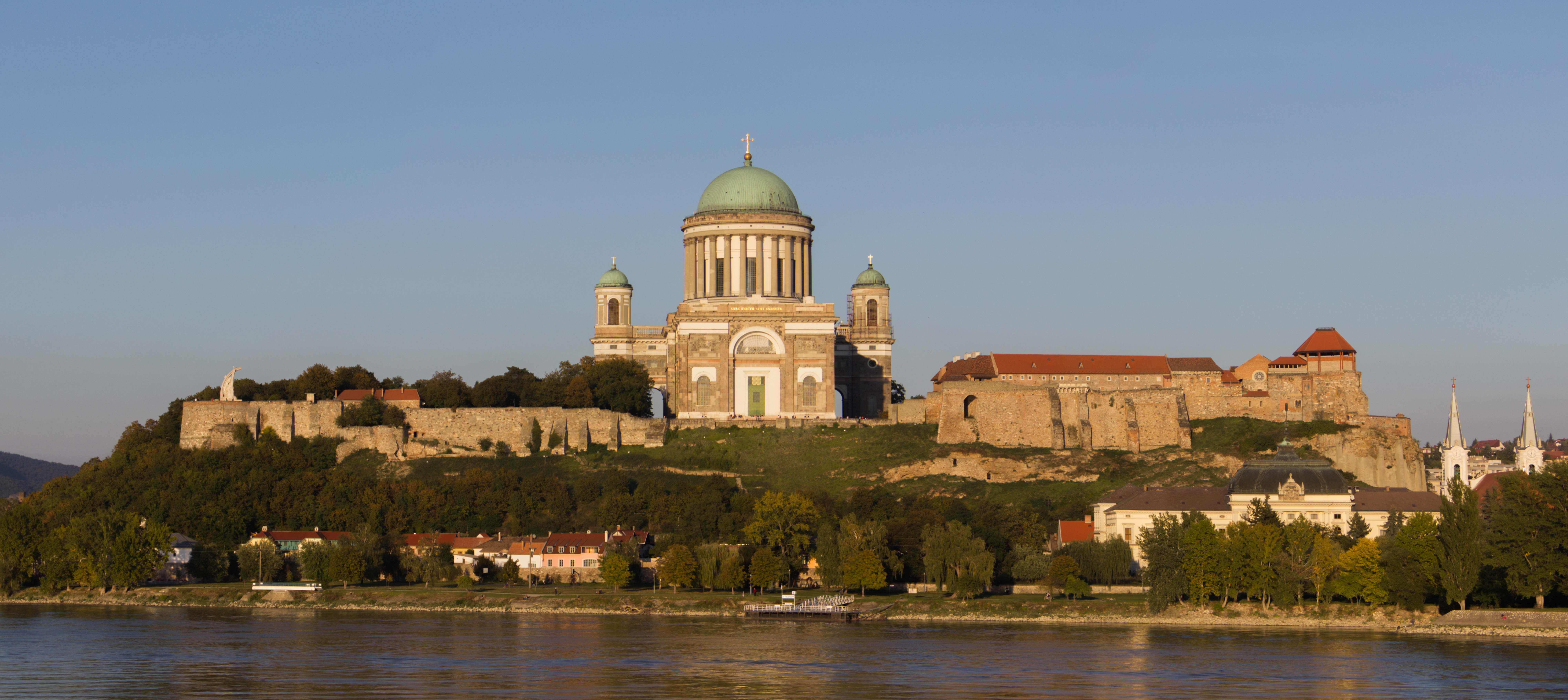
Esztergom ( ; german: Gran; la, Solva or ; sk, Ostrihom, known by alternative names) is a city with county rights in northern Hungary, northwest of the capital Budapest. It lies in Komárom-Esztergom County, on the right bank of the river Danube, which forms the border with Slovakia there. Esztergom was the capital of Hungary from the 10th until the mid-13th century when King Béla IV of Hungary moved the royal seat to Buda. Esztergom is the seat of the ''prímás'' (see Primate) of the Roman Catholic Church in Hungary, and the former seat of the Constitutional Court of Hungary. The city has a Christian Museum with the largest ecclesiastical collection in Hungary. Its cathedral, Esztergom Basilica, is the largest church in Hungary. Toponym The Roman town was called ''Solva''. The medieval Latin name was ''Strigonium''. The first early medieval mention is "''ſtrigonensis trigonensiscomes''" (1079-1080). The first interpretation of the name was suggested by Antonio ... [...More Info...] [...Related Items...] OR: [Wikipedia] [Google] [Baidu] |
Middle Ages
In the history of Europe, the Middle Ages or medieval period lasted approximately from the late 5th to the late 15th centuries, similar to the post-classical period of global history. It began with the fall of the Western Roman Empire and transitioned into the Renaissance and the Age of Discovery. The Middle Ages is the middle period of the three traditional divisions of Western history: classical antiquity, the medieval period, and the modern period. The medieval period is itself subdivided into the Early, High, and Late Middle Ages. Population decline, counterurbanisation, the collapse of centralized authority, invasions, and mass migrations of tribes, which had begun in late antiquity, continued into the Early Middle Ages. The large-scale movements of the Migration Period, including various Germanic peoples, formed new kingdoms in what remained of the Western Roman Empire. In the 7th century, North Africa and the Middle East—most recently part of the Eastern Ro ... [...More Info...] [...Related Items...] OR: [Wikipedia] [Google] [Baidu] |
Pannonian Plain
The Pannonian Basin, or Carpathian Basin, is a large basin situated in south-east Central Europe. The geomorphological term Pannonian Plain is more widely used for roughly the same region though with a somewhat different sense, with only the lowlands, the plain that remained when the Pliocene Epoch ''Pannonian Sea'' dried out. It is a geomorphological subsystem of the Alps-Himalaya system, specifically a sediment-filled back-arc basin which spread apart during the Miocene. The plain or basin is diagonally bisected by the Transdanubian Mountains, separating the larger Great Hungarian Plain (including the Eastern Slovak Lowland) from the Little Hungarian Plain. It forms a topographically discrete unit set in the European landscape, surrounded by imposing geographic boundaries—the Carpathian Mountains and the Alps. The Rivers Danube and Tisza divide the basin roughly in half. It extends roughly between Vienna in the northwest, Košice in the northeast, Zagreb in the southwe ... [...More Info...] [...Related Items...] OR: [Wikipedia] [Google] [Baidu] |
Crimean Tatars
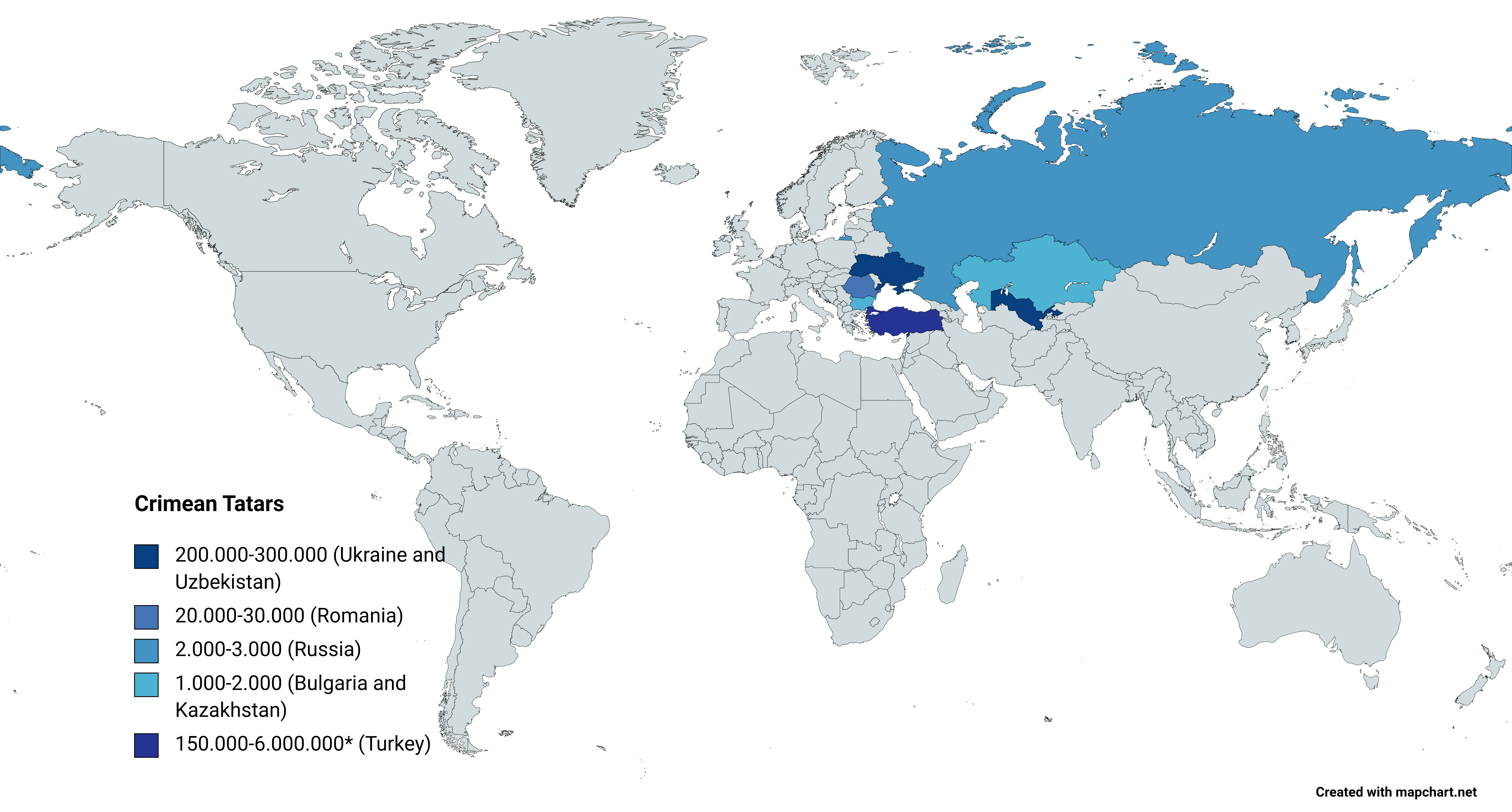
, flag = Flag of the Crimean Tatar people.svg , flag_caption = Flag of Crimean Tatars , image = Love, Peace, Traditions.jpg , caption = Crimean Tatars in traditional clothing in front of the Khan's Palace , poptime = , popplace = , region1 = , pop1 = 3,500,000 6,000,000 , ref1 = , region2 = * , pop2 = 248,193 , ref2 = , region3 = , pop3 = 239,000 , ref3 = , region4 = , pop4 = 24,137 , ref4 = , region5 = , pop5 = 2,449 , ref5 = , region7 = , pop7 = 1,803 , ref7 = , region8 = , pop8 = 1,532 , ref8 = , region9 = *() , pop9 = 7,000(500–1,000) , ref9 = , region10 = Total , pop10 = 4.024.114 (or 6.524.11 ... [...More Info...] [...Related Items...] OR: [Wikipedia] [Google] [Baidu] |
Ferenc Wesselényi
Count Ferenc Wesselényi de Hadad et Murány (1605 – Zólyomlipcse (Slovenská Ľupča), 23 March 1667) was a Hungarian military commander and the palatine of the Royal Hungary. Life He was the son of István Wesselényi, royal court counselor of King Ferdinand II of Austria. He was raised at the Jesuit school in Nagyszombat (Trnava) where he catholicized. His enormous physical strength and intense temperament predestined him for a military career. In his young ages, he participated in several battles against the Ottoman Turks. He also helped King Władysław IV of Poland with a Hungarian team against the Russians and Tatars and this deed was rewarded with Polish citizenship and a valuable estate. He was raised to the rank of count by Ferdinand II of Austria and was also appointed commander of the castle of Fülek (Filakovo). In 1647, he was appointed general and as such he fought against the Swedes and later against prince György Rákóczi of Transylvania. In 1644, he se ... [...More Info...] [...Related Items...] OR: [Wikipedia] [Google] [Baidu] |
Kalocsa
Kalocsa (; hr, Kaloča or ''Kalača''; sr, Kaloča or Калоча; german: Kollotschau) is a town in Bács-Kiskun county, Hungary. It lies south of Budapest. It is situated in a marshy but highly productive district, near the left bank of the Danube River. Historically it had greater political and economic importance than at present. Description Kalocsa is the Episcopal see of one of the four Catholic archbishops of Hungary. Amongst its buildings are a fine cathedral, the archiepiscopal palace, an astronomical observatory, a seminary for priests, and colleges for training teachers. The residents of Kalocsa and its wide-spreading communal lands are chiefly employed in the cultivation of paprika, fruit, flax, hemp and cereals, in the capture of waterfowl and in fishing. Kalocsa is one of the oldest towns in Hungary. The present archbishopric, founded about 1135, is a development of a bishopric said to have been founded in 1000 by King Stephen the Saint. It suffered much during ... [...More Info...] [...Related Items...] OR: [Wikipedia] [Google] [Baidu] |
Kingdom Of Hungary
The Kingdom of Hungary was a monarchy in Central Europe that existed for nearly a millennium, from the Middle Ages into the 20th century. The Principality of Hungary emerged as a Christian kingdom upon the coronation of the first king Stephen I at Esztergom around the year 1000;Kristó Gyula – Barta János – Gergely Jenő: Magyarország története előidőktől 2000-ig (History of Hungary from the prehistory to 2000), Pannonica Kiadó, Budapest, 2002, , p. 687, pp. 37, pp. 113 ("Magyarország a 12. század második felére jelentős európai tényezővé, középhatalommá vált."/"By the 12th century Hungary became an important European factor, became a middle power.", "A Nyugat részévé vált Magyarország.../Hungary became part of the West"), pp. 616–644 his family (the Árpád dynasty) led the monarchy for 300 years. By the 12th century, the kingdom became a European middle power within the Western world. Due to the Ottoman occupation of the central and south ... [...More Info...] [...Related Items...] OR: [Wikipedia] [Google] [Baidu] |
János Darvas
János or Janos may refer to: * János, male Hungarian given name, a variant of John Places * Janos Municipality, a municipality of Chihuahua ** Janos, Chihuahua, town in Mexico ** Janos Biosphere Reserve, a nature reserve in Chihuahua * Janos Trail, trade route from New Mexico to Janos People * James Janos (born 1951), legal birth name of Jesse Ventura * János Aczél (mathematician) (1924–2020), Hungarian-Canadian mathematician * János Adorján (1938–1995), former Hungarian handball player * János Aknai (1908–1992), Hungarian footballer * János Arany (1817–1882), Hungarian writer, poet * János Balogh (biologist) (1913–2002), Hungarian zoologist, ecologist, and professor * János Balogh (chess player) (1892–1980), Hungarian–Romanian chess master * János Balogh (footballer) (born 1982), Hungarian football goalkeeper * Janos Bardi (1923–1990) * János Bartl (1878–1958), magic supply dealer * János Batsányi (1763–1845), Hungarian poet * János Bédl ... [...More Info...] [...Related Items...] OR: [Wikipedia] [Google] [Baidu] |


