|
Komárom-Esztergom County
Komárom-Esztergom ( hu, Komárom-Esztergom megye, ; german: Komitat Komorn-Gran; sk, Komárňansko-ostrihomská župa) is an administrative Hungarian county in Central Transdanubia Region; its shares its northern border the Danube with Slovakia. It shares borders with the Hungarian counties of , , and and the Slovakian Nitra Region (Nové Zámky District, Komárno District). Its county seat is Tatabánya. History Middle Ages The predecessor of Komárom Esztergom County, Komárom county and Esztergom county were founded by Stephen I of Hungary. Both counties had parts that now belong to Slovakia. Throughout their history the borders of the two counties were frequently modified, and they were merged several times as well. When the castle of Esztergom was captured by the Ottomans in 1543, the leadership of the county fled from there. The castles of Érsekújvár, Komárom, and Tata were the three border castles stopping the Ottoman conquest for long decades. During the O ... [...More Info...] [...Related Items...] OR: [Wikipedia] [Google] [Baidu] |
Counties Of Hungary
, alt_name = , alt_name1 = , alt_name2 = , alt_name3 = , alt_name4 = , map = , category = Unitary state , territory = Hungary , upper_unit = , start_date = 1950 (Current form, 19 + Budapest) , start_date1 = , start_date2 = , start_date3 = , start_date4 = , legislation_begin = , legislation_begin1 = , legislation_begin2 = , legislation_begin3 = , legislation_begin4 = , legislation_end = , legislation_end1 = , legislation_end2 = , legislation_end3 = , legislation_end4 = , end_date = , end_date1 = , end_date2 = , end_date3 = , end_date4 = , current_number = 19 , number_date = 1950 , type = , type1 = , type2 = , type3 = , type4 = , status = , statu ... [...More Info...] [...Related Items...] OR: [Wikipedia] [Google] [Baidu] |
Postal Codes In Hungary
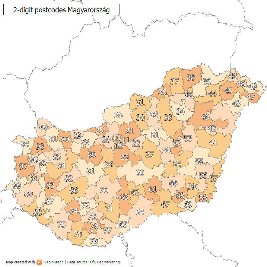
Postal codes in Hungary are four digit numeric. The first digit is for the postal region, as listed below (with the postal centre indicated after the number): * 1xxx Budapest (*) * 2xxx Szentendre * 3xxx Hatvan * 4xxx Debrecen (*) * 5xxx Szolnok * 6xxx Kecskemét * 7xxx Sárbogárd * 8xxx Székesfehérvár * 9xxx Győr Not all of the above are county capitals: Hatvan, Sárbogárd and Szentendre are major cities, but not county capitals. They are, however, all well communicated cities and big junctions. In Budapest postal codes are in the format 1XYZ, where X and Y are the two digits of the district number (from 01 to 23) and the last digit is the identification number of the post office in the district (there are more than one in each district). A special system exists for PO Box deliveries, which do not follow the district system. These special postal codes refer to a specific post office rather than an area. The "1000" postal code designates the Countrywide Logistics Centre ... [...More Info...] [...Related Items...] OR: [Wikipedia] [Google] [Baidu] |
Nové Zámky
Nové Zámky (; hu, Érsekújvár; german: Neuhäus ; la, Novum Castrum; tr, Uyvar) is a town in Nové Zámky District in the Nitra Region of southwestern Slovakia. Geography The town is located on the Danubian Lowland, on the Nitra River, at an altitude of 119 metres. It is located around 100 km from Bratislava and around 25 km from the Hungarian border. It is a road and railway hub of southern Slovakia. The town lies in the temperate zone and has a continental climate. Annual average temperature reaches around , with the warmest month being July with an average of and the coldest January with . Average annual precipitation is 556 mm. History The town has a distinguished history. From the second half of the 10th century until 1918, it was part of the Kingdom of Hungary. A fortress was built as a defence against the Ottoman Turks, on the site of an older settlement in the years 1573–81. Between 1589 and 1663, the settlement was the seat of the Cap ... [...More Info...] [...Related Items...] OR: [Wikipedia] [Google] [Baidu] |
Ottoman Empire
The Ottoman Empire, * ; is an archaic version. The definite article forms and were synonymous * and el, Оθωμανική Αυτοκρατορία, Othōmanikē Avtokratoria, label=none * info page on book at Martin Luther University) // CITED: p. 36 (PDF p. 38/338) also known as the Turkish Empire, was an empire that controlled much of Southeast Europe, Western Asia, and Northern Africa between the 14th and early 20th centuries. It was founded at the end of the 13th century in northwestern Anatolia in the town of Söğüt (modern-day Bilecik Province) by the Turkoman tribal leader Osman I. After 1354, the Ottomans crossed into Europe and, with the conquest of the Balkans, the Ottoman beylik was transformed into a transcontinental empire. The Ottomans ended the Byzantine Empire with the conquest of Constantinople in 1453 by Mehmed the Conqueror. Under the reign of Suleiman the Magnificent, the Ottoman Empire marked the peak of its power and prosperity, as well a ... [...More Info...] [...Related Items...] OR: [Wikipedia] [Google] [Baidu] |
Esztergom
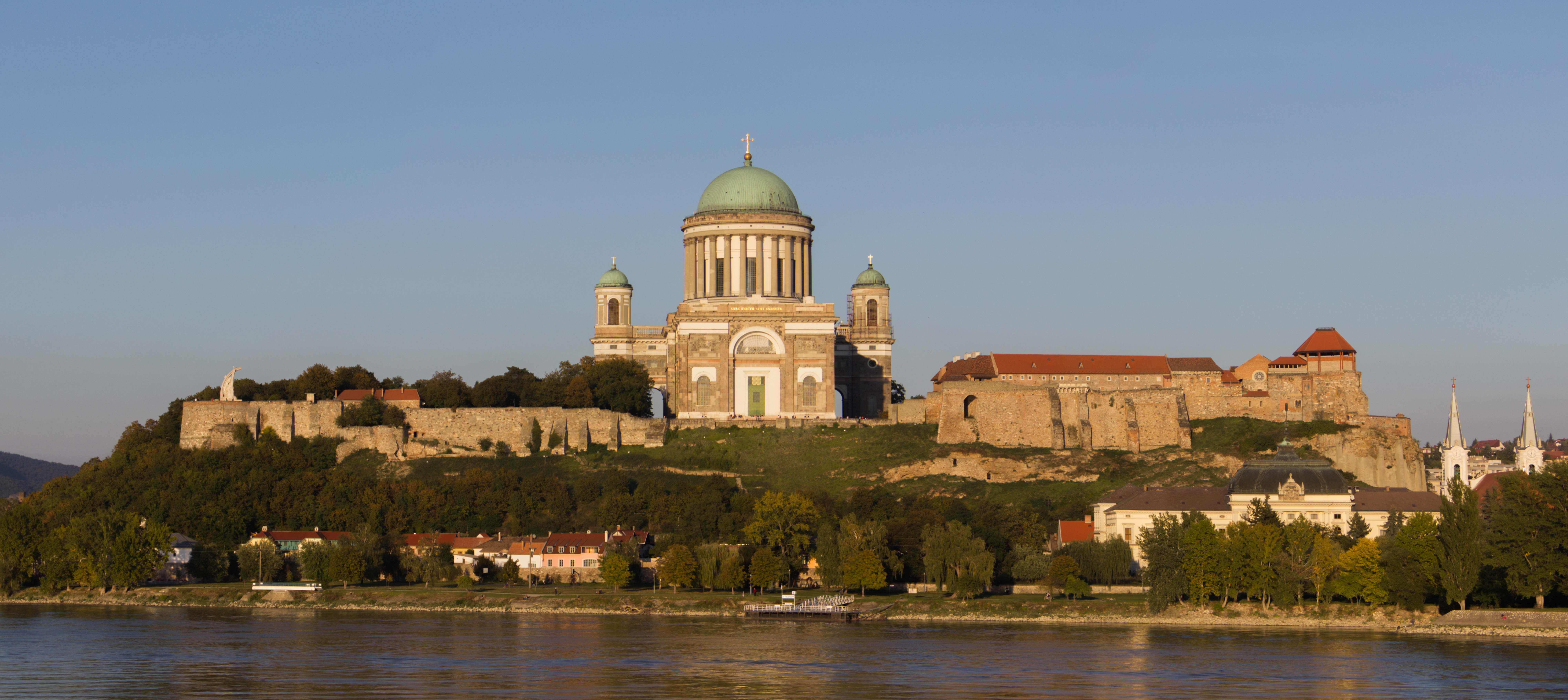
Esztergom ( ; german: Gran; la, Solva or ; sk, Ostrihom, known by alternative names) is a city with county rights in northern Hungary, northwest of the capital Budapest. It lies in Komárom-Esztergom County, on the right bank of the river Danube, which forms the border with Slovakia there. Esztergom was the capital of Hungary from the 10th until the mid-13th century when King Béla IV of Hungary moved the royal seat to Buda. Esztergom is the seat of the ''prímás'' (see Primate) of the Roman Catholic Church in Hungary, and the former seat of the Constitutional Court of Hungary. The city has a Christian Museum with the largest ecclesiastical collection in Hungary. Its cathedral, Esztergom Basilica, is the largest church in Hungary. Toponym The Roman town was called ''Solva''. The medieval Latin name was ''Strigonium''. The first early medieval mention is "''ſtrigonensis trigonensiscomes''" (1079-1080). The first interpretation of the name was suggested by Anto ... [...More Info...] [...Related Items...] OR: [Wikipedia] [Google] [Baidu] |
Stephen I Of Hungary
Stephen I, also known as King Saint Stephen ( hu, Szent István király ; la, Sanctus Stephanus; sk, Štefan I. or Štefan Veľký; 975 – 15 August 1038), was the last Grand Prince of the Hungarians between 997 and 1000 or 1001, and the first King of Hungary from 1000 or 1001, until his death in 1038. The year of his birth is uncertain, but many details of his life suggest that he was born in, or after, 975, in Esztergom. He was given the pagan name Vajk at birth, but the date of his baptism is unknown. He was the only son of Grand Prince Géza and his wife, Sarolt, who was descended from a prominent family of '' gyulas''. Although both of his parents were baptized, Stephen was the first member of his family to become a devout Christian. He married Gisela of Bavaria, a scion of the imperial Ottonian dynasty. After succeeding his father in 997, Stephen had to fight for the throne against his relative, Koppány, who was supported by large numbers of pagan warriors. H ... [...More Info...] [...Related Items...] OR: [Wikipedia] [Google] [Baidu] |
Komárom County
Komárom (Hungarian: ; german: Komorn; la, Brigetio, later ; sk, Komárno) is a city in Hungary on the south bank of the Danube in Komárom-Esztergom County. Komárno, Slovakia, is on the northern bank. Komárom was formerly a separate village called . In 1892 Komárom and Újszőny were connected with an iron bridge and in 1896 the two towns were united under the name city of Komárom. The fortress played an important role in the Hungarian Revolution of 1848 and many contemporary English sources refer to it as the Fortress of Comorn. History Following the Hungarian conquest of the Carpathian Basin at the turn of the 9th and 10th centuries, Prince Árpád gave Komárom and the Komárom county vicinity to tribal chieftain Ketel. Ketel was the first known ancestor of the famous Koppán (genus) clan. At the beginning of the 12th century, this tribe founded the town's Benedictine Monastery in honor of the Blessed Virgin, mentioned in 1222 by the name of Monostorium de Koppá ... [...More Info...] [...Related Items...] OR: [Wikipedia] [Google] [Baidu] |
County Seat
A county seat is an administrative center, seat of government, or capital city of a county or civil parish. The term is in use in Canada, China, Hungary, Romania, Taiwan, and the United States. The equivalent term shire town is used in the US state of Vermont and in some other English-speaking jurisdictions. County towns have a similar function in the Republic of Ireland and the United Kingdom, as well as historically in Jamaica. Function In most of the United States, counties are the political subdivisions of a state. The city, town, or populated place that houses county government is known as the seat of its respective county. Generally, the county legislature, county courthouse, sheriff's department headquarters, hall of records, jail and correctional facility are located in the county seat, though some functions (such as highway maintenance, which usually requires a large garage for vehicles, along with asphalt and salt storage facilities) may also be located or conducted ... [...More Info...] [...Related Items...] OR: [Wikipedia] [Google] [Baidu] |
Komárno District
Komárno District ( sk, okres Komárno, hu, Komáromi járás) is a district in the Nitra Region of western Slovakia. Until 1918, the district was mostly part of the Komárom county within the Kingdom of Hungary. The district has a population of 108.556 of which 74.976 (69.1%) are Hungarians and 30.079 (27.7%) are Slovaks The Slovaks ( sk, Slováci, singular: ''Slovák'', feminine: ''Slovenka'', plural: ''Slovenky'') are a West Slavic ethnic group and nation native to Slovakia who share a common ancestry, culture, history and speak Slovak. In Slovakia, 4.4 mi ... (2001). Municipalities References Districts of Slovakia Hungarian-speaking countries and territories Geography of Nitra Region {{Nitra-geo-stub ... [...More Info...] [...Related Items...] OR: [Wikipedia] [Google] [Baidu] |
Nové Zámky District
Nové Zámky District (''okres Nové Zámky'') is a district in the Nitra Region of western Slovakia. Until 1918, the area of the district was split between several county of Kingdom of Hungary: the largest area in the north formed part of Nitra; an area in the south between Dvory nad Žitavou and Strekov formed part of Komárno; an area in the north-east around Veľké Lovce formed part of Tekov; a sizable area in the east formed part of Esztergom (Ostrihom); and a small area around Salka Salka ( hu, Ipolyszalka) is a village and municipality in the Nové Zámky District in the Nitra Region of south-west Slovakia. History In historical records the village was first mentioned in 1156. Geography The municipality lies at an altitude ... formed part of Hont County. Population Municipalities References Districts of Slovakia {{Nitra-geo-stub ... [...More Info...] [...Related Items...] OR: [Wikipedia] [Google] [Baidu] |
Nitra Region
The Nitra Region ( sk, Nitriansky kraj, ; hu, Nyitrai kerület) is one of the administrative regions of Slovakia. It was first established in 1923 and from 1996 exists in its present borders. It consists of seven districts ( sk, okres) and 354 municipalities, from which 16 have a town status. The economy of the region focuses more on agriculture, than in other Slovak regions. Nitra is its seat, largest city, and cultural and economic center. Geography This region with a long history is situated in the southwest of Slovakia, mostly in the eastern part of the Danubian Lowland. It is divided into two sub-units: the Danubian Flat in the south-west, with eastern part of the Žitný ostrov island, and the Danubian Hills in the north, centre and east. Mountain ranges reaching into the region are: Považský Inovec in the north-west, where the region's highest point, Veľký Inovec, is located, Tribeč in the north from Nitra, Pohronský Inovec in the north-east and Štiavnické vrchy ... [...More Info...] [...Related Items...] OR: [Wikipedia] [Google] [Baidu] |


