|
Kinbasket Lake
Kinbasket Lake (or Kinbasket Reservoir) is a reservoir on the Columbia River in southeast British Columbia, north of the city of Revelstoke and the town of Golden. The reservoir was created by the construction of the Mica Dam. The lake includes two reaches, Columbia Reach (to the south) and Canoe Reach (to the north), referring to the river valleys flooded by the dam. To the north it almost reaches the town of Valemount in an impoundment of the Canoe River. To the south it reaches upstream the Columbia River towards the city of Golden. The original, smaller Kinbasket Lake was named in 1866 after Kinbasket, a chief of the Shuswap people. The modern, large lake was created after the completion of the Mica Dam in 1973, and was called McNaughton Lake (after Andrew McNaughton) until 1980. A number of small communities were inundated by the creation of Kinbasket Lake, and comprised a region known as the Big Bend Country, a subregion of the Columbia Country. Among these towns were Mi ... [...More Info...] [...Related Items...] OR: [Wikipedia] [Google] [Baidu] |
Valemount, British Columbia
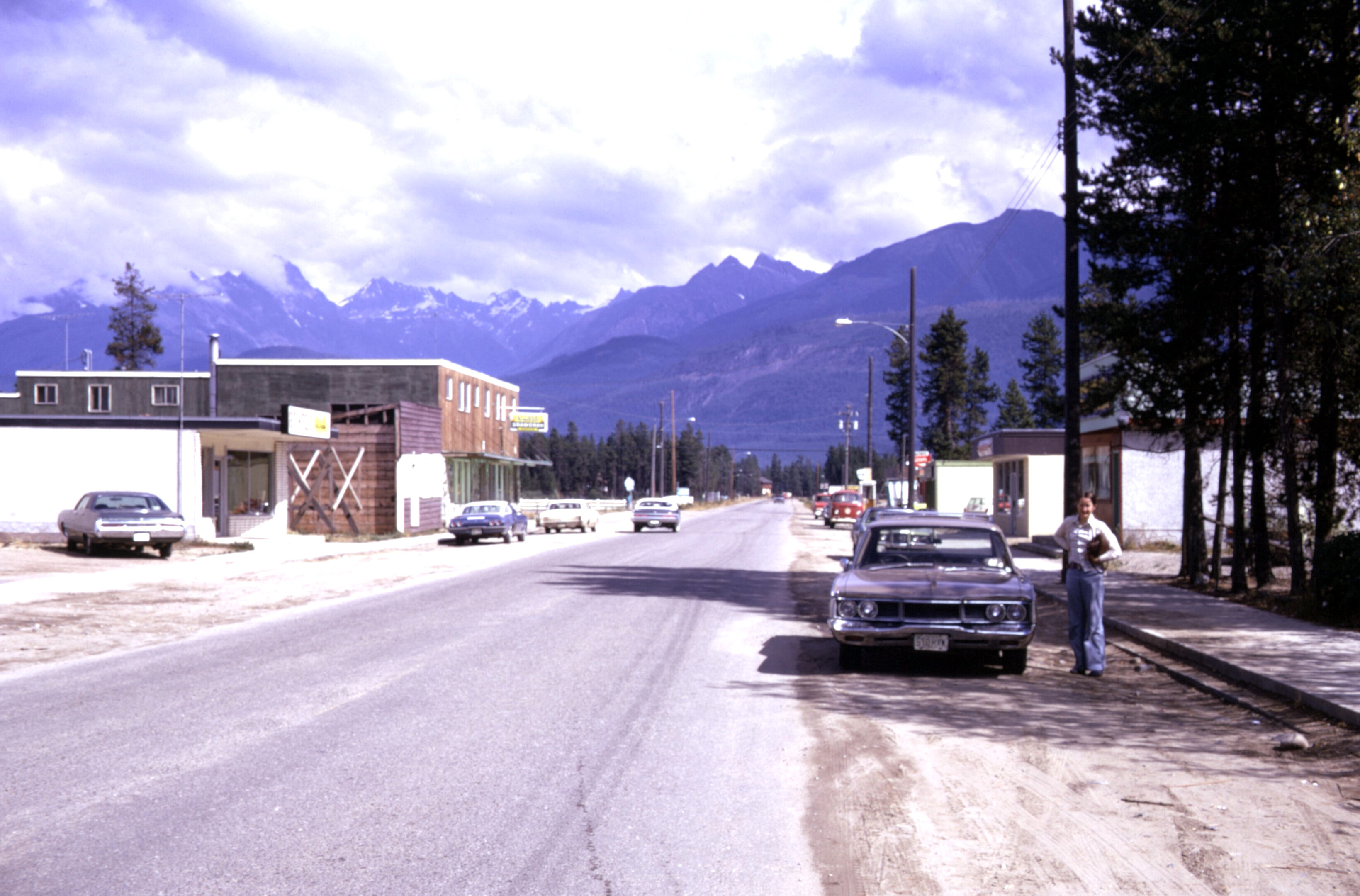
Valemount () is a village municipality of 1,018 people in east central British Columbia, Canada, from Kamloops, British Columbia. It is between the Rocky, Monashee, and Cariboo Mountains. It is the nearest community to the west of Jasper National Park, and is also the nearest community to Mount Robson Provincial Park, which features Mount Robson, the tallest mountain in the Canadian Rockies. Outdoor recreation is popular in summer and winter—hiking, skiing, snowmobiling, cross country skiing, mountain biking and horseback riding are common activities. Valemount is one of 14 designated Resort Municipalities in British Columbia. As a flag stop Via Rail's ''Canadian'' calls at the Valemount railway station two or three times (depending on the season) per week in each direction. The name Valemount was coined for the C.N.R. station there in 1927 from the words "vale" and "mount." History The land that would become Valemount is in the traditional territory of the Kootenai, Shuswap ... [...More Info...] [...Related Items...] OR: [Wikipedia] [Google] [Baidu] |
Big Bend Country
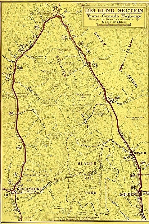
In the Canadian province of British Columbia, Big Bend Country is the region around the northernmost section of the Columbia River, which changes from a northwestward course along the Rocky Mountain Trench to curve around the northern end of the Selkirk Mountains to head southwest between that range and the Monashee Mountains, which lie to the west. The area is part of the larger Columbia Country, which includes the Columbia Valley and upper Arrow Lakes of eastern British Columbia. The north of the railway line, and enclosed by the river, roughly defines the Big Bend. However, in earlier eras, the descriptive was more narrowly understood. History Explorers Familiar with the river for navigation, the Big Bend is a traditional territory of the Secwepemc (Shuswap) people, but is also claimed by the Ktunaxa. The Blackfoot raided and at times occupied the area. David Thompson of the Hudson's Bay Company, and later the North West Company, was the first European to travel the upper re ... [...More Info...] [...Related Items...] OR: [Wikipedia] [Google] [Baidu] |
Lakes Of British Columbia
A lake is an area filled with water, localized in a basin, surrounded by land, and distinct from any river or other outlet that serves to feed or drain the lake. Lakes lie on land and are not part of the ocean, although, like the much larger oceans, they do form part of the Earth's water cycle. Lakes are distinct from lagoons, which are generally coastal parts of the ocean. Lakes are typically larger and deeper than ponds, which also lie on land, though there are no official or scientific definitions. Lakes can be contrasted with rivers or streams, which usually flow in a channel on land. Most lakes are fed and drained by rivers and streams. Natural lakes are generally found in mountainous areas, rift zones, and areas with ongoing glaciation. Other lakes are found in endorheic basins or along the courses of mature rivers, where a river channel has widened into a basin. Some parts of the world have many lakes formed by the chaotic drainage patterns left over from the last ice ... [...More Info...] [...Related Items...] OR: [Wikipedia] [Google] [Baidu] |
Columbia River Treaty
The Columbia River Treaty is a 1961 agreement between Canada and the United States on the development and operation of dams in the upper Columbia River basin for power and flood control benefits in both countries. Four dams were constructed under this treaty: three in the Canadian province of British Columbia (Duncan Dam, Mica Dam, Keenleyside Dam) and one in the U.S. state of Montana (Libby Dam). The treaty provided for the sharing with Canada of half of the downstream US power and flood benefits, and allows the operation of Treaty storage for other benefits. The long-term impacts of the treaty have been mixed: while the dams have provided enormous economic benefits to British Columbia and the U.S. Pacific Northwest through hydroelectric generation and flood control, there are longstanding concerns regarding social and economic impacts to the local communities, and the environmental effects associated with the construction and operation of large dams. Background In 1944, the Cana ... [...More Info...] [...Related Items...] OR: [Wikipedia] [Google] [Baidu] |
Beavermouth (railway Point), British Columbia
Beavermouth is about west of Golden, and about east of the mid-point of the Connaught Tunnel beneath Rogers Pass, in southeastern British Columbia. At the mouth of the Beaver River, the train station was called Beavermouth, but the adjacent community, which no longer exists, was known as Beaver or Beaver Mouth. Nowadays, the closest road access is to the nearby Kinbasket Lake Resort. Railway In November 1884, the Canadian Pacific Railway (CP) railhead's westward advance reached Beavermouth. Inspector Sam Steele, Sergeant Fury, and about six or seven constables of the North-West Mounted Police maintained law and order within the camps. At Beavermouth, the police post was on the opposite side of the Beaver River to the construction camp, being connected by a bridge. The police facilities included cells for 30 prisoners, a courtroom, staff dining hall, and quarters for the men. In contrast, the worker quarters contained two long double tiers of bunks for 100 men, separated by a nar ... [...More Info...] [...Related Items...] OR: [Wikipedia] [Google] [Baidu] |
La Porte, British Columbia
La Porte was a boomtown in British Columbia, Canada, during the Big Bend Gold Rush. The site at the foot of the Dalles des Morts, or Death Rapids, was chosen as the location of a ferry and town on April 23, 1866, during the first voyage of the steamboat '' Forty-Nine'' up the Columbia River The Columbia River (Upper Chinook: ' or '; Sahaptin: ''Nch’i-Wàna'' or ''Nchi wana''; Sinixt dialect'' '') is the largest river in the Pacific Northwest region of North America. The river rises in the Rocky Mountains of British Columbia, C .... The name reflected its role as the gateway to the mines. By 1871, engineer Walter Moberly returned from a survey trip to report that a single resident remained at La Porte. And by 1885 all of the houses were in ruins. References {{coord missing, British Columbia Ghost towns in British Columbia ... [...More Info...] [...Related Items...] OR: [Wikipedia] [Google] [Baidu] |
Boat Encampment
Boat Encampment is a ghost town in the East Kootenay region of southeastern British Columbia. The locality was at the tip of the Big Bend on the north shore of the Columbia River. The general vicinity, on the former Big Bend Highway, was by road about northwest of Golden and north of Revelstoke. Precise location The initial site was on a long woody point, but the appearance on maps has ranged from the west shore of the Canoe River to the former highway bridge about southeast of the former mouth of the Wood River. The consensus places the initial location between the mouths of the Canoe and Wood rivers. After the highway was opened, the bridge location assumed the name and was chosen for viewing purposes as the site for the 1953 cairn and plaque. A fishing lodge opened in the vicinity. In 1943, the area was designated a National Historic Site of Canada. In 1973, the historic marker was relocated when the enlarged Kinbasket Lake formed the Mica Dam reservoir. In 2000, a memorial ... [...More Info...] [...Related Items...] OR: [Wikipedia] [Google] [Baidu] |
Big Bend, British Columbia
Big or BIG may refer to: * Big, of great size or degree Film and television * ''Big'' (film), a 1988 fantasy-comedy film starring Tom Hanks * '' Big!'', a Discovery Channel television show * ''Richard Hammond's Big'', a television show presented by Richard Hammond * ''Big'' (TV series), a 2012 South Korean TV series * '' Banana Island Ghost'', a 2017 fantasy action comedy film Music * '' Big: the musical'', a 1996 musical based on the film * Big Records, a record label * ''Big'' (album), a 2007 album by Macy Gray * "Big" (Dead Letter Circus song) * "Big" (Sneaky Sound System song) * "Big" (Rita Ora and Imanbek song) * "Big", a 1990 song by New Fast Automatic Daffodils * "Big", a 2021 song by Jade Eagleson from '' Honkytonk Revival'' *The Notorious B.I.G., an American rapper Places * Allen Army Airfield (IATA code), Alaska, US * BIG, a VOR navigational beacon at London Biggin Hill Airport * Big River (other), various rivers (and other things) * Big Island (disamb ... [...More Info...] [...Related Items...] OR: [Wikipedia] [Google] [Baidu] |
Columbia Country
Columbia Country refers to the upper basin of the Columbia River in the Canadian province of British Columbia. It includes a smaller region known as the Columbia Valley, near the river's headwaters at Columbia Lake in the Rocky Mountain Trench, as well as the Big Bend of that river, now mostly inundated by Kinbasket Lake and Revelstoke Lake. The area has no precisely defined boundaries, but conventionally Columbia Country encompasses the region upstream of Revelstoke, as the Arrow Lakes are generally referred to as a region in their own right, or as part of the West Kootenay. The lower Columbia, around the cities of Castlegar and Trail, is generally considered part of the West Kootenay, not the Columbia Country. Usages References to Columbia Country appears in the names of "twinned" region names like Columbia-Kootenay or Columbia-Shuswap. The former refers to the East Kootenay, the latter to the Revelstoke- Big Bend region, plus perhaps Golden. See also *Columbia River Drain ... [...More Info...] [...Related Items...] OR: [Wikipedia] [Google] [Baidu] |
Andrew McNaughton
Andrew is the English form of a given name common in many countries. In the 1990s, it was among the top ten most popular names given to boys in English-speaking countries. "Andrew" is frequently shortened to "Andy" or "Drew". The word is derived from the el, Ἀνδρέας, ''Andreas'', itself related to grc, ἀνήρ/ἀνδρός ''aner/andros'', "man" (as opposed to "woman"), thus meaning "manly" and, as consequence, "brave", "strong", "courageous", and "warrior". In the King James Bible, the Greek "Ἀνδρέας" is translated as Andrew. Popularity Australia In 2000, the name Andrew was the second most popular name in Australia. In 1999, it was the 19th most common name, while in 1940, it was the 31st most common name. Andrew was the first most popular name given to boys in the Northern Territory in 2003 to 2015 and continuing. In Victoria, Andrew was the first most popular name for a boy in the 1970s. Canada Andrew was the 20th most popular name chosen for male ... [...More Info...] [...Related Items...] OR: [Wikipedia] [Google] [Baidu] |


