|
Karl Ludwig Philipp Zeyher
Karl Ludwig Philipp Zeyher (2 August 1799 Dillenburg, Hessen, Germany – 13 December 1858 Cape Town), was a botanical and insect collector who collected extensively in South Africa. He was the author, with Christian Friedrich Ecklon, of ''Enumeratio Plantarum Africae Australis'' (1835-7), a descriptive catalogue of South African plants. In 1816 Zeyher was apprenticed to his uncle Johann Michael Zeyher who was head gardener at the ducal gardens of Schwetzingen. Here he met Franz Sieber and was talked into a partnership with the aim of collecting and selling natural history specimens - a burgeoning industry in the 19th century. They sailed for Mauritius in August 1822, however Zeyher was left at the Cape while Sieber went on to Mauritius and Australia. On his return in April 1824, Sieber picked up the specimens collected by Zeyher, assuring him of payment in due course. No payment ever materialised and Zeyher became aware that he would be forced to operate on his own. He jo ... [...More Info...] [...Related Items...] OR: [Wikipedia] [Google] [Baidu] |
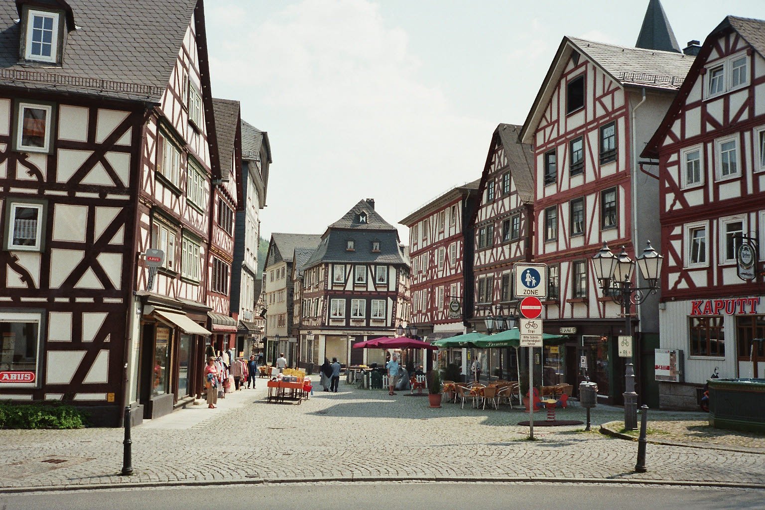
Dillenburg
Dillenburg, officially Oranienstadt Dillenburg, is a town in Hesse's Gießen (region), Gießen region in Germany. The town was formerly the seat of the old Dillkreis district, which is now part of the Lahn-Dill-Kreis. The town lies on the German-Netherlands, Dutch holiday road called the Orange Route, joining towns, cities and regions associated with the House of Orange-Nassau, as well as on the German Timber-Frame Road and the Rothaarsteig hiking trail. Geography Location Dillenburg lies on the eastern edge of the Westerwald range in the narrow valley of the river Dill (river), Dill, which flows from Hesse-Westphalia border to Wetzlar, emptying into the Lahn. Neighbouring communities Dillenburg borders in the north on the community of Eschenburg, in the east on the community of Siegbach, in the south on the town of Herborn (Hesse), Herborn, and the community of Breitscheid (Hesse), Breitscheid, and in the west on the town of Haiger (all in the Lahn-Dill-Kreis). Const ... [...More Info...] [...Related Items...] OR: [Wikipedia] [Google] [Baidu] |
Oliphants/Doring River
The Olifants River ( af, Olifantsrivier) is a river in the northwestern area of the Western Cape Province of South Africa. The upper and main catchment area of the Olifants river is around Ceres and the Cederberg mountains. The Clanwilliam and Bulshoek dams are located on the river and provide water for the towns and farms along the watercourse. The river is approximately 285 km long with a catchment area of 46,220 km2 and flows into the Atlantic Ocean at Papendorp, 250 km north of Cape Town. Watershed The Olifants River rises in the Winterhoek Mountains north of Ceres. The mainstem is about 265 km long. The river flows to the north-west through a deep, narrow valley that widens and flattens into a broad floodplain below Clanwilliam. The river eventually drains into the Atlantic Ocean near Papendorp. At the mouth the Olifants river is split in two by an island that exhibits interesting rock formations. Tributaries Its main tributary is the Doring River, ch ... [...More Info...] [...Related Items...] OR: [Wikipedia] [Google] [Baidu] |
Algoa Bay
Algoa Bay is a maritime bay in the Eastern Cape, South Africa. It is located in the east coast, east of the Cape of Good Hope. Algoa Bay is bounded in the west by Cape Recife and in the east by Cape Padrone. The bay is up to deep. The harbour city of Port Elizabeth is situated adjacent to the bay, as is the Port of Ngqura deep water port facility. History The Portuguese explorer Bartolomeu Dias was the first European to reach Algoa Bay in 1488, where he planted a wooden cross on a small island now called St Croix or Santa Cruz island. He gave the bay a name meaning "Bay of the Rock", which was changed in Portugal to ''Bahia de Lagoa'' or Bay of the Lagoon, and which eventually became Algoa Bay. Joshua Slocum talks about Algoa Bay in his book 'Sailing Alone Around the World' (this is not an historical account): Nautical charts of the bay caution mariners that "projectiles and badly corroded mustard gas containers have been found in the area between Cape St Francis and Bir ... [...More Info...] [...Related Items...] OR: [Wikipedia] [Google] [Baidu] |
Langkloof
The Langkloof is a 160 km long valley in South Africa, lying between Herold, a small village northeast of George, and The Heights - just beyond Twee Riviere. History The kloof was given its name by Isaq Schrijver in 1689, and more thoroughly explored by a later expedition under ensign August Frederik Beutler August Frederik Beutler (c. 1728 in Dinkelsbühl – ? in Cape Town) was an ensign ( sergeant 1747–49, ensign 1749–54) in the employ of the Dutch East India Company who headed an epic 1752 reconnaissance expedition lasting 8 months ... in 1752. The valley has been farmed since 1760 and developed into an important fruit-growing region during the 1900s, specifically prized for its apples and pears. Joubertina is the largest but also the youngest town in the Langkloof, and was founded in 1907 as a Dutch-Reformed community, named in honour of the Rev. W.A. Joubert of Uniondale. The reverend prohibited the sale of alcohol in the town, a ban which was never ... [...More Info...] [...Related Items...] OR: [Wikipedia] [Google] [Baidu] |
Knysna
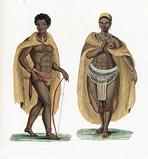
Knysna () is a town with 76,150 inhabitants (2019 mid-year estimates) in the Western Cape province of South Africa. and is one of the destinations on the loosely defined Garden Route tourist route. It lies at 34° 2' 6.3168'' S and 23° 2' 47.2884'' E., and is situated 60 kilometres east of the city of George on the N2 highway, and 33 kilometres west of the Plettenberg Bay on the same road. History Early history Forty fossilised hominid footprints, dating to about 90,000 years ago, along with various other archaeological discoveries suggest that humans have lived in Knysna for well over 300,000 years. The first of these were various San Hunter-gatherer peoples who inhabited most of Southern Africa in paleolithic. The San were gradually displaced and absorbed by south migrating Khoekhoe peoples. Houtunqua (Outeniqua) Khoe The indigenous inhabitants of the Knysna area are a southern Khoekhoe people called the Houtunqua or Outeniqua. Their name means "The People Who Bear Honey" ... [...More Info...] [...Related Items...] OR: [Wikipedia] [Google] [Baidu] |
George, Western Cape
George is the second largest city in the Western Cape province of South Africa. The city is a popular holiday and conference centre, as well as the administrative and commercial hub and the seat of the Garden Route District Municipality. It is named after the British Monarch George III. The city is situated roughly halfway between Cape Town and Port Elizabeth on the Garden Route. It is situated on a 10-kilometre plateau between the Outeniqua Mountains to the north and the Indian Ocean to the south. The former township of Pacaltsdorp, now a fully incorporated suburb, lies to the south. History Early history Prior to European settlement in the late 1700s the area was inhabited by the Khoekhoen tribes: the Gouriquas, Attequas and Outeniquas. Many places in the area, such as the surrounding Outeniqua Mountains, come from Khoekhoen names for these locations. 18th and 19th century The settlement that was to become George was established as a result of the growing demand for ... [...More Info...] [...Related Items...] OR: [Wikipedia] [Google] [Baidu] |
Outeniqua Mountains
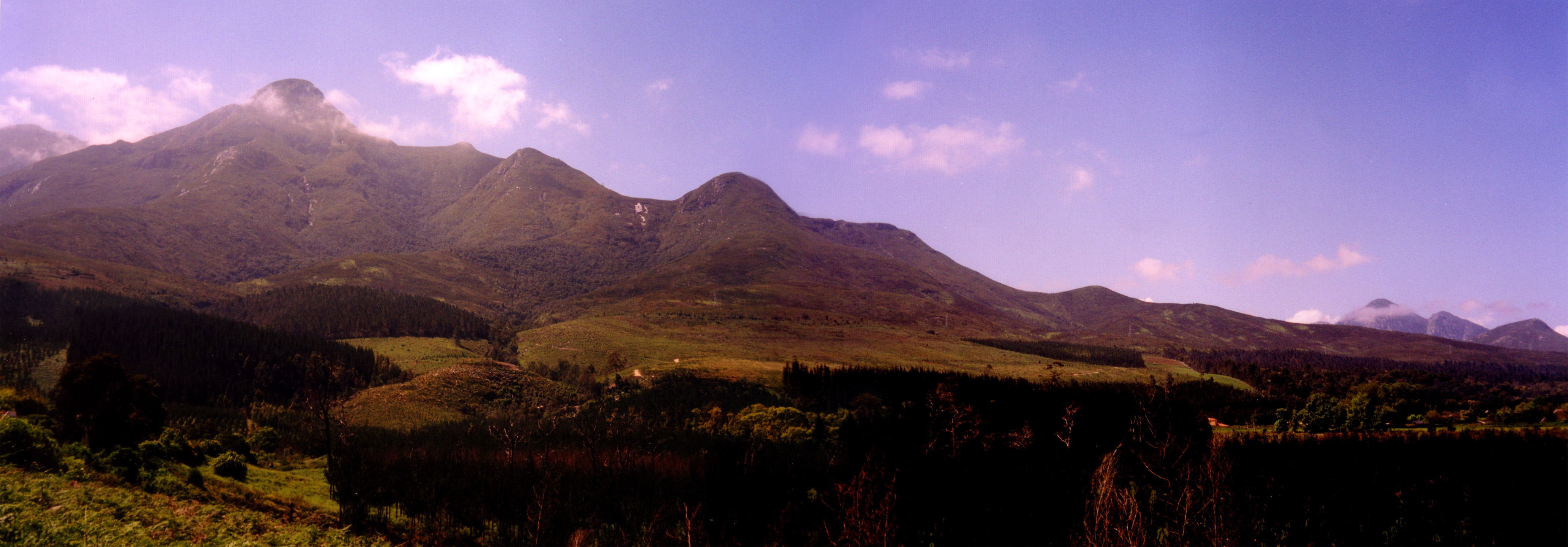
The Outeniqua Mountains, named after the Outeniqua Khoikhoi who lived there, is a mountain range that runs a parallel to the southern coast of South Africa, and forms a continuous range with the Langeberg to the west and the Tsitsikamma Mountains to the east. It was known as ''Serra de Estrella'' (Mountain of the Star) to the Portuguese. The mountains are part of the Garden Route of South Africa. Nomenclature "Outeniqua" is said to be derived from a Khoikhoi tribe that once lived in the mountains, and means "they who bear honey". Indigenous rock paintings can still be found in the area. History The region was first explored by white settlers in 1668 and in 1782, French explorer and ornithologist François Levaillant explored the area and discovered farmers had settled at foot of the mountain range. Historic incidents On 1 June 2002, former South Africa cricket captain Hansie Cronje's scheduled flight home from Johannesburg to George, Western Cape was grounded so he hitched a ride ... [...More Info...] [...Related Items...] OR: [Wikipedia] [Google] [Baidu] |
Swartberg
The Swartberg mountains (''black mountain'' in Afrikaans) are a mountain range in the Western Cape province of South Africa. It is composed of two main mountain chains running roughly east–west along the northern edge of the semi-arid Little Karoo. To the north of the range lies the other large semi-arid area in South Africa, the Great Karoo. Most of the Swartberg Mountains are above 2000 m high, making them the tallest mountains in the Western Cape. It is also one of the longest, spanning some 230 km from south of Laingsburg in the west to between Willowmore and Uniondale in the east. Geologically, these mountains are part of the Cape Fold Belt. Much of the Swartberg is part of a UNESCO World Heritage Site. The two ranges The Swartberg consists of two officially named ranges, the Smaller and the Greater Swartberg Mountains. ''Klein Swartberge'' The Smaller Swartberg are the westernmost of the two. Ironically, this range is the higher one, including the province's high ... [...More Info...] [...Related Items...] OR: [Wikipedia] [Google] [Baidu] |
Karoo
The Karoo ( ; from the Afrikaans borrowing of the South Khoekhoe !Orakobab or Khoemana word ''ǃ’Aukarob'' "Hardveld") is a semi-desert natural region of South Africa. No exact definition of what constitutes the Karoo is available, so its extent is also not precisely defined. The Karoo is partly defined by its topography, geology and climate, and above all, its low rainfall, arid air, cloudless skies, and extremes of heat and cold.Potgieter, D.J. & du Plessis, T.C. (1972) ''Standard Encyclopaedia of Southern Africa''. Vol. 6. pp. 306–307. Nasou, Cape Town.''Reader’s Digest Illustrated Guide to Southern Africa''. (5th Ed. 1993). pp. 78–89. Reader’s Digest Association of South Africa Pty. Ltd., Cape Town. The Karoo also hosted a well-preserved ecosystem hundreds of million years ago which is now represented by many fossils. The ǃ’Aukarob formed an almost impenetrable barrier to the interior from Cape Town, and the early adventurers, explorers, hunters, and travelers o ... [...More Info...] [...Related Items...] OR: [Wikipedia] [Google] [Baidu] |
Langeberg
The Langeberg Range is a mountain range in the Western Cape province of South Africa. Its highest peak is Keeromsberg at 2,075 m that lies 15 km northeast of the town of Worcester. Some of the highest peaks of the range are located just to the north of Swellendam, in a subrange known as the Clock Peaks whose highest point is the 1,710 m high Misty Point. Local lore states one can tell the time by means of the shadows cast by the seven summits of the Clock Peaks. Etymology The name is Dutch and means "long mountain" Physiography and geology The range runs roughly NW/SE in its western part and in an east-west direction in its mid and eastern section and is approximately 250 km long, from Worcester, past Robertson, Montagu, Swellendam, Heidelberg and Riversdale to the proximity of George. The Langeberg's most westerly point is located 5 km east of the town of Worcester; the range ends some 20 km North of Mossel Bay in the east. The open plains of the Little ... [...More Info...] [...Related Items...] OR: [Wikipedia] [Google] [Baidu] |
Swellendam
Swellendam is the fifth oldest town in South Africa (after Cape Town, Stellenbosch, Simon's Town, and Paarl), a town with 17,537 inhabitants situated in the Western Cape province. The town has over 50 provincial heritage sites, most of them buildings of Cape Dutch architecture. Swellendam is situated on the N2, approximately 220 km from both Cape Town and George. History Early travellers and explorers who visited the Cape in the 16th century traded with the Khoikhoi people who lived on these shores and in the interior. When the Dutch East India Company established a replenishment station at the Cape in 1652, trade continued inland as far as Swellendam. In 1743 Swellendam was declared a magisterial district, the third-oldest in South Africa, and was named after Governor Hendrik Swellengrebel, the first South African born Governor, and his wife, Helena Ten Damme. This outlying settlement soon became a gateway to the interior, and was visited by many famous explorers an ... [...More Info...] [...Related Items...] OR: [Wikipedia] [Google] [Baidu] |
Cape Agulhas
Cape Agulhas (; pt, Cabo das Agulhas , "Cape of the Needles") is a rocky headland in Western Cape, South Africa. It is the geographic southern tip of the African continent and the beginning of the dividing line between the Atlantic and Indian Oceans according to the International Hydrographic Organization. Historically, the cape has been known to sailors as a major hazard on the traditional clipper route. It is sometimes regarded as one of the great capes. It was most commonly known in English as Cape L'Agulhas until the 20th century. The town of L'Agulhas is located near to the cape. Geography Cape Agulhas is located in the Overberg region, 170 kilometres (105 mi) southeast of Cape Town. The cape was named by Portuguese navigators, who called it ''Cabo das Agulhas''—Portuguese for "Cape of Needles"—after noticing that around the year 1500 the direction of magnetic north (and therefore the compass needle) coincided with true north in the region. The cape is ... [...More Info...] [...Related Items...] OR: [Wikipedia] [Google] [Baidu] |


