|
Karacabey
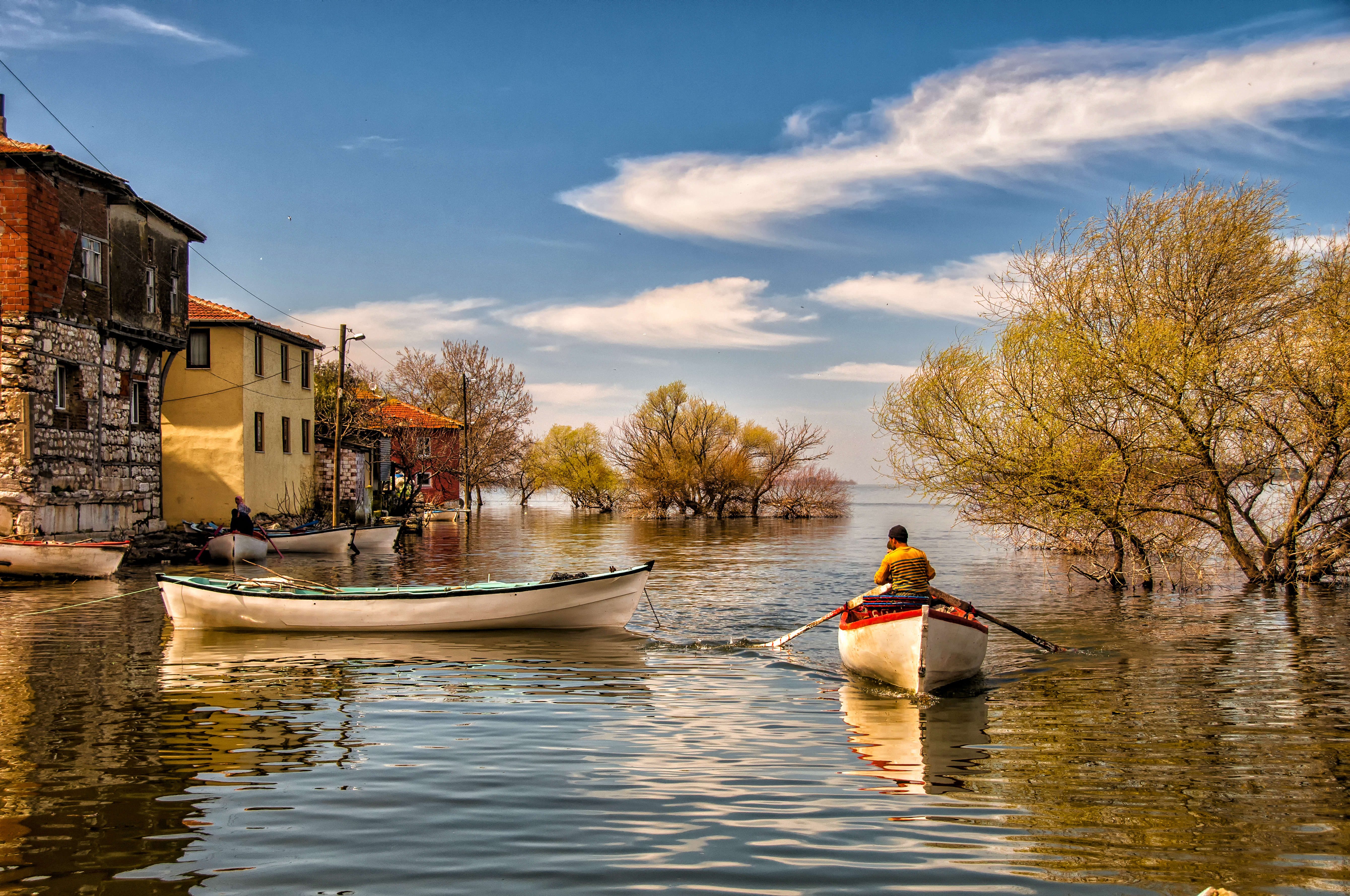
Karacabey is a town and district of Bursa Province in the Marmara Region of Turkey. It is located just west of the Simav River near its confluence with the Adirnaz River. District of Karacabey borders districts of Mudanya and Nilüfer from east, ones of Mustafakemalpaşa and Susurluk from south, one of Manyas from southwest and Bandırma from west. It is sited on the ancient town of Miletopolis. Karacabey is an industrial area as well as an agricultural one. It is known as the plantation area of a special variety of onions. There are many famous food factories around Karacabey such as Nestle and many varieties of vegetables and fruits are planted in Karacabey. There is a nearby lake called Uluabat. The Marmara Sea is 32 km to the north. The town is named for a Turkish soldier during the Ottoman era named Karaca Bey. The former name of the town was Mihalich Hazlitt, W. '' The Classical Gazetteer: A Dictionary of Ancient Geography, Sacred and Profane.''Macestus" Whittake ... [...More Info...] [...Related Items...] OR: [Wikipedia] [Google] [Baidu] |
Marmara Sea
The Sea of Marmara,; grc, Προποντίς, Προποντίδα, Propontís, Propontída also known as the Marmara Sea, is an inland sea located entirely within the borders of Turkey. It connects the Black Sea to the Aegean Sea via the Bosporus and Dardanelles straits, separating the country's European and Asian sides. The Sea of Marmara is a small sea with an area of , and dimensions of . Its greatest depth is . Name The Sea of Marmara is named after the largest island to its south side which is called Marmara Island because it is rich in marble (Greek (''mármaron'') "marble)." In classical antiquity it was known as the Propontis, which is derived from the Greek words ''pro-'' (before) and ''pontos'' (sea) and reflects the fact that the Ancient Greeks used to sail through it to reach the Black Sea that they called Pontos. Mythology In Greek mythology, a storm on the Propontis brought the Argonauts back to an island they had left, precipitating a battle in whic ... [...More Info...] [...Related Items...] OR: [Wikipedia] [Google] [Baidu] |
Bandırma
Bandırma () is a city in northwestern Turkey with 161,894 inhabitants as of 2021 on the Sea of Marmara. Bandırma is a district of Balıkesir Province. Bandırma is located in the south of the Marmara Sea, in the bay with the same name, and is an important port city. It is approximately two hours away from Istanbul, Izmir and Bursa. Bandırma may be reached by land, sea, air and rail. Regular ship trips are made to Tekirdağ and Istanbul from Bandırma every day. The accelerated train services between Izmir and Bandırma, which are made every day in connection with the ferry, offer a different transportation alternative. Bandırma is home to the fifth-largest port in Turkey, second in the Marmara sea to Istanbul. The annual average trade volume of Bandırma Port, which meets 90% of the exports from Balıkesir Province, is 800 million dollars. Bandırma's twin towns are Kamen, Germany, Tongxiang, China, and Mardin, Turkey. Geography Bandırma's lands are quite flat in the ... [...More Info...] [...Related Items...] OR: [Wikipedia] [Google] [Baidu] |
Bursa Province
Bursa Province ( tr, ) is a province in Turkey along the Sea of Marmara coast in northwestern Anatolia. It borders Balıkesir to the west, Kütahya to the south, Bilecik and Sakarya to the east, Kocaeli to the northeast and Yalova to the north. The province has an area of 11,043 km2 and a population of 3,139,744 as of 2021. Its traffic code is 16. The vast majority of the Bursa Province districts (and the city of Bursa) are located within the Marmara Region, but the districts of Büyükorhan, Harmancık, Keles and Orhaneli are located within the Aegean Region. The city of Bursa was the capital of the Ottoman State between 1326 and 1365, until the Ottoman conquest of Edirne, then known as Adrianople, which became the new Ottoman capital between 1365 and 1453, when Constantinople became the final Ottoman capital. Districts Demographics See also * City of Bursa * İznik İznik is a town and an administrative district in the Province of Bursa, Turkey ... [...More Info...] [...Related Items...] OR: [Wikipedia] [Google] [Baidu] |
Ulubatlı Hasan
Ulubatlı Hasan (sometimes misspelt as Uluabatlı Hasan), Hasan of Ulubat (1428 – May 29, 1453) was a Timarli Sipâhî in the service of Sultan Mehmed II of the Ottoman Empire who achieved legendary status as a heroic Turkish martyr at the successful Siege of Constantinople.The Companion Guide to Istanbul: And Around the Marmara By John Freely, Susan Glyn, pg. 356 He was born in a small village called Ulubat (near Karacabey) in the province of Bursa. At the age of 25 he was present at the Siege of Constantinople (April 6, 1453 – May 29, 1453). The Turks had tried to take the grand city and last stronghold of the Roman Empire several times before, but this time, under the command of Sultan Mehmed II, who was in his early twenties at the time and already showing potential of being a great military leader, it looked like victory was at hand. But despite several assaults and the severe hammering by the cannons, the great double walls of Constantinople held for 53 days. On th ... [...More Info...] [...Related Items...] OR: [Wikipedia] [Google] [Baidu] |
Lopadium
Ulubad or Uluabat, in the Byzantine period Lopadion ( grc, Λοπάδιον), Latinized as Lopadium, is a settlement near the town of Karacabey in the Bursa Province of northwestern Turkey. It was sited on the ancient Miletouteichos. History Uluabat is located on the banks of the Mustafakemalpaşa River (ancient and medieval Rhyndacus). It is first mentioned by Theodore of Stoudios in one of his letters, as the site of a ''xenodocheion'' (caravanserai). By the late 11th century, it featured a market town. The existence of a 4th-century bridge carrying the road between Cyzicus on the Sea of Marmara to the interior of Asia Minor made it a place of some strategic importance, especially in the wars of the Komnenian emperors against the Seljuk Turks in the 11th–12th centuries, during which it is best known. Alexios I Komnenos (r. 1081–1118) fought the Turks in the vicinity, and in 1130, his successor John II Komnenos (r. 1118–43) built there a great fortress which became the ... [...More Info...] [...Related Items...] OR: [Wikipedia] [Google] [Baidu] |
Simav River
The Simav ( tr, Simav Çayı) or Susurluk RiverTurkish General Directorate of State Water Works (DSİ)." Archive accessed 3 Sept. 2011. (''Susurluk Çayı'') is a river in Anatolian Turkey. Its course is 321 km long and its basin comprises 22 400 km2. It was the classical Macestus Hazlitt, W. '' The Classical Gazetteer: A Dictionary of Ancient Geography, Sacred and Profane.''Macestus" Whittaker & Co. (London), 1851. Accessed 4 Sept. 2011. (; el, Μέκεστος, ''Mékestos''). In the 19th century, it was known as the Mikalick. The Simav has its source in Kütahya Province, from which it flows north across the plain of Simav into Balıkesir Province. There is a reservoir at the Çaygören Dam,Turkish General Directorate of State Water Works (DSİ).Çaygören Baraji (tr). Archive accessed 3 Sept. 2011. out of which the Simav flows past Susurluk and meets the Adirnaz. During the classical period, the Macestus was a tributary of the Rhyndacus (the modern Adirnaz), but today the ... [...More Info...] [...Related Items...] OR: [Wikipedia] [Google] [Baidu] |
Cyzicus
Cyzicus (; grc, Κύζικος ''Kúzikos''; ota, آیدینجق, ''Aydıncıḳ'') was an ancient Greek town in Mysia in Anatolia in the current Balıkesir Province of Turkey. It was located on the shoreward side of the present Kapıdağ Peninsula (the classical Arctonnesus), a tombolo which is said to have originally been an island in the Sea of Marmara only to be connected to the mainland in historic times either by artificial means or an earthquake. The site of Cyzicus, located on the Erdek and Bandırma roads, is protected by Turkey's Ministry of Culture. History Ancient The city was said to have been founded by Pelasgians from Thessaly, according to tradition at the coming of the Argonauts; later it received many colonies from Miletus, allegedly in 756 BC, but its importance began near the end of the Peloponnesian War when the conflict centered on the sea routes connecting Greece to the Black Sea. At this time, the cities of Athens and Miletus diminished in im ... [...More Info...] [...Related Items...] OR: [Wikipedia] [Google] [Baidu] |
Lake Uluabat
Lake Uluabat ( tr, Uluabat Gölü and ) is the name of a freshwater lake in the vicinity of Bursa, Turkey. It is a large lake, covering an area of between 135 and 160 km2 depending on the water level, but very shallow, being only 3 m deep at its deepest point. The lake contains eight islands and one other that is sometimes an island and sometimes a peninsula. The largest island is known as Halilbey Island. In the southwest the lake is fed by the Mustafakemalpaşa River, which has formed a silty delta. Water leaves the lake by way of the Ulubat stream, flowing to the west, and reaches the Sea of Marmara via the Susurluk River. Most shores of the lake are covered in submerged plants, and it has the most extensive white water lily beds in Turkey. Uluabat Lake is one of the breeding areas for the endangered pygmy cormorant (''Phalacrocorax pygmeus''). The latest DHKD (Society for the Protection of Nature Turkey) survey in June 1998 found 823 pygmy cormorant pairs, 105 night h ... [...More Info...] [...Related Items...] OR: [Wikipedia] [Google] [Baidu] |
Gargara
Gargara ( grc, Γάργαρα) was an ancient Greek city on the southern coast of the Troad region of Anatolia. It was initially located beneath Mount Gargaron, one of the three peaks of Mount Ida, today known as Koca Kaya (). At some point in the 4th century BCE the settlement moved approximately 5.8 km south of Koca Kaya to a site on the small coastal plain near the modern villages of Arıklı and Nusratlı (), at which point the previous site came to be known as Old Gargara ( grc, Παλαιγάργαρος). Both sites are located in the Ayvacık district of Çanakkale Province in Turkey. Mount Gargaron Mount Gargaron has been identified with the mountain today called Koca Kaya ( Turkish ''Great Rock''), a western spur of Mount Ida with a maximum elevation of 780 m. The poet Epicharmus (''fl.'' 540 - 450 BCE) refers to the mountain as "snowcapped" (ἀγάννιφα), and the ''Etymologicum Magnum'' (ca. 1150 CE) knew a tradition according to which the inhabitants ... [...More Info...] [...Related Items...] OR: [Wikipedia] [Google] [Baidu] |
Miletopolis
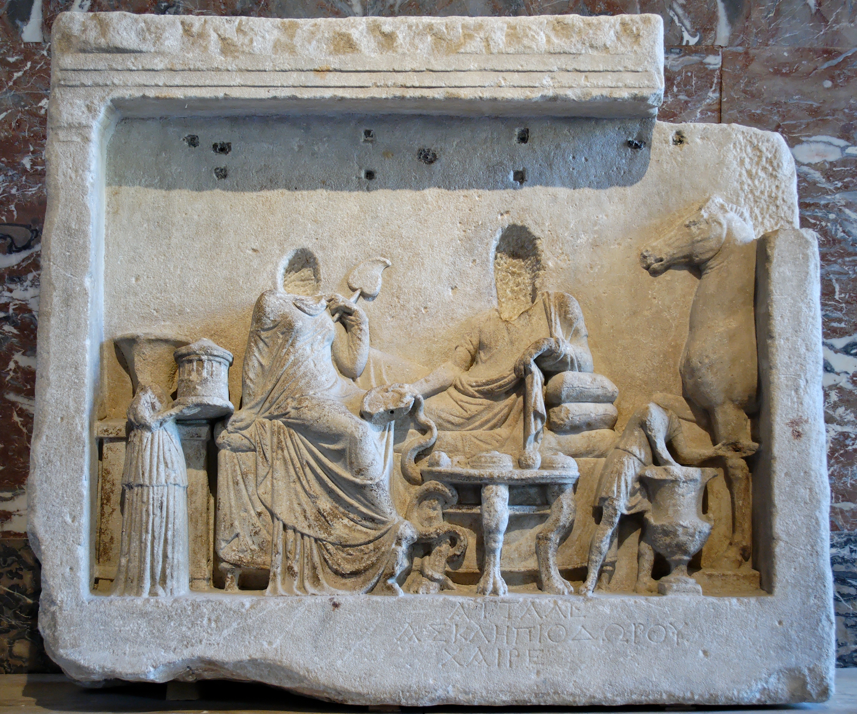
Miletopolis ( grc, Μιλητόπολις) or Miletoupolis (Μιλητούπολις) was a town in the north of ancient Mysia, at the confluence of the rivers Macestus and Rhyndacus, and on the west of the lake which derives its name from the town. It was a Milesian colony. Strabo mentions that a part of the inhabitants of the town were transferred to Gargara at some indeterminant time. It was Christianised at an early date and remains a bishopric of the Greek Orthodox Church and a titular see of the Roman Catholic Church. The current Greek Orthodox Bishop to hold the title of Miletopolis is Bishop Iakovos of Miletopolis who serves as an assistant bishop in the Greek Orthodox Archdiocese of Australia. Its site is located near Karacabey Karacabey is a town and district of Bursa Province in the Marmara Region of Turkey. It is located just west of the Simav River near its confluence with the Adirnaz River. District of Karacabey borders districts of Mudanya and Nilüfer fro ... [...More Info...] [...Related Items...] OR: [Wikipedia] [Google] [Baidu] |
Colonies In Antiquity
Colonies in antiquity were post-Iron Age city-states founded from a mother-city (its "metropolis"), not from a territory-at-large. Bonds between a colony and its metropolis remained often close, and took specific forms during the period of classical antiquity. Generally, colonies founded by the ancient Phoenicians, Carthage, Rome, Alexander the Great and his successors remained tied to their metropolis, but Greek colonies of the Archaic and Classical eras were sovereign and self-governing from their inception. While Greek colonies were often founded to solve social unrest in the mother-city, by expelling a part of the population, Hellenistic, Roman, Carthaginian, and Han Chinese colonies were used for trade, expansion and empire-building. Egyptian colony Egyptian settlement and colonisation is attested from about 3200 BC onward all over the area of southern Canaan with almost every type of artifact: architecture (fortifications, embankments and buildings), pottery, vessels, ... [...More Info...] [...Related Items...] OR: [Wikipedia] [Google] [Baidu] |


