|
Kufra
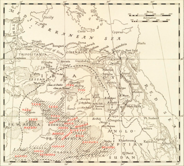
Kufra () is a basinBertarelli (1929), p. 514. and oasis group in the Kufra District of southeastern Cyrenaica in Libya. At the end of the 19th century, Kufra became the centre and holy place of the Senussi order. It also played a minor role in the Western Desert Campaign of World War II. It is located in a particularly isolated area, not only because it is in the middle of the Sahara Desert but also because it is surrounded on three sides by depressions which make it dominate the passage of the east-west land traffic across the desert. For the colonial Italians, it was also important as a station on the north-south air route to Italian East Africa. These factors, along with Kufra's dominance of the southeastern Cyrenaica region of Libya, highlight the strategic importance of the oasis and why it was a point of conflict during World War II. Etymology The folk etymology associates the word "Kufra" as coming from the Arabic ''word kafir'' (كافر), meaning "disbeliever" or " ... [...More Info...] [...Related Items...] OR: [Wikipedia] [Google] [Baidu] [Amazon] |
Capture Of Kufra
The Capture of Kufra (, ) was part of the Allied Western Desert Campaign during the Second World War. Kufra is a group of oases in the Kufra District of south-eastern Cyrenaica in the Libyan Desert. In 1940, it was part of the colony of Italian Libya , which was part of (ASI), which had been established in 1934. With some early assistance from the British Long Range Desert Group, Kufra was besieged from 31 January to 1 March 1941 by Free French forces which forced the surrender of the Italian and Libyan garrison. Background Kufra, in the Libyan Desert subregion of the Sahara, was an important trade and travel centre for the nomadic desert peoples of the region, including Berbers and Senussi. The Senussi made the oasis their capital at one point against British, Italian and French designs on the region. In 1931, Italy captured Kufra and incorporated it into the Italian North Africa () colonisation of the Maghreb. The Italian post at Kufra included the Buma airfield and ra ... [...More Info...] [...Related Items...] OR: [Wikipedia] [Google] [Baidu] [Amazon] |
Kufra District
Kufra, Kufrah or Kofra ( '), also spelled ''Cufra'' in Italian, is the largest district of Libya and the second largest such district in Africa. It is slightly smaller than the country of Turkmenistan. Its capital is Al Jawf, one of the oases in Kufra basin. There is a very large oil refinery near the capital. In the late 15th century, Leo Africanus reported an oasis in the land of the ''Berdoa'', visited by a caravan coming from Awjila. It is possible that this oasis in question was either the Al Jawf or the Taiserbo oasis, and on early modern maps, the Al Kufra region was often labelled as ''Berdoa'' based on this report. History The name ''Kufra'' (comes from Kufuh and Epher) itself is a derivation from ''kafir'', the Arabic term for disbeliever. Kufra did not fall under the dominion of either the Arabs or the Ottomans and was owned by the Arab Bedouin tribe of the Zuwayya only in the mid-19th century, and eventually by the Italians by the 1930s. In 1931, during the campaig ... [...More Info...] [...Related Items...] OR: [Wikipedia] [Google] [Baidu] [Amazon] |
Kufra Airport
Kufra Airport is an airport serving Al Jawf, capital of the Kufra District in southeastern Libya. The airport is just east of the city. History Kufra Airport began as Buma Airfield, built in the 1930s as a minor facility by the Italians. In early World War II, it provided an air link to Italian East Africa (Ethiopia, Eritrea, and Italian Somaliland). It was captured by Free French units under General Leclerc on 1 March 1941 along with Kufra Oasis. Libyan Airlines operated a twice-weekly service from Benghazi with Boeing 727-200 for at least ten years prior to its suspension in 2004. For a couple of years leading up to the revolution Tibesti Airlines (later renamed Air Libya) operated a twice-weekly Benghasi – Kufra – Khartum service with a leased British Aerospace 146 aircraft. Air Libya also operated an intermittent weekly direct flight to Tripoli with a Boeing 727-200. In July 2013, Libyan Airlines re-launched the Benghazi service that was suspended nine years earl ... [...More Info...] [...Related Items...] OR: [Wikipedia] [Google] [Baidu] [Amazon] |
Oasis
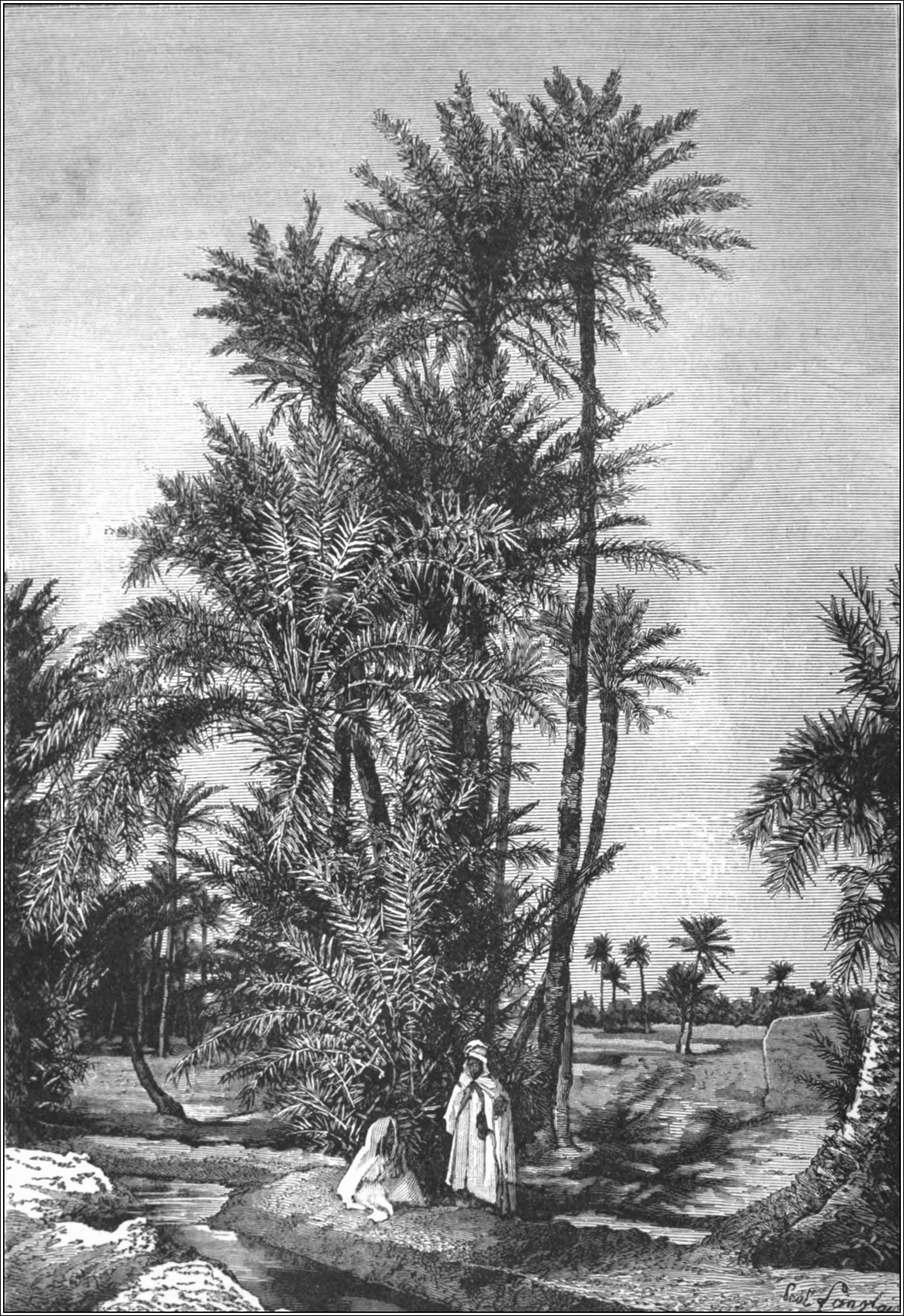
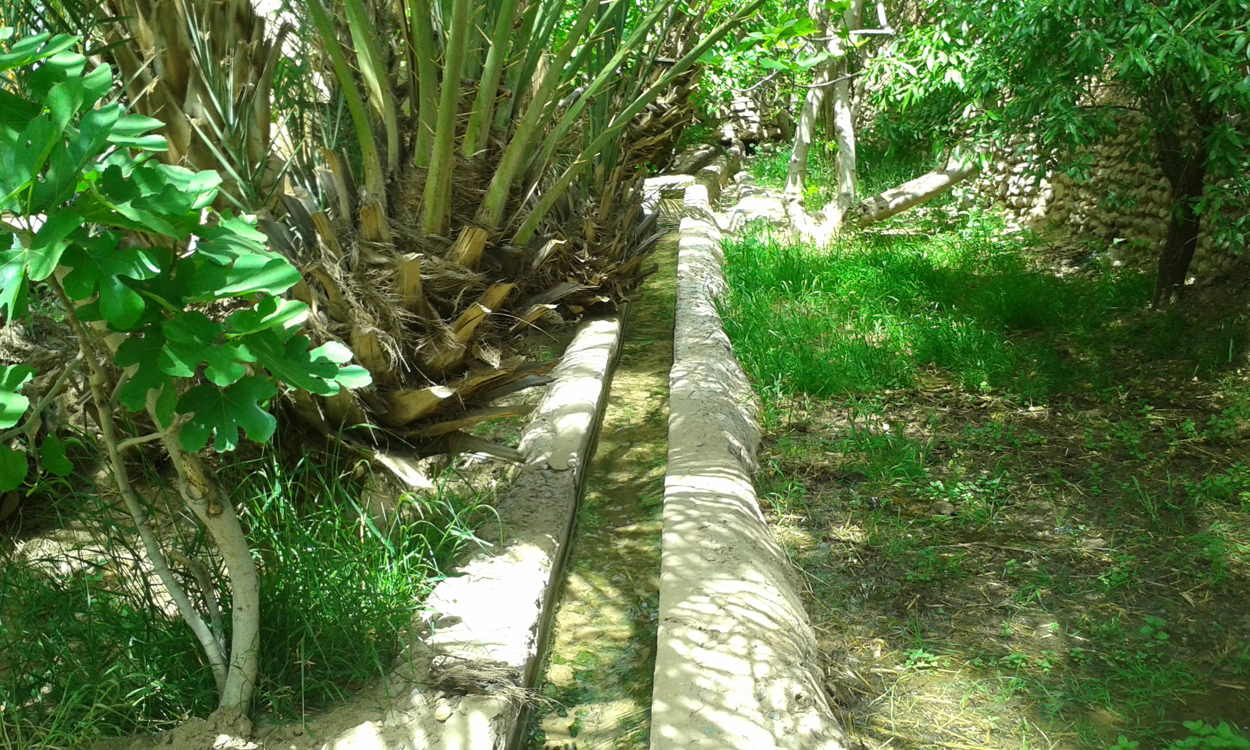
In ecology, an oasis (; : oases ) is a fertile area of a desert or semi-desert environmentBattesti, Vincent (2005) Jardins au désert: Évolution des pratiques et savoirs oasiens: Jérid tunisien. Paris: IRD éditions. . that sustains plant life and provides habitat for animals. Surface water may be present, or water may only be accessible from wells or underground channels created by humans. In geography, an oasis may be a current or past rest stop on a transportation route, or less-than-verdant location that nonetheless provides access to underground water through deep wells created and maintained by humans. Although they depend on a natural condition, such as the presence of water that may be stored in reservoirs and us ... [...More Info...] [...Related Items...] OR: [Wikipedia] [Google] [Baidu] [Amazon] |
El Tag
El Tag (; also ''Al-Tag'', ''Al-Taj'') is a village and holy site in the Kufra Oasis, within the Libyan Desert subregion of the Sahara. It is in the Kufra District in the southern Cyrenaica region of southeastern Libya. The Arabic ''el tag'' translates as "crown" in English, and derives from the site's position above the Kufra basin.Bertarelli (1929), p. 515. El Tag, being on a rise, is without an oasis spring and native date palm habitat. Senussi El-Tag was founded in 1895 by Muhammad El-Mahdi es-Senussi (1844–1902), after the Ottomans forced him and the Senussi Order from Jaghbub in the Cyrenaican desert to Kufra. He was the son of the founder and the supreme leader (1859-1902) of the Order. El-Mahdi founded a Zaouia (''madrassa''—school) with a mosque with a low octagonal minaret tower here. He also built several tombs of the Senussi family here, which later included his own, therefore making El-Tag a Senussi holy place. Italians and World War II During the colonial Ital ... [...More Info...] [...Related Items...] OR: [Wikipedia] [Google] [Baidu] [Amazon] |
Libya
Libya, officially the State of Libya, is a country in the Maghreb region of North Africa. It borders the Mediterranean Sea to the north, Egypt to Egypt–Libya border, the east, Sudan to Libya–Sudan border, the southeast, Chad to Chad–Libya border, the south, Niger to Libya–Niger border, the southwest, Algeria to Algeria–Libya border, the west, and Tunisia to Libya–Tunisia border, the northwest. With an area of almost , it is the 4th-largest country in Africa and the Arab world, and the List of countries and outlying territories by total area, 16th-largest in the world. Libya claims 32,000 square kilometres of southeastern Algeria, south of the Libyan town of Ghat, Libya, Ghat. The largest city and capital is Tripoli, Libya, Tripoli, which is located in northwestern Libya and contains over a million of Libya's seven million people. Libya has been inhabited by Berber people, Berbers since the late Bronze Age as descendants from Iberomaurusian and Capsian cultures. I ... [...More Info...] [...Related Items...] OR: [Wikipedia] [Google] [Baidu] [Amazon] |
Districts Of Libya
In Libya there are currently 106 districts, second level administrative subdivisions known in Arabic as Baladiyat of Libya, ''baladiyat'' (singular ''baladiyah''). The number has varied since 2013 between 99 and 108. The first level administrative divisions in Libya are currently the governorates (''muhafazat''), which have yet to be formally delineated, but which were originally tripartite as: Tripolitania in the northwest, Cyrenaica in the east, and Fezzan in the southwest; and later divided into Governorates of Libya, ten governorates. Prior to 2013 there were twenty-two first level administrative subdivisions known by the term ''shabiyah'' (Arabic language, Arabic singular ''šaʿbiyya'', plural ''šaʿbiyyāt'') which constituted the districts of Libya. In the 1990s the shabiyat had replaced an older baladiyat system. Historically the area of Libya was considered three provinces (or states), Tripolitania in the northwest, Cyrenaica in the east, and Fezzan in the southwe ... [...More Info...] [...Related Items...] OR: [Wikipedia] [Google] [Baidu] [Amazon] |
Al Jawf, Libya
Al Jawf ( ') is a town in southeastern Libya, the capital of the Kufra District, Kufra district in Libya. The city has an elevation of 382.2 m (1,254 feet). In 2022, the city's population was 18,587. Al Jawf receives almost no rain, averaging only per year. Summer high temperatures average above . The city lies in the largest oasis in the Kufra basin,Bertarelli (1929), p. 514. extracting the water from the Nubian Sandstone Aquifer System. It is one of the most heavily irrigated oasis, oases in the Sahara. The surrounding area contains clusters of center-pivot irrigation systems used for agriculture. The distinctive pattern was photographed from orbit by the crew of the International Space Station in 2016. Climate Al Jawf has a hot desert climate (Köppen climate classification ''BWh''). Sources * References {{District capitals of Libya Populated places in Kufra District Cyrenaica ... [...More Info...] [...Related Items...] OR: [Wikipedia] [Google] [Baidu] [Amazon] |
Friedrich Gerhard Rohlfs
Friedrich Gerhard Rohlfs (14 April 1831 – 2 June 1896) was a German geographer, explorer, author and adventurer. Biography Friedrich Gerhard Rohlfs was born at Vegesack, later part of Bremen. His father was a physician, and encouraged Rohlfs to join the field of medicine. After the ordinary course at the gymnasium of Osnabrück, he entered the Bremen corps in 1848, and took part as a volunteer in the Schleswig-Holstein campaign, being made an officer after the battle of Idstedt (July 1850). Rohlfs then became a medical student, and studied at the universities of Heidelberg, Würzburg, and Göttingen. He wanted to travel, and joined the French Foreign Legion in a medical capacity, serving during the conquest of Kabylia. He attained the highest rank open to a foreigner, and was decorated for bravery as Chevalier of the Legion of Honour. Having learned Arabic and the mode of life of the inhabitants, in 1861 he went to Morocco, and was for some time personal physician to a nob ... [...More Info...] [...Related Items...] OR: [Wikipedia] [Google] [Baidu] [Amazon] |
Awjila
Awjila (Arabic: أوجلة; Latin: ''Augila'') is an oasis town in the Al Wahat District in the Cyrenaica region of northeastern Libya. Since classical times, it has been known as a place where high-quality dates are farmed. The oasis was mentioned by the Greek historian Herodotus (c. 484–425 BCE), who referred to it as ''Augila''. Historically, Awjila was one of the ancient homelands of the Toubou (Goran), an Indigenous people, and was abandoned following a Berber invasion that occurred long before Herodotus’s time. The name Augila originates from the Toubou term ''Wajulo'', meaning "lowland," and continues to preserve the oasis’s Indigenous linguistic heritage. Since the Arab conquest in the 7th century, Islam has played an important role in the community. The oasis is located on the east-west caravan route between Egypt and Tripoli, Libya, and the north-south route between Benghazi and the Sahel between Lake Chad and Darfur. In the past, it was an important trading ce ... [...More Info...] [...Related Items...] OR: [Wikipedia] [Google] [Baidu] [Amazon] |
Toubou
The Toubou or Tubu (from Old Tebu, meaning "rock people") are an ethnic group native to the Tibesti Mountains that inhabit the central Sahara in northern Chad, southern Libya, northeastern Niger, and northwestern Sudan. They live either as herders and nomads or as farmers near oases. Their society is clan-based, with each clan having certain oases, pastures and wells. The Toubou are generally divided into two closely related groups: the Teda (or Tuda, Téda, Toda, Tira) and the Daza (or Dazzaga, Dazagara, Dazagada). They are believed to share a common origin and speak the Tebu languages, which are from the Saharan branch of the Nilo-Saharan language family. Tebu is divided further into two closely related languages, called '' Tedaga'' (Téda Toubou) and ''Dazaga'' (Daza Toubou). Of the two groups, the Daza, found to the south of the Teda, are more numerous. The Toubou people are also referred to as the Tabu, Tebu, Tebou, Tibu, 'Tibbu, Toda, Todga, Todaga, Tubu, Tuda, Tudaga ... [...More Info...] [...Related Items...] OR: [Wikipedia] [Google] [Baidu] [Amazon] |
Vehicle Registration Plates Of Libya
Libya requires its residents to register their motor vehicles and display vehicle registration plates. Current plates are Vehicle registration plates of Europe#Format, European standard 520 mm × 110 mm. Current Series Libya's current series of license plates entered circulation in 2013, after First Libyan Civil War, Libyan Revolution and the overthrow of Gaddafi. Numbers on license plates are in Latin Alphabet, and all plates carry the Arabic text ليبيا meaning ''Libya'', in Naskh (script), Naskh Script, either on the right hand side or the right top corner. Private Vehicles Private vehicle license plates are black on white and follow the format [# - 1 to 999999]. The First number (#), a 1 or 2 digit number consists of a code corresponding to Baladiyat of Libya, Municipality in Libya. This number is separated by a dash from the registration code, which can be 1 to 6 digits. In the city of Tripoli, Libya, Tripoli, due to its larger population, 7-digit registratio ... [...More Info...] [...Related Items...] OR: [Wikipedia] [Google] [Baidu] [Amazon] |


