|
Komakuk Beach, Yukon
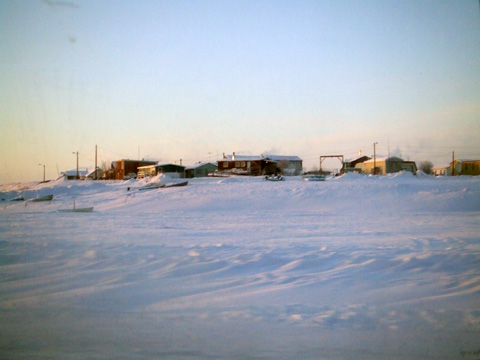
Komakuk Beach was the site of a DEW Line station, located on the Arctic coast of Yukon, Canada. The station was closed in 1993 pursuant to the general policy of dismantling such stations that was adopted following the collapse of the Soviet Union, which effectively ended the Cold War and obviated the need to maintain these installations. Komakuk Beach had been the scene of considerable environmental damage, which took seven years to clean up; following this, the site was incorporated into Ivvavik National Park in 2000. The immediate area surrounding the former station is completely uninhabited, as the northernmost settlement within Yukon is at Old Crow, approximately to the south. Situated in a narrow coastal plain at the base of the Richardson Mountains and having a tundra climate, Komakuk Beach is located at 69°35' North latitude and 140°11' West longitude. The indigenous Inuvialuit population of Komakuk Beach, together with that of Herschel Island (Qiqiktaruk), were relo ... [...More Info...] [...Related Items...] OR: [Wikipedia] [Google] [Baidu] |
Distant Early Warning Line
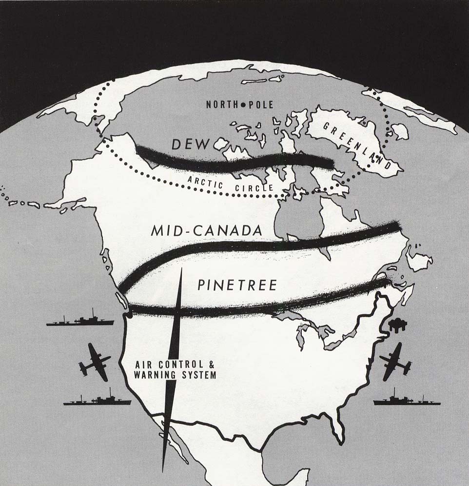
The Distant Early Warning Line, also known as the DEW Line or Early Warning Line, was a system of radar stations in the northern Arctic region of Canada, with additional stations along the north coast and Aleutian Islands of Alaska (see Project Stretchout and Project Bluegrass), in addition to the Faroe Islands, Greenland, and Iceland. It was set up to detect incoming bombers of the Soviet Union during the Cold War, and provide early warning of any sea-and-land invasion. The DEW Line was the northernmost and most capable of three radar lines in Canada and Alaska. The first of these was the joint Canadian-United States Pinetree Line, which ran from Newfoundland to Vancouver Island just north of the Canada–United States border, but even while it was being built there were concerns that it would not provide enough warning time to launch an effective counterattack. The Mid-Canada Line (MCL) was proposed as an inexpensive solution using bistatic radar. This provided a "t ... [...More Info...] [...Related Items...] OR: [Wikipedia] [Google] [Baidu] |
Inuvialuit
The Inuvialuit (sing. Inuvialuk; ''the real people'') or Western Canadian Inuit are Inuit who live in the western Canadian Arctic region. They, like all other Inuit, are descendants of the Thule who migrated eastward from Alaska. Their homeland – the Inuvialuit Settlement Region – covers the Arctic Ocean coastline area from the Alaskan border, east through the Beaufort Sea and beyond the Amundsen Gulf which includes some of the western Canadian Arctic Islands, as well as the inland community of Aklavik and part of Yukon. The land was demarked in 1984 by the Inuvialuit Final Agreement. History and migration The Inuvialuit Settlement Region was primarily inhabited by ''Siglit'' Inuit until their numbers were decimated by the introduction of new diseases in the second half of the 19th century. Nunatamiut, Alaskan Inuit, moved into traditional Siglit areas in the 1910s and 20s, enticed in part by renewed demand for furs from the Hudson's Bay Company and European markets. T ... [...More Info...] [...Related Items...] OR: [Wikipedia] [Google] [Baidu] |
Environment Canada
Environment and Climate Change Canada (ECCC; french: Environnement et Changement climatique Canada),Environment and Climate Change Canada is the applied title under the Federal Identity Program; the legal title is Department of the Environment (). is the department of the Government of Canada responsible for coordinating environmental policies and programs, as well as preserving and enhancing the natural environment and renewable resources. It is also colloquially known by its former name, Environment Canada (EC; french: Environnement Canada, links=no). The minister of environment and climate change has been Steven Guilbeault since October 26, 2021; Environment and Climate Change Canada supports the minister's mandate to: "preserve and enhance the quality of the natural environment, including water, air, soil, flora and fauna; conserve Canada's renewable resources; conserve and protect Canada's water resources; forecast daily weather conditions and warnings, and provide detaile ... [...More Info...] [...Related Items...] OR: [Wikipedia] [Google] [Baidu] |
Inuvik, Northwest Territories
Inuvik (''place of man'') is the only town in the Inuvik Region, and the third largest community in Canada's Northwest Territories. Located in what is sometimes called the Beaufort Delta Region, it serves as its administrative and service centre and is home to federal, territorial, and Indigenous government offices, along with the regional hospital and airport. Inuvik is located on the northern edge of the boreal forest, just before it begins to transition to tundra, and along the east side of the enormous Mackenzie River delta. The town lies on the border between the Gwich'in Settlement Region and the Inuvialuit Settlement Region. History Inuvik was conceived in 1953 as a replacement administrative centre for the hamlet of Aklavik on the west of the Mackenzie Delta, as the latter was prone to flooding and had no room for expansion. Initially called "New Aklavik", it was renamed Inuvik in 1958. The school was built in 1959 and the hospital, government offices and staff ... [...More Info...] [...Related Items...] OR: [Wikipedia] [Google] [Baidu] |
Aklavik, Northwest Territories
Aklavik (Inuvialuktun: ''Akłarvik'') (from the Inuvialuktun meaning '' barrenground grizzly place'') is a hamlet located in the Inuvik Region of the Northwest Territories, Canada. Until 1961, with a population over 1,500, the community served as the regional administrative centre for the territorial government. Because of repeated flooding in this area, the government developed Inuvik to the east. It was meant to entirely replace Aklavik, but many of the residents of the original community persevered and kept Aklavik going. Its 2018 population was 623. The hamlet's mayor is Andrew Charlie. History Aklavik began to develop in the early 1900s after the Hudson's Bay Company opened a trading post in 1912. The Roman Catholic Church later established a mission here in 1926. Located on the Peel Channel, the community became a transportation hub in the Mackenzie. It was in a good trapping area. Aklavik became part of the Northwest Territories and Yukon Radio System (NWT ... [...More Info...] [...Related Items...] OR: [Wikipedia] [Google] [Baidu] |
Northwest Territories, Canada
The Northwest Territories (abbreviated ''NT'' or ''NWT''; french: Territoires du Nord-Ouest, formerly ''North-Western Territory'' and ''North-West Territories'' and namely shortened as ''Northwest Territory'') is a federal territory of Canada. At a land area of approximately and a 2016 census population of 41,790, it is the second-largest and the most populous of the three territories in Northern Canada. Its estimated population as of 2022 is 45,605. Yellowknife is the capital, most populous community, and only city in the territory; its population was 19,569 as of the 2016 census. It became the territorial capital in 1967, following recommendations by the Carrothers Commission. The Northwest Territories, a portion of the old North-Western Territory, entered the Canadian Confederation on July 15, 1870. Since then, the territory has been divided four times to create new provinces and territories or enlarge existing ones. Its current borders date from April 1, 1999, when the ... [...More Info...] [...Related Items...] OR: [Wikipedia] [Google] [Baidu] |
Herschel Island
Herschel Island (french: Île d'Herschel; Inuit languages: ''Qikiqtaruk'') is an island in the Beaufort Sea (part of the Arctic Ocean), which lies off the coast of Yukon in Canada, of which it is administratively a part. It is Yukon's only offshore island. History Early history The earliest evidence of human occupation unearthed so far by archaeological investigations is that of the Thule culture, dating to approximately 1000 years ago. These people are the ancestors of the present-day Inuvialuit. The Inuvialuktun word for Herschel Island is "Qikiqtaruk", which simply means "island". The first European to sight the island was explorer Sir John Franklin, who named it on 15 July 1826.Burn, C. R. (2009) "After whom is Herschel Island named"? Arctic 62(3):317–323. It is not clear after whom the island was named. Franklin's journal records states that he wished to honour the name Herschel, of which three persons are notable for their scientific accomplishments: Sir William H ... [...More Info...] [...Related Items...] OR: [Wikipedia] [Google] [Baidu] |
Climate
Climate is the long-term weather pattern in an area, typically averaged over 30 years. More rigorously, it is the mean and variability of meteorological variables over a time spanning from months to millions of years. Some of the meteorological variables that are commonly measured are temperature, humidity, atmospheric pressure, wind, and precipitation. In a broader sense, climate is the state of the components of the climate system, including the atmosphere, hydrosphere, cryosphere, lithosphere and biosphere and the interactions between them. The climate of a location is affected by its latitude/ longitude, terrain, altitude, land use and nearby water bodies and their currents. Climates can be classified according to the average and typical variables, most commonly temperature and precipitation. The most widely used classification scheme was the Köppen climate classification. The Thornthwaite system, in use since 1948, incorporates evapotranspiration along ... [...More Info...] [...Related Items...] OR: [Wikipedia] [Google] [Baidu] |
Arctic Ocean
The Arctic Ocean is the smallest and shallowest of the world's five major oceans. It spans an area of approximately and is known as the coldest of all the oceans. The International Hydrographic Organization (IHO) recognizes it as an ocean, although some oceanographers call it the Arctic Mediterranean Sea. It has been described approximately as an estuary of the Atlantic Ocean. It is also seen as the northernmost part of the all-encompassing World Ocean. The Arctic Ocean includes the North Pole region in the middle of the Northern Hemisphere and extends south to about 60°N. The Arctic Ocean is surrounded by Eurasia and North America, and the borders follow topographic features: the Bering Strait on the Pacific side and the Greenland Scotland Ridge on the Atlantic side. It is mostly covered by sea ice throughout the year and almost completely in winter. The Arctic Ocean's surface temperature and salinity vary seasonally as the ice cover melts and freezes; its salinit ... [...More Info...] [...Related Items...] OR: [Wikipedia] [Google] [Baidu] |
Tundra
In physical geography, tundra () is a type of biome where tree growth is hindered by frigid temperatures and short growing seasons. The term ''tundra'' comes through Russian (') from the Kildin Sámi word (') meaning "uplands", "treeless mountain tract". There are three regions and associated types of tundra: Arctic tundra, alpine tundra, and Antarctic tundra. Tundra vegetation is composed of dwarf shrubs, sedges, grasses, mosses, and lichens. Scattered trees grow in some tundra regions. The ecotone (or ecological boundary region) between the tundra and the forest is known as the tree line or timberline. The tundra soil is rich in nitrogen and phosphorus. The soil also contains large amounts of biomass and decomposed biomass that has been stored as methane and carbon dioxide in the permafrost, making the tundra soil a carbon sink. As global warming heats the ecosystem and causes soil thawing, the permafrost carbon cycle accelerates and releases much of these soil-conta ... [...More Info...] [...Related Items...] OR: [Wikipedia] [Google] [Baidu] |
Brooks Range
The Brooks Range ( Gwich'in: ''Gwazhał'') is a mountain range in far northern North America stretching some from west to east across northern Alaska into Canada's Yukon Territory. Reaching a peak elevation of on Mount Isto, the range is believed to be approximately 126 million years old. In the United States, these mountains are considered a subrange of the Rocky Mountains, whereas in Canada they are considered separate, as the northern border of the Rocky Mountains is considered to be the Liard River far to the south in the province of British Columbia. While the range is mostly uninhabited, the Dalton Highway and Trans-Alaska Pipeline System run through the Atigun Pass (1,415 m, 4,643 ft) on their way to the oil fields at Prudhoe Bay on Alaska's North Slope. The Alaska Native villages of Anaktuvuk and Arctic Village, as well as the very small communities of Coldfoot, Wiseman, Bettles, and Chandalar, are the range's only settlements. In the far west, near th ... [...More Info...] [...Related Items...] OR: [Wikipedia] [Google] [Baidu] |


