|
Koganei, Tokyo
is a Cities of Japan, city located in the Western Tokyo, western portion of the Tokyo Metropolis, Japan. , the city had an estimated population of 123,698 in 61,832 households. The total area of the city is so the population density is about 11,000 persons per km². Geography Koganei is approximately at the center of Tokyo metropolis, and is located about 20 kilometers west of Shinjuku, where Tokyo Metropolitan Government has its headquarters. It is flanked on the north and the south by two large parks. To the north is Koganei Park, which includes the Edo-Tokyo Open Air Architectural Museum, a branch of the Edo-Tokyo Museum located in Ryōgoku, Tokyo. To the south are Nogawa Park and Tama Cemetery. The city has an elevation of between 40 and 70 meters above sea level. Surrounding municipalities *Chōfu, Tokyo, Chōfu *Mitaka, Tokyo, Mitaka *Musashino, Tokyo, Musashino *Fuchū, Tokyo, Fuchū *Kokubunji, Tokyo, Kokubunji *Kodaira, Tokyo, Kodaira *Nishitokyo, Tokyo, Nishitokyo Cli ... [...More Info...] [...Related Items...] OR: [Wikipedia] [Google] [Baidu] |
Cities Of Japan
A is a local Public administration, administrative unit in Japan. Cities are ranked on the same level as and , with the difference that they are not a component of . Like other contemporary administrative units, they are defined by the Local Autonomy Law of 1947. City status Article 8 of the Local Autonomy Law sets the following conditions for a municipality to be designated as a city: *Population must generally be 50,000 or greater (原則として人口5万人以上) *At least 60% of households must be established in a central urban area (中心市街地の戸数が全戸数の6割以上) *At least 60% of households must be employed in commerce, industry or other urban occupations (商工業等の都市的業態に従事する世帯人口が全人口の6割以上) *Any other conditions set by prefectural ordinance must be satisfied (他に当該都道府県の条例で定める要件を満たしていること) The designation is approved by the prefectural governor and t ... [...More Info...] [...Related Items...] OR: [Wikipedia] [Google] [Baidu] |
Tokyo Metropolitan Government
The is the government of the Tokyo, Tokyo Metropolis. One of the 47 Prefectures of Japan, prefectures of Japan, the government consists of a popularly elected governor and assembly. The Tokyo Metropolitan Government Building, headquarters building is located in the ward of Shinjuku, Tokyo, Shinjuku. The metropolitan government administers the Special wards of Tokyo, special wards, cities, towns and villages that constitute part of the Tokyo Metropolis. With a population closing in on 14 million living within its boundaries, and many more commuting from neighbouring prefectures, the metropolitan government wields significant political power within Japan. Structure of Tokyo Metropolis Under Law of Japan, Japanese law, Tokyo is designated as a ''to'' (wiktionary:都, 都), translated as ''metropolis''. Within Tokyo Metropolis lie dozens of smaller entities, including Special wards of Tokyo, twenty-three special wards (特別wiktionary:区, 区 -ku) which until 1943 made up Tokyo ... [...More Info...] [...Related Items...] OR: [Wikipedia] [Google] [Baidu] |
Musashi Province
was a Provinces of Japan, province of Japan, which today comprises Tokyo, Tokyo Metropolis, most of Saitama Prefecture and part of Kanagawa Prefecture. It was sometimes called . The province encompassed Kawasaki, Kanagawa, Kawasaki and Yokohama. Musashi bordered on Kai Province, Kai, Kōzuke Province, Kōzuke, Sagami Province, Sagami, Shimōsa Province, Shimōsa, and Shimotsuke Provinces. Musashi was the largest province in the Kantō region. History Musashi had its ancient capital in modern Fuchū, Tokyo, and its provincial temple in what is now Kokubunji, Tokyo. By the Sengoku period, the main city was Edo, which became the dominant city of eastern Japan. Edo Castle was the headquarters of Tokugawa Ieyasu before the Battle of Sekigahara and became the dominant city of Japan during the Edo period, being renamed Tokyo Prefecture, Tokyo during the Meiji Restoration. Hikawa Shrine (Saitama), ''Hikawa-jinja'' was designated as the chief Shinto shrine (''ichinomiya'') of the provinc ... [...More Info...] [...Related Items...] OR: [Wikipedia] [Google] [Baidu] |
Humid Subtropical Climate
A humid subtropical climate is a subtropical -temperate climate type, characterized by long and hot summers, and cool to mild winters. These climates normally lie on the southeast side of all continents (except Antarctica), generally between latitudes 25° and 40° and are located poleward from adjacent tropical climates, and equatorward from either humid continental (in North America and Asia) or oceanic climates (in other continents). It is also known as warm temperate climate in some climate classifications. Under the Köppen climate classification, ''Cfa'' and ''Cwa'' climates are either described as humid subtropical climates or warm temperate climates. This climate features mean temperature in the coldest month between (or ) and and mean temperature in the warmest month or higher. However, while some climatologists have opted to describe this climate type as a "humid subtropical climate", Köppen himself never used this term. The humid subtropical climate classific ... [...More Info...] [...Related Items...] OR: [Wikipedia] [Google] [Baidu] |
Nishitokyo, Tokyo
() is a city located in the western portion of Tokyo Metropolis, Japan. , the city had an estimated population of 206,047, and a population density of 13,000 persons per km2. The total area of the city is . Geography Nishitokyo is located at the centre of the geological/geographical region known as the Musashino Terrace, and is covered with the Kantō loam formation. The city has a good water supply, owing to rivers running through the city - the Shakujii River, Shirako River, Shin River (tributary of Shirako River) and Tamagawa Josui River. From east to west, the city is about 4.8 km, and from south to north is about 5.6 km. Neighborhoods *former city of Hoya ::Fuji-machi, Hibarigaoka, Higashi-cho, Higashi-fushimi, Hoya-cho, Izumi-cho, Kita-machi, Naka-machi, Sakae-cho, Shimo-hoya, Shin-machi, Sumiyoshi-cho, Yagisawa *former city of Tanashi ::Kitahara-cho, Midori-cho, Minami-cho, Mukodai-cho, Nishihara-cho, Shibakubo-cho, Tanashi-cho, Yato-cho Surrounding mu ... [...More Info...] [...Related Items...] OR: [Wikipedia] [Google] [Baidu] |
Kodaira, Tokyo
is a Cities of Japan, city located in the western Tokyo, western portion of the Tokyo Metropolis, Japan. , the city had an estimated population of 195,207 in 93,654 households, and a population density of 9500 persons per km2. The total area of the city was . Geography Kodaira is located in the Musashino Terrace near the geographic centre of Tokyo Metropolis. Surrounding municipalities Tokyo Metropolis *Higashiyamato, Tokyo, Higashiiyamato *Higashimurayama, Tokyo, Higashimurayama *Higashikurume, Tokyo, Higashikurume *Koganei, Tokyo, Koganei *Kokubunji, Tokyo, Kokubunji *Nishitokyo, Tokyo, Nishitokyo *Tachikawa, Tokyo, Tachikawa Climate Kodaira has a humid subtropical climate (Köppen ''Cfa'') characterized by warm summers and cool winters with light to no snowfall. The average annual temperature in Kodaira is 14.0 °C. The average annual rainfall is 1647 mm with September as the wettest month. The temperatures are highest on average in August, at around 25.5 °C ... [...More Info...] [...Related Items...] OR: [Wikipedia] [Google] [Baidu] |
Kokubunji, Tokyo
250px, Ruins of Musashi Kokubun-ji temple is a city located in the western portion of the Tokyo Metropolis, Japan. , the city had an estimated population of 126,791, and a population density of 11,000 persons per km2. The total area of the city was . Geography Kokubunji is located on the Musashino Terrace of western Tokyo, approximately in the geographic centre of mainland Tokyo Metropolis. The city extends for about 5.68 kilometers east-to-west by about 3.86 kilometers north-to-south. Surrounding municipalities Tokyo Metropolis * Fuchū * Kodaira * Koganei * Kunitachi *Tachikawa Climate Kokubunji has a humid subtropical climate (Köppen ''Cfa'') characterized by warm summers and cool winters with light to no snowfall. The average annual temperature in Kokubunji is 14.0 °C. The average annual rainfall is 1647 mm, with September as the wettest month. The temperatures are highest on average in August (at around 25.5 °C) and lowest in January (at around 2.6&nbs ... [...More Info...] [...Related Items...] OR: [Wikipedia] [Google] [Baidu] |
Fuchū, Tokyo
file:FuchuCityHall2023091.jpg, 260px, Fuchū City Hall is a Cities of Japan, city located in the western Tokyo, western portion of the Tokyo Metropolis, Japan. Fuchū serves as a regional commercial center and a commuter town for workers in central Tokyo. The city hosts large scale manufacturing facilities for Toshiba, NEC and Suntory, as well as the Bank of Japan's main computer operations center. Local sporting attractions include the Tokyo Racecourse and the training grounds of Japan Rugby League One, Top League Rugby union, rugby teams Toshiba Brave Lupus Tokyo, Toshiba Brave Lupus and Tokyo Sungoliath, Suntory Sungoliath. , the city had an estimated population of 260,508, and a population density of 8,900 persons per square kilometer. The total area of the city is . Geography Fuchū is located about 20 km west of the centre of Tokyo. Using the Keiō Line from Shinjuku Station, Shinjuku, it is 25 minutes to Fuchū Station (Tokyo), Fuchū Station (main station). It spr ... [...More Info...] [...Related Items...] OR: [Wikipedia] [Google] [Baidu] |
Musashino, Tokyo
is a city located in the western portion of the Tokyo Metropolis, Japan. , the city had an estimated population of 147,754 in 78,614 households, and a population density of 13,000 persons per km2. The total area of the city is . Based on the 2019 survey by SUUMO, the Kichijoji neighborhood of Musashino was the third most desirable place to live in central Japan. Popular attractions in Musashino include Kichijōji; a residential and shopping neighborhood with malls such as Atre Kichijoji, recreational areas such as Inokashira Park, Musashino Chuo Park, Musashino Municipal Athletic Stadium and Musashino Sports Complex. Geography Musashino is located in the Musashino Terrace of central Tokyo Metropolis. It is bordered by the 23 Special Wards of Tokyo. Musashino is composed of the following neighborhoods: Kichijoji Kitamachi, Kichijoji Higashi Cho, Kichijoji Honcho, Kichijoji Minamicho, Kyonan Cho, Gotenyama, Sakai, Sakurazuki, Sekimae, Nakacho, Nishikubo, Midoricho, and Yaha ... [...More Info...] [...Related Items...] OR: [Wikipedia] [Google] [Baidu] |
Mitaka, Tokyo
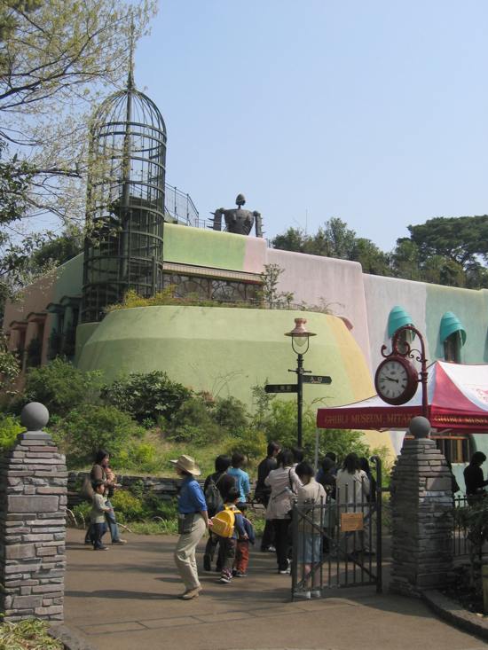
file:井之頭恩賜公園 (16016034730).jpg, 260px, Inokashira Park in Mitaka is a Cities of Japan, city in the Western Tokyo region of Tokyo Metropolis, Japan. , the city had an estimated population of 190,403, and a population density of 12,000 persons per km2. The total area of the city was . Geography Mitaka is located on the Kantō region, Kantō Plain, just outside the 23 special wards of Tokyo Metropolis, which are on its eastern borders. The Tamagawa Aqueduct canal, which runs alongside Mitaka station, has an important place in history, built in 1653 to feed the local metropolitan area, metropolis. It is also the place where novelist Osamu Dazai died by suicide in 1948. The National Astronomical Observatory of Japan is located in Mitaka. Surrounding municipalities Tokyo Metropolis *Chōfu, Tokyo, Chōfu *Koganei, Tokyo, Koganei *Musashino, Tokyo, Musashino *Setagaya, Tokyo, Setagaya *Suginami, Tokyo, Suginami Climate Mitaka has a humid subtropical climate (Köppen ''Cfa ... [...More Info...] [...Related Items...] OR: [Wikipedia] [Google] [Baidu] |
Tama Cemetery
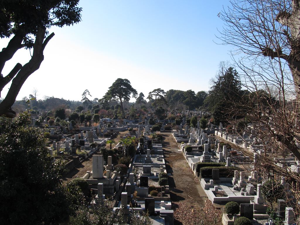
in Tokyo is the largest municipal cemetery in Japan. It is split between the cities of Fuchū, Tokyo, Fuchu and Koganei, Tokyo, Koganei within the Tokyo Metropolis. First established in April 1923 as , it was redesignated Tama Cemetery in 1935. It is one of the largest green areas in Tokyo. History Around 1900, Tokyo had five public cemeteries - Aoyama Cemetery, Aoyama, , Yanaka Cemetery, Yanaka, Zoshigaya Cemetery, Zoshigaya and Kameido. As the population of Tokyo grew, and cemetery space grew scarce, there was a need to build a cemetery outside of the city limits of Tokyo. In 1919, city park manager Kiyoshi Inoshita issued a plan to establish a large park/cemetery to the north, east and west of Tokyo. Tama, Tokyo, Tama, to the west of Tokyo, was selected in 1920, with construction started two years later. It was said that the site was chosen because of access to transportation infrastructure, such as the Kōshū Kaidō, Keiō Line, Seibu Tamagawa Line, and Chūō Main Line. T ... [...More Info...] [...Related Items...] OR: [Wikipedia] [Google] [Baidu] |


