|
Killaloe, County Clare (Civil Parish)
Killaloe (; ) is a civil parish in County Clare, Ireland. The main settlement is the town of Killaloe. Location The parish is in the barony of Tulla. It is from Ennis and from Dublin. The name is said to be a corrupt form of ''Kill-da-Lua'', and to be derived from the foundation of an abbey by St. Lua or Molua in the 6th century. The town is on the west bank of the Shannon near the falls of Killaloe, about a mile from Lough Derg. In 1837 an old bridge with 19 arches crossed the river at this point. The parish in 1837 covered 13,045 statute acres, most of which were farmed. History The town became head of a diocese founded about 639 by Pope John IV. The first bishop was Saint Flannan. Turlogh O’Brien built a bridge over the River Shannon at Killaloe in 1054. Hugh O’Connor destroyed the castle of Killaloe in 1061 and burned the town. It was burned again in 1080 and 1084. Moriertach, King of Ireland was buried in Killaloe in 1120 in a great ceremony. In 1177 the town was th ... [...More Info...] [...Related Items...] OR: [Wikipedia] [Google] [Baidu] |
County Clare
County Clare () is a Counties of Ireland, county in the Provinces of Ireland, province of Munster in the Southern Region, Ireland, Southern part of Republic of Ireland, Ireland, bordered on the west by the Atlantic Ocean. Clare County Council is the Local government in the Republic of Ireland, local authority. The county had a population of 127,938 at the 2022 census of Ireland, 2022 census. The county seat and largest settlement is Ennis. Etymology There are two main hypotheses for the origins of the county name "Clare". One is that the name is derived from Thomas de Clare, Lord of Thomond, Thomas de Clare an Anglo-Norman peer and soldier from the de Clare family, who was deeply embroiled in local politics and fighting in the 1270s and 1280 and had had acquired land in Kilkenny and Thomond that included the Castle of Clare. In 1590 County Clare was named after the castle, which is in a strategic location. An alternative hypothesis is that the county name ''Clare'' comes from ... [...More Info...] [...Related Items...] OR: [Wikipedia] [Google] [Baidu] |
Civil Parishes In Ireland
Civil parishes () are units of territory in the island of Ireland that have their origins in old Gaelic territorial divisions. They were adopted by the Anglo-Norman Lordship of Ireland and then by the Elizabethan Kingdom of Ireland, and were formalised as land divisions at the time of the Plantations of Ireland. They no longer correspond to the boundaries of Roman Catholic or Church of Ireland parishes, which are generally larger. Their use as administrative units was gradually replaced by Poor_law_union#Ireland, Poor Law Divisions in the 19th century, although they were not formally abolished. Today they are still sometimes used for legal purposes, such as to locate property in deeds of property registered between 1833 and 1946. Origins The Irish parish was based on the Gaelic territorial unit called a ''túath'' or ''Trícha cét''. Following the Norman invasion of Ireland, the Anglo-Normans, Anglo-Norman barons retained the ''tuath'', later renamed a parish or manor, as a un ... [...More Info...] [...Related Items...] OR: [Wikipedia] [Google] [Baidu] |
Killaloe, County Clare
Killaloe ( ; ) is a small town in east County Clare, Republic of Ireland, Ireland. It lies on the River Shannon on the western bank of Lough Derg (Shannon), Lough Derg and is connected by Killaloe Bridge to the "twin town" of Ballina, County Tipperary, Ballina on the eastern bank of the lake. The Killaloe Electoral Area is one of six such areas in County Clare and returns four members to Clare County Council. Killaloe is at the center of the Killaloe, County Clare (Civil parish), Killaloe Civil parish. History The town owes its origin to a sixth-century monastic settlement founded by Saint Molua, or Lua, on an island in the Shannon 1 km downstream from the present Killaloe Bridge which later moved onto the mainland. In the tenth century it was a base for Brian Boru as it controlled the strategic crossing of the Shannon above Limerick, where the Viking#Ireland, Vikings were in control. Brian Boru had his palace, Kincora (Ceann Coradh), on the high ground where the curre ... [...More Info...] [...Related Items...] OR: [Wikipedia] [Google] [Baidu] |
Ennis
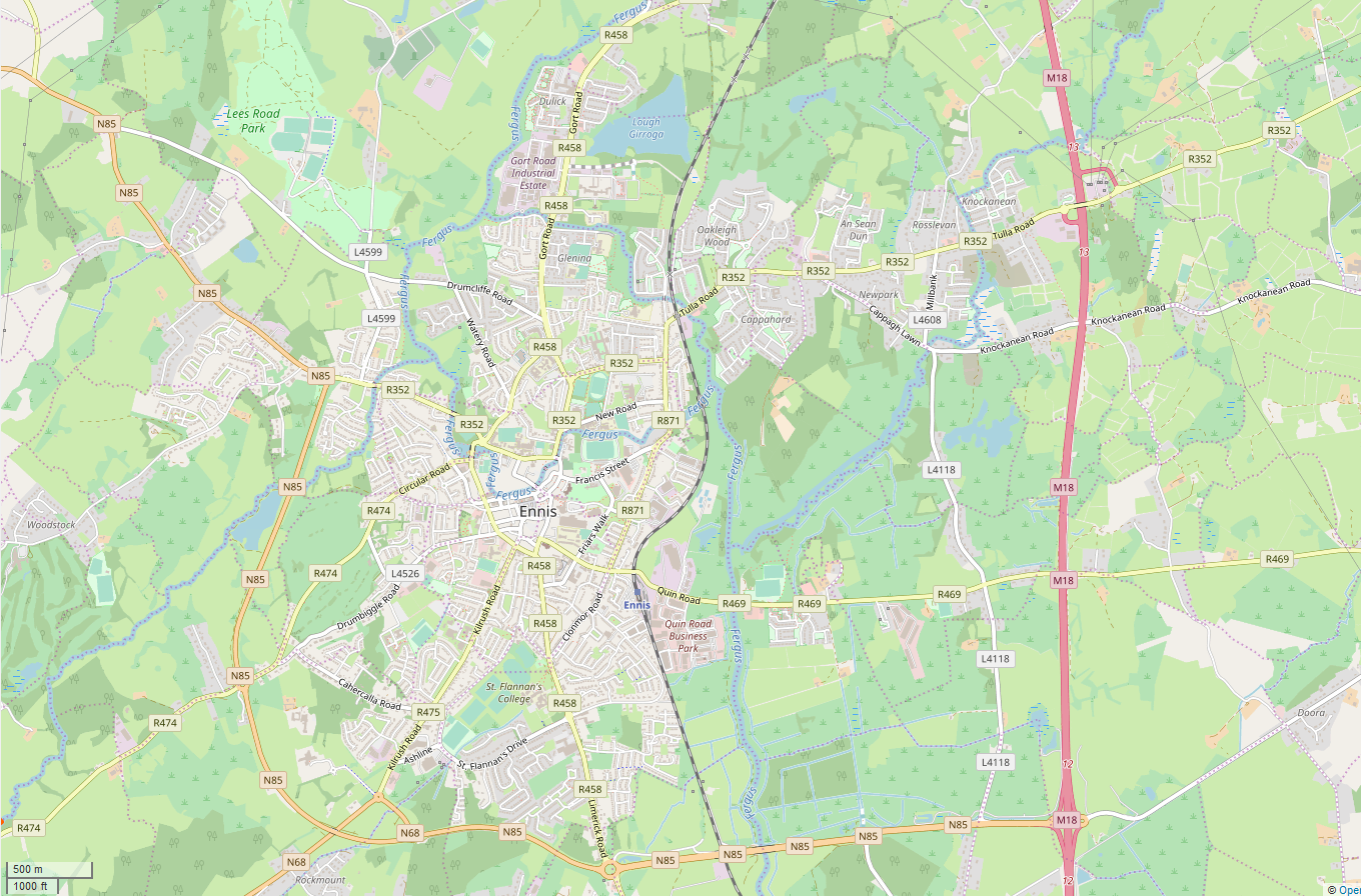
Ennis ( , meaning 'island' or 'river meadow') is the county town of County Clare, in the mid-west of Ireland. The town lies on the River Fergus, north of where the river widens and enters the Shannon Estuary. Ennis is the largest town in County Clare, with a population of 27,923, making it the 6th largest town, and 11th largest urban settlement, as of the 2022 census. Dating from the 12th century the town's Irish name is short for , deriving from its location between two courses of the River Fergus. Ennis has had considerable success in the Irish Tidy Towns competition. In 2005 and 2021, the town was named Ireland's tidiest town, and was named Ireland's tidiest large urban centre on multiple occasions. The town straddles two baronies. Most of the town, including its historic centre, is in the Barony of Islands. However, the eastern and north-eastern edges of the town are in the Barony of Bunratty Upper. History The name Ennis derives from the Irish word "Inis", mea ... [...More Info...] [...Related Items...] OR: [Wikipedia] [Google] [Baidu] |
River Shannon
The River Shannon ( or archaic ') is the major river on the island of Ireland, and at in length, is the longest river in the British Isles. It drains the Shannon River Basin, which has an area of , – approximately one fifth of the area of Ireland. Known as an important waterway since antiquity, the Shannon first appeared in maps by the Graeco-Egyptian geographer Ptolemy ( 100 – 170 AD). The river flows generally southwards from the Shannon Pot in County Cavan before turning west and emptying into the Atlantic Ocean through the long Shannon Estuary. Limerick city stands at the point where the river water meets the sea water of the estuary. The Shannon is tidal east of Limerick as far as the base of the Ardnacrusha dam. The Shannon divides the west of Ireland (principally the province of Connacht) from the east and south (Leinster and most of Munster; County Clare, being west of the Shannon but part of the province of Munster, is the major exception.) The river rep ... [...More Info...] [...Related Items...] OR: [Wikipedia] [Google] [Baidu] |
Townland
A townland (; Ulster-Scots: ''toonlann'') is a traditional small land division used in Ireland and in the Western Isles of Scotland, typically covering . The townland system is of medieval Gaelic origin, predating the Norman invasion, and most have Irish-derived names. However, some townland names and boundaries come from Norman manors, plantation divisions, or later creations of the Ordnance Survey.Connolly, S. J., ''The Oxford Companion to Irish History, page 577. Oxford University Press, 2002. ''Maxwell, Ian, ''How to Trace Your Irish Ancestors'', page 16. howtobooks, 2009. Townlands cover the whole island of Ireland, and the total number of inhabited townlands in Ireland was 60,679 in 1911. The total number recognised by the Placenames Database of Ireland as of 2014 was 61,098, including uninhabited townlands. Etymology The term "townland" in English is derived from the Old English word ''tūn'', denoting an enclosure. The term describes the smallest unit of land di ... [...More Info...] [...Related Items...] OR: [Wikipedia] [Google] [Baidu] |


