|
Kilcunda, Victoria
Kilcunda is a seaside town located south east of Melbourne between Phillip Island and Wonthaggi near Dalyston via the South Gippsland Highway on the Bass Highway, in the Bass Coast Shire of Gippsland, Victoria, Australia. Known originally as a train station near Wonthaggi, it is now the location of a very popular swimming hole at the Bourne Creek Trestle Bridge and at the 2016 census, Kilcunda had a population of 578. The name "Kilcunda" is believed to be from the Aboriginal term for 'an exclamation', and is reported by one authority to mean, 'Oh dear, the sticks!' Today Trestle Bridge The 91 m long Kilcunda Bridge was built over the Bourne Creek. It is protected by the National Trust. This trestle bridge was constructed for the Victorian Railways to carry coal from what was then known as the Powlett Coal Fields. It is a particularly significant monument because most of the steam-locomotive fuel that serviced the Victorian Railways network, from 1911 until 1978, crossed ... [...More Info...] [...Related Items...] OR: [Wikipedia] [Google] [Baidu] |
Electoral District Of Bass
The electoral district of Bass is one of the electoral districts of Victoria, Australia, for the Victorian Legislative Assembly. It covers an area of south east of Melbourne, stretching from the satellite suburb of Clyde, Victoria, Clyde through rural areas to the coast at Inverloch, Victoria, Inverloch and Phillip Island. It includes the suburbs and towns of Bass, Victoria, Bass, Cape Paterson, Victoria, Cape Paterson, Clyde, Corinella, Victoria, Corinella, Cowes, Victoria, Cowes, Grantville, Victoria, Grantville, Inverloch, Kilcunda, Victoria, Kilcunda, Koo Wee Rup, Victoria, Koo Wee Rup, Lang Lang, Victoria, Lang Lang, Pearcedale, Victoria, Pearcedale, Rhyll, Victoria, Rhyll, San Remo, Victoria, San Remo, Tooradin, Victoria, Tooradin, Ventnor, Victoria, Ventnor and Wonthaggi, Victoria, Wonthaggi. It lies within the Eastern Victoria Region of the upper house, the Victorian Legislative Council, Legislative Council. Bass was created in a redistribution for the 2002 Victorian s ... [...More Info...] [...Related Items...] OR: [Wikipedia] [Google] [Baidu] |
2016 Australian Census
The 2016 Australian census was the 17th Census in Australia, national population census held in Australia. The census was officially conducted with effect on Tuesday, 9 August 2016. The total population of the Commonwealth of Australia was counted as – an increase of 8.8 per cent or people over the . Norfolk Island joined the census for the first time in 2016, adding 1,748 to the population. The ABS annual report revealed that $24 million in additional expenses accrued due to the outage on the census website. Results from the 2016 census were available to the public on 11 April 2017, from the Australian Bureau of Statistics website, two months earlier than for any previous census. The second release of data occurred on 27 June 2017 and a third data release was from 17 October 2017. Australia's next census took place in 2021 Australian census, 2021. Scope The Australian Bureau of Statistics (ABS) states the aim of the 2016 Australian census is "to count every person who ... [...More Info...] [...Related Items...] OR: [Wikipedia] [Google] [Baidu] |
Farmland
Agricultural land is typically land ''devoted to'' agriculture, the systematic and controlled use of other forms of lifeparticularly the rearing of livestock and production of cropsto produce food for humans. It is generally synonymous with both farmland or cropland, as well as pasture or rangeland. The United Nations Food and Agriculture Organization (FAO) and others following its definitions, however, also use ''agricultural land'' or as a term of art, where it means the collection of: * '' arable land'' (also known as ''cropland''): here redefined to refer to land producing crops requiring annual replanting or fallowland or pasture used for such crops within any five-year period * '' permanent cropland'': land producing crops which do not require annual replanting * ''permanent pastures'': natural or artificial grasslands and shrublands able to be used for grazing livestock This sense of "agricultural land" thus includes a great deal of land not devoted to agricultural use ... [...More Info...] [...Related Items...] OR: [Wikipedia] [Google] [Baidu] |
Anderson, Victoria
Anderson is a locality in Victoria, Australia Australia, officially the Commonwealth of Australia, is a country comprising mainland Australia, the mainland of the Australia (continent), Australian continent, the island of Tasmania and list of islands of Australia, numerous smaller isl .... The roundabout, which the locality is centralised around has been named the ''Anderson Roundabout'', which is all the town is thought of today. The town (and a nearby inlet) is named after the Anderson brothers, one of the first Europeans to settle in the area. History The town was once a large farming and transport town as freight was moved up and down the railway line. There was formerly[...More Info...] [...Related Items...] OR: [Wikipedia] [Google] [Baidu] |
Bass Coast Rail Trail
The Bass Coast Rail Trail is a rail trail located in the Bass Coast Shire of Gippsland, Victoria, Australia. The trail has been constructed along a section of the former Wonthaggi line. The trail starts at the former Anderson station and finishes shortly after the former Wonthaggi Station. The trail is long and travels from Anderson heading towards the coast downhill to Kilcunda, heading along coastal sand dunes into the open farmland surrounding Wonthaggi. The original railway line opened in 1910, being used for the transport of coal from Kilcunda and Wonthaggi, and local agricultural produce, as well as for public transport. The line was closed in 1978. Route description From Anderson to Kilcunda the trail drops in height as it winds down through farming country. The rail trail at Kilcunda is built on the coastal sand dunes and incorporates a landmark trestle bridge over Bourne Creek. Path users have panoramic scenic views of the Bass Strait coast and the Wonthag ... [...More Info...] [...Related Items...] OR: [Wikipedia] [Google] [Baidu] |
Wonthaggi Railway Line
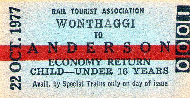
The Wonthaggi railway line is a closed railway line located in South Gippsland, Victoria (Australia), Victoria, Australia. Its primary purpose was to serve the State Coal Mine, Victoria, State Coal Mine but the line also provided passenger and general goods services. The line was opened in 1910 and closed in 1978. Background In the late nineteenth and early twentieth centuries, the Victorian Railways depended on black coal to fire its steam locomotives. Although black coal deposits around Korumburra, Victoria, Korumburra in South Gippsland had been exploited since 1891, the seams were narrow, the costs of production were relatively high and, in 1900, their production accounted for just a quarter of Victoria's consumption. It was cheaper for VR to purchase coal from Newcastle, New South Wales, but a protracted miners' dispute in 1909 threatened the NSW supplies and led to an even stronger commitment by the John Murray (Victorian politician), Murray Government of Victoria (A ... [...More Info...] [...Related Items...] OR: [Wikipedia] [Google] [Baidu] |
Trotting
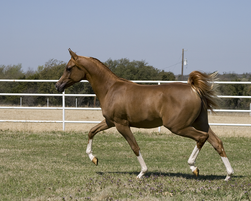
The trot is a two-beat diagonal horse gait where the diagonal pairs of legs move forward at the same time with a moment of suspension between each beat. It has a wide variation in possible speeds, but averages about . A very slow trot is sometimes referred to as a jog. An extremely fast trot has no special name, but in harness racing, the trot of a Standardbred is faster than the gallop of the average non-horse racing, racehorse, and has been clocked at over . On June 29, 2014, at Pocono Downs in Pennsylvania the Swedish standardbred Sebastian K trotted a mile in 1 minute, 49 seconds (quarters were passed at 26:2, 55:3 and 1,21:4). This is equivalent to a 1000-pace in 1.07,7 or 53.14 kilometers per hour or 33 miles per hour. From the standpoint of the balance of the horse, the trot is a very stable gait and does not require the horse to make major balancing motions with its head and neck.Harris, Susan E. ''Horse Gaits, Balance and Movement'' New York: Howell Book House 1993 ... [...More Info...] [...Related Items...] OR: [Wikipedia] [Google] [Baidu] |
Cycling
Cycling, also known as bicycling or biking, is the activity of riding a bicycle or other types of pedal-driven human-powered vehicles such as balance bikes, unicycles, tricycles, and quadricycles. Cycling is practised around the world for purposes including transport, recreation, exercise, and competitive sport. History Cycling became popularized in Europe and North America in the latter part and especially the last decade of the 19th century. Today, over 50 percent of the human population knows how to ride a bike. War The bicycle has been used as a method of reconnaissance as well as transporting soldiers and supplies to combat zones. In this it has taken over many of the functions of horses in warfare. In the Second Boer War, both sides used bicycles for scouting. In World War I, France, Germany, Australia and New Zealand used bicycles to move troops. In its 1937 invasion of China, Japan employed some 50,000 bicycle troops, and similar forces were instrumental in ... [...More Info...] [...Related Items...] OR: [Wikipedia] [Google] [Baidu] |
Bass Strait
Bass Strait () is a strait separating the island state of Tasmania from the Mainland Australia, Australian mainland (more specifically the coast of Victoria (Australia), Victoria, with the exception of the land border across Boundary Islet). The strait provides the most direct waterway between the Great Australian Bight and the Tasman Sea, and is also the only maritime route into the economically prominent Port Phillip Bay. Formed 8,000 years ago by rising sea levels at the end of the last glacial period, the strait was named after English explorer and physician George Bass (1771–1803) by History of Australia (1788–1850), European colonists. Extent The International Hydrographic Organization defines the limits of Bass Strait as follows: :''On the west.'' The eastern limit of the Great Australian Bight [being a line from Cape Otway, Australia, to King Island (Tasmania), King Island and thence to Cape Grim, the northwest extreme of Tasmania]. :''On the east.'' The western li ... [...More Info...] [...Related Items...] OR: [Wikipedia] [Google] [Baidu] |
Victorian Railways
The Victorian Railways (VR), trading from 1974 as VicRail, was the state-owned operator of most rail transport in the Australian state of Victoria from 1859 to 1983. The first railways in Victoria were private companies, but when these companies failed or defaulted, the Victorian Railways was established to take over their operations. Most of the lines operated by the Victorian Railways were of . However, the railways also operated up to five Narrow gauge lines of the Victorian Railways, narrow gauge lines between 1898 and 1962, and a line between Albury railway station, Albury and Melbourne from 1961. History Formation A Department of Railways (1858–71), Department of Railways was created in 1856 with the first appointment of staff. British engineer, George Christian Darbyshire was made first Engineer-in-Chief in 1857, and steered all railway construction work until his replacement by Thomas Higinbotham in 1860. In late 1876, New York consulting engineer Walton Evans arran ... [...More Info...] [...Related Items...] OR: [Wikipedia] [Google] [Baidu] |
Trestle Bridge
A trestle bridge is a bridge composed of a number of short spans supported by closely spaced frames usually carrying a railroad line. A trestle (sometimes tressel) is a rigid frame used as a support, historically a tripod used to support a stool or a pair of isosceles triangles joined at their apices by a plank or beam such as the support structure for a trestle table. Each supporting frame is a bent. A trestle differs from a viaduct in that viaducts have towers that support much longer spans and typically have a higher elevation. Timber and iron trestles (i.e. bridges) were extensively used in the 19th century, the former making up from 1 to 3 percent of the total length of the average railroad. In the 21st century, steel and sometimes concrete trestles are commonly used to bridge particularly deep valleys, while timber trestles remain common in certain areas. Many timber trestles were built in the 19th and early 20th centuries with the expectation that they would be te ... [...More Info...] [...Related Items...] OR: [Wikipedia] [Google] [Baidu] |
National Trust
The National Trust () is a heritage and nature conservation charity and membership organisation in England, Wales and Northern Ireland. The Trust was founded in 1895 by Octavia Hill, Sir Robert Hunter and Hardwicke Rawnsley to "promote the permanent preservation for the benefit of the Nation of lands and tenements (including buildings) of beauty or historic interest". It has since been given statutory powers, starting with the National Trust Act 1907. Historically, the Trust acquired land by gift and sometimes by public subscription and appeal, but after World War II the loss of country houses resulted in many such properties being acquired either by gift from the former owners or through the National Land Fund. One of the largest landowners in the United Kingdom, the Trust owns almost of land and of coast. Its properties include more than 500 historic houses, castles, archaeological and industrial monuments, gardens, parks, and nature reserves. Most properties are open ... [...More Info...] [...Related Items...] OR: [Wikipedia] [Google] [Baidu] |


