|
Kidsty Pike
Kidsty Pike is a fell in the English Lake District, standing to the west of Haweswater Reservoir. It is a subsidiary top of Rampsgill Head, but has long achieved the status of a separate fell, thanks to its classic peaked profile. Wainwright followed this convention in his ''Pictorial Guide to the Lakeland Fells''. Topography Two valleys run up westwards from Haweswater, above what was the village of Mardale Green before the raising of the lake. Riggindale is the southern arm and runs straight with a classic U-shaped profile. Randale starts north-westerly, rising quickly before turning due west above approximately . Between these valleys is Kidsty Pike, the east ridge of Rampsgill Head. The northern flank falls at a shallow gradient over grass to the high gathering grounds of Randale. In contrast, the southern side of the ridge drops over crag and scree to Riggindale, below. The difference in slopes gives Kidsty Pike its appeal when viewed from Haweswater, or (for example) on ... [...More Info...] [...Related Items...] OR: [Wikipedia] [Google] [Baidu] |
Rampsgill Head
Rampsgill Head is a fell in the English Lake District, standing to the west of Haweswater Reservoir in the Far Eastern Fells. It forms the focal point of three ridges which fan out north-east, north-west and south. Topography The spine of the Far Eastern Fells, travelling north from High Street, crosses the Straits of Riggindale and then collides head-on with the steep U-shaped valley of Rampsgill which comes south to meet it. The ridge splits in two, sending one arm around each side of Rampsgill and the Martindale valley system of which this forms part. The north-western branch leads over the fells of The Knott and Rest Dodd, finally reaching Place Fell above the head of Ullswater. The north-eastern branch continues the main ridge of the Far Eastern Fells, running over High Raise and ending near the foot of Ullswater at Heughescar Hill. Between these two embracing arms are the valleys of Boredale, Bannerdale, Rampsgill and Fusedale, collectively known as Martindale. Rampsgil ... [...More Info...] [...Related Items...] OR: [Wikipedia] [Google] [Baidu] |
Alfred Wainwright
Alfred Wainwright Order of the British Empire, MBE (17 January 1907 – 20 January 1991), who preferred to be known as A. Wainwright or A.W., was a British fellwalking, fellwalker, guidebook author and illustrator. His seven-volume ''Pictorial Guide to the Lakeland Fells'', published between 1955 and 1966 and consisting entirely of reproductions of his manuscript, has become the standard reference work to 214 of the fells of the English Lake District. Among his 40-odd other books is the first guide to the Coast to Coast Walk, a long-distance footpath devised by Wainwright which remains popular today. Life Alfred Wainwright was born in Blackburn, Lancashire, into a family which was relatively poor, mostly because of his stonemason father's alcoholism. He did very well at school (first in nearly every subject) although he left at the age of 13. While most of his classmates were obliged to find employment in the local mills, Wainwright started work as an office boy in Blackburn ... [...More Info...] [...Related Items...] OR: [Wikipedia] [Google] [Baidu] |
Fells Of The Lake District
A fell (from Old Norse ''fell'', ''fjall'', "mountain"Falk and Torp (2006:161).) is a high and barren landscape feature, such as a mountain or moor-covered hill. The term is most often employed in Fennoscandia, Iceland, the Isle of Man, parts of northern England, and Scotland. Etymology The English word "fell" comes from Old Norse ''fell'' and ''fjall'' (both forms existed). It is cognate with Danish ''fjeld'', Faroese ''fjall'' and ''fjøll'', Icelandic ''fjall'' and ''fell'', Norwegian ''fjell'' with dialects ''fjøll'', ''fjødd'', ''fjedd'', ''fjedl'', ''fjill'', ''fil(l)'', and ''fel'', and Swedish ''fjäll'', all referring to mountains rising above the alpine tree line.Bjorvand and Lindeman (2007:270–271). British Isles In northern England, especially in the Lake District and in the Pennine Dales, the word "fell" originally referred to an area of uncultivated high ground used as common grazing usually on common land and above the timberline. Today, gen ... [...More Info...] [...Related Items...] OR: [Wikipedia] [Google] [Baidu] |
High Street (Lake District)
High Street is a fell in the English Lake District. At , its summit is the highest point in the far eastern part of the national park. The fell is named after the Roman road that ran over the summit. History Roman road A Roman road, a scheduled monument, crosses the fell between Roman forts at Brougham ('' Brocavum'') near Penrith and Ambleside ('' Galava'').B Conduit, ''Lake District Walks'' (Norwich 1991) p. 65 Although the route takes the road higher than any other Roman road in England, the High Street range has quite gentle slopes and a flat summit plateau, characteristics that may have persuaded Roman surveyors to build the road over the fell tops rather than through the valleys which were densely forested and marshy making them susceptible to ambush. There has been speculation that the Romans made use of a prehistoric trackway. The nature of the Roman road remains problematic, as much of it is sunken in a hollow, rather than being built on top of an embankment or ... [...More Info...] [...Related Items...] OR: [Wikipedia] [Google] [Baidu] |
Cairn
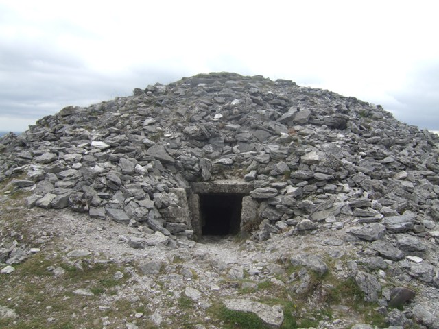
A cairn is a human-made pile (or stack) of stones raised for a purpose, usually as a marker or as a burial mound. The word ''cairn'' comes from the (plural ). Cairns have been and are used for a broad variety of purposes. In prehistory, they were raised as markers, as memorials and as burial monuments (some of which Chambered cairn, contained chambers). In the modern era, cairns are often raised as landmarks, especially to mark the summits of mountains, and as Trail blazing, trail markers. They vary in size from small piles of stones to entire artificial hills, and in complexity from loose conical rock piles to elaborate megalithic structures. Cairns may be painted or otherwise decorated, whether for increased visibility or for religious reasons. History Europe The building of cairns for various purposes goes back into prehistory in Eurasia, ranging in size from small rock sculptures to substantial human-made hills of stone (some built on top of larger, natural hills). ... [...More Info...] [...Related Items...] OR: [Wikipedia] [Google] [Baidu] |
Shap
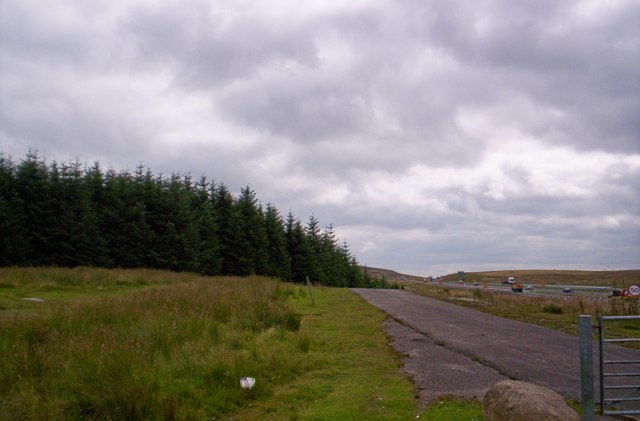
Shap is a village and civil parish located among fells and isolated dales in Westmorland and Furness, Cumbria, England. The village is in the historic county of Westmorland. The parish had a population of 1,221 in 2001, increasing slightly to 1,264 at the 2011 Census. Location The village lies along the A6 road and the West Coast Main Line, and is near to the M6 motorway. It is situated from Penrith and about from Kendal. Shap is on the route of the Coast to Coast Walk. Etymology Early (12th and 13th century) forms such as ''Hep'' and ''Yheppe'' point to an Old Norse rendering ''Hjáp'' of an Old English original ''Hēap'' = "heap" (of stones), probably referring to an ancient stone circle, cairn or to the Shap Stone Avenue just to the west of the village. History Although Shap is geographically a small village, it is legally a market town with a charter dating from the 17th century. The parish was, between 1905 and 1935, administered by an urban district council. At ... [...More Info...] [...Related Items...] OR: [Wikipedia] [Google] [Baidu] |
M6 Motorway
The M6 motorway is the longest motorway in the United Kingdom. It is located entirely within England, running for just over from the Midlands to the border with Scotland. It begins at Junction 19 of the M1 motorway, M1 and the western end of the A14 road (England), A14 at the Catthorpe Interchange, near Rugby, Warwickshire, Rugby before heading north-west. It passes Coventry, Birmingham, Wolverhampton, Stoke-on-Trent, Preston, Lancashire, Preston, Lancaster, Lancashire, Lancaster and Carlisle, Cumbria, Carlisle and runs between Manchester and Liverpool before terminating at Junction 45 near Gretna, Scotland, Gretna. Here, just short of the Scottish border it becomes the A74(M) and M74 motorways, A74(M) which continues to Glasgow as the M74. Its busiest sections are between junctions 4 and 10a in the West Midlands, and junctions 16 to 19 in Cheshire; these sections have now been converted to Active traffic management, smart motorways. It incorporated the Preston By-pass, the fi ... [...More Info...] [...Related Items...] OR: [Wikipedia] [Google] [Baidu] |
A Pictorial Guide To The Lakeland Fells
''A Pictorial Guide to the Lakeland Fells'' is a series of seven books by A. Wainwright, detailing the fells (the local word for hills and mountains) of the Lake District in northwest England. Written over a period of 13 years from 1952, they consist entirely of reproductions of Wainwright's manuscript, hand-produced in pen and ink with no typeset material. The series has been in print almost continuously since it was first published between 1955 and 1966, with more than 2 million copies sold. It is still regarded by many walkers as the definitive guide to the Lakeland mountains. The 214 fells described in the seven volumes have become known as the Wainwrights. the LDWA register of those who have climbed all the fells listed 674 names. The Wainwright Society maintains a "register of current Society members who have climbed all 214 fells". First editions The first five books were originally published by Wainwright's friend, Henry Marshall, Chief Librarian of Kendal and We ... [...More Info...] [...Related Items...] OR: [Wikipedia] [Google] [Baidu] |
Haweswater Reservoir
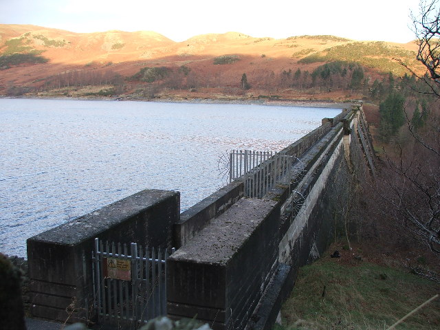
Haweswater is a reservoir in the valley of Mardale, Cumbria in the Lake District, England. Work to raise the height of the original natural lake was started in 1929. It was controversially dammed after the UK Parliament passed a local act of Parliament, the Manchester Corporation Act 1919 ( 9 & 10 Geo. 5. c. cxix), giving Manchester Corporation permission to build the reservoir to supply drinking water to the city. The decision caused a public outcry because the farming villages of Measand and Mardale Green would be flooded and the valley altered forever. The reservoir is now owned by United Utilities. It supplies about 25% of the North West's water supply. Etymology Haweswater is derived from Old Norse or Old English. 'Hafr's lake' refers to the personal Norse name 'Hafr' or in Old English 'Hæfer'; 'water' or 'wæter' is the dominant term for 'lake' in old English. Geology Haweswater is the location of a caldera volcano succession. History Haweswater was originally ... [...More Info...] [...Related Items...] OR: [Wikipedia] [Google] [Baidu] |
List Of Wainwrights
Wainwrights are the 214 English peaks (known locally as ''fells'') described in Alfred Wainwright's seven-volume ''Pictorial Guide to the Lakeland Fells'' (1955–66). They all lie within the boundary of the Lake District National Park in Cumbria, and all but one (Castle Crag) are over in height. Over two million copies of the ''Pictorial Guides'' have been sold since their publication. In 1974, Wainwright published a supplementary volume ''The Outlying Fells of Lakeland'' (1974), which includes another 116 summits (described in 56 walks); these are the Wainwright Outlying Fells. Summiting all of the Wainwrights is a popular form of peak bagging in the Lake District, along with the List of Birketts in the Lake District, Birketts. Because both lists are based on historical books, unlike, for example, the Lists of mountains and hills in the British Isles#Munros, Munros, their constituents remain fixed, regardless of revisions to height or other metrics. There are 214 Wainwrights ... [...More Info...] [...Related Items...] OR: [Wikipedia] [Google] [Baidu] |
Fell
A fell (from Old Norse ''fell'', ''fjall'', "mountain"Falk and Torp (2006:161).) is a high and barren landscape feature, such as a mountain or Moorland, moor-covered hill. The term is most often employed in Fennoscandia, Iceland, the Isle of Man, parts of northern England, and Scotland. Etymology The English word "fell" comes from Old Norse ''fell'' and ''fjall'' (both forms existed). It is cognate with Danish language, Danish ''fjeld'', Faroese language, Faroese ''fjall'' and ''fjøll'', Icelandic language, Icelandic ''fjall'' and ''fell'', Norwegian language, Norwegian ''fjell'' with Norwegian dialects, dialects ''fjøll'', ''fjødd'', ''fjedd'', ''fjedl'', ''fjill'', ''fil(l)'', and ''fel'', and Swedish language, Swedish ''fjäll'', all referring to mountains rising above the Tree line, alpine tree line.Bjorvand and Lindeman (2007:270–271). British Isles In northern England, especially in the Lake District and in the Pennines, Pennine Dale (origin), Dales, the wor ... [...More Info...] [...Related Items...] OR: [Wikipedia] [Google] [Baidu] |


