|
Keizer, OR
Keizer () is a city located in Marion County, Oregon, United States, along the 45th parallel. As of the 2020 United States census, its population was 39,376, making it the 14th most populous city in Oregon. It lies in the Willamette Valley, and is part of the Salem Metropolitan Statistical Area. It was named after pioneer Thomas Dove (T. D.) Keizur and his family, who arrived in the Wagon Train of 1843, and later filed donation land claims. History The original settlement was at Keizer Bottom, near the banks of the Willamette River. The community was named after Thomas Dove Keizur, one of its first settlers. Somewhere in the translation of donation land claim records, his name was misspelled. The settlement suffered in the flood of 1861, and the inhabitants rebuilt their homes on higher ground. Further floods in 1943, 1945, 1946 and 1948 hampered the growth of the community, and it was not until dams were built in the 1950s to regulate the flow of the Willamette that Keizer ... [...More Info...] [...Related Items...] OR: [Wikipedia] [Google] [Baidu] |
City
A city is a human settlement of a substantial size. The term "city" has different meanings around the world and in some places the settlement can be very small. Even where the term is limited to larger settlements, there is no universally agreed definition of the lower boundary for their size. In a narrower sense, a city can be defined as a permanent and Urban density, densely populated place with administratively defined boundaries whose members work primarily on non-agricultural tasks. Cities generally have extensive systems for housing, transportation, sanitation, Public utilities, utilities, land use, Manufacturing, production of goods, and communication. Their density facilitates interaction between people, government organisations, government organizations, and businesses, sometimes benefiting different parties in the process, such as improving the efficiency of goods and service distribution. Historically, city dwellers have been a small proportion of humanity overall, bu ... [...More Info...] [...Related Items...] OR: [Wikipedia] [Google] [Baidu] |
Wagon Train Of 1843
The Oregon Trail was a east–west, large-wheeled wagon route and emigrant trail in North America that connected the Missouri River to valleys in Oregon Territory. The eastern part of the Oregon Trail crossed what is now the states of Kansas, Nebraska, and Wyoming. The western half crossed the current states of Idaho and Oregon. The Oregon Trail was laid by fur traders and trappers from about 1811 to 1840 and was initially only passable on foot or horseback. By 1836, when the first migrant wagon train was organized in Independence, Missouri, a wagon trail had been cleared to Fort Hall, Idaho. Wagon trails were cleared increasingly farther west and eventually reached the Willamette Valley in Oregon, at which point what came to be called the Oregon Trail was complete, though further improvements in the forms of bridges, cutoffs, ferries, and roads would make the trip faster and safer. From various starting points in Iowa, Missouri, or Nebraska Territory, the routes converged a ... [...More Info...] [...Related Items...] OR: [Wikipedia] [Google] [Baidu] |
Keizer Station In Oregon 3
{{disambig ...
Keizer may refer to: * Keizer (surname) * Keizer (artist), a street artist in Cairo, Egypt * Keizer, Oregon * The Dutch word for an emperor or caesar *Salem-Keizer Volcanoes, minor league baseball team from Keizer, Oregon See also * Keyser (other) * Kaiser Kaiser ( ; ) is the title historically used by German and Austrian emperors. In German, the title in principle applies to rulers anywhere in the world above the rank of king (). In English, the word ''kaiser'' is mainly applied to the emperors ... [...More Info...] [...Related Items...] OR: [Wikipedia] [Google] [Baidu] |
United States Census Bureau
The United States Census Bureau, officially the Bureau of the Census, is a principal agency of the Federal statistical system, U.S. federal statistical system, responsible for producing data about the American people and American economy, economy. The U.S. Census Bureau is part of the United States Department of Commerce, U.S. Department of Commerce and its Director of the United States Census Bureau, director is appointed by the president of the United States. Currently, Ron S. Jarmin is the acting director of the U.S. Census Bureau. The Census Bureau's primary mission is conducting the United States census, U.S. census every ten years, which allocates the seats of the United States House of Representatives, U.S. House of Representatives to the U.S. state, states based on their population. The bureau's various censuses and surveys help allocate over $675 billion in federal funds every year and it assists states, local communities, and businesses in making informed decisions. T ... [...More Info...] [...Related Items...] OR: [Wikipedia] [Google] [Baidu] |
Nature Trail
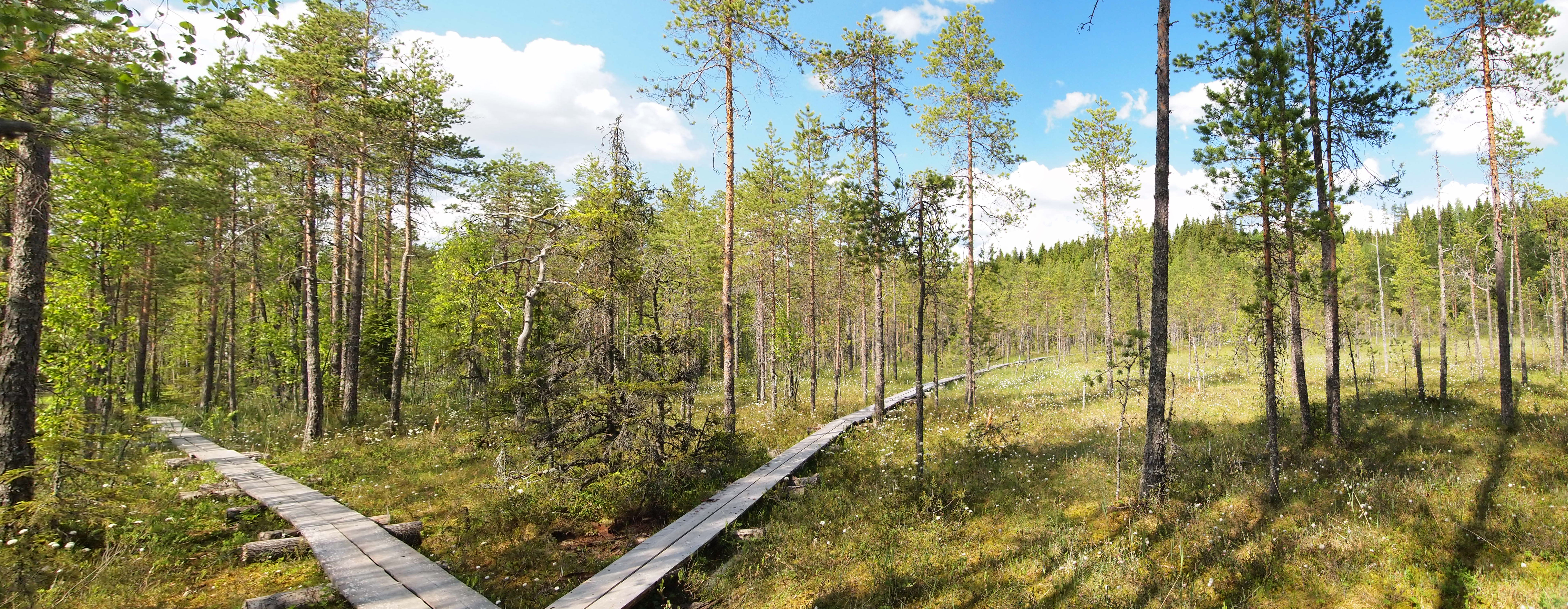
An educational trail (or sometimes educational path), nature trail or nature walk is a specially developed hiking trail or footpath that runs through the countryside, along which there are marked stations or stops next to points of natural science, natural, technological or cultural interest. These may convey information about, for example, flora and fauna, soil science, geology, mining, ecology or cultural history. Longer trails, that link more widely spaced natural phenomena or structures together, may be referred to as themed trails or paths. In order to give a clearer explanation of the objects located at each station, display boards or other exhibits are usually erected, in keeping with the purpose of the trail. These may include: information boards, photographs and pictures, maps or plans, display cases and models, slides, sound or multimedia devices, facilities to enable experimentation and so on. The routes are regularly maintained. Educational trails with a strong thema ... [...More Info...] [...Related Items...] OR: [Wikipedia] [Google] [Baidu] |
Dog Park
A dog park is a park for dogs to exercise and play off-leash in a controlled environment under the supervision of their owners. Description Dog parks have varying features, although they typically offer a fence, separate double-gated entry and exit points, adequate drainage, benches for humans, shade for hot days, parking close to the site, water, pooper-scooper to pick up and dispose of Feces, animal waste in covered trash cans, and regular Maintenance, repair and operations, maintenance and cleaning of the grounds. However, it is a norm to pick up after one's own dog. Dog parks may also offer wheel-chair access, a pond for swimming and a separate enclosure for small dogs. Some dog parks have separate play spaces for large and small dogs. Others have one large area for dogs of all sizes. There is debate about this issue, as some argue that dogs should be segregated by size, while others feel that dogs of all sizes can and should socialize together. History In 1979, Ohlone ... [...More Info...] [...Related Items...] OR: [Wikipedia] [Google] [Baidu] |
Clear Lake, Oregon
Clear Lake is an unincorporated community in Marion County, Oregon, United States, just north of Keizer. It is west and north of Oregon Route 219 and east of Wheatland Road N. It is likely named for Clear Lake, which is approximately a half-mile west of it. Clear Lake is a disconnected meander of the Willamette River The Willamette River ( ) is a major tributary of the Columbia River, accounting for 12 to 15 percent of the Columbia's flow. The Willamette's main stem is long, lying entirely in northwestern Oregon in the United States. Flowing northward .... References Unincorporated communities in Marion County, Oregon Unincorporated communities in Oregon {{MarionCountyOR-geo-stub ... [...More Info...] [...Related Items...] OR: [Wikipedia] [Google] [Baidu] |
Unincorporated Area
An unincorporated area is a parcel of land that is not governed by a local general-purpose municipal corporation. (At p. 178.) They may be governed or serviced by an encompassing unit (such as a county) or another branch of the state (such as the military). There are many unincorporated communities and areas in the United States and Canada, but many countries do not use the concept of an unincorporated area. By country Argentina In Argentina, the provinces of Chubut Province, Chubut, Córdoba Province (Argentina), Córdoba, Entre Ríos Province, Entre Ríos, Formosa Province, Formosa, Neuquén Province, Neuquén, Río Negro Province, Río Negro, San Luis Province, San Luis, Santa Cruz Province, Argentina, Santa Cruz, Santiago del Estero Province, Santiago del Estero, Tierra del Fuego Province, Argentina, Tierra del Fuego, and Tucumán Province, Tucumán have areas that are outside any municipality or commune. Australia Unlike many other countries, Australia has only local go ... [...More Info...] [...Related Items...] OR: [Wikipedia] [Google] [Baidu] |
Salem, Oregon
Salem ( ) is the List of capitals in the United States, capital city of the U.S. state of Oregon, and the county seat of Marion County, Oregon, Marion County. It is located in the center of the Willamette Valley alongside the Willamette River, which runs north through the city. The river forms the boundary between Marion and Polk County, Oregon, Polk counties, and the city neighborhood of West Salem, Salem, Oregon, West Salem is in Polk County. Salem was founded in 1842, became the capital of the Oregon Territory in 1851, and was incorporated in 1857. Salem had a population of 175,535 at the 2020 United States census, making it the List of cities in Oregon, third-most populous city in the state after Portland, Oregon, Portland and Eugene, Oregon, Eugene. Salem is the principal city of the Salem Metropolitan Statistical Area, a United States metropolitan area, metropolitan area that covers Marion and Polk counties and had a combined population of 433,353 at the 2020 United States ... [...More Info...] [...Related Items...] OR: [Wikipedia] [Google] [Baidu] |
1948 Columbia River Flood
The 1948 Columbia River flood (or Vanport Flood) was a regional flood that occurred in the Pacific Northwest of the United States and Canada. Large portions of the Columbia River watershed were impacted, including the Portland area, Eastern Washington, northeastern Oregon, Idaho Panhandle, northwestern Montana, and southeastern British Columbia. A publication of the U.S. Geological Survey in 1949 stated property damage reached $102.7 million (1949 value), 250,000 acres of farmland were flooded, 20,000 acres of land were damaged or destroyed, and at least 16 died in the flood (the phrasing suggests these were deaths from the Vanport community); estimates for total deaths from the flood go as high as 102. Among the damage was the complete destruction of Vanport, in the Portland metropolitan area, which was the second largest city in Oregon at the time. The flood was largely caused by rapid melting of above-average snowpack by heavy precipitation and warm temperatures. It remains th ... [...More Info...] [...Related Items...] OR: [Wikipedia] [Google] [Baidu] |
Great Flood Of 1862
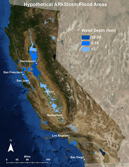
The Great Flood of 1862 was the largest flood in the recorded history of California, Oregon, and Nevada, inundating the western United States and portions of British Columbia and Mexico. It was preceded by weeks of continuous rains and snows that began in Oregon in November 1861 and continued into January 1862. This was followed by a record amount of rain from January 9–12, and contributed to a flood that extended from the Columbia River southward in western Oregon, and through California to San Diego, as well as extending as far inland as the Washington Territory (now Idaho), the Utah Territory (now Nevada and Utah), and the western New Mexico Territory (now Arizona). The event dumped an equivalent of of precipitation in California, in the form of rain and snow, over a period of 43 days. Immense snowfalls in the mountains of far western North America caused more flooding in Idaho, Arizona, New Mexico, as well as in Baja California and Sonora, Mexico the following spring and ... [...More Info...] [...Related Items...] OR: [Wikipedia] [Google] [Baidu] |


