|
Kearns, Utah
Kearns ( ) is a metro township in Salt Lake County, Utah, United States. Named after Utah's U.S. Senator Thomas Kearns, it had a population of 36,723 at the 2020 Census. This was a 2.8 percent increase over the 2010 figure of 35,731. Kearns is home to the Utah Olympic Oval, an indoor speed skating oval built for the 2002 Winter Olympics. History World War II Kearns came into existence 1 May 1942 as a World War II United States Army Air Forces training facility known as Kearns Army Air Base (also known as Kearns Center; redesignated: Camp Kearns, 1 January 1944). Before the base was built, the area consisted of dry farms on land reserved for universities and colleges. Construction of the base involved building airplane runways and hangars, with several taxiways and a large parking apron and a control tower. Several hundred buildings were also constructed and quickly assembled. Most base buildings, not meant for long-term use, were constructed of temporary or semi-permanent ... [...More Info...] [...Related Items...] OR: [Wikipedia] [Google] [Baidu] |
Metro Township
A metro township is a type of municipal government in Utah equivalent to a civil township. These were first allowed in Utah starting in 2015 (per Senate Bill 199 – the Community Preservation Act) both to allow existing unincorporated communities to avoid piecemeal annexation, and to give those residents some say in local government, without creating additional government overhead. While each metro township has a mayor and township council, and manage a budget, and cannot be annexed without its permission, its powers of taxation are limited, and must contract with other municipalities and/or municipal shared-service districts for most municipal services (police, for example). The five metro townships – all located in Salt Lake County – are Kearns, Magna, Copperton, Emigration Canyon and White City. References U.S. Board on Geographic Names [...More Info...] [...Related Items...] OR: [Wikipedia] [Google] [Baidu] |
Utah Olympic Oval
The Utah Olympic Oval is an indoor speed skating oval located southwest of Salt Lake City, in Kearns, Utah. The Oval was built for the 2002 Winter Olympics and it hosted the long track speed skating events for the 2002 games. Inside the facility the 400 meter skating track surrounds two international sized ice sheets, and is itself surrounded by a 442 meter running track. Due to its high altitude, , and the associated low air resistance, ten Olympic records and nine world records were set at the Oval during the 2002 games, the largest number of world records ever set at one event. History Along with Soldier Hollow and the Utah Olympic Park, the Utah Olympic Oval was built specifically for the 2002 Winter Olympics. On October 5, 1992, the Utah Sports Authority chose the Oquirrh Park Fitness Center in Kearns as the site for the 2002 Olympic Oval, beating out other locations in West Valley City, Sandy and downtown Salt Lake City. Funds from the 1989 Olympic referendum would be u ... [...More Info...] [...Related Items...] OR: [Wikipedia] [Google] [Baidu] |
Oquirrh Mountains
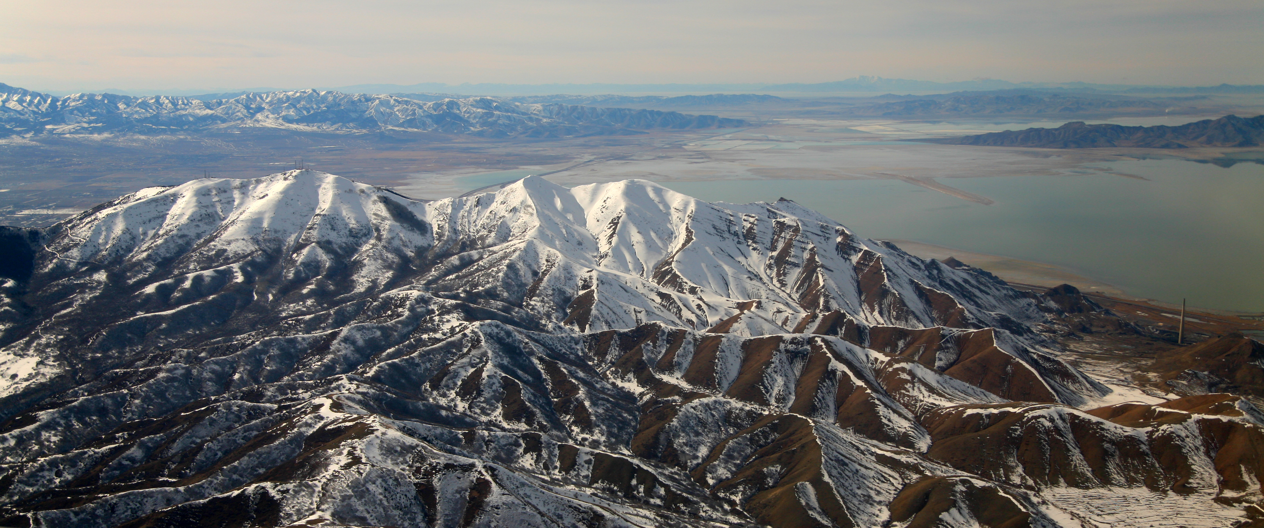
The Oquirrh Mountains is a mountain range that runs north-south for approximately 30 miles (50 km) to form the west side of Utah's Salt Lake Valley, separating it from Tooele Valley. The range runs from northwestern Utah County–central & eastern Tooele County, to the south shore of the Great Salt Lake. The highest elevation is Flat Top Mountain at 10,620 ft (3,237 m). The name Oquirrh was taken from the Goshute word meaning "wood sitting."William Bright, ed. ''Native American Placenames of the United States'' (2004, University of Oklahoma Press) The Oquirrh Mountains have been mined for gold, silver, lead, and most famously for copper, as home of the porphyry copper deposit at Bingham Canyon Mine, one of the world's largest open pit mines. As seen from Salt Lake City, the view of the mountain range is dominated by the displaced rock material (known as overburden) dug from the Kennecott mine. At the north end of the range is Kennecott's smelter complex, which refi ... [...More Info...] [...Related Items...] OR: [Wikipedia] [Google] [Baidu] |
Jordan River (Utah)
The Jordan River, in the state of Utah, United States, is a river about long. Regulated by pumps at its headwaters at Utah Lake, it flows northward through the Salt Lake Valley and empties into the Great Salt Lake. Four of Utah's six largest cities border the river: Salt Lake City, West Valley City, West Jordan, and Sandy. More than a million people live in the Jordan Subbasin, part of the Jordan River watershed that lies within Salt Lake and Utah counties. During the Pleistocene, the area was part of Lake Bonneville. Members of the Desert Archaic Culture were the earliest known inhabitants of the region; an archaeological site found along the river dates back 3,000 years. Mormon pioneers led by Brigham Young were the first European American settlers, arriving in July 1847 and establishing farms and settlements along the river and its tributaries. The growing population, needing water for drinking, irrigation, and industrial use in an arid climate, dug ditches and canals, bui ... [...More Info...] [...Related Items...] OR: [Wikipedia] [Google] [Baidu] |
West Jordan, Utah
West Jordan is a city in Salt Lake County, Utah, United States. It is a suburb of Salt Lake City and has a mixed economy. According to the 2020 Census, the city had a population of 116,961, placing it as the third most populous in the state. The city occupies the southwest end of the Salt Lake Valley at an elevation of 4,330 feet (1,320 m). Named after the nearby Jordan River, the limits of the city begin on the river's western bank and end in the eastern foothills of the Oquirrh Mountains, where Kennecott Copper Mine, the world's largest man-made excavation, is located. Settled in the mid-19th century, the city has developed into its own regional center. , the city has four major retail centers; with Jordan Landing being one of the largest mixed-use planned developments in the Intermountain West. Companies headquartered in West Jordan include Mountain America Credit Union, Lynco Sales & Service, SME Steel, and Cyprus Credit Union. The city has one major hospital, Jorda ... [...More Info...] [...Related Items...] OR: [Wikipedia] [Google] [Baidu] |
Taylorsville, Utah
Taylorsville is a city in Salt Lake County, Utah. It is part of the Salt Lake City metropolitan area. The population was 60,448 at the time of the 2020 census. Taylorsville was incorporated from the Taylorsville–Bennion CDP and portions of the Kearns metro township on July 1, 1996. The city is located adjacent to Interstate 215 and Bangerter Highway. It is located in the middle of the Salt Lake Valley. History The area called Taylorsville today is made up of two historic communities in the central part of Salt Lake County: Taylorsville and Bennion. These communities incorporated through a vote of the people with over 70 percent approval in September 1995. The city officially became the City of Taylorsville during the centennial anniversary of Utah's statehood in 1996. The land on which Taylorsville is located is part of an interconnected alluvial plain that was formed by the wearing down of the Wasatch and Oquirrh Mountains to the east and west. Beneath the surface, Taylorsv ... [...More Info...] [...Related Items...] OR: [Wikipedia] [Google] [Baidu] |
West Valley City, Utah
West Valley City is a city in Salt Lake County and a suburb of Salt Lake City in the U.S. state of Utah. The population was 140,230 at the 2020 census, making it the second-largest city in Utah. The city incorporated in 1980 from a large, quickly growing unincorporated area, combining the four communities of Granger, Hunter, Chesterfield, and Redwood. It is home to the Maverik Center and USANA Amphitheatre. History The earliest known residents of the western Salt Lake Valley were Native American bands of the Ute and Shoshoni tribes. The first European people to live in the area were the Latter-day Saints. The Euro-Americans arrived in the Salt Lake Valley in 1847. The area was first staked out by settler Joseph Harker and his family in the area they named as "over Jordan" (referring to the land west of the Jordan River, which runs through the valley). The Granger area was settled by Welsh pioneers who had come to Utah with Dan Jones in 1849. Irrigation systems and agricu ... [...More Info...] [...Related Items...] OR: [Wikipedia] [Google] [Baidu] |
Lake Bonneville
Lake Bonneville was the largest Late Pleistocene paleolake in the Great Basin of western North America. It was a pluvial lake that formed in response to an increase in precipitation and a decrease in evaporation as a result of cooler temperatures. The lake covered much of what is now western Utah and at its highest level extended into present-day Idaho and Nevada. Many other hydrographically closed basins in the Great Basin contained expanded lakes during the Late Pleistocene, including Lake Lahontan in northwestern Nevada. Geologic description Shorelines of Lake Bonneville are visible above Salt Lake City along the western front of the Wasatch Range, Wasatch Mountains and on other mountains throughout the Bonneville basin.Gilbert, G.K., 1890. Lake Bonneville. U.S. Geological Survey Monograph 1. 438 pp. These shorelines appear as shelves or benches that protrude from the mountainside above the valley floor, are visible on the ground from long distances and on satellite images, a ... [...More Info...] [...Related Items...] OR: [Wikipedia] [Google] [Baidu] |
Salt Lake Valley
Salt Lake Valley is a valley in Salt Lake County in the north-central portion of the U.S. state of Utah. It contains Salt Lake City and many of its suburbs, notably Murray, Sandy, South Jordan, West Jordan, and West Valley City; its total population is 1,029,655 as of 2010. Brigham Young said, "this is the right place," when he and his fellow Mormon settlers moved into Utah after being driven out of several states.Utah Pioneers (Salt Lake City, 1880), p. 23, quoted in Leland H. Creer, The Founding of an Empire (Salt Lake City, 1947), p. 302, n. 913. Cited by Poll R. Dealing with Dissonance: Myths, Documents and Faith. Sunstone, 1988 p. 17, available online asunstonemagazine.com/ref> Geography The Valley is surrounded in every direction except the northwest by steep mountains that at some points rise from the valley floor's base elevation. It lies nearly encircled by the Wasatch Mountains on the east, the Oquirrh Mountains on the west, Traverse Ridge to the south and the ... [...More Info...] [...Related Items...] OR: [Wikipedia] [Google] [Baidu] |
South Valley Regional Airport
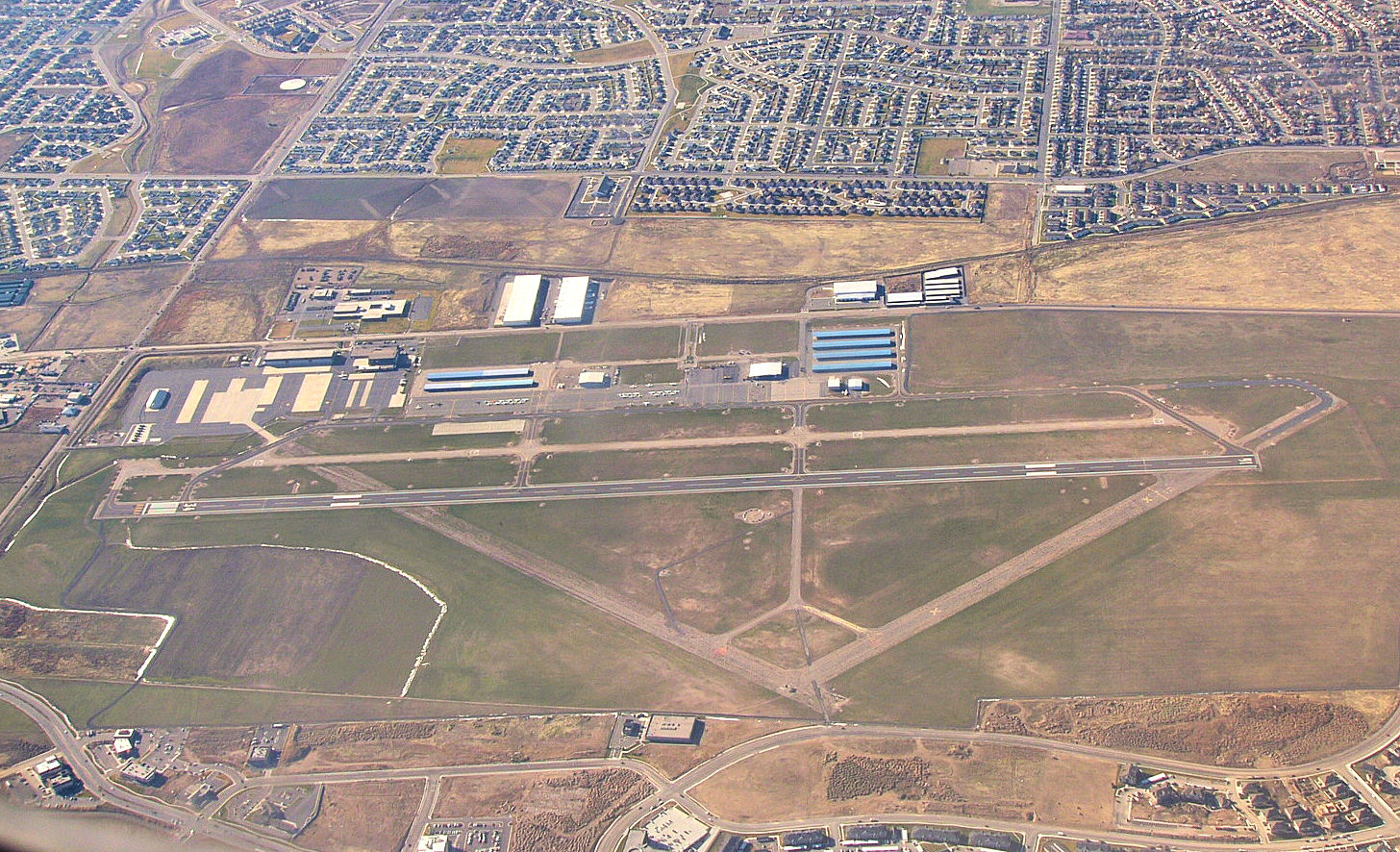
South Valley Regional Airport is a public airport located in West Jordan, southwest of Salt Lake City, Utah, United States. Established as a Utah World War II army airfield, it is the primary general aviation airport in the area and is a Utah Army National Guard training base with Apache and Blackhawk helicopters. Leading Edge Aviation is the single fixed-base operator (FBO) onsite; the FBO and Alta Aircraft Maintenance operate maintenance facilities, and the FBO and Utah Helicopter Flight Academy operate flight schools. History On 10 February 1942, the United States district engineer (Colonel E. G. Thomas) recommended a "5,450-acre dry farming area in Kearns" for an inland Army training site. For one of "the eight new technical training installations rushed into operation" during 1942–3, a Kearns, Utah "plot of 1,405 acres was purchased". The Kearns Center military unit was activated (designated) 1 May 1942, and "a contract for a theater of operations cantonment was l ... [...More Info...] [...Related Items...] OR: [Wikipedia] [Google] [Baidu] |
United States Army Air Forces
The United States Army Air Forces (USAAF or AAF) was the major land-based aerial warfare service component of the United States Army and ''de facto'' aerial warfare service branch of the United States during and immediately after World War II (1941–1945). It was created on 20 June 1941 as successor to the previous United States Army Air Corps and is the direct predecessor of the United States Air Force, today one of the six armed forces of the United States. The AAF was a component of the United States Army, which on 2 March 1942 was divided functionally by executive order into three autonomous forces: the Army Ground Forces, the United States Army Services of Supply (which in 1943 became the Army Service Forces), and the Army Air Forces. Each of these forces had a commanding general who reported directly to the Army Chief of Staff. The AAF administered all parts of military aviation formerly distributed among the Air Corps, General Headquarters Air Force, and the gro ... [...More Info...] [...Related Items...] OR: [Wikipedia] [Google] [Baidu] |
World War II
World War II or the Second World War, often abbreviated as WWII or WW2, was a world war that lasted from 1939 to 1945. It involved the World War II by country, vast majority of the world's countries—including all of the great powers—forming two opposing military alliances: the Allies of World War II, Allies and the Axis powers. World War II was a total war that directly involved more than 100 million Military personnel, personnel from more than 30 countries. The major participants in the war threw their entire economic, industrial, and scientific capabilities behind the war effort, blurring the distinction between civilian and military resources. Air warfare of World War II, Aircraft played a major role in the conflict, enabling the strategic bombing of population centres and deploying the Atomic bombings of Hiroshima and Nagasaki, only two nuclear weapons ever used in war. World War II was by far the List of wars by death toll, deadliest conflict in hu ... [...More Info...] [...Related Items...] OR: [Wikipedia] [Google] [Baidu] |


.jpg)


