|
Kawakami, Nara
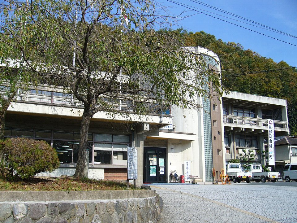
is a List of villages in Japan, village located in Yoshino District, Nara, Yoshino District, Nara Prefecture, Japan. , the village had an estimated population of 1,023 and a population density of 3.8 persons per km2. The total area of the village is . Geography Kawakami is located in central Nara Prefecture, the majority of the village is mountainous. The Mount Ōmine, Ōmine Mountains are on the west side and the Daidaka Mountains on the east side, and the area is the source of the Yoshino River. The Osako Dam and Otaki Dam are located on the Yoshino River. The area has many limestone caves and onsen, hot springs. Surrounding municipalities Mie Prefecture *Matsusaka, Mie, Matsusaka *Ōdai Nara Prefecture *Yoshino, Nara, Yoshino *Kurotaki, Nara, Kurotaki *Tenkawa, Nara, Tenkawa *Kamikitayama, Nara, Kamikitayama *Higashiyoshino, Nara, Higashiyoshino Climate Kawakami has a humid subtropical climate (Köppen ''Cfa'') characterized by warm summers and cool winters with light to no ... [...More Info...] [...Related Items...] OR: [Wikipedia] [Google] [Baidu] |
Villages Of Japan
A is a Local government, local administrative unit in Japan. Tokyo Metropolitan Government It is a local public body along with , , and . Geographically, a village's extent is contained within a prefecture. Villages are larger than a local settlement; each is a subdivision of rural , which are subdivided into towns and villages with no overlap and no uncovered area. As a result of merger and dissolution of municipalities of Japan, mergers and elevation to higher statuses, the number of villages in Japan is decreasing. As of 2006, 13 prefectures no longer have any villages: Tochigi Prefecture, Tochigi (since March 20, 2006), Fukui Prefecture, Fukui (since March 3, 2006), Ishikawa Prefecture, Ishikawa (since March 1, 2005), Shizuoka Prefecture, Shizuoka (since July 1, 20 ... [...More Info...] [...Related Items...] OR: [Wikipedia] [Google] [Baidu] |
Onsen
In Japan, are hot springs and the bathing facilities and Ryokan (inn), traditional inns around them. There are approximately 25,000 hot spring sources throughout Japan, and approximately 3,000 ''onsen'' establishments use naturally hot water from these Geothermal gradient, geothermally heated springs. ''Onsen'' may be either or . Traditionally, ''onsen'' were located outdoors, although many inns have now built indoor bathing facilities as well. Nowadays, as most households have their baths, the number of traditional public baths has decreased, but the number and popularity of have increased since the end of World War II, Second World War. Baths may be either publicly run by a municipality or privately, often connecting to a lodging establishment such as a hotel, ''Ryokan (inn), ryokan'', or ''Ryokan (inn)#Minshuku, minshuku''. The presence of an ''onsen'' is often indicated on signs and maps by the symbol ♨, the kanji (''yu'', meaning "hot water"), or the simpler phonet ... [...More Info...] [...Related Items...] OR: [Wikipedia] [Google] [Baidu] |
Unicameral
Unicameralism (from ''uni''- "one" + Latin ''camera'' "chamber") is a type of legislature consisting of one house or assembly that legislates and votes as one. Unicameralism has become an increasingly common type of legislature, making up nearly 60% of all national legislatures and an even greater share of subnational legislatures. Sometimes, as in New Zealand and Denmark, unicameralism comes about through the abolition of one of two bicameral chambers, or, as in Sweden, through the merger of the two chambers into a single one, while in others a second chamber has never existed from the beginning. Rationale for unicameralism and criticism The principal advantage of a unicameral system is more efficient lawmaking, as the legislative process is simpler and there is no possibility of gridlock (politics), deadlock between two chambers. Proponents of unicameralism have also argued that it reduces costs, even if the number of legislators stays the same, since there are fewer instituti ... [...More Info...] [...Related Items...] OR: [Wikipedia] [Google] [Baidu] |
Yamato Province
was a province of Japan, located in Kinai, corresponding to present-day Nara Prefecture in Honshū. Nussbaum, Louis-Frédéric (2005). "Yamato" in . It was also called . Yamato consists of two characters, 大 "great", and 和 " Wa". At first, the name was written with one different character (), but due to its offensive connotation, for about ten years after 737, this was revised to use more desirable characters () (see Names of Japan). The final revision was made in the second year of the Tenpyō-hōji era (). It is classified as a great province in the '' Engishiki''. The Yamato Period in the history of Japan refers to the late Kofun Period (c. 250–538) and Asuka Period (538–710). Japanese archaeologists and historians emphasize the fact that during the early Kofun Period the Yamato Kingship was in close contention with other regional powers, such as Kibi Province near present-day Okayama Prefecture. Around the 6th century, the local chieftainship gained national contro ... [...More Info...] [...Related Items...] OR: [Wikipedia] [Google] [Baidu] |
Humid Subtropical Climate
A humid subtropical climate is a subtropical -temperate climate type, characterized by long and hot summers, and cool to mild winters. These climates normally lie on the southeast side of all continents (except Antarctica), generally between latitudes 25° and 40° and are located poleward from adjacent tropical climates, and equatorward from either humid continental (in North America and Asia) or oceanic climates (in other continents). It is also known as warm temperate climate in some climate classifications. Under the Köppen climate classification, ''Cfa'' and ''Cwa'' climates are either described as humid subtropical climates or warm temperate climates. This climate features mean temperature in the coldest month between (or ) and and mean temperature in the warmest month or higher. However, while some climatologists have opted to describe this climate type as a "humid subtropical climate", Köppen himself never used this term. The humid subtropical climate classific ... [...More Info...] [...Related Items...] OR: [Wikipedia] [Google] [Baidu] |
Higashiyoshino, Nara
file:Higashiyoshino Village Office.jpg, 290px, Higashiyoshino Village Office is a List of villages in Japan, village located in Yoshino District, Nara, Yoshino District, Nara Prefecture, Japan. , the village had an estimated population of 1,322 and a population density of 10 persons per km2. The total area of the village is . It is where the last Japanese wolf was shot and killed in 1905. It is now kept as a specimen at the British Museum Geography Located in central Nara Prefecture, the majority of the village is mountainous. Mount Kunimi (Daikō), Mount Kunimi, at 1419 meters, is the highest mountain in the village. There are other mountains, such as Mount Takami, at 1248 meters, situated in western portion of Higashiyoshino. *Rivers:Yoshino River *Mountains:Mount Kunimi, Mount Takami Surrounding municipalities Mie Prefecture *Matsusaka, Mie, Matsusaka Nara Prefecture *Kawakami, Nara, Kawakami *Mitsue, Nara, Mitsue *Soni, Nara, Soni *Uda, Nara, Uda *Yoshino, Nara, Yoshino Clim ... [...More Info...] [...Related Items...] OR: [Wikipedia] [Google] [Baidu] |
Kamikitayama, Nara
290px, Kitakamiyama Village Hall is a village located in Yoshino District, Nara Prefecture, Japan. , the village had an estimated population of 380 and a population density of 1.4 persons per km2. The total area of the village is . Geography Kitakamiyama is located in the mountainous area in the southern part of Yoshino County. It is a mountain village rich in nature, with the ridge of the Omine Mountains to the west and the Daidaka Mountains and Odaigahara to the east. Wasamatayama Ski Resort, one of two ski resorts in the prefecture, is located in the north. There are many narrow roads, and it is not easy to access the village by any route other than National Route 169. Approximately 97% of the village's area is covered by forest. Climate Kamikitayama has a humid subtropical climate (Köppen climate classification ''Cfa'') with hot summers and cool to cold winters. Precipitation is significantly higher in summer than in winter, though on the whole lower than most parts of Hons ... [...More Info...] [...Related Items...] OR: [Wikipedia] [Google] [Baidu] |
Tenkawa, Nara
290px, Tenkawa Village Hall is a village located in Yoshino District, Nara Prefecture, Japan. , the village had an estimated population of 1,031 and a population density of 5.9 persons per km2. The total area of the village is . Geography Located in central Nara Prefecture, the area of Tenkawa is dominated by the Ōmine Mountain Range. It is home to the highest peak in the Kinki region, Mount Hakkyō (1,915 meters), and the Tennokawa River, the source of the Kumano River, flows through the area. Parts of the village are within the borders of the Yoshino-Kumano National Park and also part of the Sacred Sites and Pilgrimage Routes in the Kii Mountain Range World Heritage Site. Surrounding municipalities Nara Prefecture * Gojō * Kurotaki * Kawakami * Kamikitayama Climate Tenkawa has a humid subtropical climate (Köppen ''Cfa'') characterized by warm summers and cool winters with light to no snowfall. The average annual temperature in Tenkawa is 11.0 °C. The average an ... [...More Info...] [...Related Items...] OR: [Wikipedia] [Google] [Baidu] |
Kurotaki, Nara
file:Kawawake-jinja05.JPG, 290px, Kawawake Jinja in Kurotaki is a List of villages in Japan, village located in Yoshino District, Nara, Yoshino District, Nara Prefecture, Japan. , the village had an estimated population of 536 and a population density of 10 persons per km2. The total area of the village is . Geography Kurotaki is located in central Nara Prefecture, north of Mount Yoshino, and Mount Ōmine. it is part of the municipalities in the Kii Mountain Range. * Mountains: Mount Kashihara, Hyakukaidake Surrounding municipalities Nara Prefecture * Gojō, Nara, Gojō city * Kawakami, Nara, Kawakami village * Shimoichi, Nara, Shimoichi town * Tenkawa, Nara, Tenkawa village * Yoshino, Nara, Yoshino town Climate Kurotaki has a humid subtropical climate (Köppen ''Cfa'') characterized by warm summers and cool winters with light to no snowfall. The average annual temperature in Kurotaki is 12.0 °C. The average annual rainfall is 2119 mm with September as the wettest mon ... [...More Info...] [...Related Items...] OR: [Wikipedia] [Google] [Baidu] |
Yoshino, Nara
is a towns of Japan, town located in Yoshino District, Nara, Yoshino District, Nara Prefecture, Japan. , the town had an estimated population of 5,874 in 2997 households, and a population density of 61 persons per km2. The total area of the town is . In 2012, Yoshino was designated one of The Most Beautiful Villages in Japan. Geography Yoshino is located in the central part of Nara Prefecture. The Ryumon Mountains run east-to-west in the north, and the Omine Mountain Range (Mount Aonega is the highest point within the town area) spread out to the south. The mountains that extend from the Daidaka Mountains also are to the east. Between these, the Kinokawa River, Yoshino River flows from southeast-to-west through the center of the town, and the Takami River flows from east-to-west. The Yoshino River meanders left and right from the upstream (Kawakami Village) to the area where the Tsuburo River flows into it, weaving its way through the mountains. Along the way, the Takami ... [...More Info...] [...Related Items...] OR: [Wikipedia] [Google] [Baidu] |


