|
Kanmantoo, South Australia
Kanmantoo is a small mining town in South Australia. It is southeast of Adelaide in the eastern Adelaide Hills. It is in the catchment basin of the Bremer river. The name, derived from a local aboriginal word Kunga Tuko means, "different speech". In 1839 Scottish squatters were the first Europeans to settle in the area. Some of the first residents were Joseph Lean, Henry Jackson Farrington, and William Snell. Joseph Lean arrived 13 December 1840 and for several years captained some of the earliest Kanmantoo mines. Lean was a seasoned Cornish miner, and was one of the pioneers of mining in Kanmantoo. A newspaper in 1915 reported that he was the one to discover the Ore in the Kanmantoo mine. He and his descendants pioneered the nearby town of Staughton, which is now a ghost town. Infrastructure More hotels were established in Kanmantoo than any other town in the Adelaide Hills. All of them had short lives, the longest surviving one, the Kanmantoo Hotel, Which licensed from ... [...More Info...] [...Related Items...] OR: [Wikipedia] [Google] [Baidu] |
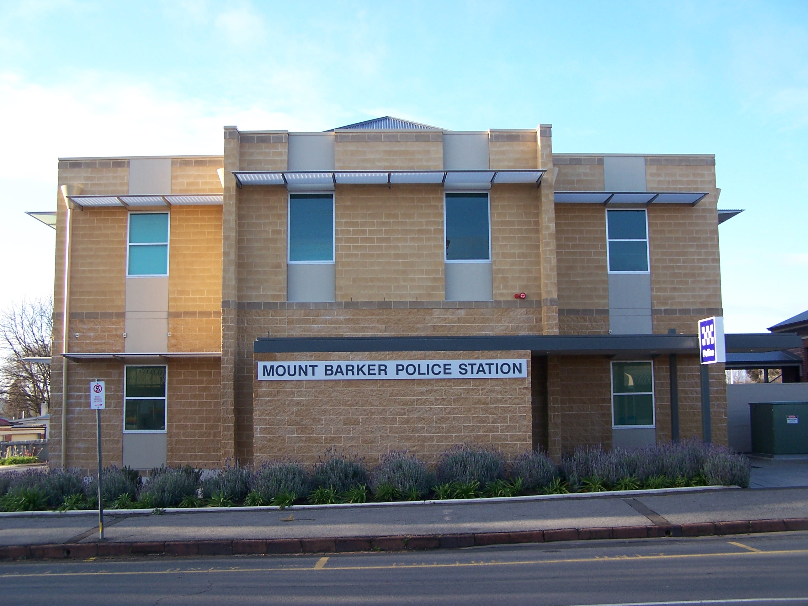
Mount Barker, South Australia
Mount Barker is a city in South Australia. Located approximately 33 kilometres (21 miles) from the Adelaide city centre, it is home to 21,554 residents (2021). It is the seat of the District Council of Mount Barker, the largest town in the Adelaide Hills, Part of Greater Adelaide, as well as one of the fastest-growing areas in the state. Mount Barker lies at the base of a local eponymous peak called the Mount Barker (South Australia), Mount Barker summit. It is 50 kilometres from the Murray River. Mount Barker was traditionally a farming area. Many of the lots just outside the town area are farming lots, although some of them have been replaced with new subdivisions in recent times. History Mount Barker, the mountain, was sighted by Captain Charles Sturt in 1830, although he thought he was looking at the previously discovered Mount Lofty. This sighting of Mount Barker was the first by a European. Captain Collet Barker corrected Sturt's error when he surveyed the area in 1831. St ... [...More Info...] [...Related Items...] OR: [Wikipedia] [Google] [Baidu] |
Adelaide Hills
The Adelaide Hills region is located in the southern Mount Lofty Ranges east of the city of Adelaide in the state of South Australia. The largest town in the area, Mount Barker, South Australia, Mount Barker, is one of Australia's fastest-growing towns. Before British colonisation of South Australia, the area was inhabited by the Peramangk people. The Adelaide Hills wine region comprises areas of the Adelaide Hills above . History Before European settlement, the Peramangk people occupied the Adelaide Hills region, including the land from the foothills, north from Mount Barker through Harrogate, South Australia, Harrogate, Gumeracha, Mount Pleasant, South Australia, Mount Pleasant and Springton, South Australia, Springton to the Angaston, South Australia, Angaston and Gawler, South Australia, Gawler districts in the Barossa Valley, and also southwards to Strathalbyn, South Australia, Strathalbyn and Myponga, South Australia, Myponga on the Fleurieu Peninsula, as well as some ... [...More Info...] [...Related Items...] OR: [Wikipedia] [Google] [Baidu] |
Hundred Of Kanmantoo
The Hundred of Kanmantoo is a cadastral unit of hundred in the eastern Adelaide Hills. One of the 10 hundreds of the County of Sturt, it was proclaimed on 13 November 1847 by Governor Frederick Robe and named after the Kanmantoo gold mine, itself presumed to be named after an indigenous term by William Giles. Apart from the town of Kanmantoo the following towns and localities of the Mount Barker District Council are within (or partly within) the Hundred of Kanmantoo: * Harrogate * Brukunga * Dawesley * Nairne (most part) * Hay Valley (most part) * Mount Barker Summit (east half) * Petwood * Mount Barker Springs (east half) * St Ives * Callington (half west of Bremer River) * Mount Torrens (south portion) An eastern portion of Woodside (in the Adelaide Hills Council area) is also within the hundred, crossing the western border. Local government The District Council of Nairne was established in 1853, incorporating the Hundred of Kanmantoo as well as the Hundred of ... [...More Info...] [...Related Items...] OR: [Wikipedia] [Google] [Baidu] |
Cycling
Cycling, also known as bicycling or biking, is the activity of riding a bicycle or other types of pedal-driven human-powered vehicles such as balance bikes, unicycles, tricycles, and quadricycles. Cycling is practised around the world for purposes including transport, recreation, exercise, and competitive sport. History Cycling became popularized in Europe and North America in the latter part and especially the last decade of the 19th century. Today, over 50 percent of the human population knows how to ride a bike. War The bicycle has been used as a method of reconnaissance as well as transporting soldiers and supplies to combat zones. In this it has taken over many of the functions of horses in warfare. In the Second Boer War, both sides used bicycles for scouting. In World War I, France, Germany, Australia and New Zealand used bicycles to move troops. In its 1937 invasion of China, Japan employed some 50,000 bicycle troops, and similar forces were instrumental in ... [...More Info...] [...Related Items...] OR: [Wikipedia] [Google] [Baidu] |
South Eastern Freeway
South Eastern Freeway is a freeway in South Australia (SA). It is a part of the National Highway network linking the state capital cities of Adelaide, SA, and Melbourne, Victoria, and is signed as route M1. It carries traffic over the Adelaide Hills between Adelaide and the River Murray, near Murray Bridge, where it is connected via the Swanport Bridge to the Dukes Highway, which is the main road route to Victoria. It was formerly signposted as Princes Highway, which refers to the coastal route from Adelaide to Sydney via Melbourne. It is often referred to by South Australians simply as the freeway, as it was the first freeway in South Australia, and is still the longest, and the only one with "Freeway" in its name rather than "Expressway" or "Highway". South Eastern Freeway includes twin-tube tunnels – the Heysen Tunnels – in the descent towards Adelaide, the first of their kind on the National Highway. Route South Eastern Freeway commences at the intersection ... [...More Info...] [...Related Items...] OR: [Wikipedia] [Google] [Baidu] |
Nairne, South Australia
Nairne is a small township in the Adelaide Hills of South Australia. Nairne is about from Mount Barker, South Australia, in the federal Division of Mayo and in the state electoral district of Kavel. At the 2016 Australian census, 2016 census, Nairne had a population of 6,086. History Nairne was founded by Matthew Smillie in 1839 and named for his wife's family. In 1854 the District Council of Nairne was established to govern local affairs of the town and its surrounds extending past Callington, South Australia, Callington to the east. Chapman's Bacon Factory was founded in Nairne in 1899 by the Chapman family and was closed in 2002 and has since been developed into a successful and thriving complex including a supermarket, post office and several variety shops. In the late 1920s, the route of the Princes Highway, part of the main road route between Adelaide and Melbourne was changed to pass through Nairne, with road improvements from Mount Barker, South Australia, Mount Barke ... [...More Info...] [...Related Items...] OR: [Wikipedia] [Google] [Baidu] |
Adelaide Geosyncline
The Adelaide Superbasin (previously known as the Adelaide Geosyncline and Adelaide Rift Complex) is a major Neoproterozoic to middle Cambrian geological province in central and south-east South Australia, western New South Wales, and western Victoria. The Adelaide Superbasin consists of a thick pile of sedimentary rocks and minor volcanic rocks that were deposited on the eastern margin of Australia during the time of breakup of the supercontinent Rodinia. A number of authors have noted the similarity in these sedimentary rocks with rocks found in western North America and have suggested that they were formerly adjacent to each other in Rodinia. This is one major correlation in the SWEAT (south-west USA against East Antarctica) reconstruction of Rodinia. Particularly notable events that are preserved in the rock record of the Adelaide Superbasin are the two Neoproterozoic Snowball Earth events (the Sturtian and Marinoan Glaciations), the Neoproterozoic Oxygenation Event, the E ... [...More Info...] [...Related Items...] OR: [Wikipedia] [Google] [Baidu] |
Hillgrove Resources
Hillgrove Resources () is an Australian mining company. Its principal activity has been the Kanmantoo copper mine which was forecast to reach the end of its economic life. Mine life has since been extended, however to a further 6-10 years. Hillgrove also has exploration rights for other prospects in the area, such as extending the Kanmantoo mine underground, and another deposit near Sanderston. References mining companies of Australia Companies based in Adelaide Companies listed on the Australian Securities Exchange {{SouthAustralia-stub ... [...More Info...] [...Related Items...] OR: [Wikipedia] [Google] [Baidu] |
William Giles (colonial Manager)
William Giles (27 December 1791 – 11 May 1862), occasionally referred to as William Giles, sen. to distinguish him from his eldest son, was the third colonial manager of the South Australian Company, and a South Australian politician, prominent in the founding of the state of South Australia. Early life Giles was born on 27 December 1791 in Great Staughton, Huntingdonshire, England, and was educated at Kimbolton School in nearby Cambridgeshire. Travel to South Australia The new British Province of South Australia was established on 19 February 1836 when King William IV signed Letters Patent under the ''South Australia Act 1834'', signalling the final action needed to establish the Province under United Kingdom law. Giles, a close friend of one of the founders of the South Australian Company, George Fife Angas, left England for South Australia on the ship ''Hartley'' sixteen months later, in June 1837. He was accompanied by his new (and pregnant) second wife, Emily Elizabeth ... [...More Info...] [...Related Items...] OR: [Wikipedia] [Google] [Baidu] |
Kanmantoo Mine
The Kanmantoo mine is a copper mine in the Australian state of South Australia located near the town of Kanmantoo about southeast of the state capital of Adelaide. History Copper was first discovered and mined in the 1840s. The town was established to house workers at the mine, which at that time was an underground mine. The original mine was active from 1846 to 1874. A new open-cut mine operated from 1970 to 1976. The current mine operators acquired the mining and exploration leases in stages over 2003–2008, and started mining operations from 2011. Processing at the mine site produces concentrates which are transported by road to Port Adelaide via the South Eastern Freeway South Eastern Freeway is a freeway in South Australia (SA). It is a part of the National Highway network linking the state capital cities of Adelaide, SA, and Melbourne, Victoria, and is signed as route M1. It carries traffic over the Adel .... Geology The mineral deposits are in Cambrian Kanmant ... [...More Info...] [...Related Items...] OR: [Wikipedia] [Google] [Baidu] |
Bremer River (South Australia)
The Bremer River, part of the lower Murray-Darling catchment, is a river that is located in the Adelaide Hills region in the Australian state of South Australia. Course and features The Bremer River rises on the eastern side of the Mount Lofty Ranges at an altitude of south of and flows generally south, joined by the Mount Barker Creek and Dawesley Creek, before emptying into Lake Alexandrina at the lower end of the Murray-Darling basin. The river descends over its course. The largest town in the catchment area is Mount Barker. Other towns include Nairne and Kanmantoo. Towns on the Bremer River itself include Harrogate, Callington and Langhorne Creek, where the floodwaters are used to irrigate the local vineyards. The river is crossed by the Old Princes Highway near Callington. Etymology One recorded Aboriginal name for the Bremer River was ''Miochi''.''Register'' newspaper, 24 October 1840, page 4. On 31 December 1837 the first European visitor, Robert Cock, n ... [...More Info...] [...Related Items...] OR: [Wikipedia] [Google] [Baidu] |


