|
Kamigotō Airport
Kamigotō Airport is a public aerodrome located on Kashiragashima Island (頭ヶ島), a smaller bridge-linked island just off the far east coast of Nakadorijima in the Gotō Islands, Nagasaki Prefecture, Japan. The site is about northeast of Kamigotō town office, Shinkamigotō. The terminal was renovated in July 2015 and the airport remains active for emergency medical shuttles, but commercial passenger routes have been suspended for several years. Given the airport's lack of traffic and its unusually remote location, the runway has been used occasionally as a venue for 'dark sky' appreciation tours with tourists lying on the runway and staring at the cosmos above. History The airport opened in April 1981 (Showa 56) with a 800m long, 25m wide landing strip built along the entire north–south flattened top of Kashiragashima. Nagasaki Airways, rebranded after March 2001 as Oriental Air Bridge, operated small passenger planes to Fukuoka Airport (until March 2004) and to Nagasaki ... [...More Info...] [...Related Items...] OR: [Wikipedia] [Google] [Baidu] |
Nagasaki Prefecture
is a Prefectures of Japan, prefecture of Japan, mainly located on the island of Kyūshū, although it also includes a number of islands off Kyūshū's northwest coast - including Tsushima and Iki. Nagasaki Prefecture has a population of 1,246,481 (1 February 2025) and has a geographic area of 4,130 Square kilometre, km2 (1,594 sq mi). Nagasaki Prefecture borders Saga Prefecture to the northeast. Nagasaki is the capital and largest city of Nagasaki Prefecture, with other major cities including Sasebo, Isahaya, Nagasaki, Isahaya, and Ōmura, Nagasaki, Ōmura. Nagasaki Prefecture is located in western Kyūshū with a territory consisting of many mainland peninsulas centered around Ōmura Bay, as well as islands and archipelagos including Tsushima Island, Tsushima and Iki Island, Iki in the Korea Strait and the Gotō Islands in the East China Sea. Nagasaki Prefecture is known for its century-long Nanban trade, trading history with the Europeans and as the sole place of direct trade ... [...More Info...] [...Related Items...] OR: [Wikipedia] [Google] [Baidu] |
Asphalt Concrete
Asphalt concrete (commonly called asphalt, blacktop, or pavement in North America, and Tarmacadam, tarmac or bitumen macadam in the United Kingdom and the Republic of Ireland) is a composite material commonly used to surface road surface, roads, parking lots, airports, and the core of embankment dams. Asphalt mixtures have been used in pavement construction since the nineteenth century. It consists of Construction aggregate, mineral aggregate Binder (material), bound together with bitumen (a substance also independently known as asphalt, Pitch (resin), pitch, or tar), laid in layers, and compacted. The American English terms ''asphalt'' (or ''asphaltic'') ''concrete'', ''bituminous asphalt concrete'', and ''bituminous mixture'' are typically used only in engineering and construction documents, which define concrete as any composite material composed of mineral aggregate adhered with a binder. The abbreviation, ''AC'', is sometimes used for ''asphalt concrete'' but can also denot ... [...More Info...] [...Related Items...] OR: [Wikipedia] [Google] [Baidu] |
Aeronautical Information Publication
In aviation, an Aeronautical Information Publication (or AIP) is defined by the International Civil Aviation Organization (ICAO) as a publication issued by or with the authority of a state and containing aeronautical information of a lasting character essential to air navigation. It is designed to be a manual containing thorough details of regulations, procedures and other information pertinent to flying aircraft in the particular country to which it relates. It is usually issued by or on behalf of the respective civil aviation administration. Overview The structure and contents of AIPs are standardized by international agreement through ICAO. AIPs normally have three parts – GEN (general), ENR (en route) and AD (aerodromes). The document contains many charts; most of these are in the AD section where details and charts of all public aerodromes are published. AIPs are kept up-to-date by regular revision on a fixed cycle. For operationally significant changes in information ... [...More Info...] [...Related Items...] OR: [Wikipedia] [Google] [Baidu] |
Aeronautical Information Service
The Aeronautical Information Service, or AIS (French: , SIA) is a service established in support of international civil aviation, whose objective is to ensure the flow of information necessary for the safety, regularity, and efficiency of international air navigation. The manner in which aeronautical information is gathered and managed is governed by Annex 15 to the Convention on International Civil Aviation (ICAO Annex 15), which defines how an aeronautical information service shall receive and/or originate, collate or assemble, edit, format, publish/store and distribute specified aeronautical information/data. The goal is to satisfy the need for uniformity and consistency in the provision of aeronautical information/data that is required for operational use by international civil aviation. ICAO Annex 15 specifies that aeronautical information should be published as an integrated aeronautical information package (IAIP), composed of the following elements: * The Aeronautical Infor ... [...More Info...] [...Related Items...] OR: [Wikipedia] [Google] [Baidu] |
Gotō Islands
The are Japanese islands in the Sea of Japan. They are part of Nagasaki Prefecture. Geography There are 140 islands, including five main ones: , , , , and . The northernmost island is Ukujima. The group of islands runs approximately from Osezaki Lighthouse, Fukue Island to Tsuwazaki Lighthouse, Nakadōri Island. Its center is near Naru Island at about . To the north is Tsushima Island in the Tsushima Strait and to the east is Kyūshū and the rest of Nagasaki Prefecture. It is about from the port of Nagasaki. The Tsushima Current (a branch of the Kuroshio) passes around the islands. The southern of the two principal islands, Fukue, measures approximately north-to-south by east-to-west; the northern, Nakadōri Island, measures approximately north-to-south by east-to-west at its widest point. Most of Nakadōri Island, however, is quite narrow, measuring less than wide for much of its length. Some dome-shaped hills command the old castle town of Fukue. The isla ... [...More Info...] [...Related Items...] OR: [Wikipedia] [Google] [Baidu] |
Japan
Japan is an island country in East Asia. Located in the Pacific Ocean off the northeast coast of the Asia, Asian mainland, it is bordered on the west by the Sea of Japan and extends from the Sea of Okhotsk in the north to the East China Sea in the south. The Japanese archipelago consists of four major islands—Hokkaido, Honshu, Shikoku, and Kyushu—and List of islands of Japan, thousands of smaller islands, covering . Japan has a population of over 123 million as of 2025, making it the List of countries and dependencies by population, eleventh-most populous country. The capital of Japan and List of cities in Japan, its largest city is Tokyo; the Greater Tokyo Area is the List of largest cities, largest metropolitan area in the world, with more than 37 million inhabitants as of 2024. Japan is divided into 47 Prefectures of Japan, administrative prefectures and List of regions of Japan, eight traditional regions. About three-quarters of Geography of Japan, the countr ... [...More Info...] [...Related Items...] OR: [Wikipedia] [Google] [Baidu] |
Oriental Air Bridge
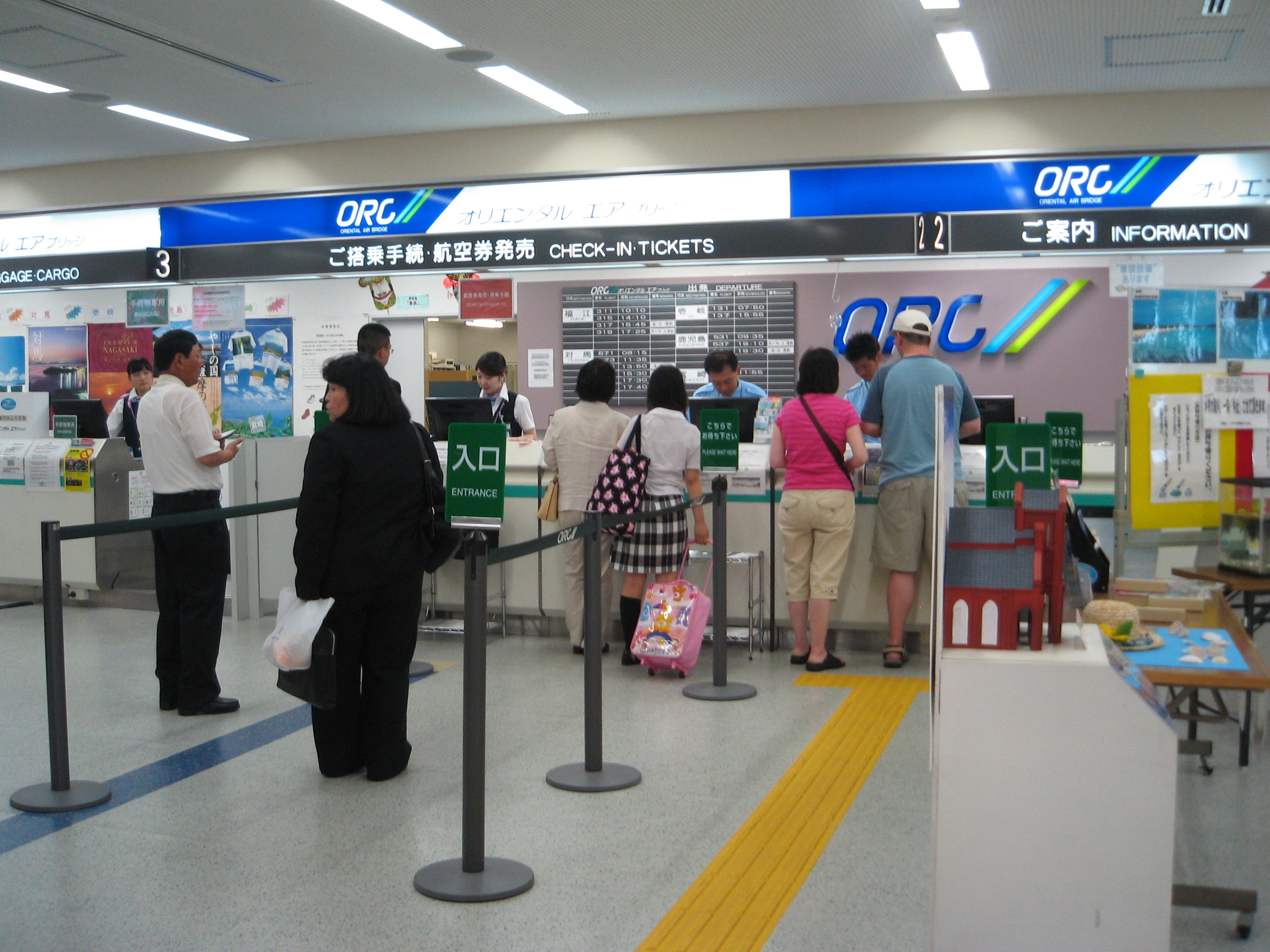
is a Japanese regional airline headquartered on the grounds of Nagasaki Airport in Ōmura, Nagasaki, Ōmura, Nagasaki Prefecture, Japan. It operates regional services to the islands within Nagasaki Prefecture and also operates domestic services from Fukuoka Airport, Fukuoka and Chubu Centrair International Airport, Nagoya with ANA Wings aircraft. History The airline was established on June 12, 1961 as Nagasaki Airways. It was renamed Oriental Air Bridge in March 2001. In late 2022, ORC received its first of two ATR 42-600 which are scheduled to replace their De Havilland Canada Dash 8, Bombardier Dash 8 Q200 fleet. Destinations Oriental Air Bridge serves the following destinations (as of January 2023): Codeshare agreements Oriental Air Bridge has codeshare agreements with the following airlines: *All Nippon Airways *Japan Airlines Fleet Current fleet As of February 2024, the Oriental Air Bridge fleet consists of the following aircraft: [...More Info...] [...Related Items...] OR: [Wikipedia] [Google] [Baidu] |
Fukuoka Airport
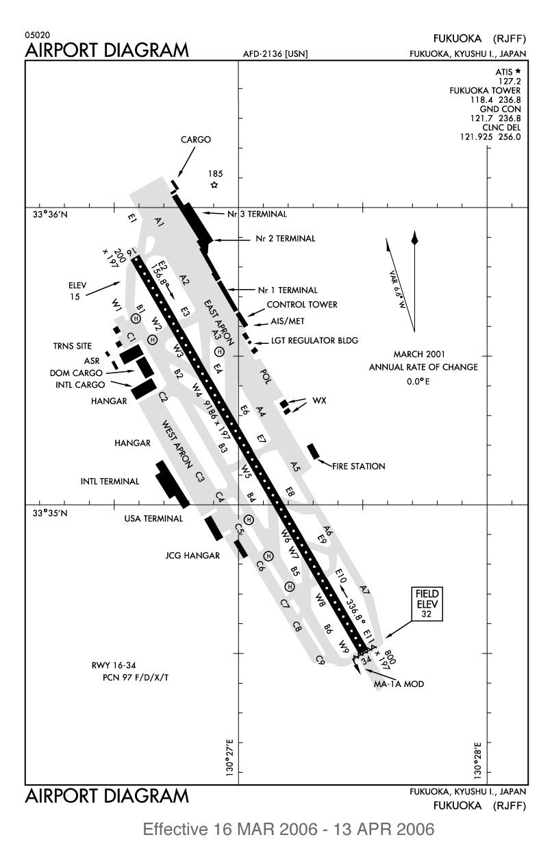
— formerly known as Itazuke Air Base — is an international airport located east of Hakata Station in Hakata-ku, Fukuoka, Japan. The facility has two runways and covers 355 hectares (877 acres) of land. Fukuoka Airport is the principal airport on the island of Kyushu and is the fourth busiest passenger airport in Japan, serving 25 million passengers in 2018. The airport is surrounded by residential areas and subject to a curfew from 22:00 every night to 07:00 the following morning, at the request of local residents. The domestic terminal boasts extensive facilities, but the international terminal is located on the other side of the runway. The domestic terminal is connected to the city by the Fukuoka City Subway, and a subway from the airport to the business district takes about ten minutes. The international terminal is only accessible by road, although there is scheduled inter-terminal airport bus to the domestic terminal and the subway station, and scheduled bus servi ... [...More Info...] [...Related Items...] OR: [Wikipedia] [Google] [Baidu] |
Nagasaki Airport
is an airport located off the coast of Ōmura, Nagasaki Prefecture, Japan. The airport was the first airport in the world to be built on the ocean, using an existing small island located in the center of Ōmura Bay, with land areas that were fully reclaimed. Nagasaki Airport was built to replace the former airport called Omura Airport, which was located on the mainland and had a shorter runway of . The former airport was transferred to the Japan Self-Defense Force in 2011, and was renamed into Omura Air Base. Oriental Air Bridge, a regional airline is based at the airport. History The mainland portion of the airport opened as an Imperial Japanese Navy airfield in 1923, and served as the main base for the now defunct 21st Naval Air Base. During World War II, several aircraft factories were constructed near the airfield and the base was used extensively for manufacturing and repairing many aircraft. After the war, the airfield was converted into a civilian airport and was ... [...More Info...] [...Related Items...] OR: [Wikipedia] [Google] [Baidu] |
Gotō-Fukue Airport
, is a third class airport located southwest of Gotō, Nagasaki Prefecture, off the western coast of Kyūshū, Japan. The airport also serves the city of Fukue. It is also known as and, since 2014, also styled Gotō Tsubaki Airport (五島つばき空港). Currently the terminal building's exterior displays both names. Tsubaki means camellia, and is a notable reference on Fukue Island which is famed for producing camellia oil and is home to two ancient camellia trees each over 300 years old that have been declared 'national monuments' Summary The airport opened in October of 1963. It is located on the largest island in the Gotō Islands The are Japanese islands in the Sea of Japan. They are part of Nagasaki Prefecture. Geography There are 140 islands, including five main ones: , , , , and . The northernmost island is Ukujima. The group of islands runs approximately fr ... at the foot of Onidake mountain. The surrounding area is largely cultivated farmland. A p ... [...More Info...] [...Related Items...] OR: [Wikipedia] [Google] [Baidu] |


