|
Kabataş, Beyoğlu
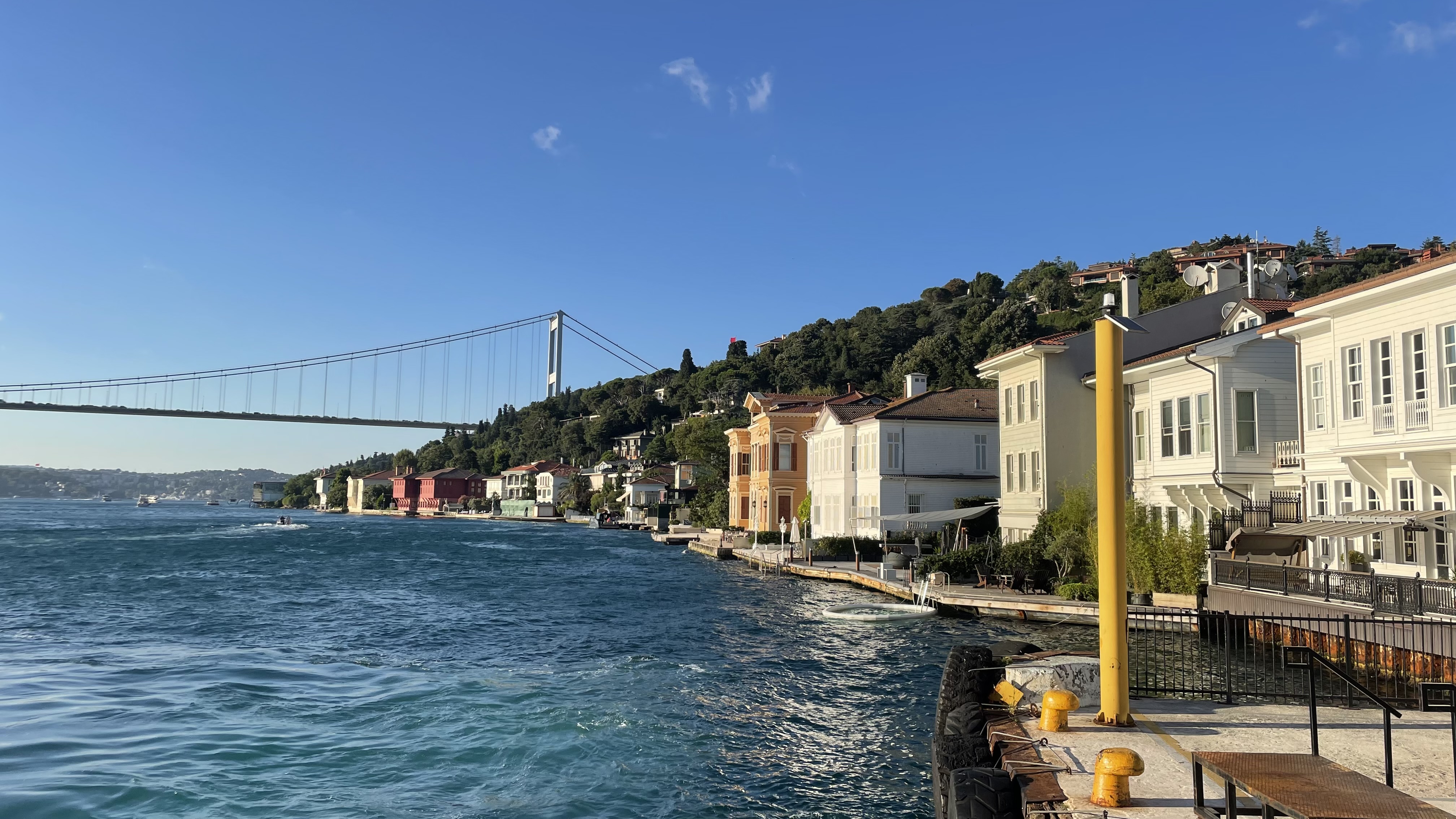
Kabataş is a busy waterside area of Beyoğlu municipality on the European shore of the Bosphorus between Karaköy and Beşiktaş in Istanbul, Turkey. It is a major transport interchange served by the T1 tram line to Bağcılar and the funicular railway to Taksim Square. Ferries depart for Üsküdar and Kadıköy on the Asian shore as well as to the Princes Islands. There are also high-speed ferry services to Bursa Bursa () is a city in northwestern Turkey and the administrative center of Bursa Province. The fourth-most populous city in Turkey and second-most populous in the Marmara Region, Bursa is one of the industrial centers of the country. Most of .... Historical and famous places Kabataş is home to the 19th-century Dolmabahçe Mosque and the Vodafone Park Stadium used by the Beşiktaş J.K. football team. References * Istanbul.com ''Information on Kabataş quarter'' External links Images of Kabataş Detailed map of Kabataş Quarters of Beyoğlu Bo ... [...More Info...] [...Related Items...] OR: [Wikipedia] [Google] [Baidu] |
Taksim Square
Taksim Square (, ), situated in Beyoğlu in the European part of Istanbul, Turkey, is a major tourist and leisure district famed for its restaurants, shops, and hotels. It is considered the heart of modern Istanbul, with the central station of the Istanbul Metro network. Taksim Square is also the location of the Republic Monument () which was crafted by Pietro Canonica and inaugurated in 1928. The monument commemorates the 5th anniversary of the foundation of the Republic of Turkey in 1923, following the Turkish War of Independence. The square is flanked to the south by The Marmara Hotel, to the east by the Atatürk Cultural Centre, to the north by Gezi Park and to the west by Taksim Mosque. Several major roads converge on the square: Gümüşsuyu Caddesi, Cumhuriyet Caddesi, Tarlabaşı Bulvarı, İstiklal Caddesi and Sıraselviler Caddesi. History The word Taksim means "division" or "distribution" in Arabic. Taksim Square was originally the point where the main water lin ... [...More Info...] [...Related Items...] OR: [Wikipedia] [Google] [Baidu] |
Beşiktaş J
Beşiktaş () is a List of districts in Turkey, district and List of municipalities in Turkey, municipality of Istanbul Province, Istanbul Province, Turkey. Its area is 18 km2 and its population is 175,190 (2022). It is located on the European shore of the Bosphorus strait. It is bordered on the north by Sarıyer and Şişli, on the west by Kağıthane and Şişli, on the south by Beyoğlu, and on the east by the Bosphorus. Directly across the Bosphorus is the district of Üsküdar. The district includes a number of important sites along the European shore of the Bosphorus, from Dolmabahçe Palace in the south to the Bebek, Istanbul, Bebek area in the north. It is also home to many inland (and relatively expensive, upper-middle class) neighborhoods such as Levent and Etiler. Some of its other well-known neighborhoods include Yıldız, Beşiktaş, Yıldız, Kuruçeşme, Ortaköy, and Arnavutköy. Beşiktaş' historic commercial centre is the Beşiktaş quarter and Çarşı ... [...More Info...] [...Related Items...] OR: [Wikipedia] [Google] [Baidu] |
Vodafone Park
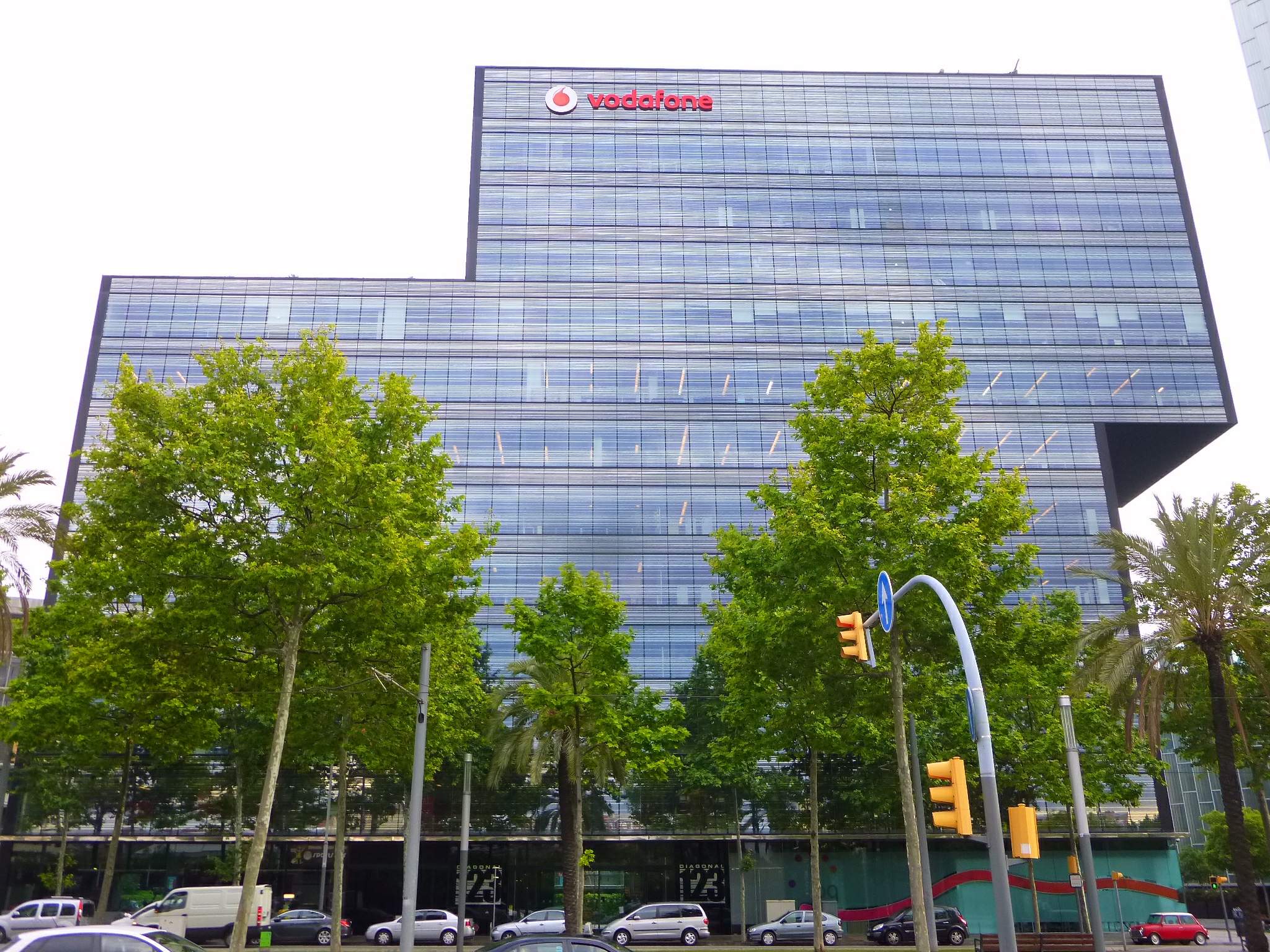
Vodafone Group Public Limited Company () is a British multinational telecommunications company. Its registered office and global headquarters are in Newbury, Berkshire, England. It predominantly operates services in Asia, Africa, Europe, and Oceania. , Vodafone owns and operates networks in 15 countries, with partner networks in 46 further countries. Its Vodafone Global Enterprise division provides telecommunications and IT services to corporate clients in 150 countries. Vodafone has a primary listing on the London Stock Exchange and is a constituent of the FTSE 100 Index. The company has a secondary listing on the NASDAQ as American depositary receipts (ADRs). Name The name Vodafone comes from ''voice data fone'' (the latter a sensational spelling of " phone"), chosen by the company to "reflect the provision of voice and data services over mobile phones". History Racal Telecom: 1980 to 1991 In 1980, Ernest Harrison, then chairman of Racal Electronics Plc – the U ... [...More Info...] [...Related Items...] OR: [Wikipedia] [Google] [Baidu] |
Dolmabahçe Mosque
The Dolmabahçe Mosque () is a baroque waterside mosque in Kabataş, Beyoğlu, Kabataş in the Beyoğlu district of Istanbul, Turkey, close to the Dolmabahçe Palace. It was commissioned by Queen Mother Bezmiâlem Sultan, Bezmialem Valide Sultan and designed by the Turkish Armenian architect, Garabet Balyan in 1855. After his mother's death, Sultan Abdülmecid saw the building work through to completion. The mosque has twin minarets and is distinguished by the huge stone arches on its facades which are cut with large windows, allowing light to flood the interior. From 1956 to 1960 the mosque provided a venue for the Istanbul Naval Museum, Naval Museum, only resuming prayer services in 1967. Road-widening robbed it of its courtyard and Sebil (fountain), sebil that were originally part of the design. Background In the 19th century, the Ottoman Empire covered many territories and had huge influence in Islamic arts. In the year 1853, Queen Mother Bezmiâlem Sultan, Bezmialem Valid ... [...More Info...] [...Related Items...] OR: [Wikipedia] [Google] [Baidu] |
Bursa
Bursa () is a city in northwestern Turkey and the administrative center of Bursa Province. The fourth-most populous city in Turkey and second-most populous in the Marmara Region, Bursa is one of the industrial centers of the country. Most of Turkey's automotive production takes place in Bursa. As of 2019, the Metropolitan Province was home to 3 238 618 inhabitants, 2 283 697 of whom lived in the 3 city urban districts (Osmangazi, Yıldırım and Nilüfer) plus Gürsu and Kestel. Its rich history provides various places of interest in Bursa. Bursa became the capital of the Ottoman Empire (back then the Ottoman Beylik) from 1335 until the 1360s. A more recent nickname is ("") referring to the parks and gardens located across the city, as well as to the vast, varied forests of the surrounding region. Bursa has a rather orderly urban growth and borders a fertile plain. The mausoleums of the early Ottoman sultans are located in Bursa, and the city's main landmarks include nu ... [...More Info...] [...Related Items...] OR: [Wikipedia] [Google] [Baidu] |
Princes' Islands
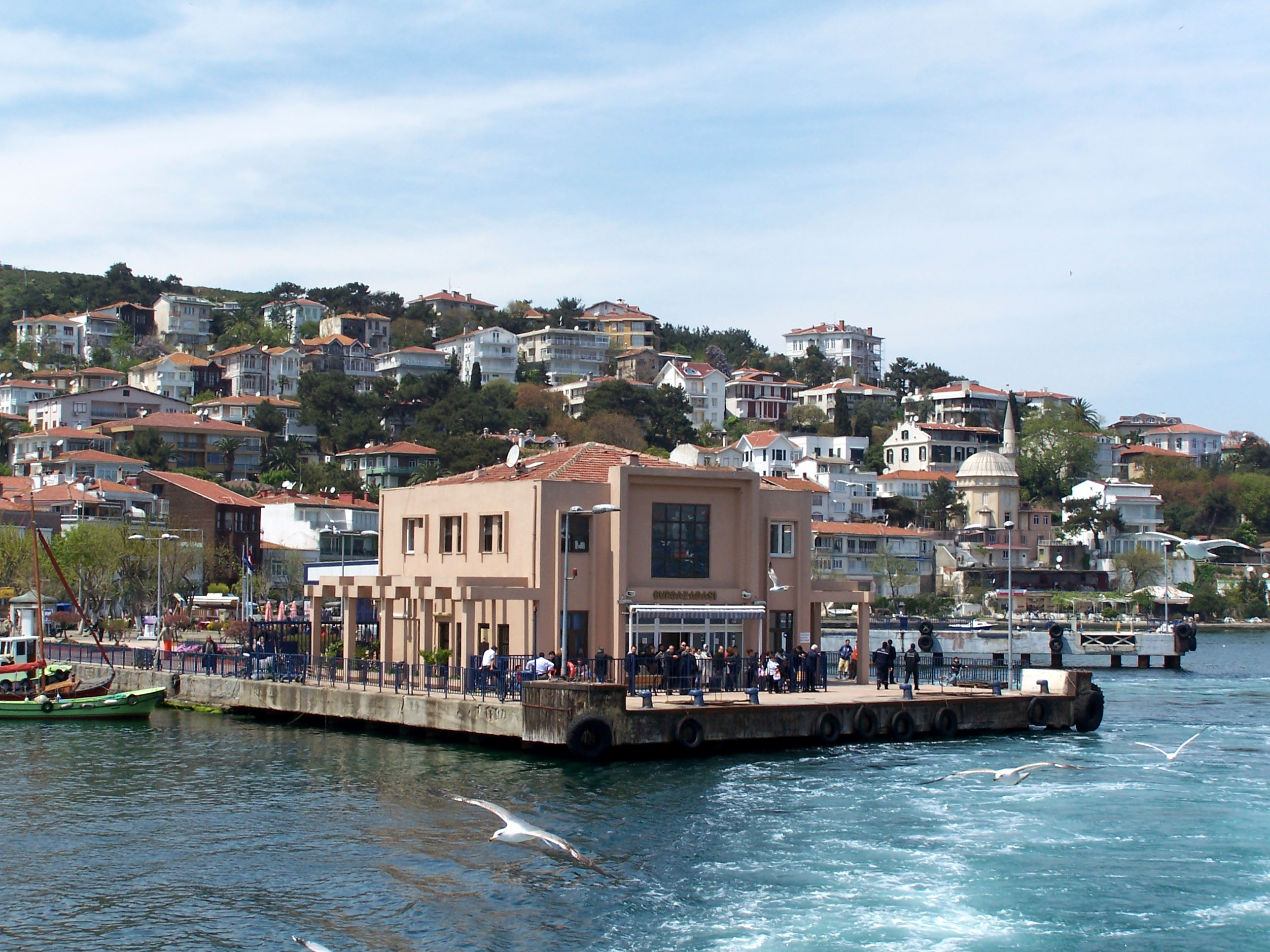
The Princes' Islands (; the word "princes" is plural, because the name means "Islands of the Princes", , ''Pringiponisia''), officially just Adalar (); alternatively the Princes' Archipelago; is an archipelago off the coast of Istanbul, Turkey, in the Sea of Marmara. The islands constitute the municipality and district of Adalar within Istanbul Province. With a total land area of , it is the fifth smallest district in Istanbul, and with a permanent population of 16,690 (2022), it is by far the least populous district in Istanbul. Adalar District is made up of the main 4 Büyükada, Kınalıada, Burgazada and Heybeliada islands and the other smaller islands. Etymology There are several references to the islands in the ancient Greek period, when they went by the name (), often transliterated as ''Demonesi'' or ''Demonisi''. During the Middle Byzantine period the archipelago has been recorded by the 6th century lexicographer Hesychius of Alexandria as (), meaning "demon's ... [...More Info...] [...Related Items...] OR: [Wikipedia] [Google] [Baidu] |
Kadıköy
Kadıköy () is a municipality and Districts of Turkey, district on the Asian side of Istanbul Province, Istanbul Province, Turkey. Its area is 25 km2, and its population is 467,919 (2023). It is a large and populous area in the Asian side of Istanbul, on the northern shore of the Sea of Marmara. It partially faces the historic city centre of Fatih on the European side of the Bosporus. It is bordered by the districts of Üsküdar, to the northwest, Ataşehir, to the northeast, and Maltepe, Istanbul, Maltepe, to the southeast. Kadıköy was known in classical antiquity and during the Roman Empire, Roman and Byzantine Empire, Byzantine eras as Chalcedon (). Chalcedon was known as the 'city of the blind'. The settlement has been under control of many empires, finally being taken by the Ottomans before the fall of Constantinople. At first, Chalcedon was Rural area, rural, but with time it Urbanization, urbanized. Kadıköy separated from the Üsküdar district in 1928. One o ... [...More Info...] [...Related Items...] OR: [Wikipedia] [Google] [Baidu] |
Üsküdar
Üsküdar () is a municipality and district of Istanbul Province, Turkey. Its area is 35 km2, and its population is 524,452 (2022). It is a large and densely populated district on the Anatolian (Asian) shore of the Bosphorus. It is bordered to the north by Beykoz, to the east by Ümraniye, to the southeast by Ataşehir and to the south by Kadıköy; with Karaköy, Kabataş, Beşiktaş, and the historic Sarayburnu quarter of Fatih facing it on the opposite shore to the west. Üsküdar has been a conservative cultural center of the Anatolian side of Istanbul since Ottoman times with its landmark as well as numerous tiny mosques and dergahs. Üsküdar is a major transport hub, with ferries to Eminönü, Karaköy, Kabataş, Beşiktaş and some of the Bosphorus suburbs. Üsküdar is a stop on the Marmaray rail service at the point where it starts its journey under the Bosphorus, re-emerging on the European side at Sirkeci. Via Marmaray, Üsküdar is linked to Gebz ... [...More Info...] [...Related Items...] OR: [Wikipedia] [Google] [Baidu] |
Istanbul Modern Tramways
The Istanbul Tram () is a modern tram system on the European side of Istanbul. The first section, the T1 (Istanbul Tram), T1 opened in 1992, followed by the T2, which opened in 2006. In 2011, the T1 and T2 merged, with the line retaining the T1 (Istanbul Tram), T1 name. The T4 (Istanbul Tram), T4, T5 (Istanbul Tram), T5 and the T6 (Istanbul Tram), T6 lines followed, opening in 2007, 2021 and 2024 respectively. History Istanbul, the former capital of the Ottoman Empire, once had a large tramway network on both the Asian and the European sides. It first started as a horse tram in 1871, and was gradually converted to an electric tram system starting in 1912. Many additional routes were added to the tram system, in progressive stages over time. The network reached its most widespread extent in 1956 with 108 million passengers being carried by 270 tram-cars, on 56 lines. However reflecting developments in many cities around the world during the 1960s, the tram service began to be c ... [...More Info...] [...Related Items...] OR: [Wikipedia] [Google] [Baidu] |
Turkey
Turkey, officially the Republic of Türkiye, is a country mainly located in Anatolia in West Asia, with a relatively small part called East Thrace in Southeast Europe. It borders the Black Sea to the north; Georgia (country), Georgia, Armenia, Azerbaijan, and Iran to the east; Iraq, Syria, and the Mediterranean Sea to the south; and the Aegean Sea, Greece, and Bulgaria to the west. Turkey is home to over 85 million people; most are ethnic Turkish people, Turks, while ethnic Kurds in Turkey, Kurds are the Minorities in Turkey, largest ethnic minority. Officially Secularism in Turkey, a secular state, Turkey has Islam in Turkey, a Muslim-majority population. Ankara is Turkey's capital and second-largest city. Istanbul is its largest city and economic center. Other major cities include İzmir, Bursa, and Antalya. First inhabited by modern humans during the Late Paleolithic, present-day Turkey was home to List of ancient peoples of Anatolia, various ancient peoples. The Hattians ... [...More Info...] [...Related Items...] OR: [Wikipedia] [Google] [Baidu] |


