|
JetSmart Perú
JetSmart Airlines Perú S.A.C., styled as JetSMART, is a Peruvian airline owned by the Chilean ultra low-cost carrier JetSmart, itself owned by Indigo Partners. Its primary base of operations is Jorge Chávez International Airport, servicing Lima, Peru; and has a secondary base at Rodríguez Ballón International Airport, in Arequipa, Peru. Destinations JetSmart Perú operates to the following destinations: Fleet , JetSmart Perú operates an all-Airbus A320neo The Airbus A320neo family is an incremental development of the A320 family of narrow-body airliners produced by Airbus. The A320neo family (''neo'' being Greek for "new", as well as an acronym for "new engine option") is based on the Airbus A3 ... fleet composed of the following aircraft: See also * List of airlines of Peru References External linksOfficial website {{Airlines of Peru Airlines established in 2021 Airlines of Peru Low-cost carriers ... [...More Info...] [...Related Items...] OR: [Wikipedia] [Google] [Baidu] |
Jorge Chávez International Airport
Jorge Chávez International Airport is the main international airport serving Lima, the capital of Peru. It is located in Callao, northwest of the Historic Centre of Lima, the nation's capital city, and from the Miraflores District, Lima, district of Miraflores. In 2023, the airport served 22,876,785 passengers. Historically, the airport was the hub for Faucett Perú, Compañía de Aviación Faucett, which was the second oldest airline in the Americas, and Aeroperu, Aeroperú, which served as Peru's flag carrier. Now it serves as a airline hub, hub for many aviation companies. The airport was named after Peruvian aviator Jorge Chávez (1887–1910). It is among the busiest and largest airports in South America, providing international flights to North America, South America, Central America, the Caribbean and Europe, along with domestic flights in Peru. In 2022 it entered the list of the 50 most important air hubs worldwide, occupying position number 47 after having been in po ... [...More Info...] [...Related Items...] OR: [Wikipedia] [Google] [Baidu] |
José Joaquín De Olmedo International Airport
José Joaquín de Olmedo International Airport (; ) is an international airport serving Guayaquil, the capital of the Guayas Province and the most populous city in Ecuador. It is the second busiest airport in Ecuador. The airport was named after José Joaquín de Olmedo, a notable Ecuadorian poet, first mayor of Guayaquil, and former president of Ecuador. It was changed from Simón Bolívar International Airport, which is currently the name of the airports in Caracas, Venezuela, and Santa Marta, Colombia. The airport is on the Avenida de las Américas, north of Guayaquil's centre. The runway length of includes a displaced threshold on Runway 21 and a displaced threshold on Runway 03. The runway can accommodate Boeing 747 and Airbus A340-600 aircraft. The airport is in the broad delta of the Guayas River, with level terrain in all quadrants. In July 2014, the airport domestic area was enlarged; now the airport is capable of handling up to 7.5 million passengers per year. ... [...More Info...] [...Related Items...] OR: [Wikipedia] [Google] [Baidu] |
Piura
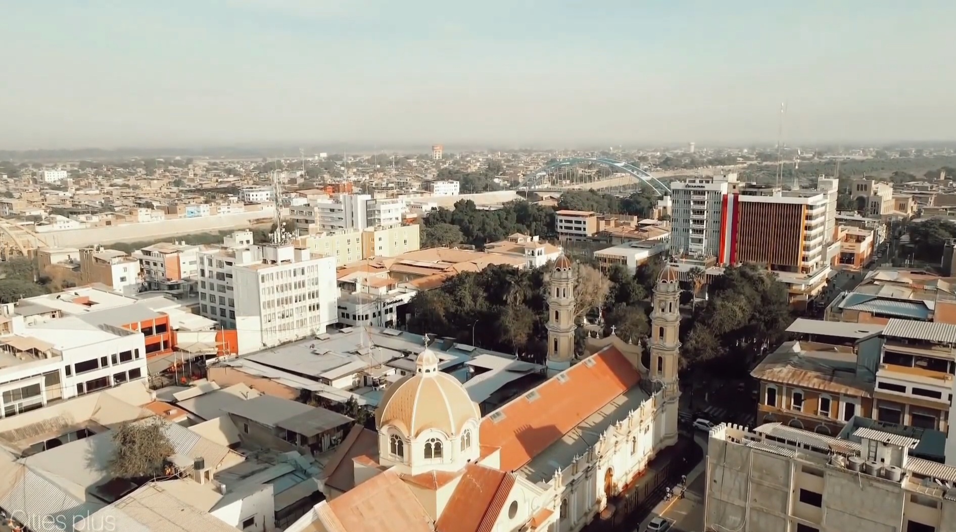
Piura is a city in northwestern Peru, located north of the Sechura Desert along the Piura River. It is the capital of the Piura Region and the Piura Province. Its population was 484,475 as of 2017 and it is the 7th most populous city in Peru. The city is located in the central eastern part of the Piura Region, 981 kilometers from the country's capital, Lima and is near to the border with Ecuador. It was here that Spanish Conqueror Francisco Pizarro founded the third Spanish city in South America and first in Peru, under the name of ''San Miguel de Piura'', in JulyHemming, J., 1970, The Conquest of the Incas, New York: Harcourt Brace Jovanovich, Inc., or August of 1532. Piura declared its independence from Spain on 4 January 1821, a few months before Peru gained its independence on 28 July 1821. It is the commercial and administrative center of the Department of Piura. Symbols Coat of arms The coat of arms of Piura was created by the Spanish Crown on December 7, 1537, thr ... [...More Info...] [...Related Items...] OR: [Wikipedia] [Google] [Baidu] |
Inca Manco Cápac International Airport
Inca Manco Cápac International Airport , known as ''Aeropuerto Internacional Inca Manco Cápac'' in Spanish, is an extremely high elevation airport serving in the city of Juliaca in Peru, west of Titicaca Lake. Airport operations are run by Corporación Peruana de Aeropuertos y Aviación Comercial S.A. (CORPAC), a government entity that oversees management of Peruvian airports. Despite being classified as international, the airport does not feature any scheduled international nonstop flights. The airport has one of the longest runways in Latin America and the longest in Peru. The airport was named after Inca Manco Cápac, founder of the Inca civilization in Cusco. Airlines and destinations The airport is currently served by the following airlines: See also * Transport in Peru * List of airports in Peru *List of highest commercial airports This is a list of the world's highest civilian airports, situated at a minimum elevation of Height above sea level, above mean ... [...More Info...] [...Related Items...] OR: [Wikipedia] [Google] [Baidu] |
Juliaca
Juliaca (; Quechua language, Quechua and ) is the capital of San Román Province in the Puno Region of southeastern Peru. It is the region's largest city with a population of 276,110 inhabitants (2017 Peru Census, 2017). On the Altiplano, Juliaca is above sea level, is located on the Collao Plateau and is northwest of Lake Titicaca (45 km), near Chachas Lake, the Maravillas river, and near the ruins of Sillustani. It is the largest trade center in the Puno region. The city hosts Carnaval Juliaca each year between February and March. During this very popular event participants, dressed in colorful costumes, gather on the streets to dance in the style of the Collao Plateau. Saint Sebastian's feast is celebrated on 20 January of every year. Juliaca's citizens rely on cars, trains, and bicycles. It is a major transit point in the region and has strong ties with Peru's southern cities, including Arequipa, Puno, Tacna, Cuzco, Ilo, Peru, Ilo, and with La Rinconada, Peru, La Rincon ... [...More Info...] [...Related Items...] OR: [Wikipedia] [Google] [Baidu] |
Coronel FAP Francisco Secada Vignetta International Airport
Coronel (Crnl.) FAP Francisco Secada Vignetta International Airport is an airport serving Iquitos, capital of Loreto Region and Peru's fifth largest city. It is also known as Iquitos International Airport, and is one of the main airports in Peru. It is located 7 km (4 miles) to the southeast of the center of Iquitos. It has a single runway 2,500 m (8,202 ft) in length. It is the only airport in Amazonia with the ISO9001 stamp. The airport plays a particularly important logistical and economic role because the city of Iquitos is only accessible by air or by river. Iquitos and FAP Captain David Abensur Rengifo International Airport, Pucallpa are the main air hubs in the Peruvian Amazon. History In 1973, Iquitos Airport changed its name in commemoration of a pilot of the Peruvian Air Force, Francisco Secada Vignetta, who was born in Iquitos and made his name in the Leticia Incident, war with Colombia that took place between 1932 and 1933. It currently administered by Aeropuerto ... [...More Info...] [...Related Items...] OR: [Wikipedia] [Google] [Baidu] |
Iquitos
Iquitos (; ) is the capital city of Peru's Maynas Province, Peru, Maynas Province and Loreto Region. It is the largest metropolis in the Peruvian Amazon, east of the Andes, as well as the List of cities in Peru, ninth-most populous city in Peru. Iquitos is the largest city in the world that cannot be reached by road that is not on an island; it is only accessible by river and air. It is known as the "capital of the Peruvian Amazon". The city is located in the Great Plains of the Amazon Basin, fed by the Amazon River, Amazon, Nanay River, Nanay, and Itaya River, Itaya rivers. Overall, it constitutes the Iquitos metropolitan area, a conurbation of 471,993 inhabitants consisting of four districts: Iquitos District, Iquitos, Punchana District, Punchana, Belén District, Maynas, Belén, and San Juan Bautista District, Maynas, San Juan Bautista. The area has long been inhabited by indigenous peoples. According to Spanish historical documents, Iquitos was established around 1757 as a ... [...More Info...] [...Related Items...] OR: [Wikipedia] [Google] [Baidu] |
Alejandro Velasco Astete International Airport
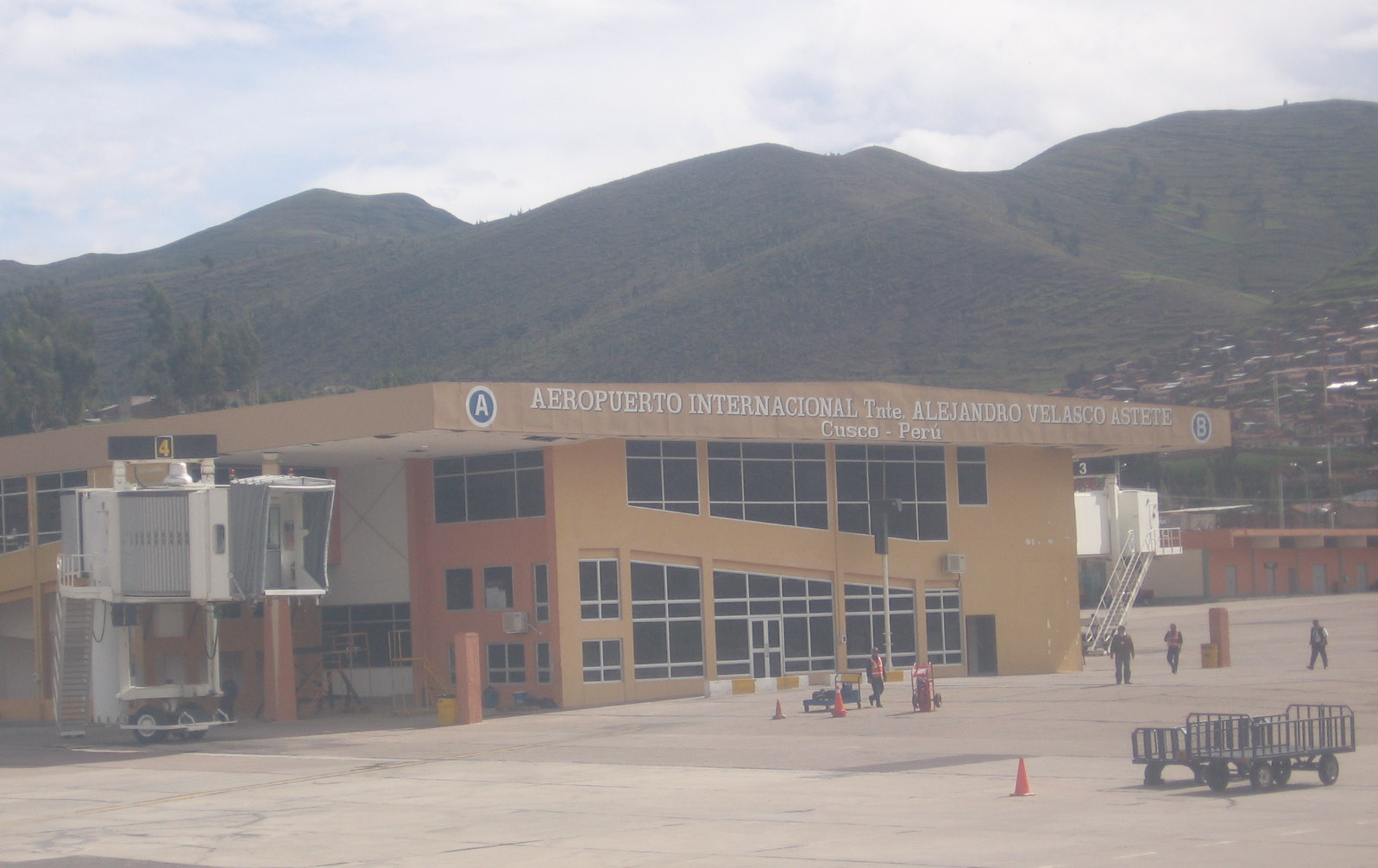
Alejandro Velasco Astete International Airport is an international airport located in the city of Cusco, in southeastern Peru. Cusco, a principal tourist attraction in Latin America, receives various domestic flights as well as some international flights. The runway is completely paved. It operates at limited capacity due to its precarious location near the city's center. Despite these limitations, the airport has consistently ranked as Peru's second most important air terminal, handling 3,004,412 national and international passengers in 2023, as reported by CORPAC. Name It was named in honor of the Peruvian pilot Alejandro Velasco Astete who was the first aeroplane pilot to cross the Andes in 1925. This first flight was from Lima directly to Cusco. Later that year, in September, while trying to avoid crashing into spectators at an airshow in the city of Puno he crashed and was killed. In recognition of his pioneering achievements in Peruvian aviation history, the airport ... [...More Info...] [...Related Items...] OR: [Wikipedia] [Google] [Baidu] |
Cuzco
Cusco or Cuzco (; or , ) is a city in southeastern Peru, near the Sacred Valley of the Andes mountain range and the Huatanay river. It is the capital of the eponymous province and department. The city was the capital of the Inca Empire until the 16th-century Spanish conquest. In 1983, Cusco was declared a World Heritage Site by UNESCO with the title " City of Cusco". It has become a major tourist destination, hosting over 2 million visitors a year and providing passage to numerous Incan ruins, such as Machu Picchu, one of the Seven modern wonders of the world and many others. The Constitution of Peru (1993) designates the city as the Historical Capital of Peru. Cusco is the seventh-most populous city in Peru; in 2017, it had a population of 428,450. It is also the largest city in the Peruvian Andes and the region is the seventh-most populous metropolitan area of Peru. Its elevation is around . The largest district in the city is the Cusco District, which has a po ... [...More Info...] [...Related Items...] OR: [Wikipedia] [Google] [Baidu] |
FAP Captain José Abelardo Quiñones González International Airport
Capitán FAP José A. Quiñones González International Airport is an airport serving Chiclayo, Peru and the surrounding metropolitan area. It is run by ADP, a private airport operator that operates various airports in northern Peru. It is the main airport of the Lambayeque Region, one of the most populous regions of Peru. The airport is also used by the Peruvian Air Force (, FAP). It hosts one of the Air Force's two air superiority/interceptor squadrons, ''Escuadrón Aéreo 612'' (Fighter Squadron 612 "Fighting Cocks"). The blast shelters housing the squadron's Mig 29 The Mikoyan MiG-29 (; NATO reporting name: Fulcrum) is a twinjet, twin-engine fighter aircraft designed in the Soviet Union. Developed by the Mikoyan design bureau as an air superiority fighter during the 1970s, the MiG-29, along with the large ... aircraft are visible from the airport runways. The airport is named after Jose Quiñones Gonzalez, an FAP pilot who was killed during the July 1941 Ecuadorian-P ... [...More Info...] [...Related Items...] OR: [Wikipedia] [Google] [Baidu] |
Chiclayo
Chiclayo (; mochica language, Mochica: ''Cɥiclaiæp'') is the principal city and capital of the Lambayeque region and Chiclayo Province in northern Peru. It is located from the Pacific coast, from the city of Trujillo, Peru, Trujillo, and from the country's capital, Lima. The city was originally founded by Spanish priests as "Santa María de los Valles de Chiclayo" in the 16th century, acting as a small town of passage and rest of travelers. It was declared an official city on 15 April 1835 by president Felipe Santiago Salaverry. He named Chiclayo "the Heroic City" to recognize the courage of its citizens in the fight for independence, a title it still holds. Other nicknames for Chiclayo include "The Capital of Friendship" and the "Pearl of the North", due to its kind and friendly nature of its people. Chiclayo is Peru's List of 20 largest cities in Peru, fourth-largest city, after Lima, Arequipa, and Trujillo, with a population of 738,000 as of 2011. [...More Info...] [...Related Items...] OR: [Wikipedia] [Google] [Baidu] |
Mayor General FAP Armando Revoredo Iglesias Airport
Mayor General FAP Armando Revoredo Iglesias Airport , known in Spanish as ''Aeropuerto Mayor General FAP Armando Revoredo Iglesias'' (with ''Mayor General'' often abbreviated as ''My. Gral.''), is an airport serving Cajamarca, capital of the Cajamarca Region in Peru. It is run by CORPAC S.A. (Corporación Peruana de Aeropuertos y Aviación Comercial S.A.), a government organization that oversees management of Peruvian airports. The runway has high terrain to the north. The Cajamarca non-directional beacon A non-directional beacon (NDB) or non-directional radio beacon is a radio beacon which does not include directional information. Radio beacons are radio transmitters at a known location, used as an aviation or marine navigational aid. NDB are i ... (Ident: MAR) is located on the field. Airlines and destinations The following airlines serve the airport: See also * Transport in Peru * List of airports in Peru References External links *OpenStreetMap - Cajamarca< ... [...More Info...] [...Related Items...] OR: [Wikipedia] [Google] [Baidu] |


