|
Illhorn
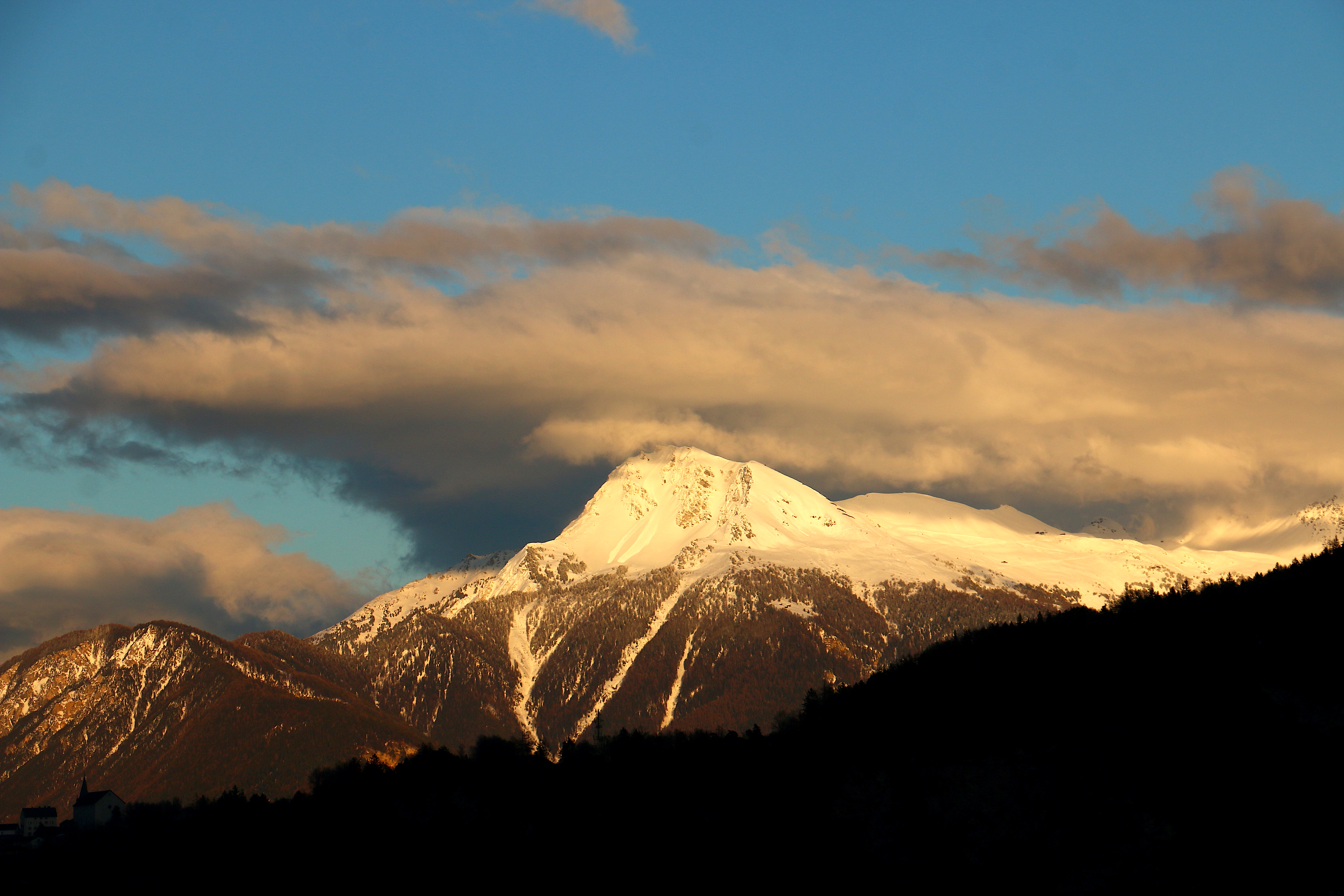
The Illhorn is a mountain of the Swiss Pennine Alps, overlooking Chandolin in the canton of Valais. With a height of 2,717 metres above sea level, it is the highest point of the Illgraben valley. Illgraben debris flows The Illgraben catchment extends from the summit of the Illhorn to the Rhone at an elevation of 610m, and experiences debris flows and mud slide A mudflow or mud flow is a form of mass wasting involving fast-moving flow of debris that has become liquified by the addition of water. Such flows can move at speeds ranging from 3 meters/minute to 5 meters/second. Mudflows contain a significa ...s several times annually. The largest recorded debris flow in the valley occurred in June 1961, and had a volume of several hundred thousand cubic metres. A warning system gives alert signals 5–15 minutes before the arrival of debris flows at channel crossings. The area is a popular hiking spot and these geomorphological processes are visible most years. References ... [...More Info...] [...Related Items...] OR: [Wikipedia] [Google] [Baidu] |
Illhorn Aus Dem Westen Betrachtet
The Illhorn is a mountain of the Swiss Pennine Alps, overlooking Chandolin in the canton of Valais. With a height of 2,717 metres above sea level, it is the highest point of the Illgraben valley. Illgraben debris flows The Illgraben catchment extends from the summit of the Illhorn to the Rhone at an elevation of 610m, and experiences debris flows and mud slide A mudflow or mud flow is a form of mass wasting involving fast-moving flow of debris that has become liquified by the addition of water. Such flows can move at speeds ranging from 3 meters/minute to 5 meters/second. Mudflows contain a significa ...s several times annually. The largest recorded debris flow in the valley occurred in June 1961, and had a volume of several hundred thousand cubic metres. A warning system gives alert signals 5–15 minutes before the arrival of debris flows at channel crossings. The area is a popular hiking spot and these geomorphological processes are visible most years. References ... [...More Info...] [...Related Items...] OR: [Wikipedia] [Google] [Baidu] |
Illsee
__NOTOC__ Illsee is a natural lake used as a reservoir above Sierre, in the Valais, Switzerland. Its surface area is . See also *List of mountain lakes of Switzerland This is a list of high-altitude lakes in Switzerland. It includes all significant lakes, natural or artificial, with an area over 4 hectares and a height over 800 metres above sea level. This height approximately corresponds to the transiti ... Lakes of Valais Reservoirs in Switzerland {{valais-lake-stub ... [...More Info...] [...Related Items...] OR: [Wikipedia] [Google] [Baidu] |
Swisstopo
Swisstopo is the official name for the Swiss Federal Office of Topography (in German language, German: ''Bundesamt für Landestopografie''; French language, French: ''Office fédéral de topographie''; Italian language, Italian: ''Ufficio federale di topografia''; Romansh language, Romansh: ''Uffizi federal da topografia''), Switzerland's national mapping agency. The current name was made official in 2002. It had been in use as the domain name for the institute's homepage, swisstopo.ch, since 1997. Maps The main class of products produced by Swisstopo are topographical maps on seven different Scale (map), scales. Swiss maps have been praised for their accuracy and quality. Regular maps * 1:25.000. This is the most detailed map, useful for many purposes. Those are popular with tourists, especially for famous areas like Zermatt and St. Moritz. These maps cost CHF 13.50 each (2004). 208 maps on this scale are published at regular intervals. The first map published on this scale ... [...More Info...] [...Related Items...] OR: [Wikipedia] [Google] [Baidu] |
Valais
Valais ( , , ; frp, Valês; german: Wallis ), more formally the Canton of Valais,; german: Kanton Wallis; in other official Swiss languages outside Valais: it, (Canton) Vallese ; rm, (Chantun) Vallais. is one of the cantons of Switzerland, 26 cantons forming the Switzerland, Swiss Confederation. It is composed of thirteen districts and its capital and largest city is Sion, Switzerland, Sion. The flag of the canton is made of thirteen stars representing the districts, on a white-red background. Valais is situated in the southwestern part of Switzerland, the country. It borders the cantons of Canton of Vaud, Vaud and Canton of Bern, Bern to the north, the cantons of Canton of Uri, Uri and Ticino to the east, as well as Italy to the south and France to the west. It is one of the three large southern Alps, Alpine cantons, along with Ticino and the Grisons, which encompass a vast diversity of ecosystems. It is a bilingual canton, French language, French and German language, German ... [...More Info...] [...Related Items...] OR: [Wikipedia] [Google] [Baidu] |
Switzerland
). Swiss law does not designate a ''capital'' as such, but the federal parliament and government are installed in Bern, while other federal institutions, such as the federal courts, are in other cities (Bellinzona, Lausanne, Luzern, Neuchâtel, St. Gallen a.o.). , coordinates = , largest_city = Zürich , official_languages = , englishmotto = "One for all, all for one" , religion_year = 2020 , religion_ref = , religion = , demonym = , german: Schweizer/Schweizerin, french: Suisse/Suissesse, it, svizzero/svizzera or , rm, Svizzer/Svizra , government_type = Federalism, Federal assembly-independent Directorial system, directorial republic with elements of a direct democracy , leader_title1 = Federal Council (Switzerland), Federal Council , leader_name1 = , leader_title2 = , leader_name2 = Walter Thurnherr , legislature = Fe ... [...More Info...] [...Related Items...] OR: [Wikipedia] [Google] [Baidu] |
Pennine Alps
The Pennine Alps (german: Walliser Alpen, french: Alpes valaisannes, it, Alpi Pennine, la, Alpes Poeninae), also known as the Valais Alps, are a mountain range in the western part of the Alps. They are located in Switzerland (Valais) and Italy (Piedmont and the Aosta Valley). The Pennine Alps are amongst the three highest major subranges of the Alps, together with the Bernese Alps and the Mont Blanc massif. Geography The Italian side is drained by the rivers Dora Baltea, Sesia and Toce, tributaries of the Po. The Swiss side is drained by the Rhône. The Great St Bernard Tunnel, under the Great St Bernard Pass, leads from Martigny, Switzerland to Aosta. Morphology The main chain ( watershed between the Mediterranean Sea and the Adriatic Sea) runs from west to east on the border between Italy (south) and Switzerland (north). From Mont Vélan, the first high summit east of St Bernard Pass, the chain rarely goes below 3000 metres and contains many four-thousanders such as Mat ... [...More Info...] [...Related Items...] OR: [Wikipedia] [Google] [Baidu] |
Mountain
A mountain is an elevated portion of the Earth's crust, generally with steep sides that show significant exposed bedrock. Although definitions vary, a mountain may differ from a plateau in having a limited Summit (topography), summit area, and is usually higher than a hill, typically rising at least 300 metres (1,000 feet) above the surrounding land. A few mountains are Monadnock, isolated summits, but most occur in mountain ranges. Mountain formation, Mountains are formed through Tectonic plate, tectonic forces, erosion, or volcanism, which act on time scales of up to tens of millions of years. Once mountain building ceases, mountains are slowly leveled through the action of weathering, through Slump (geology), slumping and other forms of mass wasting, as well as through erosion by rivers and glaciers. High elevations on mountains produce Alpine climate, colder climates than at sea level at similar latitude. These colder climates strongly affect the Montane ecosystems, ecosys ... [...More Info...] [...Related Items...] OR: [Wikipedia] [Google] [Baidu] |
Chandolin
Chandolin is a village in the district of Sierre in the Swiss canton of Valais. An independent municipality before, it merged on 1 January 2009 with neighboring Ayer, Grimentz, Saint Jean, Saint-Luc and Vissoie to form the municipality of Anniviers.Amtliches Gemeindeverzeichnis der Schweiz published by the Swiss Federal Statistical Office accessed 19 July 2011 History Chandolin is first mentioned about 1250 as ''Eschandulyns''. Chandolin was the permanent home of Swiss travel writer until her death, and it now houses the Ella Maillart Museum in her memory.Coat of arms [...More Info...] [...Related Items...] OR: [Wikipedia] [Google] [Baidu] |
Illgraben
The small Illgraben valley is one of the most geologically unstable regions of Switzerland, and is located south of Leuk in the Canton of Valais. Geology and geography The valley consists of triassic dolomite, porous limestone and quartzite,WSL video "Spectacular mudslide research site in Valais", April 2022, see Literature section and due to intense weathering, the valley is well-known among geologists as a place to study processes like erosion, rockfall, debris and mud flows. Likewise, the Illgraben serves as a laboratory to test mudflow warning systems. The Swiss Federal Institute for Forest, Snow and Landscape Research uses radars, microphones and cameras to register mudflow events, and to warn the population of Leuk. Due to the unique geology, mudflows occur two to three times a year, while places threatened by mudflows usually experience only one every 30 to 40 years. Several times a year, the Illgraben's mud flows cause the Rhône river to turn murky until it reaches L ... [...More Info...] [...Related Items...] OR: [Wikipedia] [Google] [Baidu] |
Debris Flow
Debris flows are geological phenomena in which water-laden masses of soil and fragmented rock rush down mountainsides, funnel into stream channels, entrain objects in their paths, and form thick, muddy deposits on valley floors. They generally have bulk densities comparable to those of rock avalanches and other types of landslides (roughly 2000 kilograms per cubic meter), but owing to widespread sediment liquefaction caused by high pore-fluid pressures, they can flow almost as fluidly as water. Debris flows descending steep channels commonly attain speeds that surpass 10 m/s (36 km/h), although some large flows can reach speeds that are much greater. Debris flows with volumes ranging up to about 100,000 cubic meters occur frequently in mountainous regions worldwide. The largest prehistoric flows have had volumes exceeding 1 billion cubic meters (i.e., 1 cubic kilometer). As a result of their high sediment concentrations and mobility, debris flows can be very des ... [...More Info...] [...Related Items...] OR: [Wikipedia] [Google] [Baidu] |
Mud Slide
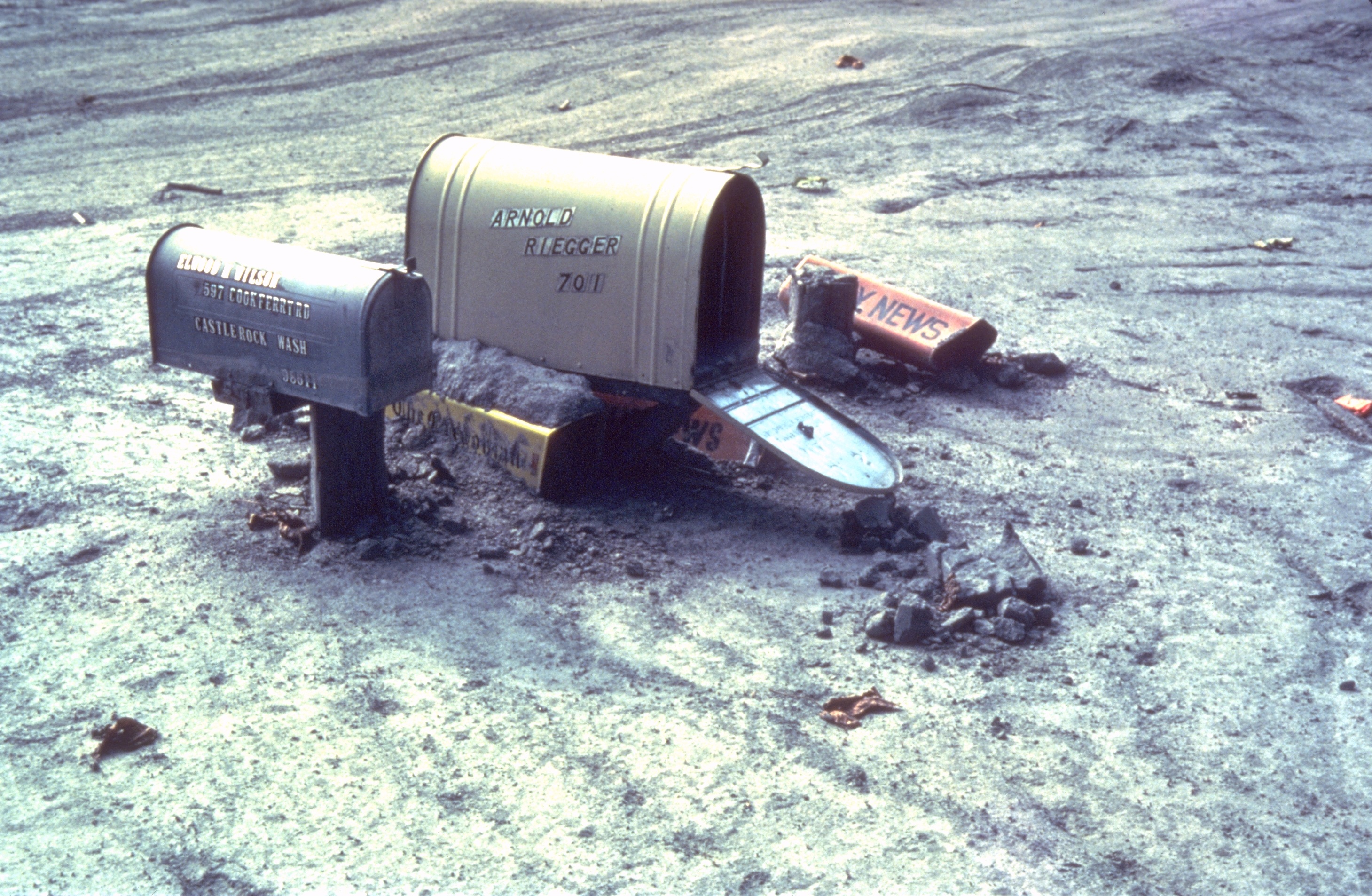
A mudflow or mud flow is a form of mass wasting involving fast-moving flow of debris that has become liquified by the addition of water. Such flows can move at speeds ranging from 3 meters/minute to 5 meters/second. Mudflows contain a significant proportion of clay, which makes them more fluid than debris flows, allowing them to travel farther and across lower slope angles. Both types of flow are generally mixtures of particles with a wide range of sizes, which typically become sorted by size upon deposition. Mudflows are often called mudslides, a term applied indiscriminately by the mass media to a variety of mass wasting events. Mudflows often start as slides, becoming flows as water is entrained along the flow path; such events are often called flow slides. Other types of mudflows include lahars (involving fine-grained pyroclastic deposits on the flanks of volcanoes) and jökulhlaups (outbursts from under glaciers or icecaps). A statutory definition of "flood-related mudsli ... [...More Info...] [...Related Items...] OR: [Wikipedia] [Google] [Baidu] |


