|
Interstate 49
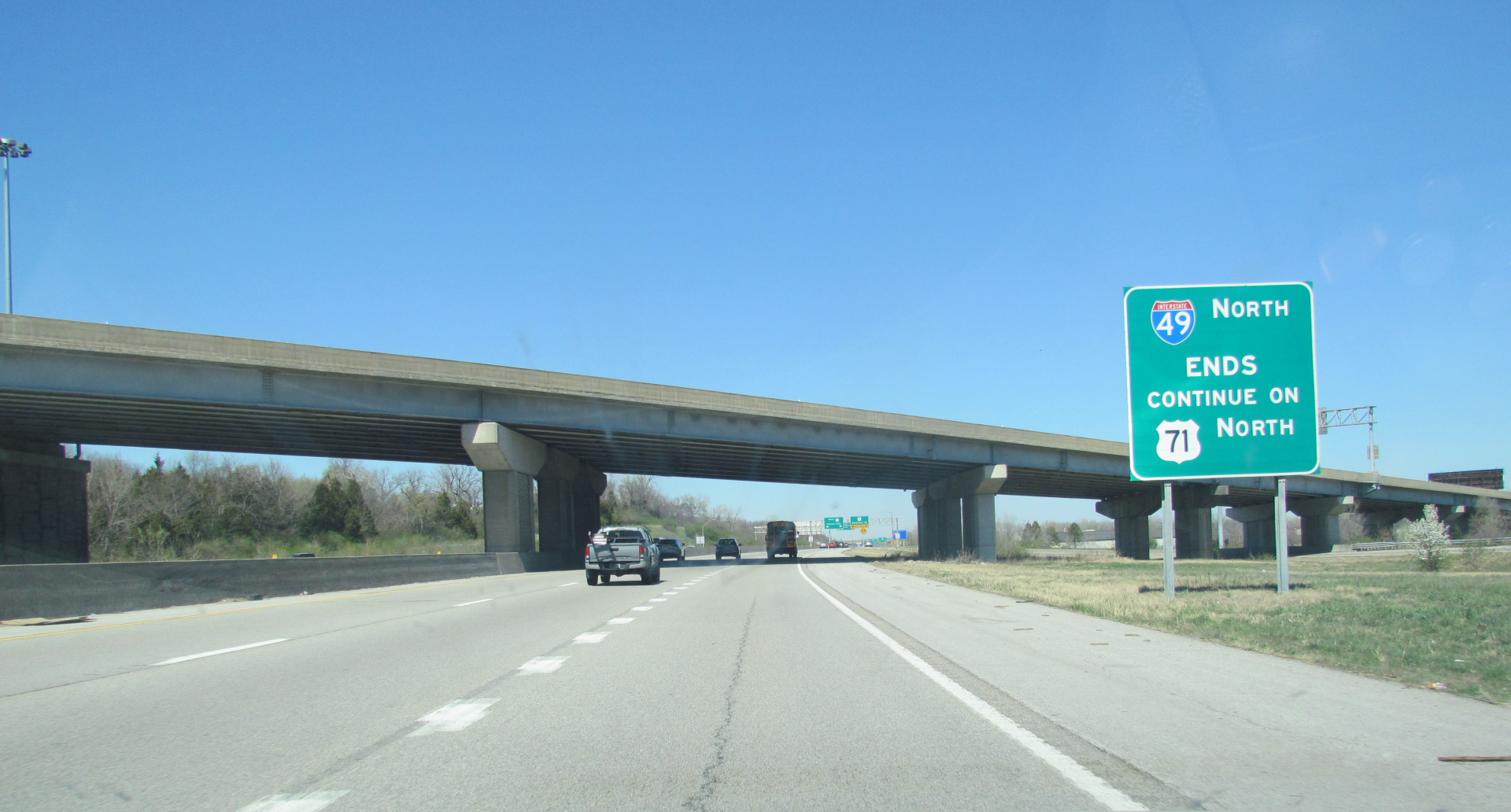
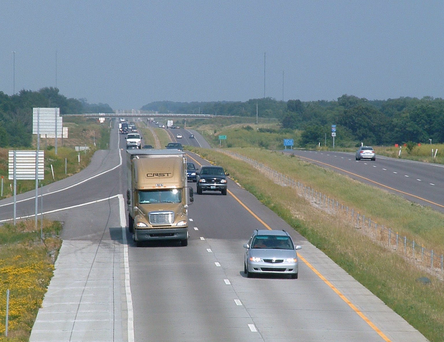
Interstate 49 (I-49) is a north–south Interstate Highway with multiple segments. The original portion is entirely within Louisiana with an additional signed portion extending from Interstate 220 (Louisiana), I-220 in Shreveport, Louisiana, Shreveport to the Arkansas state line, three newer sections are in Arkansas, and one section in Missouri. Its southern terminus is in Lafayette, Louisiana, at Interstate 10 in Louisiana, I-10 while its northern terminus is in Kansas City, Missouri, at Interstate 435, I-435 and Interstate 470 (Missouri), I-470. Future plans include portions of the remaining roadway in Louisiana, Arkansas, and Texas, to link Kansas City, Missouri with New Orleans. Although not part of the original 1957 Interstate Highway plan, residents of Missouri, Arkansas, and Louisiana began campaigning for the highway in 1965 via the "US 71 - I-29 Association". The campaign called for Interstate 29, I-29 to be extended south from Kansas City to New Orleans follo ... [...More Info...] [...Related Items...] OR: [Wikipedia] [Google] [Baidu] |
Lafayette, Louisiana
Lafayette ( , ) is the most populous city in and parish seat of Lafayette Parish, Louisiana, Lafayette Parish in the U.S. state of Louisiana, located along the Vermilion River (Louisiana), Vermilion River. It is Louisiana's List of municipalities in Louisiana, fourth-most populous city with a 2020 United States census, 2020 census population of 121,374; the consolidated city-parish's population was 241,753 in 2020. The Lafayette metropolitan area, Louisiana, Lafayette metropolitan area was Louisiana's third largest metropolitan statistical area with a population of 478,384 at the 2020 census. The Acadiana region containing Lafayette is the largest population and economic corridor between Houston, Texas and New Orleans. Originally established as Vermilionville in the 1820s and incorporated in 1836, Lafayette developed as an agricultural community until the introduction of retail and entertainment centers, and the discovery of oil in the area in the 1940s. Since the discovery of o ... [...More Info...] [...Related Items...] OR: [Wikipedia] [Google] [Baidu] |
Interstate 29
Interstate 29 (I-29) is an Interstate Highway in the Midwestern United States. I-29 runs from Kansas City, Missouri, at a junction with I-35 and I-70, to the Canada–US border near Pembina, North Dakota, where it connects with Manitoba Provincial Trunk Highway 75 (PTH 75), which continues on to Winnipeg. The road follows the course of three major rivers, all of which form the borders of US states. The southern portion of I-29 closely parallels the Missouri River from Kansas City northward to Sioux City, Iowa, where it crosses and then parallels the Big Sioux River. For the northern third of the highway, it closely follows the Red River of the North. The major cities that I-29 connects to includes (from south to north) Council Bluffs, Iowa; Sioux City, Iowa; Sioux Falls, South Dakota; Fargo, North Dakota; and Grand Forks, North Dakota. I-29 also serves as a road connection between the four largest public universities in the Dakotas: the University of North Dak ... [...More Info...] [...Related Items...] OR: [Wikipedia] [Google] [Baidu] |
Sunset, Louisiana
Sunset is a town in St. Landry Parish, Louisiana, United States. The population was 2,897 at the 2010 census, up from 2,352 in 2000. It is part of the Opelousas– Eunice Micropolitan Statistical Area. Geography According to the United States Census Bureau, the town has a total area of 3.1 square miles (8.1 km), of which 3.1 square miles (8.1 km) is land and 0.04 square mile (0.1 km) (0.96%) is water. Demographics 2020 census As of the 2020 United States census, there were 2,909 people, 1,063 households, and 796 families residing in the town. 2010 census As of the census of 2010, there were 2,897 people, 1,129 households, and 787 families residing in the town. The population density was . There were 1,226 housing units at an average density of . The racial makeup of the town was 46.8% White, 48.9% African American, 0.5% Native American, 0.1% Asian, 0.1% from other races, and 0.9% from two or more races. Hispanic or Latino of any rac ... [...More Info...] [...Related Items...] OR: [Wikipedia] [Google] [Baidu] |
Carencro, Louisiana
Carencro (; historically ) is a city in Lafayette Parish, Louisiana, United States. It is a suburb of the nearby city of Lafayette. The population was 7,526 at the 2010 census, up from 6,120 in 2000; at the 2020 census, its population was 9,272. The name of the city is derived from the Cajun French word for buzzard; the spot where the community was settled was one where large flocks of American black vultures roosted in the bald cypress trees. The name means "carrion crow." Carencro is part of the Lafayette metropolitan area. Etymology Many senior Carencro natives attest that the town's name originates from before the American Civil War. According to this local legend, Native Americans told Vermilionville settlers that in old times a large number of "carrion crows" (vultures, called ''carencro'' in French) had settled around the Vermilion River between Lafayette and Opelousas, Louisiana to feast on a fish die-off. There is a related theory, consistent with the spelli ... [...More Info...] [...Related Items...] OR: [Wikipedia] [Google] [Baidu] |
Louisiana Highway 182
Louisiana Highway 182 (LA 182) is a state highway located in central and southeastern Louisiana. It runs in a northwest to southeast direction from LA 29 in Whiteville to U.S. Highway 90 (US 90) north of Raceland. Along the way, the highway serves the cities of Opelousas, Lafayette, New Iberia, Morgan City, and Houma. LA 182 is generally bannered as a north–south highway north of Lafayette (where it largely parallels US 167) and as an east–west highway from Lafayette to Raceland (where it parallels US 90). Today, most of LA 182 follows the previous alignments of US 90 and US 167 before their re-routing onto newer four-lane alignments. Additionally, the former US 90 alignment between Lafayette and Raceland was once part of the earlier Old Spanish Trail and is still known as such in many places along the route. In 2015, a rerouting of LA 182 around Broussard via LA 89-1 and US 90, along w ... [...More Info...] [...Related Items...] OR: [Wikipedia] [Google] [Baidu] |
Limited-access
A limited-access road, known by various terms worldwide, including limited-access highway, partial controlled-access highway, and expressway, is a highway or arterial road for high-speed traffic which has many or most characteristics of a controlled-access highway (also known as a ''freeway'' or ''motorway''), including limited or no access to adjacent property; some degree of separation of opposing traffic flow (often being dual carriageways); use of grade separated interchanges to some extent; prohibition of slow modes of transport, such as bicycles, horse-drawn vehicles or ridden horses, or self-propelled agricultural machines; and very few or no intersecting cross-streets or level crossings. The degree of isolation from local traffic allowed varies between countries and regions. The precise definition of these terms varies by jurisdiction.'' Manual on Uniform Traffic Control Devices''Section 1A.13 Definitions of Words and Phrases in This Manual "Expressway—a divided highw ... [...More Info...] [...Related Items...] OR: [Wikipedia] [Google] [Baidu] |
Cloverleaf Interchange
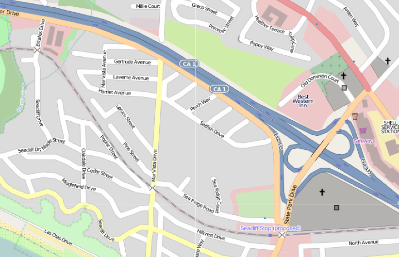
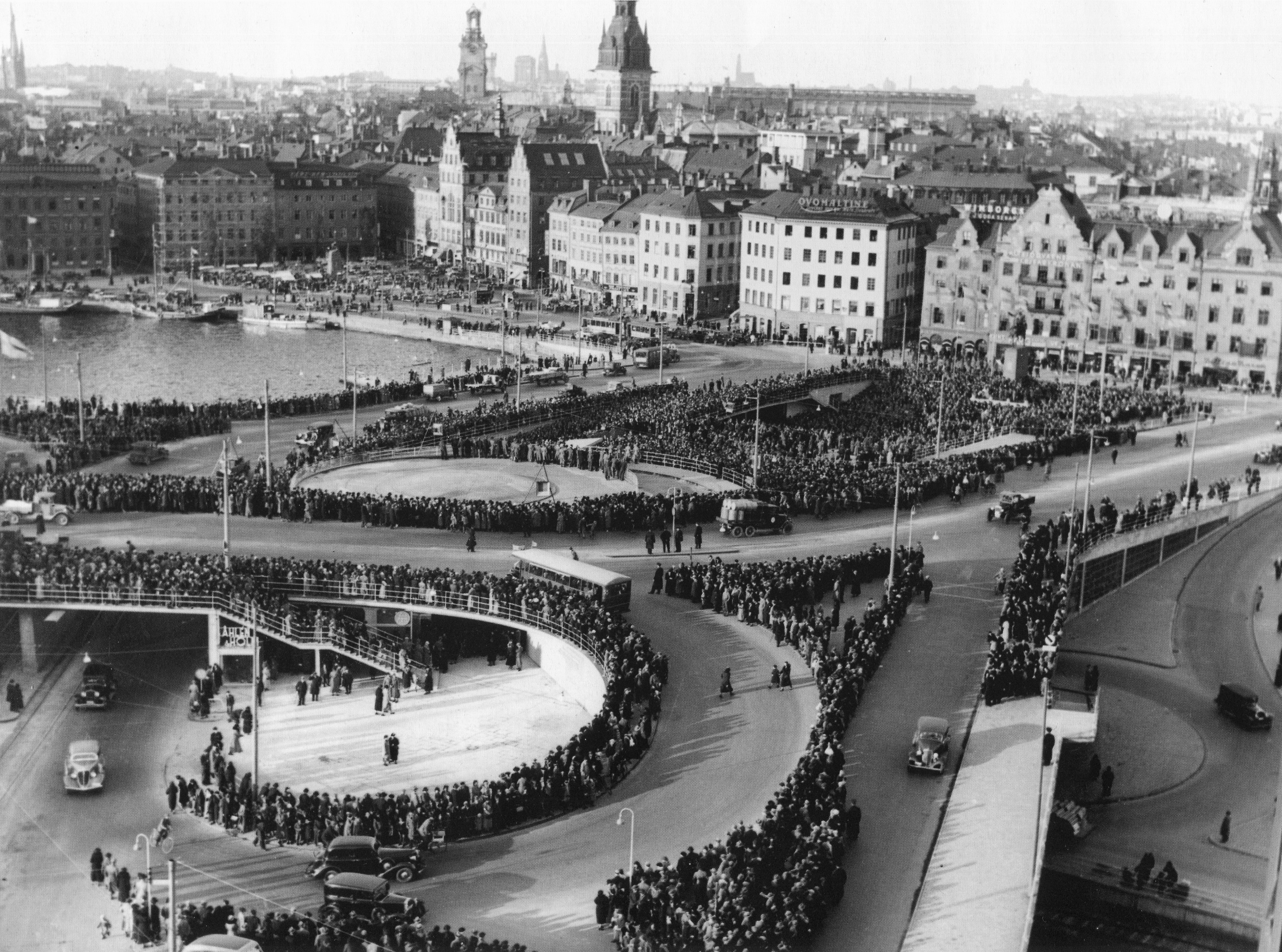
A cloverleaf interchange is a two-level interchange (road), interchange in which all turns are handled by slip roads. To go left (in right-hand traffic; reverse directions in left-driving regions), vehicles first continue as one road passes over or under the other, then exit right onto a one-way three-quarter loop ramp (270°) and merge onto the intersecting road. The objective of a cloverleaf is to allow two highways to cross without the need for any traffic to be stopped by traffic lights. The limiting factor in the capacity of a cloverleaf interchange is traffic weaving. Overview Cloverleaf interchanges, viewed from overhead or on maps, resemble the leaf, leaves of a four-leaf clover or less often a 3-leaf clover. In the United States, cloverleaf interchanges existed long before the Interstate highway, Interstate system. They were originally created for busier interchanges that the original diamond interchange system could not handle. Their chief advantage was that ... [...More Info...] [...Related Items...] OR: [Wikipedia] [Google] [Baidu] |
Interstate 49 In Missouri
Interstate 49 (I-49) is an Interstate Highway in the US state of Missouri that was designated on December 12, 2012. It overlaps U.S. Route 71 (US 71) in the western part of the state, beginning at the Arkansas state line, and ending at I-435 and I-470 on the southeast side of Kansas City. Upon completion, the highway will connect Kansas City to Texarkana, Arkansas and Shreveport along with Lafayette, Louisiana and New Orleans, Louisiana. Route description I-49 enters Missouri from the Arkansas state line on the Bella Vista Bypass near Pineville. After continuing north for , US 71 rejoins I-49 at exit 4 and is concurrent with it for the remainder of its length. It passes through many smaller communities before reaching Joplin. In Joplin, I-49 junctions with I-44 and begins a short overlap with I-44 between exits 11 and 18, heading east. Just a few miles east of Joplin, I-49 leaves I-44, heads north, and enters Carthage. I-49 then ... [...More Info...] [...Related Items...] OR: [Wikipedia] [Google] [Baidu] |
Interstate 49 In Arkansas
Interstate 49 (I-49) is an Interstate Highway in the U.S. state of Arkansas. There are two main sections of the highway across different sides of the state. The southern section starts at the Louisiana state line, then runs to Texarkana, at the Texas state line. The northern section begins at Interstate 40 in Arkansas, I-40 and at U.S. Route 71 in Arkansas, U.S. Highway 71 (US 71) in Alma, Arkansas, Alma and runs north to the Missouri state line, where the freeway continues into Missouri. An additional small section south of Fort Smith, Arkansas, Fort Smith is currently designated as Highway 549 (AR 549) until it is extended northward to the I-40 interchange, at which point it will become part of I-49. Route description I-49 enters the state from Louisiana between Ida, Louisiana, Ida and Doddridge, Arkansas, Doddridge. The first interchange in Arkansas is with US 71 at exit 4. The Interstate passes near the town of Fouke, Arkansas, Fouke, where it has ... [...More Info...] [...Related Items...] OR: [Wikipedia] [Google] [Baidu] |
Interstate 49 In Louisiana
Interstate 49 (I-49) is an Interstate Highway that currently spans in a north–south direction in the US state of Louisiana. Currently, I-49 runs from Interstate 10 in Louisiana, I-10 in Lafayette, Louisiana, Lafayette to the Arkansas state line. I-49 greatly parallels the older U.S. Route 71 in Louisiana, US Highway 71 (US 71) corridor, and connects the state's two east–west Interstates at two of its List of Louisiana metropolitan areas, metropolitan centers. Along the way, it serves the cities of Opelousas, Louisiana, Opelousas, Alexandria, Louisiana, Alexandria, and Natchitoches, Louisiana, Natchitoches, intersecting several cross-state highways, such as Interstate 20 in Louisiana, I-20, U.S. Route 190 in Louisiana, US 190, U.S. Route 167 in Louisiana, US 167, U.S. Route 165 in Louisiana, US 165, and U.S. Route 84 in Louisiana, US 84. I-49 was an intrastate Interstate Highway until December 12, 2012, when the designation was officially ... [...More Info...] [...Related Items...] OR: [Wikipedia] [Google] [Baidu] |
Interstate 70 In Missouri
Interstate 70 (I-70) in the US state of Missouri is generally parallel to the Missouri River. This section of the transcontinental Interstate Highway System, interstate begins at the Kansas state line on the Lewis and Clark Viaduct, concurrency (road), running concurrently with U.S. Route 24#Missouri, U.S. Route 24 (US 24), U.S. Route 40 in Missouri, US 40 and U.S. Route 169 in Missouri, US 169, and the east end is on the Stan Musial Veterans Memorial Bridge in St. Louis. Route description Crossing into Missouri on the Lewis and Clark Viaduct, I-70 immediately encounters the Downtown Loop (Kansas City), Downtown Loop, also called the Alphabet Loop, a small but complex loop of freeways with all of its exits having the exit number, number 2 and a letter suffix that uses the entire alphabet (except I and O). I-70 runs concurrently with Interstate 35 in Missouri, I-35 once it enters into the Loop. Both Interstates maintain the concurrency until they approach ... [...More Info...] [...Related Items...] OR: [Wikipedia] [Google] [Baidu] |
Downtown Loop (Kansas City)
The Downtown Loop (nicknamed the Alphabet Loop) is a complex layout of highways in Downtown Kansas City, Missouri involving 24 exits, four Interstate Highways, four U.S. Highways, and numerous city streets. Each exit is numbered 2 and suffixed with every letter of the alphabet except I and O (to avoid confusion with the numbers 1 and 0). The entire circumference of the loop is just over . Overview The system is nicknamed the Alphabet Loop because its exits have letter suffixes that are nearly all the letters of the English alphabet. Alphabetically, the letter suffixes begin with A in the northwest corner of the loop and proceed forward in a clockwise direction around the loop. Eastbound on the north side of the loop (EB I-70/NB I-35) are A through G; then H through M southbound on the east side (EB I-70/SB US 71); then N through U westbound on the south side (WB I-670); and finally V through Z northbound on the west side (NB I-35 alone). Interstate 70 enters the southeast co ... [...More Info...] [...Related Items...] OR: [Wikipedia] [Google] [Baidu] |
