|
Interstate 393
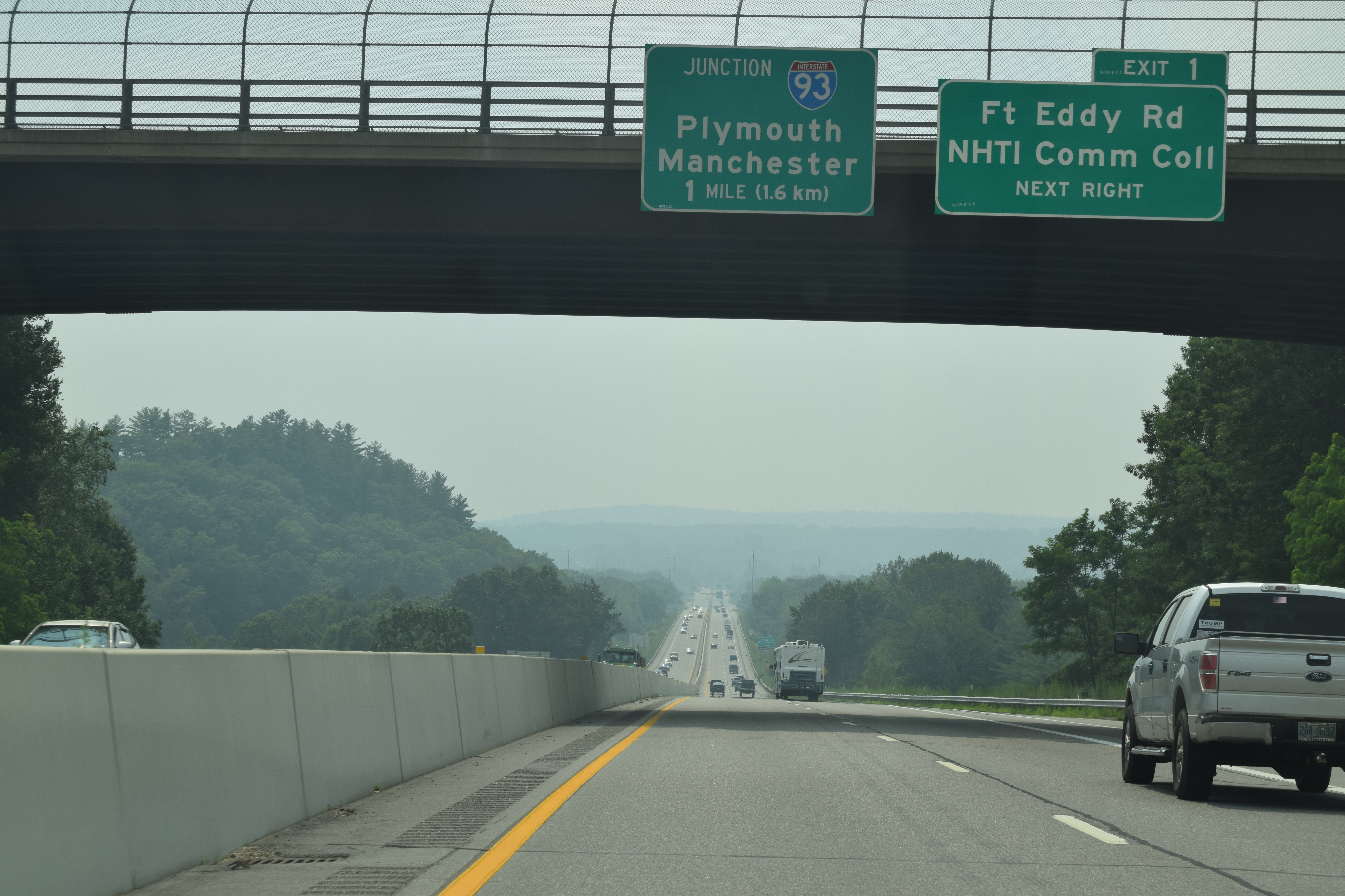
Interstate 393 (I-393) is a east–west auxiliary Interstate Highway extending from I-93 at Concord to Pembroke, New Hampshire. The primary purpose of the road is to bypass a densely built commercial strip on New Hampshire Route 9 (NH 9) in the eastern part of Concord. Several times a year, I-393 also serves traffic to events at New Hampshire Motor Speedway in Loudon. I-393 runs concurrently with US Route 4 (US 4) and US 202 for its entire length. Route description I-393 begins at I-93's exit 15 interchange, where US 4 east leaves its concurrency with I-93 south and the I-393/US 4/ US 202 concurrency begins. The four-lane freeway actually begins a short distance west of I-93 at the north end of Concord's Main Street where US 202 turns east from US 3. From there, the road then intersects Commercial Street just before the exit 15 interchange. Just east of the exit 15 cloverleaf is I-393's exit 1 to For ... [...More Info...] [...Related Items...] OR: [Wikipedia] [Google] [Baidu] |
Federal Highway Administration
The Federal Highway Administration (FHWA) is a division of the United States Department of Transportation that specializes in highway transportation. The agency's major activities are grouped into two programs, the Federal-aid Highway Program and the Federal Lands Highway Program. Its role had previously been performed by the Office of Road Inquiry, Office of Public Roads and the Bureau of Public Roads. History Background The organization has several predecessor organizations and complicated history. The Office of Road Inquiry (ORI) was founded in 1893. In 1905, that organization's name was changed to the Office of Public Roads (OPR) which became a division of the United States Department of Agriculture. The name was changed again to the Bureau of Public Roads in 1915 and to the Public Roads Administration (PRA) in 1939. It was then shifted to the Federal Works Agency which was abolished in 1949 when its name reverted to Bureau of Public Roads under the Department of Comm ... [...More Info...] [...Related Items...] OR: [Wikipedia] [Google] [Baidu] |
Steeplegate Mall
Steeplegate Mall is an enclosed shopping mall in Concord, New Hampshire, United States. Opened in 1990, it has struggled with high vacancy rates throughout its existence. Its largest retailer is JCPenney, the only traditional store left alongside Talbots and Chico's. It also features a live theater that opened in 2016, a trampoline park that opened in 2018, and a health club that opened in 2019. The mall opened with four large retail anchor stores, a food court with a mosaic, and room for about 62 storefronts, depending on layout. Following the interior's closure on April 22, 2022, after the mall's owners evicted the few remaining interior-only businesses for a potential overhaul, only six businesses with exterior entrances are open. History The mall opened August 1, 1990, with Sears, JCPenney, Sage-Allen and Steinbach as its anchors. It was built by Homart Development Company. Steinbach closed its store in 1999 as part of the company's bankruptcy. Sage-Allen, which closed ... [...More Info...] [...Related Items...] OR: [Wikipedia] [Google] [Baidu] |
Interstate Highways In New Hampshire ...
The Interstate Highways in New Hampshire comprise three current primary Interstate Highways and two auxiliary Interstates. In addition, one auxiliary Interstate number has been decommissioned along with a lone business Interstate. __TOC__ List See also * References External links *{{Commons category-inline, Interstate Highways in New Hampshire Interstate The Dwight D. Eisenhower National System of Interstate and Defense Highways, commonly known as the Interstate Highway System, is a network of controlled-access highways that forms part of the National Highway System in the United States. T ... [...More Info...] [...Related Items...] OR: [Wikipedia] [Google] [Baidu] |
Interstate 93
Interstate 93 (I-93) is an Interstate Highway in the New England states of Massachusetts, New Hampshire, and Vermont in the United States. Spanning approximately along a north–south axis, it is one of three primary Interstate Highways located entirely within New England; the other two are I-89 and I-91. The largest cities along the route are Boston, Massachusetts, and Manchester, New Hampshire; it also travels through the New Hampshire state capital of Concord. I-93 begins at an interchange with I-95, US Route 1 (US 1) and Route 128 in Canton, Massachusetts. It travels concurrently with US 1 beginning in Canton, and, with Route 3 beginning at the Braintree Split on the Braintree– Quincy city line, through the Central Artery in Downtown Boston before each route splits off beyond the Leonard P. Zakim Bunker Hill Memorial Bridge. The portion of highway between the Braintree Split and the Central Artery is named the "Southeast Expressw ... [...More Info...] [...Related Items...] OR: [Wikipedia] [Google] [Baidu] |
1979 Establishments In New Hampshire
Events January * January 1 ** United Nations Secretary-General Kurt Waldheim heralds the start of the '' International Year of the Child''. Many musicians donate to the '' Music for UNICEF Concert'' fund, among them ABBA, who write the song '' Chiquitita'' to commemorate the event. ** The United States and the People's Republic of China establish full diplomatic relations. ** Following a deal agreed during 1978, French carmaker Peugeot completes a takeover of American manufacturer Chrysler's European operations, which are based in Britain's former Rootes Group factories, as well as the former Simca factories in France. * January 7 – Cambodian–Vietnamese War: The People's Army of Vietnam and Vietnamese-backed Cambodian insurgents announce the fall of Phnom Penh, Cambodia, and the collapse of the Pol Pot regime. Pol Pot and the Khmer Rouge retreat west to an area along the Thai border, ending large-scale fighting. * January 8 – Whiddy Island Disaster: The ... [...More Info...] [...Related Items...] OR: [Wikipedia] [Google] [Baidu] |
I 393 Westbound
I, or i, is the ninth letter and the third vowel letter of the Latin alphabet, used in the modern English alphabet, the alphabets of other western European languages and others worldwide. Its name in English is ''i'' (pronounced ), plural ''ies''. History In the Phoenician alphabet, the letter may have originated in a hieroglyph for an arm that represented a voiced pharyngeal fricative () in Egyptian, but was reassigned to (as in English "yes") by Semites, because their word for "arm" began with that sound. This letter could also be used to represent , the close front unrounded vowel, mainly in foreign words. The Greeks adopted a form of this Phoenician ''yodh'' as their letter ''iota'' () to represent , the same as in the Old Italic alphabet. In Latin (as in Modern Greek), it was also used to represent and this use persists in the languages that descended from Latin. The modern letter ' j' originated as a variation of 'i', and both were used interchangeably fo ... [...More Info...] [...Related Items...] OR: [Wikipedia] [Google] [Baidu] |
Jersey Barrier
A Jersey barrier, Jersey wall, or Jersey bump is a modular concrete or plastic barrier employed to separate lanes of traffic. It is designed to minimize vehicle damage in cases of incidental contact while still preventing vehicle crossovers resulting in a likely head-on collision. Jersey barriers are also used to reroute traffic and protect pedestrians and workers during highway construction. They are named after the U.S. state of New Jersey which first started using the barriers as separators between lanes of a highway in the 1950s. The barriers are also known as a K-rail, a term stipulated in the California Department of Transportation specification for temporary concrete traffic barriers which first started using concrete median barriers in the mid-1940s. Over time, different variants were created. Taller variants, such as the Ontario Tall Wall, proved more effective at stopping vehicles and had the added advantage of blocking most oncoming headlights. More modular varian ... [...More Info...] [...Related Items...] OR: [Wikipedia] [Google] [Baidu] |
Portsmouth, New Hampshire
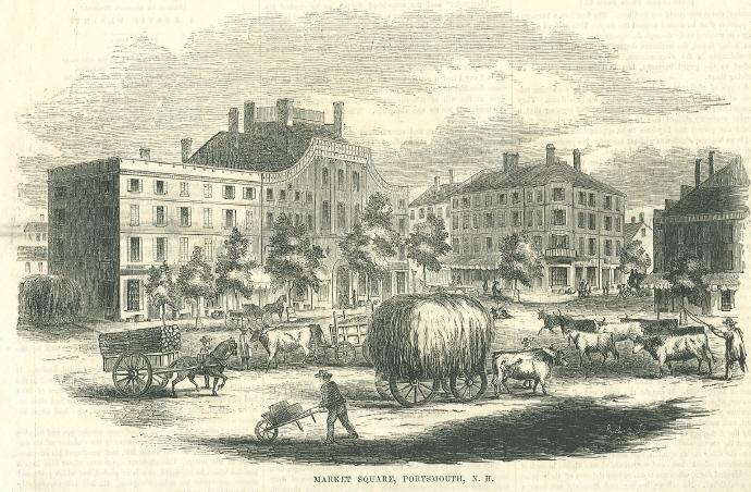
Portsmouth is a city in Rockingham County, New Hampshire, United States. At the 2020 census it had a population of 21,956. A historic seaport and popular summer tourist destination on the Piscataqua River bordering the state of Maine, Portsmouth was formerly the home of the Strategic Air Command's Pease Air Force Base, since converted to Portsmouth International Airport at Pease. History American Indians of the Abenaki and other Algonquian languages-speaking nations, and their predecessors, inhabited the territory of coastal New Hampshire for thousands of years before European contact. The first known European to explore and write about the area was Martin Pring in 1603. The Piscataqua River is a tidal estuary with a swift current, but forms a good natural harbor. The west bank of the harbor was settled by European colonists in 1630 and named Strawbery Banke, after the many wild Fragaria, strawberries growing there. The village was protected by Fort William and Mary on wh ... [...More Info...] [...Related Items...] OR: [Wikipedia] [Google] [Baidu] |
New Hampshire Department Of Transportation
The New Hampshire Department of Transportation (NHDOT) is a government agency of the U.S. state of New Hampshire. The Commissioner of NHDOT is Victoria Sheehan. The main office of the NHDOT is located in the J. O. Morton Building in Concord, New Hampshire, Concord. Functions NHDOT's general functions, as provided iNH RSA:21-L are: *Planning, developing, and maintaining a state transportation network which will provide for safe and convenient movement of people and goods throughout the state by means of a system of highways and railroads, air service, mass transit and other practicable modes of transportation in order to support state growth and economic development and promote the general welfare of the citizens of the state. *Developing and maintaining state owned land and buildings, except as otherwise provided by law, and cooperating with the New Hampshire New Hampshire Department of Administrative Services, Department of Administrative Services in preparing a long-range stat ... [...More Info...] [...Related Items...] OR: [Wikipedia] [Google] [Baidu] |
Rochester, New Hampshire
Rochester is a city in Strafford County, New Hampshire, United States. The population was 32,492 at the 2020 census. In addition to the downtown area, the city contains the villages of East Rochester, Gonic, and North Rochester. Rochester is home to Skyhaven Airport and part of Baxter Lake. Rochester was one of New Hampshire's fastest growing cities between 2010 and 2020. History Origins Rochester was once inhabited by Abenaki Indians of the Pennacook tribe. They fished, hunted and farmed, moving locations when their agriculture exhausted the soil for growing pumpkins, squash, beans and maize. ''Squanamagonic'' (abbreviated to "Gonic") means "the water of the clay place hill". The town was one of four granted by colonial governor Samuel Shute of Massachusetts and New Hampshire during his brief term. Incorporated in 1722, it was named for his close friend, Laurence Hyde, 1st Earl of Rochester, brother-in-law to King James II. As was customary, tall white pine trees ... [...More Info...] [...Related Items...] OR: [Wikipedia] [Google] [Baidu] |
Dover, New Hampshire
Dover is a city in Strafford County, New Hampshire, United States. The population was 32,741 at the 2020 census, making it the largest city in the New Hampshire Seacoast region and the fifth largest municipality in the state. It is the county seat of Strafford County, and home to Wentworth-Douglass Hospital, the Woodman Institute Museum, and the Children's Museum of New Hampshire. Etymology First recorded in its Latinised form of '' Portus Dubris'', the word "Dover" derives from the Brythonic word for "waters" (''dwfr'' in Middle Welsh). The same element is present in the word's French (''Douvres'') and Modern Welsh (''Dofr'') forms. History Settlement The first known European to explore the region was Martin Pring from Bristol, England, in 1603. In 1623, William and Edward Hilton settled at Pomeroy Cove on Dover Point, making Dover the oldest permanent settlement in New Hampshire, and seventh in the United States. One of the colony's four original townships, it then inc ... [...More Info...] [...Related Items...] OR: [Wikipedia] [Google] [Baidu] |


_(cropped_v2).jpg)


