|
Innisfil, Ontario
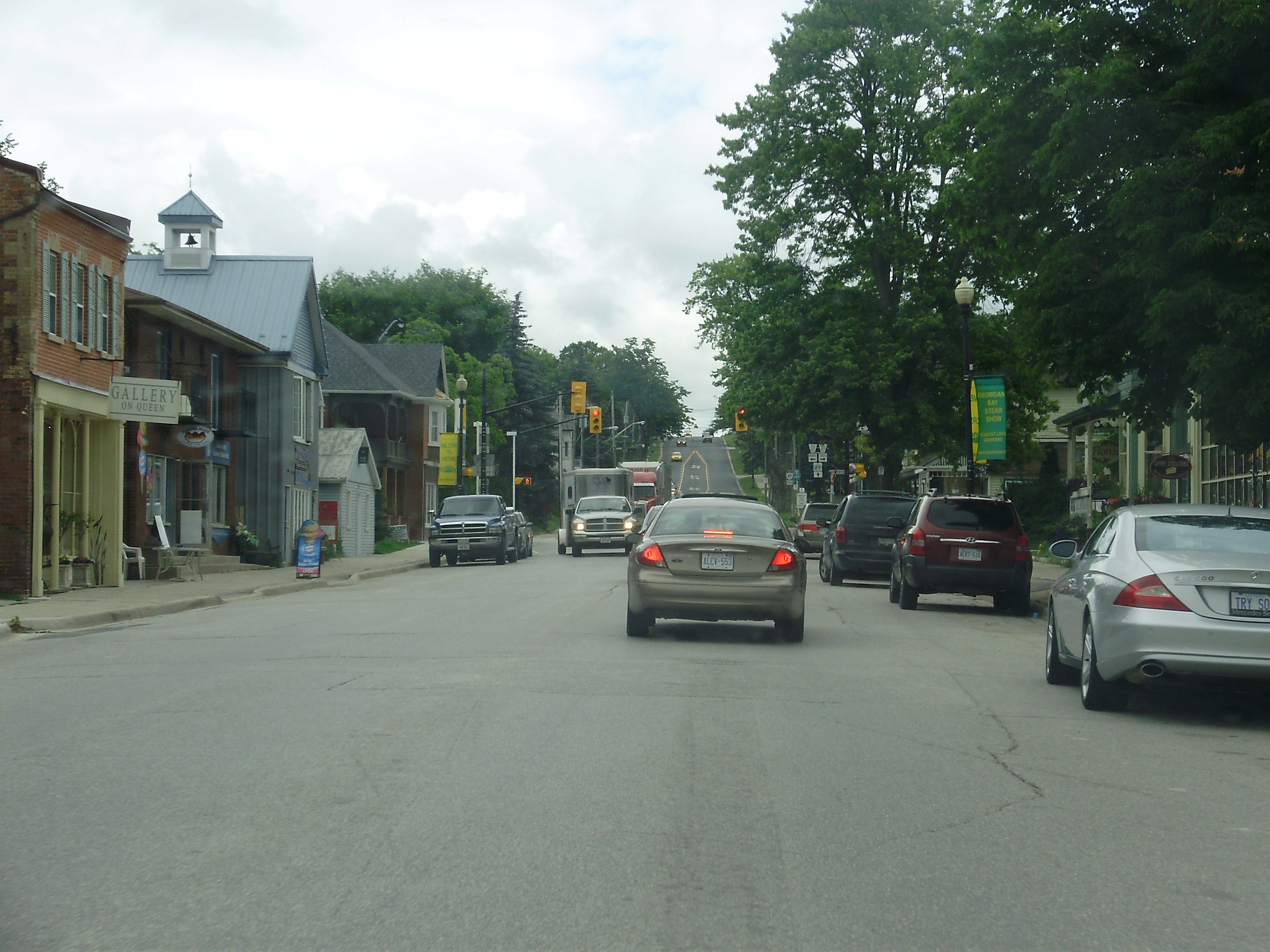
Innisfil is a town in Ontario, Canada, located on the western shore of Lake Simcoe in Simcoe County, immediately south of Barrie and north of Toronto. It has historically been a rural area, but since it is geographically sandwiched between the high-growth areas of Barrie and the York Region, there has been growing residential development in Innisfil. Etymology The name ''Innisfil'' comes from the Irish '' Inis Fáil'', an ancient mythological name for Ireland. History The history of Innisfil spans a period in excess of 170 years. The Town was hewn from almost unbroken virgin forests which had been home to the Huron Indians, and was first surveyed in 1820. The area encompassed 68,653 acres (278 km2), including the villages of Allandale, Tollendal, Painswick, Minets Point, and Holly at the time. The first settlers were the Hewson and Soules families who came by way of the East Holland River and Lake Simcoe to settle at Point Endeavour; they renamed the area Hewson's P ... [...More Info...] [...Related Items...] OR: [Wikipedia] [Google] [Baidu] |
List Of Towns In Ontario
A town is a sub-type of List of municipalities in Ontario, municipalities in the Provinces and territories of Canada, Canadian province of Ontario. A town can have the municipal status of either a List of municipalities in Ontario#Single and lower-tier municipalities, single-tier or lower-tier municipality. Ontario has 88 towns that had a cumulative population of 1,986,937 and an average population of 22,579 in the Canada 2021 Census, 2021 Census. In the Canada 2021 Census, 2021 Census, Ontario's largest and smallest towns are Oakville, Ontario, Oakville and Latchford, Ontario, Latchford with populations of 213,759 and 355 respectively. History Under the former ''Municipal Act, 1990'', a town was both an urban and a local municipality. Under this former legislation, a locality with a population of 2,000 or more could have been incorporated as a town by Ontario's Municipal Board upon review of an application from 75 or more residents of the locality. It also allowed the Munici ... [...More Info...] [...Related Items...] OR: [Wikipedia] [Google] [Baidu] |
Lia Fáil
The () or (; "Stone of Fál") is a stone at the Inauguration Mound () on the Hill of Tara in County Meath, Ireland, which served as the coronation stone for the King of Tara and hence High King of Ireland. It is also known as the Stone of Destiny or Speaking Stone. According to legend, all of the kings of Ireland were crowned on the stone up to Muirchertach mac Ercae, . Geology Archibald Geikie noted resemblances to the calcareous red sandstone of which the Stone of Scone is composed; it is not currently believed the stones originated from connected quarry sites. It has also been identified as a whitish granitoid. Mythical origin There are several different, and conflicting, legends in Irish mythology describing how the is said to have been brought to Ireland.William Forbes Skene: The Coronation Stone. Edmonston & Douglas, 1869. p. 23 The Lebor Gabala, dating to the eleventh century, states that it was brought in antiquity by the semi-divine race known as the T ... [...More Info...] [...Related Items...] OR: [Wikipedia] [Google] [Baidu] |
Methodist
Methodism, also called the Methodist movement, is a Protestant Christianity, Christian Christian tradition, tradition whose origins, doctrine and practice derive from the life and teachings of John Wesley. George Whitefield and John's brother Charles Wesley were also significant early leaders in the movement. They were named ''Methodists'' for "the methodical way in which they carried out their Christian faith". Methodism originated as a Christian revival, revival movement within Anglicanism with roots in the Church of England in the 18th century and became a separate denomination after Wesley's death. The movement spread throughout the British Empire, the United States and beyond because of vigorous Christian mission, missionary work, and today has about 80 million adherents worldwide. Most List of Methodist denominations, Methodist denominations are members of the World Methodist Council. Wesleyan theology, which is upheld by the Methodist denominations, focuses on Sanc ... [...More Info...] [...Related Items...] OR: [Wikipedia] [Google] [Baidu] |
Church (building)
A church, church building, church house, or chapel is a building used for Christian worship church service, services and Christian religion, Christian activities. The earliest identified Christian church is a house church founded between 233 AD and 256 AD. ''Church'' is also used to describe a Church (congregation), body or an assembly of Christian believers, while "the Church" may be used to refer to the worldwide Christian religious community as a whole. In traditional Christian architecture, the plan view of a church often forms a Christian cross with the centre aisle and seating representing the vertical beam and the Church architecture#Characteristics of the early Christian church building, bema and altar forming the horizontal. Towers or domes may inspire contemplation of the heavens. Modern churches have a variety of architectural styles and layouts. Some buildings designed for other purposes have been converted to churches, while many original church buildings have bee ... [...More Info...] [...Related Items...] OR: [Wikipedia] [Google] [Baidu] |
Post Offices
Post, POST, or posting may refer to: Postal services * Mail, the postal system, especially in Commonwealth of Nations countries ** An Post, the Irish national postal service ** Canada Post, Canadian postal service ** Deutsche Post, German postal service ** Iraqi Post, Iraqi postal service ** Russian Post, Russian postal service ** Hotel post, a service formerly offered by remote Swiss hotels for the carriage of mail to the nearest official post office ** United States Postal Service or USPS ** Parcel post, a postal service for mail that is heavier than ordinary letters Work * Post, a job or occupation Newspaper * '' The Manica Post'' Regional newspaper in Manicaland province, Zimbabwe * '' The Rakyat Post'' Malaysian online daily newspaper * '' Bangkok Post'' English language newspaper in Thailand Architecture and structures * Lamppost, a raised source of light on the edge of a road * Post (structural), timber framing * Post and lintel, a building system * Scratch post * ... [...More Info...] [...Related Items...] OR: [Wikipedia] [Google] [Baidu] |
List Of Numbered Roads In Simcoe County
A list of current and former county roads in Simcoe County, Ontario, Canada. Current county roads The table below lists all currently existing county roads in commission. Former county roads The following table list county roads that once existed, but were decommissioned, and transferred to local municipalities. References {{Ontario numbered highways Roads in Simcoe County, Lists of Ontario county roads, Simcoe ... [...More Info...] [...Related Items...] OR: [Wikipedia] [Google] [Baidu] |
Ontario Highway 11
King's Highway 11, commonly referred to as Highway 11, is a Ontario Provincial Highway Network, provincially-maintained highway in the Provinces and territories of Canada, Canadian province of Ontario. At , it is the second-longest highway in the province, after Ontario Highway 17, Highway 17. Highway11 begins at Ontario Highway 400, Highway 400 in Barrie and arches through northern Ontario to the Ontario–Minnesota border at Rainy River, Ontario, Rainy River via Thunder Bay; the road continues as Minnesota State Highway 72 across the Baudette–Rainy River International Bridge. North and west of North Bay, Ontario, North Bay (as well as for a short distance through Orillia), Highway11 forms part of the Trans-Canada Highway and is part of MOM's Way between Thunder Bay and Rainy River. The original section of Highway11 along Yonge Street was colloquially known as "Main Street Ontario" and was one of the first roads in what would later become Ontario. It was devised ... [...More Info...] [...Related Items...] OR: [Wikipedia] [Google] [Baidu] |
Yonge Street
Yonge Street ( ') is a major arterial route in the Canadian province of Ontario connecting the shores of Lake Ontario in Toronto to Lake Simcoe, a gateway to the Great Lakes#Geography, Upper Great Lakes. Ontario's first colonial administrator, John Graves Simcoe, named the street for his friend Sir George Yonge, 5th Baronet, Sir George Yonge, an expert on ancient Roman roads. Once the southernmost leg of provincial Ontario Highway 11, Highway 11, linking the provincial capital with northern Ontario, Yonge Street has been referred to as "Main Street Ontario". Until 1999, the ''Guinness World Records, Guinness Book of World Records'' repeated the popular misconception that Yonge Street was long, making it the longest street in the world; this was due to a conflation of Yonge Street with the rest of Ontario Highway 11, Ontario's Highway 11. The street (including the Bradford-to-Barrie extension) is only long. Due to provincial downgrading in the 1990s, no section of Yonge Street ... [...More Info...] [...Related Items...] OR: [Wikipedia] [Google] [Baidu] |
Penetanguishene Road
Penetanguishene (, sometimes shortened to Penetang) is a town in Simcoe County, Ontario, Canada. It is located on the southeasterly tip of Georgian Bay. Incorporated on February 22, 1882, this bilingual (French language, French and English language, English) community has a population of 8,962 in the Canada 2016 Census. The name ''Penetanguishene'' is believed to come from either the Wyandot language, Wyandot or Abenaki language, Abenaki via Ojibwe language, Ojibwe, meaning "land of the white rolling sands". History As early as anno Domini, AD 800, the Wyandot people settled in semi-permanent villages in the area. The young French people, French Translation, translator, Étienne Brûlé, was the first European to set foot in the Penetanguishene area, some time between 1610 and 1614. He was murdered in 1633 in Toanche, just across the bay from the modern town of Penetanguishene. In 1793, John Graves Simcoe, the first Lieutenant Governor of Upper Canada, visited the area and saw ... [...More Info...] [...Related Items...] OR: [Wikipedia] [Google] [Baidu] |
Bradford, Ontario
Bradford is the primary country urban area of the Town of Bradford West Gwillimbury, Ontario, in Canada. It overlooks a farming community, known as The Holland Marsh, located on the Holland River that flows into Lake Simcoe. History The eastern boundary of Bradford is the Holland River, named for Samuel Holland, first Surveyor General of British North America, who passed this way on an exploration from Toronto to Balsam Lake, by way of Lake Simcoe, in 1791. For several years the Holland River and Lake Simcoe provided the only means of transportation. Holland Landing was the northern terminus of Yonge Street. The military route to Georgian Bay during the War of 1812 crossed Lake Simcoe to Kempenfelt Bay, then by the Nine Mile Portage to Willow Creek and the Nottawasaga River. The Penetanguishene Road, built between 1814 and 1815 from Kempenfelt Bay, provided an alternate route to Georgian Bay. However, early settlers also used this route to get to the frontier of Simcoe C ... [...More Info...] [...Related Items...] OR: [Wikipedia] [Google] [Baidu] |
Sawmill
A sawmill (saw mill, saw-mill) or lumber mill is a facility where logging, logs are cut into lumber. Modern sawmills use a motorized saw to cut logs lengthwise to make long pieces, and crosswise to length depending on standard or custom sizes (dimensional lumber). The Portable sawmill, "portable" sawmill is simple to operate. The log lies flat on a steel bed, and the motorized saw cuts the log horizontally along the length of the bed, by the operator manually pushing the saw. The most basic kind of sawmill consists of a chainsaw and a customized jig ("Alaskan sawmill"), with similar horizontal operation. Before the invention of the sawmill, boards were made in various manual labour, manual ways, either wood splitting, rived (split) and plane (tool), planed, hewing, hewn, or more often hand sawn by two men with a whipsaw, one above and another in a saw pit below. The earliest known mechanical mill is the Hierapolis sawmill, a Roman water-powered stone mill at Hierapolis, Asia M ... [...More Info...] [...Related Items...] OR: [Wikipedia] [Google] [Baidu] |


