|
I-69 (TX)
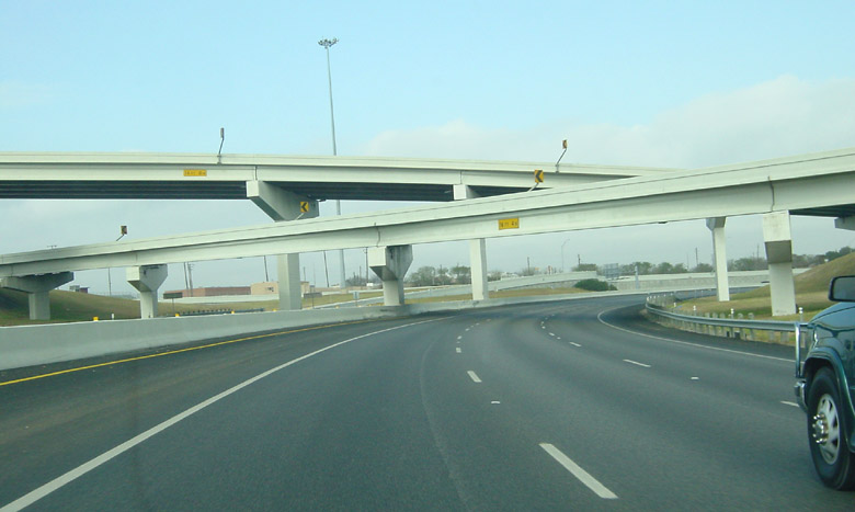
Interstate 69 (I-69) is an Interstate Highway that is in the process of being built in the US state of Texas. It is part of a longer I-69 extension known as the NAFTA superhighway, that, when completed, will connect Canada to Mexico. In Texas, it will connect Tenaha and I-69 in Louisiana at the Louisiana border through the eastern part of the state and along the Texas Gulf Coast to Victoria, where it will split into three branches: I-69E to Brownsville, I-69C to Pharr, and I-69W to Laredo. The first segment of I-69 in Texas was opened in 2011 near Corpus Christi. The American Association of State Highway and Transportation Officials (AASHTO) approved an additional of US 77 from Brownsville to the Willacy– Kenedy county line for designation as I-69, which was to be signed as I-69E upon concurrence from the Federal Highway Administration (FHWA). FHWA approval for this segment was announced on May 29, 2013. By March 2015, a section of US ... [...More Info...] [...Related Items...] OR: [Wikipedia] [Google] [Baidu] |
Rosenberg, Texas
Rosenberg is a city in the U.S. state of Texas, within the Houston–The Woodlands–Sugar Land metropolitan area and Fort Bend County. The population was 38,282 at the 2020 census, up from 30,618 at the 2010 census. The community holds the Fort Bend County fair in October. Rosenberg is adjacent to the city of Richmond, the Fort Bend County seat. History Rosenberg is named after Henry Rosenberg, who migrated from Switzerland to Galveston, Texas in 1843. Rosenberg was the first president of the Gulf, Colorado and Santa Fe Railway. Geography Rosenberg is located in central Fort Bend County at (29.552388, –95.804899), on the south side of the Brazos River. It is bordered to the northeast by Richmond, to the south by Pleak, and to the southwest by Beasley. The Southwest Freeway ( I-69 and US-59) runs through the south side of Rosenberg, bypassing the city center. The freeway leads northeast to downtown Houston, and US-59 continues southwest to Victoria an ... [...More Info...] [...Related Items...] OR: [Wikipedia] [Google] [Baidu] |
Texas
Texas (, ; Spanish: ''Texas'', ''Tejas'') is a state in the South Central region of the United States. At 268,596 square miles (695,662 km2), and with more than 29.1 million residents in 2020, it is the second-largest U.S. state by both area (after Alaska) and population (after California). Texas shares borders with the states of Louisiana to the east, Arkansas to the northeast, Oklahoma to the north, New Mexico to the west, and the Mexican states of Chihuahua, Coahuila, Nuevo León, and Tamaulipas to the south and southwest; and has a coastline with the Gulf of Mexico to the southeast. Houston is the most populous city in Texas and the fourth-largest in the U.S., while San Antonio is the second most populous in the state and seventh-largest in the U.S. Dallas–Fort Worth and Greater Houston are, respectively, the fourth- and fifth-largest metropolitan statistical areas in the country. Other major cities include Austin, the second most populous s ... [...More Info...] [...Related Items...] OR: [Wikipedia] [Google] [Baidu] |
Corpus Christi, Texas
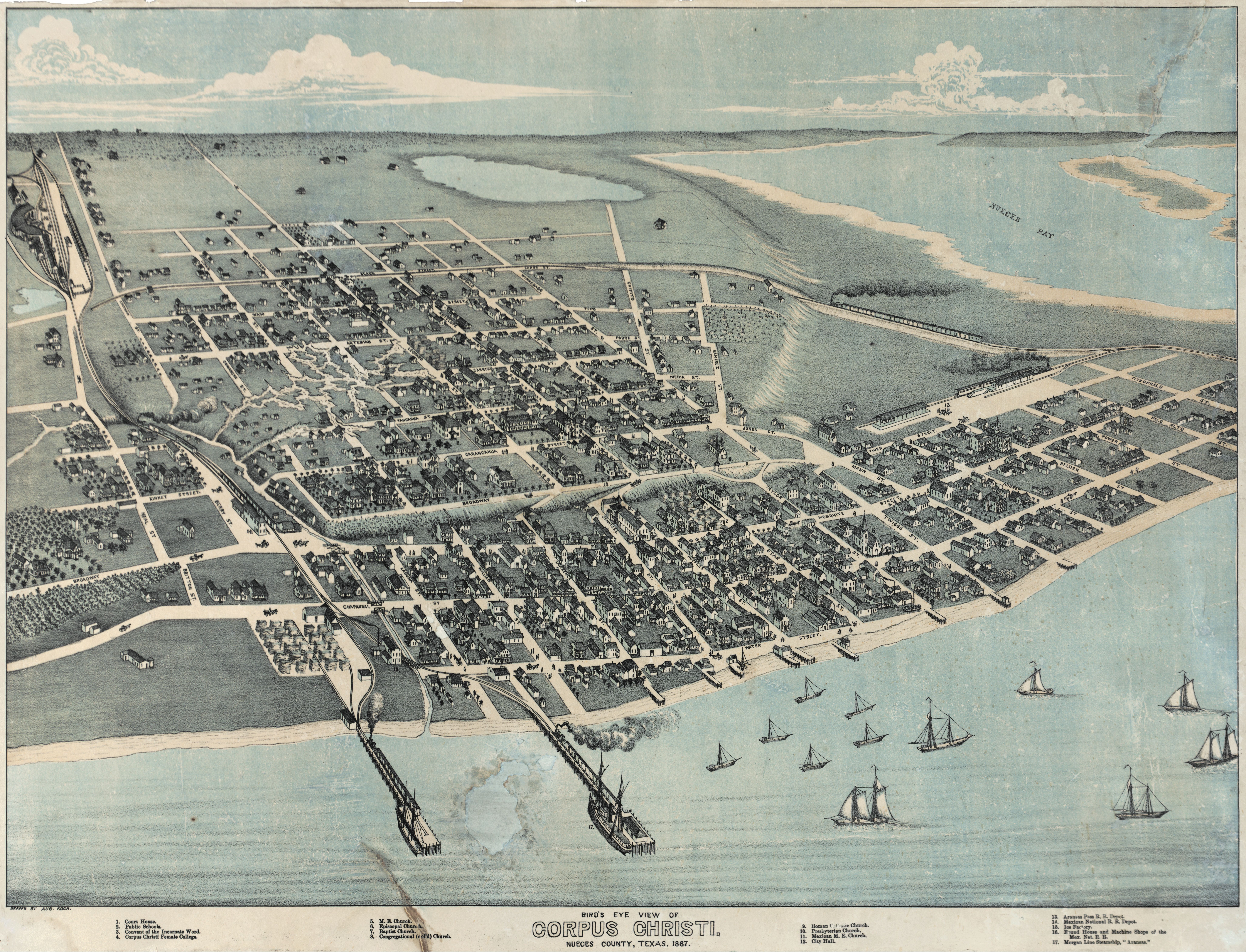
Corpus Christi (; Ecclesiastical Latin: "''Body of Christ"'') is a coastal city in the South Texas region of the U.S. state of Texas and the county seat and largest city of Nueces County, it also extends into Aransas, Kleberg, and San Patricio Counties. It is southeast of San Antonio. Its political boundaries encompass Nueces Bay and Corpus Christi Bay. Its zoned boundaries include small land parcels or water inlets of three neighboring counties. The city's population was 317,863 in 2020, making it the eighth-most populous city in Texas. The Corpus Christi metropolitan area had an estimated population of 442,600. It is also the hub of the six-county Corpus Christi-Kingsville Combined Statistical Area, with a 2013 estimated population of 516,793. The Port of Corpus Christi is the fifth-largest in the United States. The region is served by the Corpus Christi International Airport. The city's name means body of Christ in Ecclesiastical Latin, in reference to the Christian sac ... [...More Info...] [...Related Items...] OR: [Wikipedia] [Google] [Baidu] |
Laredo, Texas
Laredo ( ; ) is a city in and the county seat of Webb County, Texas, United States, on the north bank of the Rio Grande in South Texas, across from Nuevo Laredo, Tamaulipas, Mexico. Laredo has the distinction of flying seven flags (the flag of the former Republic of the Rio Grande, which is now the flag of the city, in addition to the Six Flags of Texas). Founded in 1755, Laredo grew from a village to the capital of the short-lived Republic of the Rio Grande to the largest inland port on the Mexican border. Laredo's economy is primarily based on international trade with the United States largest trading partner Mexico, and as a major hub for three areas of transportation: land, rail, and air cargo. The city is on the southern end of I-35, which connects manufacturers in northern Mexico through Interstate 35 as a major route for trade throughout the U.S. It has four international bridges and one railway bridge. According to the 2010 census, the city population was 236,091, m ... [...More Info...] [...Related Items...] OR: [Wikipedia] [Google] [Baidu] |
Interstate 69W
Interstate 69W (I-69W) is a relatively short north–south Interstate Highway running through South Texas in the United States. The freeway begins northeast of the middle of World Trade International Bridge in Laredo and ends at I-35. In the future, I-69W will head northeast for before terminating near Victoria as both I-69E and I-69W merge to form I-69. For its entire length, I-69W runs concurrently with US Highway 59 (US 59). Route description The Federal Highway Administration (FHWA) approved the designation of a section of freeway in Laredo as part of I-69W. The congressionally designated I-69W corridor begins at the Mexican border on the World Trade International Bridge, which connects to Mexican Federal Highway 85D, at the border in Laredo. It is cosigned with both US 59 and State Highway Loop 20 (Loop 20; Bob Bullock Loop) and extends to I-35 (which connects to Mexican Federal Highway 85 south of the border). In the future, I-6 ... [...More Info...] [...Related Items...] OR: [Wikipedia] [Google] [Baidu] |
Pharr, Texas
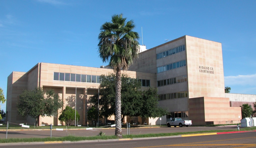
Pharr is a city in Hidalgo County, Texas, United States. As of the 2010 census, the city population was 70,400, and in 2019, the estimated population was 79,112. Pharr is connected by bridge to the Mexican city of Reynosa, Tamaulipas. Pharr is part of the McAllen–Edinburg–Mission and Reynosa–McAllen metropolitan areas. Geography Pharr is located in southern Hidalgo County at (26.206334, –98.185174). It is bordered to the west by the city of McAllen, to the north by Edinburg, the county seat, to the east by San Juan, and to the southwest by Hidalgo. The Pharr city limits extend south in a narrow band to the Rio Grande and the Pharr–Reynosa International Bridge into Mexico. According to the United States Census Bureau, Pharr has a total area of , of which , or 0.12%, is covered by water. Communities: * Las Milpas (annexed in 1987) History The community was named after sugar planter Henry Newton Pharr. For a number of years centering around early 1900, He ... [...More Info...] [...Related Items...] OR: [Wikipedia] [Google] [Baidu] |
Interstate 69C
Interstate 69C (I-69C) is a north–south freeway running through South Texas. Once complete, the freeway (with connections to Mexican Federal Highway 97) will begin at I-2/ U.S. Highway 83 (US 83) in Pharr and head northward before terminating at I-69W/ US 59 in George West near I-37. For its entire length, I-69C shares its alignment with US 281. , only an segment has been completed at the route's southern terminus in Pharr. Route description History The Federal Highway Administration (FHWA) approved the designation for the South Rio Grande Valley Segment on May 24, 2013, and the Texas Transportation Commission followed suit on May 30, 2013. This action finalized the designations of not only I-69C but also of the sections of I-69E from Brownsville north to north of Raymondville and also I-2 which is a freeway connecting with I-69C and I-69E in Pharr and Harlingen. These approvals added over to the Interstate Highway System in ... [...More Info...] [...Related Items...] OR: [Wikipedia] [Google] [Baidu] |
Brownsville, Texas
Brownsville () is a city in Cameron County in the U.S. state of Texas. It is on the western Gulf Coast in South Texas, adjacent to the border with Matamoros, Mexico. The city covers , and has a population of 186,738 as of the 2020 census. It is the 139th-largest city in the United States and 18th-largest in Texas. It is part of the Matamoros–Brownsville metropolitan area. The city is known for its year-round subtropical climate, deep-water seaport, and Hispanic culture. The city was founded in 1848 by American entrepreneur Charles Stillman after he developed a successful river-boat company nearby. It was named for Fort Brown, itself named after Major Jacob Brown, who fought and died while serving as a U.S. Army soldier during the Mexican–American War (1846–1848). As a county seat, the city and county governments are major employers. Other primary employers fall within the service, trade, and manufacturing industries, including a growing aerospace and space transp ... [...More Info...] [...Related Items...] OR: [Wikipedia] [Google] [Baidu] |
Interstate 69E
Interstate 69E (I-69E) is a north–south freeway running through South Texas. Once complete, the freeway will begin in Brownsville and head northward before terminating near Victoria as both I-69W and I-69E merge into I-69 toward Houston. For its entire length, I-69E runs concurrently with U.S. Highway 77 (US 77). The route currently exists in two segments: a segment from its southern terminus in Brownsville to the Willacy– Kenedy county line and a shorter segment south of Corpus Christi. The route has one auxiliary Interstate route, I-169 in Brownsville. History A stated goal of the Texas Department of Transportation's (TxDOT) I-69 initiative is that "existing suitable freeway sections of the proposed system be designated as I-69 as soon as possible". A bill was introduced and passed by the House of Representatives that allows Interstate quality sections of US 59, US 77, and US 281 to be signed as I-69 regardless of whether or n ... [...More Info...] [...Related Items...] OR: [Wikipedia] [Google] [Baidu] |
Victoria, Texas
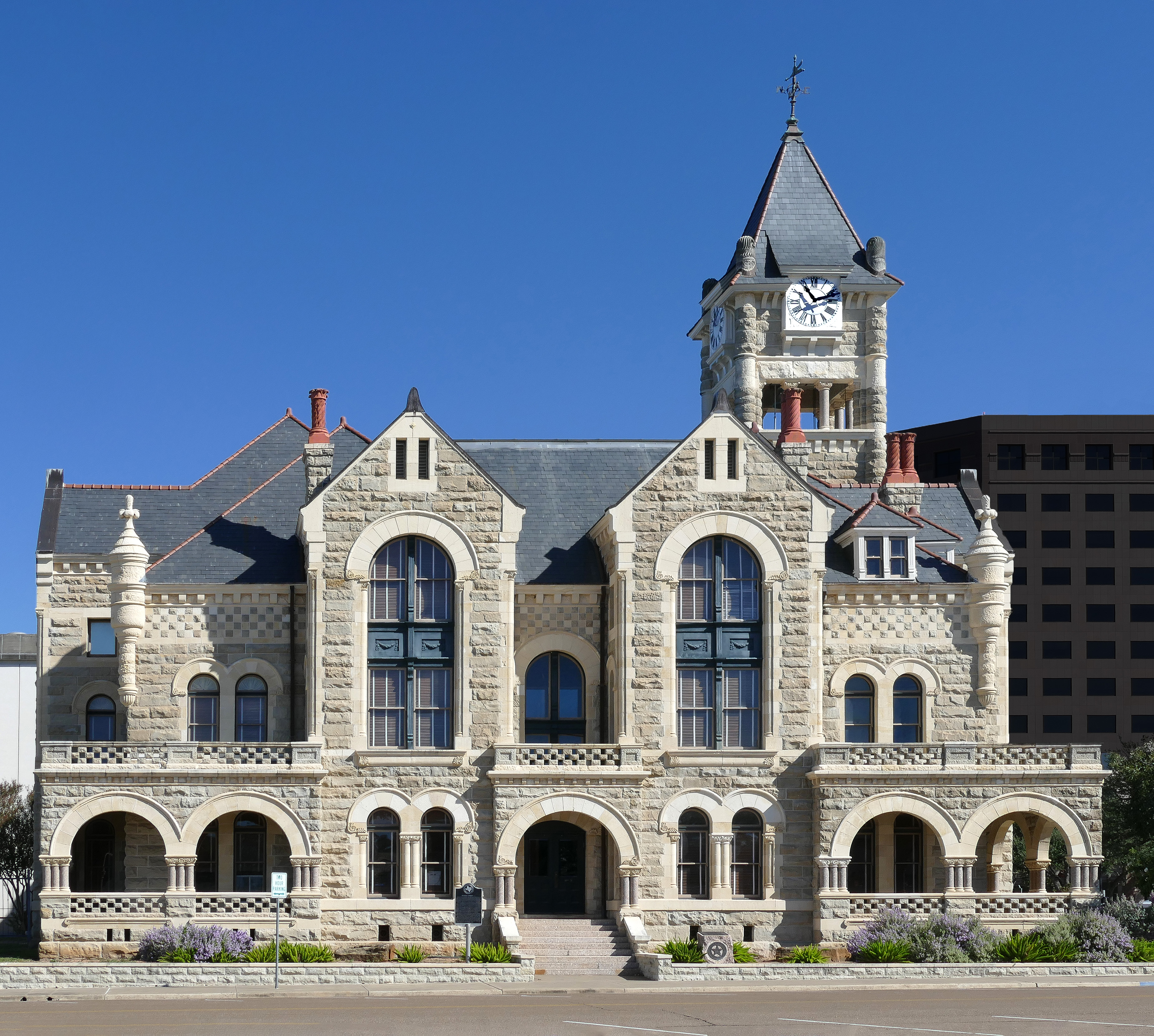
Victoria is a small city in South Texas and county seat of Victoria County, Texas. The population was 65,534 as of the 2020 census. The three counties of the Victoria Metropolitan Statistical Area had a population of 111,163 as of the 2000 census. Its elevation is . Victoria is located 30 miles inland from the Gulf of Mexico. Victoria is a two-hour drive from Corpus Christi, Houston, San Antonio, and Austin. Victoria is named for General Guadalupe Victoria, who became the first president of independent Mexico. Victoria is the cathedral city of the Roman Catholic Diocese of Victoria in Texas. History The city of Guadalupe Victoria was founded in 1824 by Martín De León, a Mexican empresario, in honor of Guadalupe Victoria, the first President of the Republic of Mexico. Victoria was initially part of De León's Colony, which had been founded that same year. By 1834, the town had a population of approximately 300. During the Texas Revolution, Guadalupe Victoria contributed ... [...More Info...] [...Related Items...] OR: [Wikipedia] [Google] [Baidu] |
Texas Gulf Coast
Texas Gulf Coast is an intertidal zone which borders the coastal region of South Texas, Southeast Texas, and the Texas Coastal Bend. The Texas coastal geography boundaries the Gulf of Mexico encompassing a geographical distance relative bearing at of coastline according to CRS and of shoreline according to NOAA. Administrative divisions of Texas Gulf Coast There are 14 Texas counties encompassing the Gulf of Mexico coastal boundary; Topography of Texas Gulf Coast The Texas coastal bend sustains the Texas–Gulf water resource region as a hydrological cycle unifying a drainage basin of river deltas at the littoral zone of the Texas Gulf Coast. Texas coastal management and impact resiliency In accordance with the Coastal Zone Management Act and Coastal Barrier Resources Act, the Texas Gulf shores maintain a coastal management program striving to prohibit coastal erosion, coastal hazards, sea-level rise, and tidal flooding. The Texas beach observed the initial coast ... [...More Info...] [...Related Items...] OR: [Wikipedia] [Google] [Baidu] |
Louisiana
Louisiana , group=pronunciation (French: ''La Louisiane'') is a state in the Deep South and South Central regions of the United States. It is the 20th-smallest by area and the 25th most populous of the 50 U.S. states. Louisiana is bordered by the state of Texas to the west, Arkansas to the north, Mississippi to the east, and the Gulf of Mexico to the south. A large part of its eastern boundary is demarcated by the Mississippi River. Louisiana is the only U.S. state with political subdivisions termed parishes, which are equivalent to counties, making it one of only two U.S. states not subdivided into counties (the other being Alaska and its boroughs). The state's capital is Baton Rouge, and its largest city is New Orleans, with a population of roughly 383,000 people. Some Louisiana urban environments have a multicultural, multilingual heritage, being so strongly influenced by a mixture of 18th century Louisiana French, Dominican Creole, Spanish, French Canadian ... [...More Info...] [...Related Items...] OR: [Wikipedia] [Google] [Baidu] |


