|
Hvalfjörður
Hvalfjörður (, "whale fjord") is situated in the west of Iceland between Mosfellsbær and Akranes. The fjord is approximately long and wide. The origin of the name Hvalfjörður is uncertain. Certainly today there is no presence of whales in the fjord; while there is a whaling station in the fjord, whaling is conducted in the open ocean outside the fjord; likewise, it is modern and postdates the naming of the fjord. One theory as to the naming of the fjord is that early settlers encountered a pod of whales trapped in the fjord who ended up beached; the stranding of whales was in early Iceland a godsend in the meat that it provided, to the point that the word ''hvalreki'' means both "whale beaching" and "windfall or godsend". However, there is no direct evidence to support this theory. Another theory is that the fjord is named after Hvalfjall ("Whale Mountain", a mountain at the bottom of the fjord), which would have been in turn named after its visual appearance. A common fol ... [...More Info...] [...Related Items...] OR: [Wikipedia] [Google] [Baidu] |
Laxá í Kjós
Laxá í Kjós (; Laxá in Kjós) is a river in the Kjósarhreppur municipality of southwestern Iceland. It flows about from the , a small lake northwest of the Þingvallavatn, into the , a cove on the Hvalfjörður fjord. It is known for its salmon fishing, particularly where the salmon must traverse up several waterfalls. Brown trout and sea trout are also caught in the river. The first salmon hatchery in Iceland, established in 1884 by Danish scientist in the village of Reynivellir, was stocked with 31 spawning salmon captured in the Laxá í Kjós and its main tributary, the Bugða . Other tributaries include the smaller Svínadalsá , Hálsá , and Þverá , all of which flow into the upper section of the river below the Þórufoss. Waterfalls The Þórufoss is an high waterfall, located about downstream from where Laxá í Kjós flows out of the Stíflisdalsvatn. A further downstream from the Þórufoss is the Pokafoss a rapids-like small waterfall with a cascad ... [...More Info...] [...Related Items...] OR: [Wikipedia] [Google] [Baidu] |
Allied Occupation Of Iceland
The Occupation of Iceland during World War II began with a British invasion in order to occupy the island and deny it to Germany. The military operation, codenamed Operation Fork, was conducted by the Royal Navy and Royal Marines. The British forces were later replaced by Canadian and then American forces, even though the United States was not yet in the war. Invasion The invasion of Iceland was a British military operation conducted by the Royal Navy and Royal Marines during World War II to occupy Iceland and deny it to Germany. At the start of the war, Britain imposed strict export controls on Icelandic goods, preventing profitable shipments to Germany, as part of its naval blockade. Britain offered assistance to Iceland, seeking cooperation "as a belligerent and an ally", but Reykjavík declined and reaffirmed its neutrality. The German diplomatic presence in Iceland, along with the island's strategic importance, alarmed the British. On 9 April 1940, Germany overran De ... [...More Info...] [...Related Items...] OR: [Wikipedia] [Google] [Baidu] |
Glymur
Glymur () is a waterfall in Hvalfjarðarsveit, Vesturland, Iceland. It is the second-tallest in the country with a cascade of . Glymur was long regarded as the tallest until being surpassed by Morsárfoss, a newly measured waterfall near Morsárjökull in 2011. It is situated at the rear end of the Hvalfjörður. Since the opening of the Hvalfjörður Tunnel under this fjord, visitor numbers have dropped. The river Botnsá runs from the Hvalvatn lake and after a short distance the water falls down alongside the Hvalfell mountain into a steep canyon. The waterfall can be accessed from a parking area at the end of the road. Hikers can view the waterfall from marked paths on the east side of the river Botnsá. Gallery Glymurschlucht.JPG, Downstream view of the canyon Rauðhöfði.jpg, Legend of Rauðhöfði The second picture is an engraving showing people trying to escape from a monster whale. It is an illustration of the Icelandic legend of Redhead (Rauðhöfði ) which i ... [...More Info...] [...Related Items...] OR: [Wikipedia] [Google] [Baidu] |
Waterfalls Of Iceland
Iceland is well suited for waterfalls (Icelandic: s. ''foss,'' pl. ''fossar''). This Nordic countries, Nordic island country lies along the Mid-Atlantic Ridge which separates North America and Europe near where the North Atlantic and Arctic Oceans meet. Frequent rain and snow is caused by its near-Arctic location. Large glaciers exist throughout the country whose summer melts feed many rivers. As a result, it is home to a number of large and powerful waterfalls. It is estimated that there are more than 10.000 waterfalls in Iceland. North * Dettifoss is the most powerful waterfall in Iceland. * Gljúfursárfoss * Selfoss (waterfall), Selfoss * Hafragilsfoss * Goðafoss * Aldeyjarfoss South * Faxi or Vatnsleysufoss in Tungufljót river * Foss á Síðu * Gluggafoss * Gljúfrafoss * Gjáin has many small waterfalls * Gullfoss (''Golden Falls'') * Háifoss (''High Falls'') * Hjálparfoss * Kvernufoss * Merkjárfoss * Ófærufoss used to be noted for the natural arch, natural br ... [...More Info...] [...Related Items...] OR: [Wikipedia] [Google] [Baidu] |
Route 1 (Iceland)
Route 1 or the Ring Road ( or ) is a National road (Iceland), national road in Iceland that circles the entire country. As a major Trunk road, trunk route, it is considered to be the most important piece of transport infrastructure in Iceland as it connects the majority of towns together in the most densely populated areas of the country. Economically, it carries a large proportion of goods traffic as well as Tourism, tourist traffic. The total length of the road is , making it the longest ring road in Europe. The road was completed in 1974, coinciding with the 1,100th anniversary of Settlement of Iceland, the country's settlement when the longest bridge in Iceland, crossing the Skeiðará river in the southeast, was opened. Previously, vehicles intending to travel between southern settlements, e.g. Vík to Höfn, had to travel north of the country through Akureyri, making the opening a major transport improvement to the country. Many popular tourist attractions in Iceland, su ... [...More Info...] [...Related Items...] OR: [Wikipedia] [Google] [Baidu] |
Flag Officer Commanding, Iceland (C)
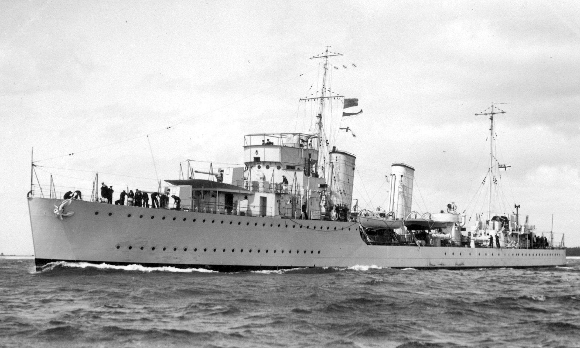
The Flag Officer Commanding, Iceland (C) was an appointment of the British Royal Navy during the Second World War. His headquarters were at the stone frigate HMS Baldur, based at Hvitanes, in Hvalfjörður fjord, on the west coast of Iceland. It was initially administered by the Admiral Commanding, Iceland (C), then as the Flag Officer Commanding, Iceland (C), from 1942 to 1945. History Following the German invasion of Denmark in April 1940, Iceland, then in personal union with Denmark, declared neutrality throughout the rest of the war. Iceland's location was of strategic importance to the British who decided to station naval forces at a naval base called HMS Baldur at Hvitanes following the invasion of Iceland in May 1940. In addition it also established an accounting and accommodation shore base called HMS Baldur II. Iceland was an important base for North Atlantic convoys, patrol and anti-submarine duties. The Admiralty appointed a flag officer to administer the station. On ... [...More Info...] [...Related Items...] OR: [Wikipedia] [Google] [Baidu] |
Fjords Of Iceland
The fjords of Iceland, listed in a clockwise direction round the island from the SW to the east. There are no important fjords along the south coast: most of the inlets there are lagoons. Western fjords * Faxaflói ** Stakksfjörður ** Hafnarfjörður ** Skerjafjörður ** Kollafjörður ** Hvalfjörður ** Borgarfjörður ** Haffjörður *Breiðafjörður ** Fjords on northern Snæfellsnes and in Dalasýsla ("Dalir"): *** Grundarfjörður *** Kolgrafafjörður *** Hraunsfjörður *** Vigrafjörður *** Álftafjörður *** Hvammsfjörður ** Fjords in Barðaströnd: *** Gilsfjörður *** Króksfjörður *** Berufjörður *** Þorskafjörður **** Djúpifjörður **** Gufufjörður *** Kollafjörður *** Kvígindisfjörður *** Skálmarfjörður **** Vattarfjörður *** Kerlingarfjörður **** Mjóifjörður *** Kjálkafjörður *** Vatnsfjörður Westfjords * Patreksfjörður * Tálknafjörður * Arnarfjörður ** Suðurfirðir *** Fossfjörður *** Reykjarfjörður *** T ... [...More Info...] [...Related Items...] OR: [Wikipedia] [Google] [Baidu] |
Akranes
Akranes () is a port town and municipality on the west coast of Iceland, around north of the capital Reykjavík. The area where Akranes is located was settled in the 9th century; however, it did not receive a municipal charter until 1942. History Akranes was settled in the 9th century by the brothers Þormóður and Ketill, sons of Bresi, who came from Ireland. The town started to form in the mid-17th century as a fishing village. In 1942, it was formally chartered, and in the following years it had the biggest surge in population in its history. Industry has been a big and growing employer: a cement plant has been operated in the town since the 1950s, and an aluminium smelting plant has been in operation near the town since 1998. Economy The fishing industry remains the town's most important source of employment. Akranes also acts as a service center for the large rural region surrounding it. The town is expected to grow in the coming years because of an increase in industr ... [...More Info...] [...Related Items...] OR: [Wikipedia] [Google] [Baidu] |
Birch
A birch is a thin-leaved deciduous hardwood tree of the genus ''Betula'' (), in the family Betulaceae, which also includes alders, hazels, and hornbeams. It is closely related to the beech- oak family Fagaceae. The genus ''Betula'' contains 30 to 60 known taxa of which 11 are on the IUCN 2011 Red List of Threatened Species. They are typically short-lived pioneer species and are widespread in the Northern Hemisphere, particularly in northern areas of temperate climates and in boreal climates. Birch wood is used for a wide range of purposes. Description Birch species are generally small to medium-sized trees or shrubs, mostly of northern temperate and boreal climates. The simple leaves are alternate, singly or doubly serrate, feather-veined, petiolate and stipulate. They often appear in pairs, but these pairs are really borne on spur-like, two-leaved, lateral branchlets. The fruit is a small samara, although the wings may be obscure in some species. They differ from t ... [...More Info...] [...Related Items...] OR: [Wikipedia] [Google] [Baidu] |
Nootka Lupine
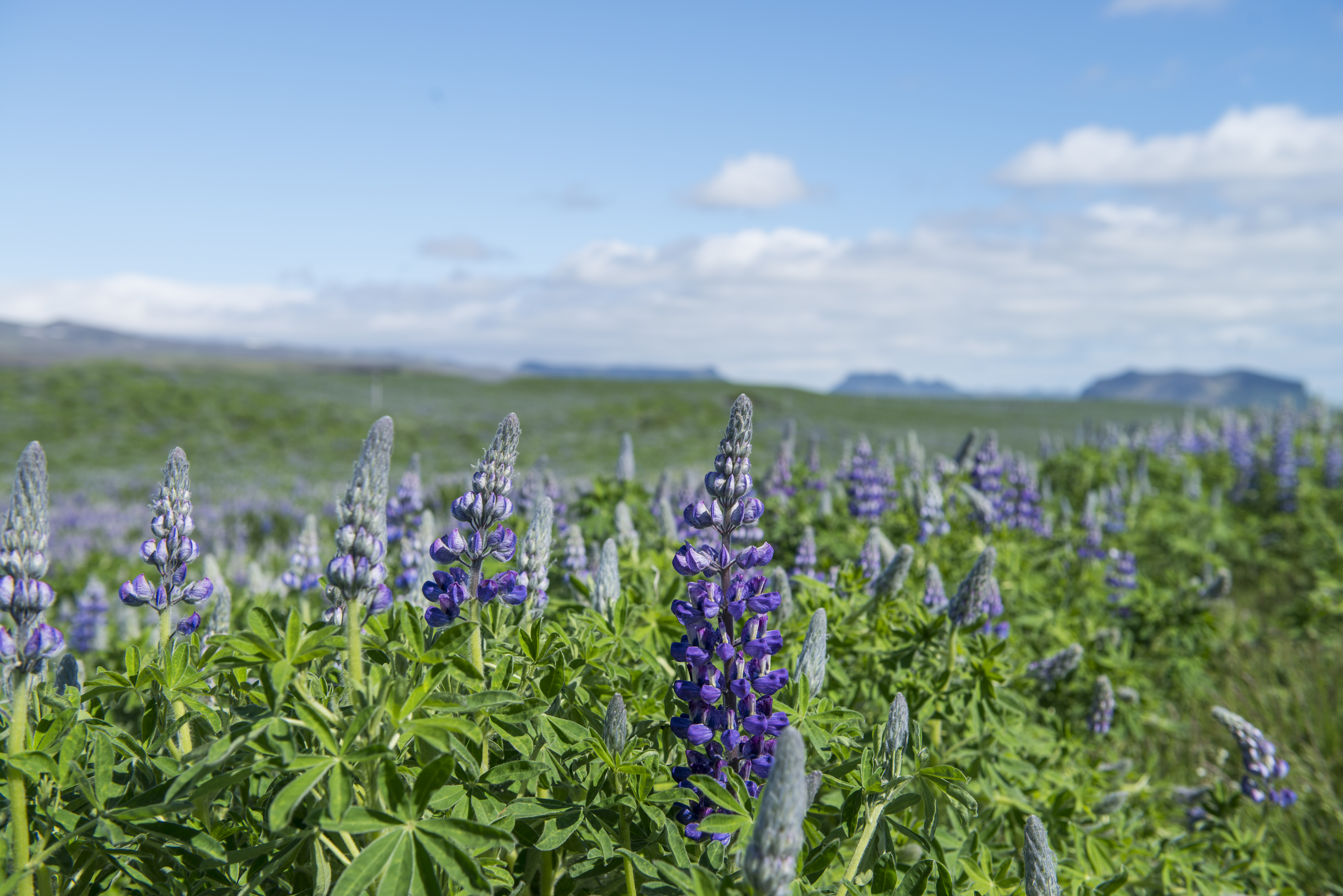
''Lupinus nootkatensis'', the Nootka lupine, is a perennial plant of the genus ''Lupinus'' in the legume family, Fabaceae. It is native to North America and was introduced to Europe in the late 18th century. It grows up to 60 cm tall, and has bright bluish-purple flowers. The Nootka lupine is common on the west coast of North America, and is one of the species from which the garden hybrids are derived, being valued in Britain and other North-European countries for its tolerance of cool, wet summers. In North America, it grows along roadsides, gravel bars, and forest clearings from the Aleutian Islands and Southcentral Alaska, and along the Alaskan panhandle to British Columbia. It is a rigorous self-seeder and can often be seen along roadsides and in open meadows. Their long tap roots make transplanting difficult, so sowing seed is preferable. Taxonomy The species was first described as ''Lupinus nootkatensis'' in 1810 by James Donn in '' Botanical Magazine'', Vol. 32, Pa ... [...More Info...] [...Related Items...] OR: [Wikipedia] [Google] [Baidu] |


