|
Horseheads (village), New York
Horseheads is a village in Chemung County, New York, United States. The population was 6,606 at the 2020 census. The name is derived from the number of bleached skulls of pack horses left behind by the Sullivan Expedition. The village of Horseheads is located within the town of Horseheads. It is north of the city of Elmira and is part of the Elmira Metropolitan Statistical Area. History In September 1779, forces under General John Sullivan marched north from Easton, Pennsylvania, over to Wyoming, Pennsylvania, and on up the Susquehanna River to Newtown (Elmira), then continued north through what is now known as Horseheads to the Finger Lakes region and west to Genesee, on a scorched-earth mission against Loyalists and more significantly against their Iroquois allies. They returned about three weeks later, largely on the same route. The journey had been particularly severe and wearing upon the animals, and their food supply was found insufficient. Arriving about north ... [...More Info...] [...Related Items...] OR: [Wikipedia] [Google] [Baidu] |
Village (United States)
In the United States, the meaning of village varies by geographic area and legal jurisdiction. In many areas, "village" is a term, sometimes informal, for a type of administrative division at the local government level. Since the Tenth Amendment to the United States Constitution prohibits the federal government from legislating on local government, the states are free to have political subdivisions called "villages" or not to and to define the word in many ways. Typically, a village is a type of municipality, although it can also be a special district or an unincorporated area. It may or may not be recognized for governmental purposes. In informal usage, a U.S. village may be simply a relatively small clustered human settlement without formal legal existence. In colonial New England, a village typically formed around the meetinghouses that were located in the center of each town.Joseph S. Wood (2002), The New England Village', Johns Hopkins University Press Many of these colon ... [...More Info...] [...Related Items...] OR: [Wikipedia] [Google] [Baidu] |
Welcome To Horseheads!
A welcome is a kind of greeting designed to introduce a person to a new place or situation, and to make them feel at ease. The term can similarly be used to describe the feeling of being accepted on the part of the new person. In some contexts, a welcome is extended to a stranger to an area or a household. "The concept of welcoming the stranger means intentionally building into the interaction those factors that make others feel that they belong, that they matter, and that you want to get to know them". It is also noted, however, that " many community settings, being welcoming is viewed as in conflict with ensuring safety. Thus, welcoming becomes somewhat self-limited: 'We will be welcoming unless you do something unsafe'". Different cultures have their own traditional forms of welcome, and a variety of different practices can go into an effort to welcome: Indications that visitors are welcome can occur at different levels. For example, a welcome sign, at the national, state ... [...More Info...] [...Related Items...] OR: [Wikipedia] [Google] [Baidu] |
Horseheads 1855 Extension Historic District
Horseheads 1855 Extension Historic District is a national historic district located at Horseheads in Chemung County, New York. The residential district includes a rich variety of exceptionally well preserved examples of the vernacular architectural styles once popular in such communities. The included structures reflect the diversity of architectural styles popular between 1860 and 1920. ''See also:'' It is adjacent to Hanover Square and Horseheads High School. It was listed on the National Register of Historic Places The National Register of Historic Places (NRHP) is the United States federal government's official list of districts, sites, buildings, structures and objects deemed worthy of preservation for their historical significance or "great artist ... in 1980. Gallery File:Horseheads 1855 Ext 1.jpg File:Horseheads 1855 Ext 2.jpg References Historic districts on the National Register of Historic Places in New York (state) Historic districts in Chemung ... [...More Info...] [...Related Items...] OR: [Wikipedia] [Google] [Baidu] |
Hanover Square Historic District (Horseheads, New York)
The Hanover Square Historic District is a downtown business district in Horseheads, New York. an''Accompanying 9 photos, from 1981''/ref> Most of the buildings in the district were built between 1862 and 1882 in the Romanesque Revival style. The homogeneity of the district is owed to the fact that a fire levelled the town in 1862, allowing for redevelopment in this manner. The brick buildings, with their decorative corbelling, are remarkably intact. The district was added to the National Register of Historic Places in 1982. History There was a small village built around a large rock deposited by a glacier by the time General John Sullivan came to the area during the Sullivan Expedition The 1779 Sullivan Expedition (also known as the Sullivan-Clinton Expedition, the Sullivan Campaign, and the Sullivan-Clinton Genocide) was a United States military campaign during the American Revolutionary War, lasting from June to October 1779 .... The Town of Horseheads grew from this sm ... [...More Info...] [...Related Items...] OR: [Wikipedia] [Google] [Baidu] |
Chemung Railway Depot-Horseheads
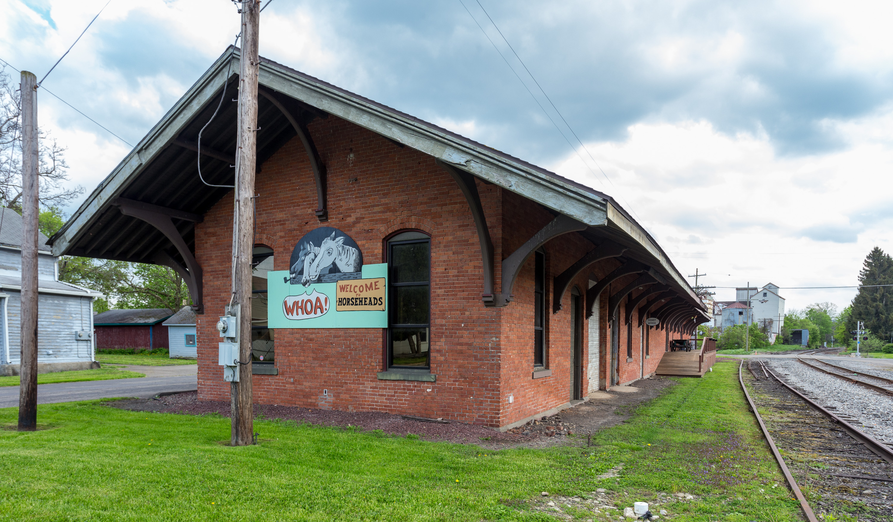
Horseheads is a historic railway depot located at Horseheads, Chemung County, New York. It was built in 1866 by the Northern Central Railway (NCRY). The train station was operated by the NCRY and its successor, the Pennsylvania Railroad, until 1956. The Italianate style building is significant architecturally and historically as a representative of a 19th-century railroad depot. an''Accompanying 4 photos, from 1996''/ref> After being closed by the railroad, the depot was purchased by the local feed mill, where it was used for storage for many decades until it was sold to be used as a retail location in 1994. The interior space has been slightly modified and the original wood floors have been replaced by cement ones, but it remains mostly as built. The Horseheads Historical Society purchased the depot in 1995 and started the restoration process in 1997. The new depot museum officially opened on September 18, 1999. The Historical Society now operates a museum and small rental spa ... [...More Info...] [...Related Items...] OR: [Wikipedia] [Google] [Baidu] |
Chemung Canal
The Chemung Canal is a former canal in New York, United States. The canal connected Seneca Lake at Watkins Glen to the Chemung River at Elmira, New York. It was planned to connect the Finger Lakes region and Pennsylvania's Susquehanna River watershed with New York's Erie Canal system. The latter connected the Great Lakes with the Hudson River and ultimately the Atlantic port of New York City. The state government allocated $300,000 for the construction, which started in 1830 and was completed in 1833. Opening to full service was delayed because of damage from a rainstorm in May 1833. Damage by rain and seasonal flooding was a yearly problem during the use of the canal. Forty-nine locks were needed to raise and lower barges passing through the canal. The selection of the Chemung Canal's route was a disappointment to Ithaca, New York, which had hoped to make the Erie–Susquehanna connection via Cayuga Lake. In 1854, the completion of the Junction Canal extended the leng ... [...More Info...] [...Related Items...] OR: [Wikipedia] [Google] [Baidu] |
Upstate New York
Upstate New York is a geographic region consisting of the area of New York State that lies north and northwest of the New York City metropolitan area. Although the precise boundary is debated, Upstate New York excludes New York City and Long Island, and most definitions of the region also exclude all or part of Westchester and Rockland counties, which are typically included in Downstate New York. Major cities across Upstate New York from east to west include Albany, Utica, Binghamton, Syracuse, Rochester, and Buffalo. Upstate New York is divided into several subregions: the Hudson Valley (of which the lower part is sometimes debated as to being "upstate"), the Capital District, the Mohawk Valley region, Central New York, the Southern Tier, the Finger Lakes region, Western New York, and the North Country. Before the European colonization of the United States, Upstate New York was populated by several Native American tribes. It was home to the Iroquois Confederacy, ... [...More Info...] [...Related Items...] OR: [Wikipedia] [Google] [Baidu] |
Iroquois
The Iroquois ( or ), officially the Haudenosaunee ( meaning "people of the longhouse"), are an Iroquoian-speaking confederacy of First Nations peoples in northeast North America/ Turtle Island. They were known during the colonial years to the French as the Iroquois League, and later as the Iroquois Confederacy. The English called them the Five Nations, comprising the Mohawk, Oneida, Onondaga, Cayuga, and Seneca (listed geographically from east to west). After 1722, the Iroquoian-speaking Tuscarora people from the southeast were accepted into the confederacy, which became known as the Six Nations. The Confederacy came about as a result of the Great Law of Peace, said to have been composed by Deganawidah the Great Peacemaker, Hiawatha, and Jigonsaseh the Mother of Nations. For nearly 200 years, the Six Nations/Haudenosaunee Confederacy were a powerful factor in North American colonial policy, with some scholars arguing for the concept of the Middle Ground, in that Eu ... [...More Info...] [...Related Items...] OR: [Wikipedia] [Google] [Baidu] |
Loyalist (American Revolution)
Loyalists were colonists in the Thirteen Colonies who remained loyal to the British Crown during the American Revolutionary War, often referred to as Tories, Royalists or King's Men at the time. They were opposed by the Patriots, who supported the revolution, and called them "persons inimical to the liberties of America." Prominent Loyalists repeatedly assured the British government that many thousands of them would spring to arms and fight for the crown. The British government acted in expectation of that, especially in the southern campaigns in 1780–81. Britain was able to effectively protect the people only in areas where they had military control, and in return, the number of military Loyalists was significantly lower than what had been expected. Due to the conflicting political views, loyalists were often under suspicion of those in the British military, who did not know whom they could fully trust in such a conflicted situation; they were often looked down upon. Pat ... [...More Info...] [...Related Items...] OR: [Wikipedia] [Google] [Baidu] |
Genesee, New York
Genesee is a town in Allegany County, New York, United States. The population was 1,653 at the 2020 census. Genesee is in the southwestern corner of the county, southeast of Olean. History The first settler arrived ''circa'' 1823. The town of Genesee was established in 1830 from a division of the town of Cuba. Much of the early economy was based on harvesting the forests, but oil production began in approximately 1890. Geography According to the United States Census Bureau, the town has a total area of , of which is land and , or 0.13%, is water. The south town line is the Pennsylvania ( McKean County) border, and the west town line is shared with the town of Portville in Cattaraugus County. New York State Route 417 is an important east-west highway through the town. Demographics As of the census of 2000, there were 1,803 people, 661 households, and 493 families residing in the town. The population density was 49.7 people per square mile (19.2/km2). There were 800 housin ... [...More Info...] [...Related Items...] OR: [Wikipedia] [Google] [Baidu] |
Finger Lakes
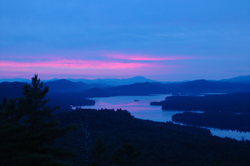
The Finger Lakes are a group of eleven long, narrow, roughly north–south lakes located south of Lake Ontario in an area called the ''Finger Lakes region'' in New York, in the United States. This region straddles the northern and transitional edge, known as the Finger Lakes Uplands and Gorges ecoregion, of the Northern Allegheny Plateau and the Ontario Lowlands ecoregion of the Great Lakes Lowlands.Bryce, S.A., Griffith, G.E., Omernik, J.M., Edinger, G., Indrick, S., Vargas, O., and Carlson, D., 2010''Ecoregions of New York'' Reston, Virginia, U.S. Geological Survey, map scale 1:1,250,000. The geological term '' finger lake'' refers to a long, narrow lake in an overdeepened glacial valley, while the proper name ''Finger Lakes'' goes back to the late 19th century.Mullins, H.T., Hinchey, E.J., Wellner, R.W., Stephens, D.B., Anderson, W.T., Dwyer, T.R. and Hine, A.C., 1996. ''Seismic stratigraphy of the Finger Lakes: a continental record of Heinrich event H-1 and Laurentide ic ... [...More Info...] [...Related Items...] OR: [Wikipedia] [Google] [Baidu] |
Susquehanna River
The Susquehanna River (; Lenape: Siskëwahane) is a major river located in the Mid-Atlantic region of the United States, overlapping between the lower Northeast and the Upland South. At long, it is the longest river on the East Coast of the United States. By watershed area, it is the 16th-largest river in the United States,Susquehanna River Trail Pennsylvania Fish and Boat Commission, accessed March 25, 2010.Susquehanna River , Green Works Radio, accessed March 25, 2010. and also the longest river in ... [...More Info...] [...Related Items...] OR: [Wikipedia] [Google] [Baidu] |


