|
Horná Streda
Horná Streda (, known as ''Vág-Szerdahely'' before 1898) is a village and municipality in Nové Mesto nad Váhom District in the Trenčín Region of western Slovakia. History In historical records the village was first mentioned in 1263. Prior to 1918 it was part of Nyitra County, Austria-Hungary. It then became part of the First Czechoslovak Republic. Geography The municipality lies at an altitude of 169 metres and covers an area of 9.827 km². It has a population of about 1300 people. The village lies about 7 km north of Piešťany and approximately 12 km south of Nové Mesto nad Váhom. Horná Streda is about an hour's drive away from Bratislava, the capital of Slovakia. The village lies on the banks of the river Váh and is the site of a small hydroelectric power plant. Genealogical resources The records for genealogical research are available at the state archive "Statny Archiv in Bratislava, Slovakia" * Roman Catholic church records (births/marriages ... [...More Info...] [...Related Items...] OR: [Wikipedia] [Google] [Baidu] |
Trenčín Region
The Trenčín Region ( sk, Trenčiansky kraj, ; cs, Trenčínský kraj; hu, Trencséni kerület) is one of the eight Slovak administrative regions. It consists of 9 districts ('' okresy''). The region was established in 1996: previously it had been a part of West-Slovak region (Západoslovenský kraj) and partly central Slovak region (Stredoslovenský kraj). Industry is a main branch of region economy. Geography It is located in the north-western Slovakia, has an area of 4,502 km² and a population of 600,386 (2005). The Danubian Lowland reaches the region to Nové Mesto nad Váhom and Partizánske areas. There are several mountain ranges in the region: a small part of the Little Carpathians in the south-west, White Carpathians in the north-west, Maple Mountains in the north, Strážov Mountains in the centre, Považský Inovec in the south, Vtáčnik in the south-east and Žiar in the east. Small parts of Lesser Fatra and of the Kremnica Mountains also stretch to ... [...More Info...] [...Related Items...] OR: [Wikipedia] [Google] [Baidu] |
Altitude
Altitude or height (also sometimes known as depth) is a distance measurement, usually in the vertical or "up" direction, between a reference datum and a point or object. The exact definition and reference datum varies according to the context (e.g., aviation, geometry, geographical survey, sport, or atmospheric pressure). Although the term ''altitude'' is commonly used to mean the height above sea level of a location, in geography the term elevation is often preferred for this usage. Vertical distance measurements in the "down" direction are commonly referred to as depth. In aviation In aviation, the term altitude can have several meanings, and is always qualified by explicitly adding a modifier (e.g. "true altitude"), or implicitly through the context of the communication. Parties exchanging altitude information must be clear which definition is being used. Aviation altitude is measured using either mean sea level (MSL) or local ground level (above ground leve ... [...More Info...] [...Related Items...] OR: [Wikipedia] [Google] [Baidu] |
Hydroelectric Power
Hydroelectricity, or hydroelectric power, is electricity generated from hydropower (water power). Hydropower supplies one sixth of the world's electricity, almost 4500 TWh in 2020, which is more than all other renewable sources combined and also more than nuclear power. Hydropower can provide large amounts of low-carbon electricity on demand, making it a key element for creating secure and clean electricity supply systems. A hydroelectric power station that has a dam and reservoir is a flexible source, since the amount of electricity produced can be increased or decreased in seconds or minutes in response to varying electricity demand. Once a hydroelectric complex is constructed, it produces no direct waste, and almost always emits considerably less greenhouse gas than fossil fuel-powered energy plants. [...More Info...] [...Related Items...] OR: [Wikipedia] [Google] [Baidu] |
Váh
The Váh (; german: Waag, ; hu, Vág; pl, Wag w Słowniku geograficznym Królestwa Polskiego i innych krajów słowiańskich (''in Geographical Dictionary of Polish Kingdom and other Slavic countries'').) is the longest within . Towns on the river include Liptovský Hrádok, Liptovský Mikuláš, Ružomberok, [...More Info...] [...Related Items...] OR: [Wikipedia] [Google] [Baidu] |
Bratislava
Bratislava (, also ; ; german: Preßburg/Pressburg ; hu, Pozsony) is the capital and largest city of Slovakia. Officially, the population of the city is about 475,000; however, it is estimated to be more than 660,000 — approximately 140% of the official figures. Bratislava is in southwestern Slovakia at the foot of the Little Carpathians, occupying both banks of the River Danube and the left bank of the River Morava. Bordering Austria and Hungary, it is the only national capital that borders two sovereign states. The city's history has been influenced by people of many nations and religions, including Austrians, Bulgarians, Croats, Czechs, Germans, Hungarians, Jews, Romani, Serbs and Slovaks. It was the coronation site and legislative center and capital of the Kingdom of Hungary from 1536 to 1783; eleven Hungarian kings and eight queens were crowned in St Martin's Cathedral. Most Hungarian parliament assemblies were held here from the 17th century until the Hunga ... [...More Info...] [...Related Items...] OR: [Wikipedia] [Google] [Baidu] |
Nové Mesto Nad Váhom
Nové Mesto nad Váhom (; german: Neustadt an der Waag, Neustadtl, Waag-Neustadtl, Waagneustadtl, Waag-Neustadt; hu, Vágújhely, Vág-Újhely) is a town in the Trenčín Region of Slovakia. Geography District town located at the northern edge of the Danubian Hills at the foothills of the northern end of the White Carpathians, on the Váh river. Other mountains nearby are the White Carpathian and the Považský Inovec. It is situated 27 km from Trenčín and 100 km from Bratislava and has an area of 32.583 km2. The Town parts are: Mnešice, Izbice, Javorinaská, Hájovky, Samoty, Luka, Centrum, Rajková (northern city), Záhumenice. Places of interest * Zelená voda Lakes 1 km - watersports, windsurfing, fishing, sports centre, camping area, disco and music festival place * Čachtice Castle 6 km - home of Elizabeth Báthory * Beckov Castle 5 km * Tematin Castle 12 km * the most famous Slovak Spa town Piešťany 18 km * Trenčín ... [...More Info...] [...Related Items...] OR: [Wikipedia] [Google] [Baidu] |
Piešťany
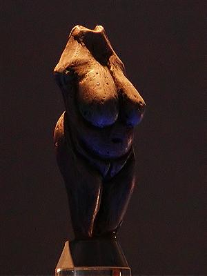
Piešťany (; german: Pistyan, hu, Pöstyén, pl, Pieszczany , cs, Píšťany ) is a town in Slovakia. It is located in the western part of the country within the Trnava Region and is the seat of its own district. It is the biggest and best known spa town in Slovakia and has around 28,000 inhabitants. Etymology The name Piešťany comes from Slovak ''Piesok'' (sand), referring to local sandbanks. The etymology is straightforward – ''Piešťanci'' – people who live on the sandy site and ''Piešťany'' – their settlement. History The first human settlement in the area is dated to the prehistoric times, about 80,000 years ago. People were attracted to the site by abundance of game in the vicinity of the thermal springs that did not freeze in winter. A small female statue called Venus of Moravany was found in the nearby village Moravany nad Váhom. It is made of mammoth ivory and is dated to 22,800 BC. It currently resides in the Bratislava Castle museum. In another near ... [...More Info...] [...Related Items...] OR: [Wikipedia] [Google] [Baidu] |
Population
Population typically refers to the number of people in a single area, whether it be a city or town, region, country, continent, or the world. Governments typically quantify the size of the resident population within their jurisdiction using a census, a process of collecting, analysing, compiling, and publishing data regarding a population. Perspectives of various disciplines Social sciences In sociology and population geography, population refers to a group of human beings with some predefined criterion in common, such as location, race, ethnicity, nationality, or religion. Demography is a social science Social science is one of the branches of science, devoted to the study of societies and the relationships among individuals within those societies. The term was formerly used to refer to the field of sociology, the original "science of soc ... which entails the statistical study of populations. Ecology In ecology, a population is a group of organisms of ... [...More Info...] [...Related Items...] OR: [Wikipedia] [Google] [Baidu] |
Area
Area is the quantity that expresses the extent of a region on the plane or on a curved surface. The area of a plane region or ''plane area'' refers to the area of a shape or planar lamina, while ''surface area'' refers to the area of an open surface or the boundary of a three-dimensional object. Area can be understood as the amount of material with a given thickness that would be necessary to fashion a model of the shape, or the amount of paint necessary to cover the surface with a single coat. It is the two-dimensional analogue of the length of a curve (a one-dimensional concept) or the volume of a solid (a three-dimensional concept). The area of a shape can be measured by comparing the shape to squares of a fixed size. In the International System of Units (SI), the standard unit of area is the square metre (written as m2), which is the area of a square whose sides are one metre long. A shape with an area of three square metres would have the same area as three such squares. ... [...More Info...] [...Related Items...] OR: [Wikipedia] [Google] [Baidu] |
First Czechoslovak Republic
The First Czechoslovak Republic ( cs, První československá republika, sk, Prvá česko-slovenská republika), often colloquially referred to as the First Republic ( cs, První republika, Slovak: ''Prvá republika''), was the first Czechoslovak state that existed from 1918 to 1938, a union of ethnic Czechs and Slovaks. The country was commonly called Czechoslovakia ( Czech and sk, Československo), a compound of ''Czech'' and ''Slovak''; which gradually became the most widely used name for its successor states. It was composed of former territories of Austria-Hungary, inheriting different systems of administration from the formerly Austrian ( Bohemia, Moravia, a small part of Silesia) and Hungarian territories (mostly Upper Hungary and Carpathian Ruthenia). After 1933, Czechoslovakia remained the only ''de facto'' functioning democracy in Central Europe, organized as a parliamentary republic. Under pressure from its Sudeten German minority, supported by neighbouring ... [...More Info...] [...Related Items...] OR: [Wikipedia] [Google] [Baidu] |
Nové Mesto Nad Váhom District
Nové Mesto nad Váhom District ( sk, okres Nové Mesto nad Váhom, hu, Vágújhelyi járás) is a district in the Trenčín Region of western Slovakia. Before 1920, the territory of the district was mostly part of the county of Kingdom of Hungary of Nyitra Nitra (; also known by other alternative names) is a city in western Slovakia, situated at the foot of Zobor Mountain in the valley of the river Nitra. It is located 95 km east of Bratislava. With a population of about 78,353, it is the fifth la ..., with an area in the north forming part of the county of Trencsén. Municipalities References External links Official site Districts of Slovakia {{Trenčín-geo-stub ... [...More Info...] [...Related Items...] OR: [Wikipedia] [Google] [Baidu] |
Austria-Hungary
Austria-Hungary, often referred to as the Austro-Hungarian Empire,, the Dual Monarchy, or Austria, was a constitutional monarchy and great power in Central Europe between 1867 and 1918. It was formed with the Austro-Hungarian Compromise of 1867 in the aftermath of the Austro-Prussian War and was dissolved shortly after its defeat in the First World War. Austria-Hungary was ruled by the House of Habsburg and constituted the last phase in the constitutional evolution of the Habsburg monarchy. It was a multinational state and one of Europe's major powers at the time. Austria-Hungary was geographically the second-largest country in Europe after the Russian Empire, at and the third-most populous (after Russia and the German Empire). The Empire built up the fourth-largest machine building industry in the world, after the United States, Germany and the United Kingdom. Austria-Hungary also became the world's third-largest manufacturer and exporter of electric home appliances, e ... [...More Info...] [...Related Items...] OR: [Wikipedia] [Google] [Baidu] |


