|
Higashine, Yamagata
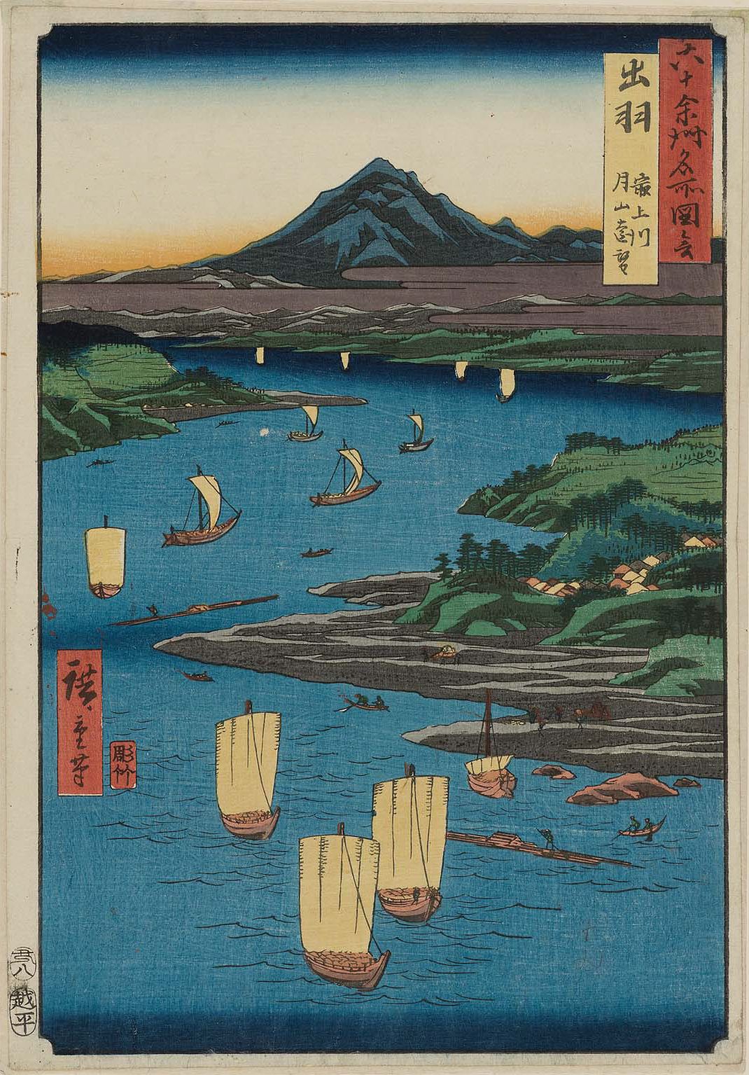
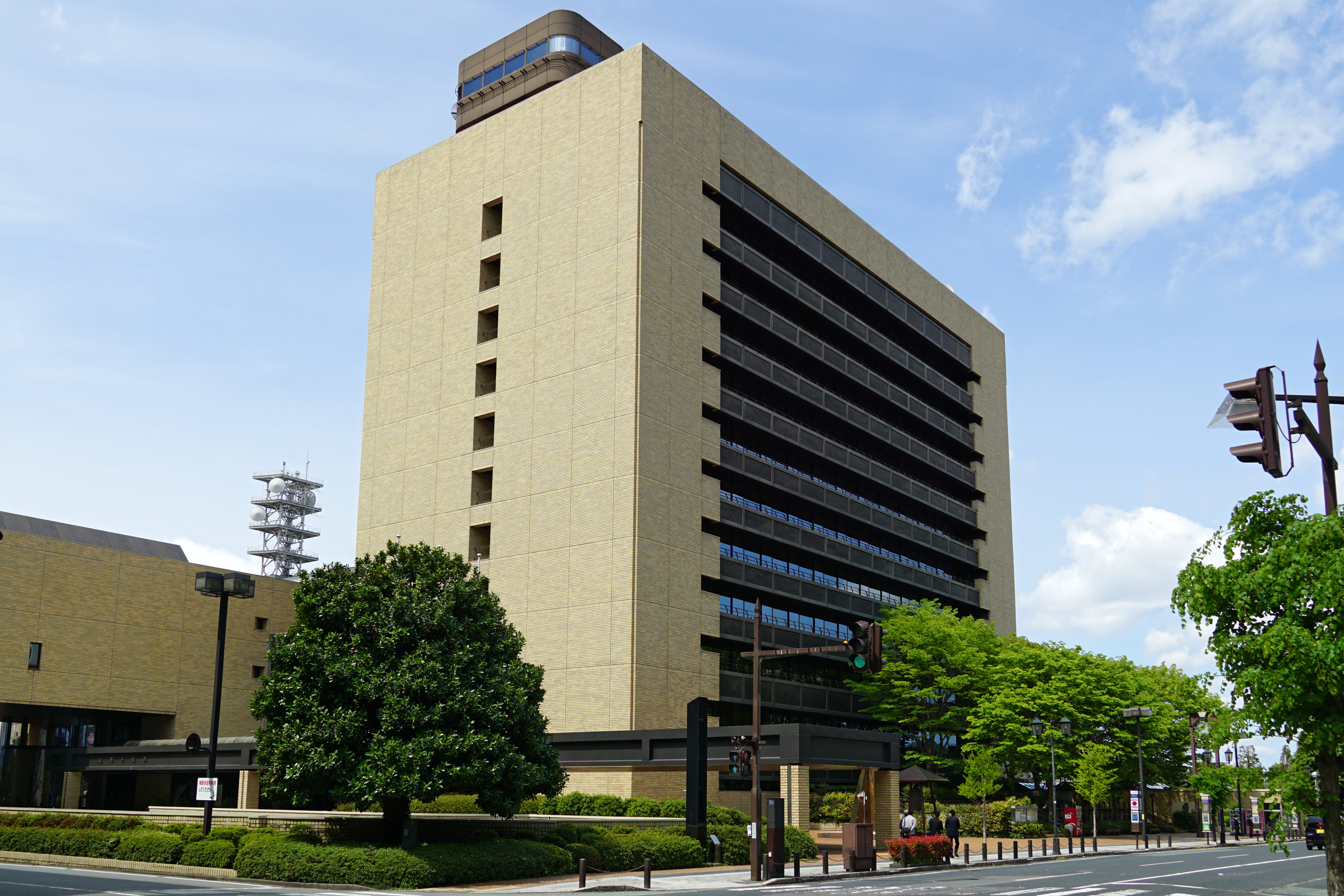
is a Cities of Japan, city located in Yamagata Prefecture, Japan. , the city had an estimated population of 47,910 in 17868 households, and a population density of 230 persons per km². The total area of the city is . Geography Located on the eastern shore of the Mogami River in the northern part of the Yamagata Basin, the urban area of Higashine is located in an alluvial fan created by the Shirasui River, the Murayamano River, and the Nitto River flowing from the Ōu Mountains in the eastern part of the city. The western portion of the city is hilly, rising to the Ōu Mountains which form its eastern border. Neighboring municipalities *Miyagi Prefecture **Sendai *Yamagata Prefecture **Kahoku, Yamagata, Kahoku **Murayama, Yamagata, Murayama **Obanazawa, Yamagata, Obanazawa **Tendō, Yamagata, Tendō **Yamagata, Yamagata, Yamagata Climate Higashine has a humid continental climate (Köppen climate classification ''Cfa'') with large seasonal temperature differences, with warm to ... [...More Info...] [...Related Items...] OR: [Wikipedia] [Google] [Baidu] |
Cities Of Japan
A is a local Public administration, administrative unit in Japan. Cities are ranked on the same level as and , with the difference that they are not a component of . Like other contemporary administrative units, they are defined by the Local Autonomy Law of 1947. City status Article 8 of the Local Autonomy Law sets the following conditions for a municipality to be designated as a city: *Population must generally be 50,000 or greater (原則として人口5万人以上) *At least 60% of households must be established in a central urban area (中心市街地の戸数が全戸数の6割以上) *At least 60% of households must be employed in commerce, industry or other urban occupations (商工業等の都市的業態に従事する世帯人口が全人口の6割以上) *Any other conditions set by prefectural ordinance must be satisfied (他に当該都道府県の条例で定める要件を満たしていること) The designation is approved by the prefectural governor and t ... [...More Info...] [...Related Items...] OR: [Wikipedia] [Google] [Baidu] |
Sendai
is the capital Cities of Japan, city of Miyagi Prefecture and the largest city in the Tōhoku region. , the city had a population of 1,098,335 in 539,698 households, making it the List of cities in Japan, twelfth most populated city in Japan. The modern city was founded in 1600 by the ''daimyō'' Date Masamune. It is nicknamed the ; there are Japanese zelkova trees lining many of the main thoroughfares such as and . In the summer, the Sendai Tanabata Festival, the largest Tanabata festival in Japan, is held. In winter, the trees are decorated with thousands of lights for the , lasting through most of December. The city is also home to Tohoku University, one of the former Imperial Universities. On 11 March 2011, coastal areas of the city suffered catastrophic damage from a 2011 Tōhoku earthquake and tsunami, magnitude 9.0 offshore earthquake,] which triggered a destructive tsunami. History Edo period Although the Sendai area was inhabited as early as 20,000 years ago, the ... [...More Info...] [...Related Items...] OR: [Wikipedia] [Google] [Baidu] |
Matsumae Domain
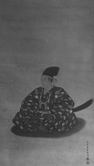
file:Matsumae Nagahiro.jpg, 270px, Matsumae Nagahiro, final daimyo of Matsumae Domain The Matsumae Domain (松前藩), a prominent domain during the Edo period, was situated in Matsumae, Matsumae Island (Ishijima), which is currently known as Matsumae Town, Matsumae District, Hokkaido, Matsumae District, Hokkaido, via Tsugaru District, Mutsu, Tsugaru District, Oshima Province. The clan's leader, also known as the lord of the domain, constructed Matsumae Castle, Matsumae Fukuyama Castle in the same location and henceforth, the clan came to be referred to as the Fukuyama clan. In 1868, the castle was relocated to Tatejo in Assabu-cho, Hiyama-gun, within the territory, and was known as Tatehan during the Meiji era, Meiji period. Initially, the Matsumae clan's jurisdiction was limited to the Wajin territory on the Oshima Peninsula in southwest Hokkaido. However, they gradually expanded their control over the Ezo region, which is now part of Hokkaido, and transformed it into their dom ... [...More Info...] [...Related Items...] OR: [Wikipedia] [Google] [Baidu] |
Tokugawa Shogunate
The Tokugawa shogunate, also known as the was the military government of Japan during the Edo period from 1603 to 1868. The Tokugawa shogunate was established by Tokugawa Ieyasu after victory at the Battle of Sekigahara, ending the civil wars of the Sengoku period following the collapse of the Ashikaga shogunate. Ieyasu became the ''shōgun,'' and the Tokugawa clan governed Japan from Edo Castle in the eastern city of Edo (Tokyo), Edo (Tokyo) along with the ''daimyō'' lords of the ''samurai'' class. The Tokugawa shogunate organized Japanese society under the strict Edo society, Tokugawa class system and banned most foreigners under the isolationist policies of ''Sakoku'' to promote political stability. The Tokugawa shoguns governed Japan in a feudal system, with each ''daimyō'' administering a ''Han system, han'' (feudal domain), although the country was still nominally organized as provinces of Japan, imperial provinces. Under the Tokugawa shogunate, Japan experienced rapid ... [...More Info...] [...Related Items...] OR: [Wikipedia] [Google] [Baidu] |
Edo Period
The , also known as the , is the period between 1600 or 1603 and 1868 in the history of Japan, when the country was under the rule of the Tokugawa shogunate and some 300 regional ''daimyo'', or feudal lords. Emerging from the chaos of the Sengoku period, the Edo period was characterized by prolonged peace and stability, urbanization and economic growth, strict social order, Isolationism, isolationist foreign policies, and popular enjoyment of Japanese art, arts and Culture of Japan, culture. In 1600, Tokugawa Ieyasu prevailed at the Battle of Sekigahara and established hegemony over most of Japan, and in 1603 was given the title ''shogun'' by Emperor Go-Yōzei. Ieyasu resigned two years later in favor of his son Tokugawa Hidetada, Hidetada, but maintained power, and defeated the primary rival to his authority, Toyotomi Hideyori, at the Siege of Osaka in 1615 before his death the next year. Peace generally prevailed from this point on, making samurai largely redundant. Tokugawa sh ... [...More Info...] [...Related Items...] OR: [Wikipedia] [Google] [Baidu] |
Heian Period
The is the last division of classical Japanese history, running from 794 to 1185. It followed the Nara period, beginning when the 50th emperor, Emperor Kammu, moved the capital of Japan to Heian-kyō (modern Kyoto). means in Japanese. It is a period in Japanese history when the Chinese influence on Japanese culture, Chinese influences were in decline and the national culture matured. The Heian period is also considered the peak of the Japanese Emperors of Japan, imperial court, noted for its Japanese art, art, especially Japanese poetry, poetry and Japanese literature, literature. Two syllabaries unique to Japan, katakana and hiragana, emerged during this time. This gave rise to Japan's famous vernacular literature, with many of its texts written by court ladies who were not as educated in Chinese as their male counterparts. Although the Imperial House of Japan had power on the surface, the real power was in the hands of the Fujiwara clan, a powerful Kuge, aristocratic family wh ... [...More Info...] [...Related Items...] OR: [Wikipedia] [Google] [Baidu] |
Engishiki
The is a Japanese book of laws and customs. The major part of the writing was completed in 927. Nussbaum, Louis-Frédéric. (2005)"''Engi-shiki''"in ''Japan Encyclopedia'', p. 178. History Emperor Daigo ordered the compilation of the ''Engishiki'' in 905. Although previous attempts at codification are known to have taken place, neither the ''Konin'' nor the ''Jogan Gishiki'' survive, making the Engishiki important for early Japanese historical and religious studies. Fujiwara no Tokihira began the task, but work stalled when he died four years later in 909. His brother Fujiwara no Tadahira continued the work in 912 eventually completing it in 927. While the ''Engishiki'' was presented to the throne in 927, it was not used as a basis for enacting policy until 967. Possible reasons for this delay in application include a need for it to be revised, the fact that it was simply a record of already existing systems, and also that some of those systems functioned in name only. Co ... [...More Info...] [...Related Items...] OR: [Wikipedia] [Google] [Baidu] |
Dewa Province
was a province of Japan comprising modern-day Yamagata Prefecture and Akita Prefecture, except for the city of Kazuno and the town of Kosaka. Dewa bordered on Mutsu and Echigō Provinces. Its abbreviated form name was . History Early period Prior to the Asuka period, Dewa was inhabited by Ainu or Emishi tribes, and was effectively outside of the control of the imperial dynasty. Abe no Hirafu conquered the native Emishi tribes at what are now the cities of Akita and Noshiro in 658 and established a fort on the Mogami River. In 708 AD was created within Echigō Province. The area of Dewa District was roughly that of the modern Shōnai area of Yamagata Prefecture, and was gradually extended to the north as the Japanese pushed back the indigenous people of northern Honshū. Dewa District was promoted to the status of a province () in 712 AD, and gained Okitama and Mogami Districts, formerly part of Mutsu Province. A number of military expeditions were sent to the area, ... [...More Info...] [...Related Items...] OR: [Wikipedia] [Google] [Baidu] |
Japan Meteorological Agency
The Japan Meteorological Agency (JMA; ''気象庁, Kishō-chō'') is a division of the Ministry of Land, Infrastructure, Transport and Tourism dedicated to the Scientific, scientific observation and research of natural phenomena. Headquartered in Minato, Tokyo the government agency, agency collects data on meteorology, hydrology, seismology, volcanology, and other related fields. The JMA is responsible for collecting and disseminating weather data and Forecasting, forecasts to the public, as well as providing specialized information for aviation and Marine weather forecasting, marine sectors. Additionally, the JMA issues warnings for volcanic eruptions and is integral to the nationwide Earthquake Early Warning (Japan), Earthquake Early Warning (EEW) system. As one of the Regional Specialized Meteorological Centers designated by the World Meteorological Organization (WMO), the JMA also Forecasting, forecasts, Tropical cyclone naming, names, and distributes warnings for tropical ... [...More Info...] [...Related Items...] OR: [Wikipedia] [Google] [Baidu] |
Humid Continental Climate
A humid continental climate is a climatic region defined by Russo-German climatologist Wladimir Köppen in 1900, typified by four distinct seasons and large seasonal temperature differences, with warm to hot (and often humid) summers, and cold (sometimes severely cold in the northern areas) and snowy winters. Precipitation is usually distributed throughout the year, but often these regions do have dry seasons. The definition of this climate in terms of temperature is as follows: the mean temperature of the coldest month must be below or depending on the isotherm, and there must be at least four months whose mean temperatures are at or above . In addition, the location in question must not be semi-arid or arid. The cooler ''Dfb'', ''Dwb'', and ''Dsb'' subtypes are also known as hemiboreal climates. Although amount of snowfall is not a factor used in defining the humid continental climate, snow during the winter in this type of climate is almost a guarantee, either intermitte ... [...More Info...] [...Related Items...] OR: [Wikipedia] [Google] [Baidu] |
Yamagata, Yamagata
is the capital city of Yamagata Prefecture located in the Tōhoku region of northern Japan. , the city had an estimated population of 242,505 in 103,165 households, and a population density of 636 persons per km2. The total area of the city is . Geography Yamagata is in the southern portion of the Yamagata Basin in southeast Yamagata Prefecture. The northern and northwestern parts of the city are flatland, and the eastern part of the city is occupied by the Ōu Mountains. The city includes Mount Zaō within its borders. The Mamigasaki River passes through the city, and the Tachiyagawa River forms the border between Yamagata and Tendō. Neighboring municipalities *Miyagi Prefecture ** Kawasaki **Sendai *Yamagata Prefecture ** Higashine ** Kaminoyama ** Nakayama ** Nanyō ** Tendō ** Yamanobe Climate Yamagata has a Humid continental climate (Köppen climate classification ''Dfa'') closely bordering on Humid Subtropical climate (Köppen ''Cfa'') with large seasonal temperature ... [...More Info...] [...Related Items...] OR: [Wikipedia] [Google] [Baidu] |
Tendō, Yamagata
is a Cities of Japan, city located in Yamagata Prefecture, Japan. , the city had an estimated population of 61,947 in 22392 households, and a population density of 550 persons per km2. The total area of the city is . Geography Tendō is located in the east-central portion of the Yamagata Basin, bordered by the Ōu Mountains to the east. Neighboring municipalities *Yamagata Prefecture **Higashine, Yamagata, Higashine **Kahoku, Yamagata, Kahoku **Nakayama, Yamagata, Nakayama **Sagae, Yamagata, Sagae **Yamagata, Yamagata, Yamagata Climate Tendō has a Humid continental climate (Köppen climate classification ''Cfa'') with large seasonal temperature differences, with warm to hot (and often humid) summers and cold (sometimes severely cold) winters. Precipitation is significant throughout the year, but is heaviest from August to October. The average annual temperature in Tendō is 11.1 °C. The average annual rainfall is 1381 mm with September as the wettest month. The temp ... [...More Info...] [...Related Items...] OR: [Wikipedia] [Google] [Baidu] |


