|
Haskell Strait, Antarctica
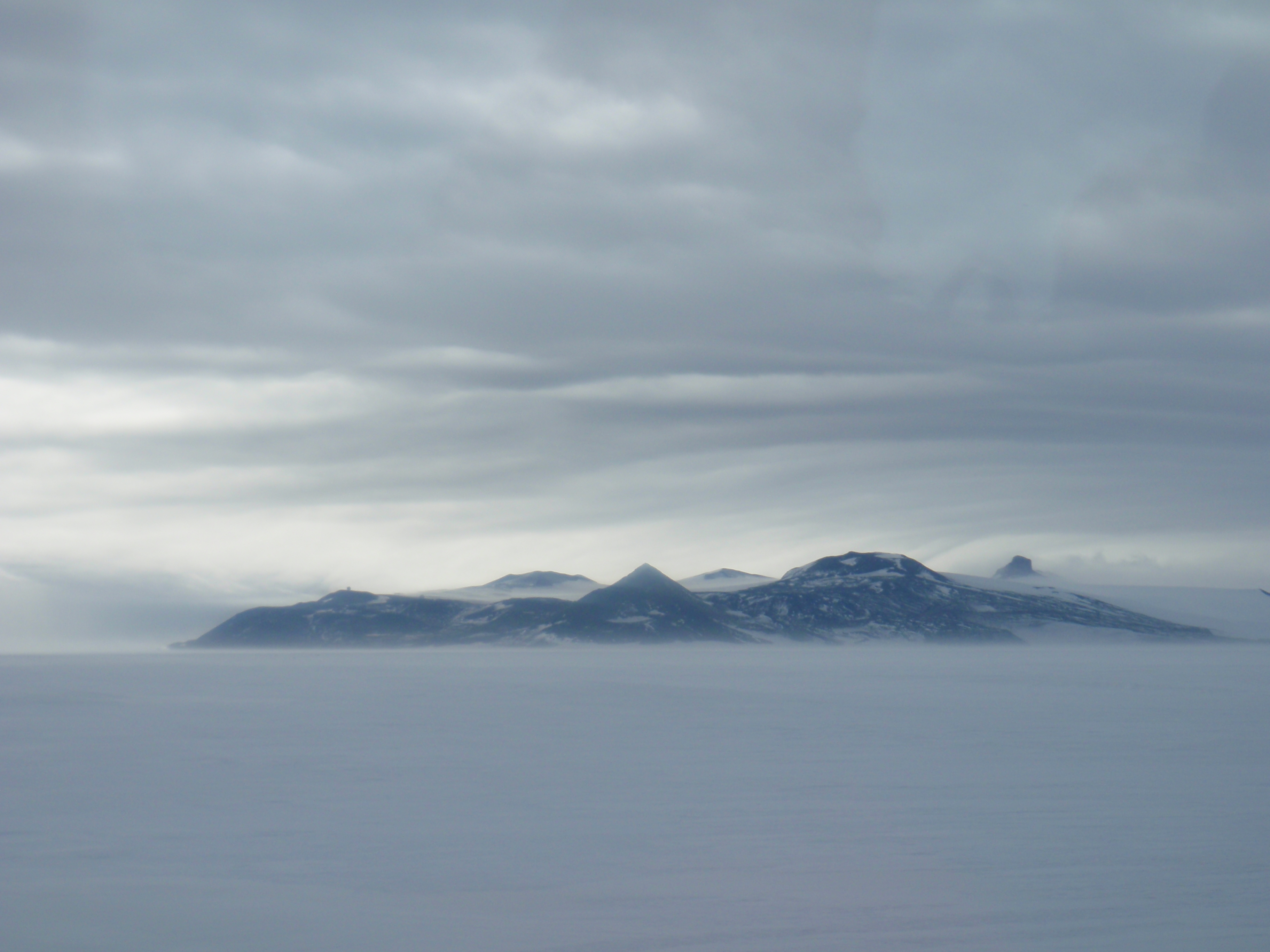
Haskell Strait refers to the ocean passage in southern McMurdo Sound, running between Cape Armitage, Ross Island and Cape Spencer-Smith, White Island, Antarctica. Oceanographically, it separates McMurdo Sound from the ocean basin (ice shelf cavity) beneath the Ross Ice Shelf. The Strait itself is around 25 km wide and in places over 900 m deep. Currents of nearly half a knot have been measured in the Strait, although typical flows are lower. It is mostly covered by the ice of the McMurdo Ice Shelf and fast ice in southern McMurdo Sound. On rare occasions sea-ice breakout exposes the north-west corner of the Strait which becomes navigable and vessels can actually moor off Scott Base. Name It is named after the New Zealand polar scientist Dr Timothy G. Haskell in 2009. It is unclear why it was not named previously as a strait. Possibly, this was because it is typically ice-covered and is dominated by the barrier (the McMurdo Ice Shelf). However, it dwarfs the other name ... [...More Info...] [...Related Items...] OR: [Wikipedia] [Google] [Baidu] |
McMurdo Sound
McMurdo Sound is a sound in Antarctica. It is the southernmost navigable body of water in the world, and is about from the South Pole. Captain James Clark Ross discovered the sound in February 1841, and named it after Lt. Archibald McMurdo of HMS ''Terror''. The sound today serves as a resupply route for cargo ships and for airplanes that land on the floating ice airstrips near McMurdo Station. Physical characteristics Wildlife in the sound include killer whales, seals, Adélie penguins, and emperor penguins. Boundary and Extents The sound extends approximately 55 kilometers (34 mi) in length and width, and opens into the larger Ross Sea to the north. To the south, the sound is bounded by the Ross Ice Shelf cavity, to the west lies the Royal Society Range, and to the east is Ross Island. McMurdo Sound is separated from the McMurdo Ice Shelf (itself part of the Ross Ice Shelf) by the Haskell Strait. Winter Quarters Bay lies at the south end of the Sound, and i ... [...More Info...] [...Related Items...] OR: [Wikipedia] [Google] [Baidu] |
Cape Armitage
Hut Point Peninsula () is a long, narrow peninsula from wide and long, projecting south-west from the slopes of Mount Erebus on Ross Island, Antarctica. McMurdo Station (US) and Scott Base (NZ) are Antarctic research stations located on the Hut Point Peninsula. History The British National Antarctic Expedition (1901–04) under Robert Falcon Scott built its hut on Hut Point, a small point lying north-east of Cape Armitage, the southern headland of the peninsula. Members of the British Antarctic Expedition, 1910–13 (BAE), under Scott, wintering on Cape Evans and often using the hut during their journeys, came to refer to the whole peninsula as the Hut Point Peninsula. Stonehouse, Bernard. ''Encyclopedia of Antarctica and the Southern Oceans'', John Wiley and Sons, 2002. Historic sites and monuments Several features on Hut Point, including the cross memorial for George Vince and the store hut for the Scott expeditions, are protected under the Antarctic Treaty. Both th ... [...More Info...] [...Related Items...] OR: [Wikipedia] [Google] [Baidu] |
Ross Island
Ross Island is an island formed by four volcanoes in the Ross Sea near the continent of Antarctica, off the coast of Victoria Land in McMurdo Sound. Ross Island lies within the boundaries of Ross Dependency, an area of Antarctica claimed by New Zealand. History Discovery Sir James Ross discovered it in 1840, and it was later named in honour of him by Robert F. Scott. Ross Island was the base for many of the early expeditions to Antarctica. It is the southernmost island reachable by sea. Huts built by Scott's and Shackleton's expeditions are still standing on the island, preserved as historical sites. Today Ross Island is home to New Zealand's Scott Base, and the largest Antarctic settlement, the U.S. Antarctic Program's McMurdo Station. Greenpeace established World Park Base on the island and ran it for five years, from 1987 to 1992. Geography Because of the persistent presence of the ice sheet, the island is sometimes taken to be part of the Antarctic mainland. I ... [...More Info...] [...Related Items...] OR: [Wikipedia] [Google] [Baidu] |
Cape Spencer-Smith
Cape Spencer-Smith is the northernmost cape of White Island, in the Ross Archipelago. Named by the New Zealand Geological Survey Antarctic Expedition (NZGSAE) (1958–59) for the Rev. Arnold Spencer-Smith, chaplain with the Ross Sea Party of the Imperial Trans-Antarctic Expedition The Imperial Trans-Antarctic Expedition of 1914–1917 is considered to be the last major expedition of the Heroic Age of Antarctic Exploration. Conceived by Ernest Shackleton, Sir Ernest Shackleton, the expedition was an attempt to make the ... (1914–17), who died on March 9, 1916, on the return journey after laying the depots to Mount Hope for Shackleton's party. He had suffered from scurvy and had been carried for 40 days on a sledge by his companions prior to his death. It is separated from Ross Island by Haskell Strait. References Headlands of Victoria Land Scott Coast {{ScottCoast-geo-stub ... [...More Info...] [...Related Items...] OR: [Wikipedia] [Google] [Baidu] |
Ross Ice Shelf
The Ross Ice Shelf is the largest ice shelf of Antarctica (, an area of roughly and about across: about the size of France). It is several hundred metres thick. The nearly vertical ice front to the open sea is more than long, and between high above the water surface. Ninety percent of the floating ice, however, is below the water surface. Most of Ross Ice Shelf is in the Ross Dependency claimed by New Zealand. It floats in, and covers, a large southern portion of the Ross Sea and the entire Roosevelt Island located in the east of the Ross Sea. The ice shelf is named after Sir James Clark Ross, who discovered it on 28 January 1841. It was originally called "The Barrier", with various adjectives including "Great Ice Barrier", as it prevented sailing further south. Ross mapped the ice front eastward to 160° W. In 1947, the U.S. Board on Geographic Names applied the name "Ross Shelf Ice" to this feature and published it in the original U.S. Antarctic Gazetteer. In Ja ... [...More Info...] [...Related Items...] OR: [Wikipedia] [Google] [Baidu] |
Fast Ice
Fast ice (also called ''land-fast ice'', ''landfast ice'', and ''shore-fast ice'') is sea ice that is "fastened" to the coastline, to the sea floor along shoals or to grounded icebergs.Leppäranta, M. 2011. The Drift of Sea Ice. Berlin: Springer-Verlag. Fast ice may either grow in place from the sea water or by freezing pieces of drifting ice to the shore or other anchor sites.Kovacs, A.and M. Mellor. 1974. "Sea ice morphology and ice as a geologic agent in the Southern Beaufort Sea." pp. 113-164, in: ''The Coast and Shelf of the Beaufort Sea'', J.C. Reed and J.E. Sater (Eds.), Arlington, Va.: U.S.A. Unlike drift (or pack) ice, fast ice does not move with currents and winds. The width (and the presence) of this ice zone is usually seasonal and depends on ice thickness, topography of the sea floor and islands. It ranges from a few meters to several hundred kilometers. Seaward expansion is a function of a number of factors, notably water depth, shoreline protection, time of ... [...More Info...] [...Related Items...] OR: [Wikipedia] [Google] [Baidu] |
Timothy Haskell NZAM (cropped)
Timothy is a masculine name. It comes from the Greek name ( Timόtheos) meaning "honouring God", "in God's honour", or "honoured by God". Timothy (and its variations) is a common name in several countries. People Given name * Timothy (given name), including a list of people with the name * Tim (given name) * Timmy * Timo * Timotheus * Timothée Surname * Christopher Timothy (born 1940), Welsh actor. * Miriam Timothy (1879–1950), British harpist. * Nick Timothy (born 1980), British political adviser. Mononym * Saint Timothy, a companion and co-worker of Paul the Apostle * Timothy I (Nestorian patriarch) Education * Timothy Christian School (Illinois), a school system in Elmhurst, Illinois * Timothy Christian School (New Jersey), a school in Piscataway, New Jersey Arts and entertainment * "Timothy" (song), a 1970 song by The Buoys * ''Timothy Goes to School'', a Canadian-Chinese children's animated series * ''Timothy'' (TV film), a 2014 Australian television comedy * ... [...More Info...] [...Related Items...] OR: [Wikipedia] [Google] [Baidu] |
Timothy Haskell
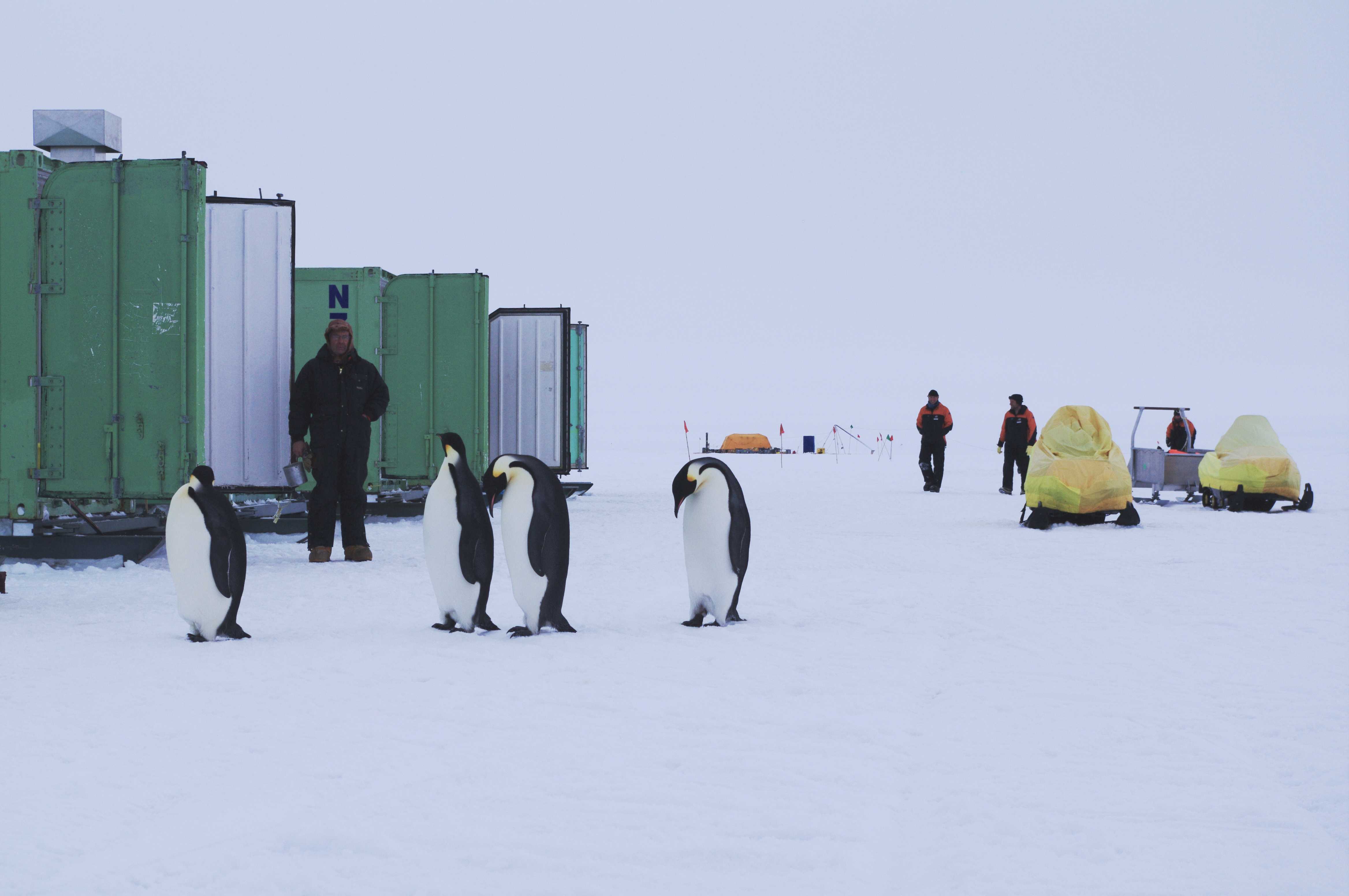
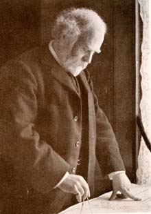
Timothy George Haskell is a New Zealand scientist. Career and impact Haskell started his career at the Physics and Engineering Laboratory of DSIR (New Zealand) and remained with them through its evolution to Industrial Research Limited (IRL). He shifted to Callaghan Innovation in 2012. He worked with Bill Robinson on the development and installation of earthquake base isolation foundations for Te Papa. However, he is best known for his development of "Camp Haskell" - a containerised facility for working on the Sea ice of McMurdo Sound. He had equipment mounted on the Erebus Glacier Tongue when it calved in 1990. He had just finished a field trip to the glacier in 2010 when it next calved. He worked with Paul Callaghan for a time, developing portable Nuclear magnetic resonance (NMR) technology. Initial application to the determination of sea ice heterogeneity evolved to become a range of bench-top NMR devices developed by the spin-off company Magritek. In 2009 ... [...More Info...] [...Related Items...] OR: [Wikipedia] [Google] [Baidu] |
Minna Bluff
Minna Bluff is a rocky promontory at the eastern end of a volcanic Antarctic peninsula projecting deep into the Ross Ice Shelf at . It forms a long, narrow arm which culminates in a south-pointing hook feature (Minna Hook), and is the subject of research into Antarctic cryosphere history, funded by the National Science Foundation, Office of Polar Programs. The bluff is mentioned repeatedly in the history of Antarctic exploration. It was first sighted in June 1902, during Captain Robert Falcon Scott's ''Discovery'' Expedition, 1901–04. It was thereafter recognised as a key landmark and location for vital supply depots for southern journeys towards the South Pole. Originally identified simply as "the Bluff", it was later named by Scott after the wife of Royal Geographical Society former president Sir Clements Markham. Every expedition that followed Scott on this route after his pioneering journey (including Ernest Shackleton in 1908, Scott himself in 1911 and Shackleton's R ... [...More Info...] [...Related Items...] OR: [Wikipedia] [Google] [Baidu] |
Heroic Age Of Antarctic Exploration
The Heroic Age of Antarctic Exploration was an era in the exploration of the continent of Antarctica which began at the end of the 19th century, and ended after the First World War; the Shackleton–Rowett Expedition of 1921–1922 is often cited by historians as the dividing line between the "Heroic" and "Mechanical" ages. During the Heroic Age, the Antarctic region became the focus of international efforts that resulted in intensive scientific and geographical exploration by 17 major Antarctic expeditions launched from ten countries.Barczewski, pp. 19–20. The common factor in these expeditions was the limited nature of the resources available to them before advances in transport and communication technologies revolutionized the work of exploration. Each of these expeditions therefore became a feat of endurance that tested, and sometimes exceeded, the physical and mental limits of its personnel. The "heroic" label, bestowed later, recognized the adversities which had to be ... [...More Info...] [...Related Items...] OR: [Wikipedia] [Google] [Baidu] |
Apsley Cherry-Garrard
Apsley George Benet Cherry-Garrard (2 January 1886 – 18 May 1959) was an English explorer of Antarctica. He was a member of the ''Terra Nova'' expedition and is acclaimed for his 1922 account of this expedition, ''The Worst Journey in the World''. Early life Born in Bedford, as Apsley George Benet Cherry, the eldest child of Apsley Cherry of Denford Park and his wife, Evelyn Edith (née Sharpin), daughter of Henry Wilson Sharpin of Bedford. He was educated at Winchester College and at Christ Church, Oxford where he read classics and modern history. While at Oxford, he rowed in the 1908 Christ Church crew which won the Grand Challenge Cup at the Henley Royal Regatta. His surname was changed to Cherry-Garrard by the terms of his great-aunt's will, through which his father inherited the Lamer Park estate near Wheathampstead, Hertfordshire. Apsley inherited the estate on his father's death in 1907. Cherry-Garrard had always been enamoured of the stories of his father ... [...More Info...] [...Related Items...] OR: [Wikipedia] [Google] [Baidu] |


