|
Harmar Township, Allegheny County, Pennsylvania
Harmar Township is a township in Allegheny County, Pennsylvania, United States. It contains the communities of Acmetonia, Harmarville, Harmar Heights, and Chapel Downs. The population was 3,136 at the 2020 census. The township was named after Harmar Denny, a U.S. congressman and son of Ebenezer Denny. Geography Harmar Township is located at . According to the United States Census Bureau, the township has a total area of , of which is land and , or 7.45%, is water. Streams Harmar Township is entirely in the Allegheny River drainage basin and contains one undeveloped state park, Allegheny Islands State Park, on three alluvial islands in the Allegheny River. Deer Creek flows through the township; it joins the Allegheny at Harmar. Surrounding and adjacent neighborhoods The township has six land borders, including Indiana Township to the north, Frazer Township to the northeast, Springdale Township and Cheswick to the east, O'Hara Township to the southwest and Fox ... [...More Info...] [...Related Items...] OR: [Wikipedia] [Google] [Baidu] |
Allegheny Islands State Park
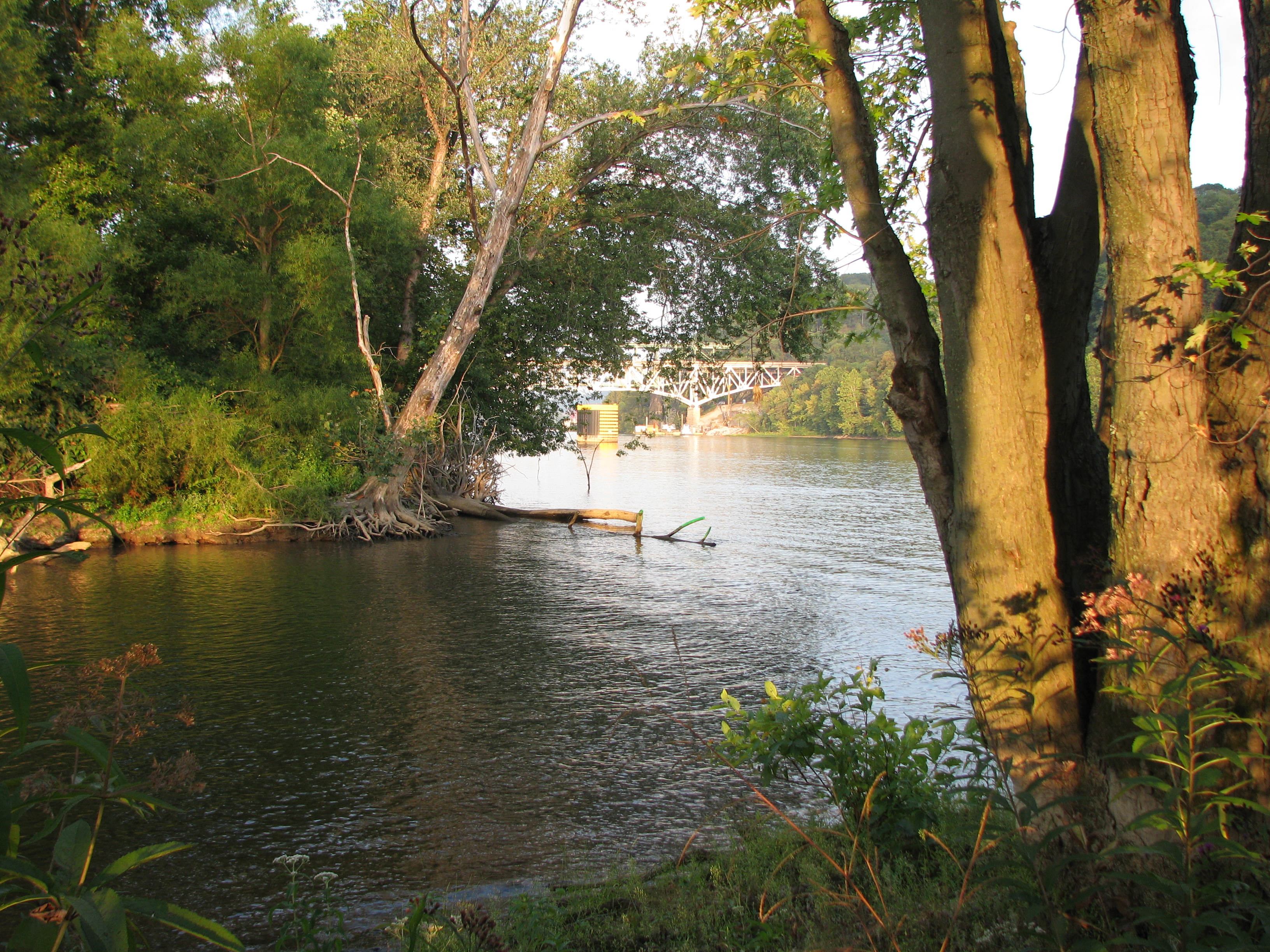
Allegheny Islands State Park is a Pennsylvania state park in Harmar Township, Allegheny County, Pennsylvania in the United States. The undeveloped park is composed of three alluvial islands located in the middle of the Allegheny River northeast of Pittsburgh. The islands are just north of the boroughs of Oakmont and Plum, and southwest of Cheswick.''Note: shows Allegheny River and its islands'' Bridges for the Pennsylvania Turnpike ( Interstate 76) and the Bessemer and Lake Erie Railroad Branch of the Canadian National Railway cross the Allegheny River at the middle island. Islands The park land on the islands has a total area of , with two islands downstream of the Allegheny River Lock and Dam Three (officially named the ''C. W. Bill Young Lock and Dam''), and the other island upstream. Twelve Mile Island is the farthest downstream (west) and has a number of houses and buildings on the western four-fifths of the island (the park land is the eastern end). The remaini ... [...More Info...] [...Related Items...] OR: [Wikipedia] [Google] [Baidu] |
Fox Chapel, Pennsylvania
Fox Chapel is a borough in Allegheny County, Pennsylvania, United States. It is a suburb of Pittsburgh located northeast of downtown. The population was 5,343 as of the 2020 census. The borough continually garners national prominence and is home to many of the wealthiest and most powerful patriciate families in Pennsylvania. History In the 1750s, the Seneca Indians lived in the region. Until the late 18th century, American Indian tribes hunted and fished in the general Fox Chapel area. Virginia and Pennsylvania both claimed the territory. The dispute was not resolved until after the Revolutionary War. Today, less than 1% of its population is Native American. The first white settler in the area was James Powers, who arrived around 1790. The first schoolhouse was on Squaw Run, where it stood in 1806. It was a log house. A church was organized in 1818 on Kittanning Road, on a branch of Pine Creek. The Pittsburgh Field Club, which was established in 1882, moved to present-da ... [...More Info...] [...Related Items...] OR: [Wikipedia] [Google] [Baidu] |
O'Hara Township, Allegheny County, Pennsylvania
O'Hara Township is a township with home rule status Pennsylvania Codebr>Title 302, Section 21.1-101 ''et seq.'' in Allegheny County, Pennsylvania, United States, six miles northeast of Downtown Pittsburgh. The community was long organized as a township, and retains "Township" in its official name, but adopted a home rule charter in 1973 (taking effect on January 5, 1976) and is no longer subject to the Pennsylvania Township Code. The population was 9,288 at the 2020 census. It is named for James O'Hara, an early American industrialist in western Pennsylvania, and a Revolutionary War general. Geography O'Hara Township is located at (40.498001, -79.886789). It consists of five non-contiguous areas, including Sixmile Island, with Sharpsburg, Aspinwall and Fox Chapel separating them. It is bordered by Shaler Township to the west, Harmar Township, Oakmont, and Verona to the east, and Sharpsburg, Aspinwall, and Blawnox to the south. According to the United States Ce ... [...More Info...] [...Related Items...] OR: [Wikipedia] [Google] [Baidu] |
Cheswick, Pennsylvania
Cheswick is a borough in Allegheny County, Pennsylvania, United States, along the Allegheny River. The population was 1,672 as of the 2020 census. Cheswick Borough was incorporated in 1902. It is a residential suburb of the Pittsburgh metropolitan area. History Cheswick, named for a town in England, is a small town of about . The history of the lands of Cheswick seems to have belonged to the Keen family at least in part, for Archie Pillow, or Pillar, as spelled in old records, inherited land from the Keen family. That land, in part, is where Cheswick is today. Archie's brother, George, once owned the second oldest house in the community. Thomas Pillow owned the land from Highland Avenue to the Harmar Township line. The level land near the Allegheny River was used as farmland (Borland farm). Borland & Truck farms sold vegetables to Pittsburgh in the days of the canal. Barges and rafts of lumber were floated down the river to the steel mills. The men were fed by women who took b ... [...More Info...] [...Related Items...] OR: [Wikipedia] [Google] [Baidu] |
Springdale Township, Pennsylvania
Springdale Township is a township in Allegheny County, Pennsylvania, United States. It contains the two communities of Orrville and Harwick. The population was 1,636 at the 2010 census. Geography Springdale Township is located at (40.55474 -79.78914). According to the United States Census Bureau, the township has a total area of , of which is land and , or 6.28%, is water. Surrounding and adjacent neighborhoods Springdale Township has two land borders, including Springdale and Cheswick to the south, Harmar Township to the west, and Frazier and East Deer townships to the north. Across the Allegheny River to the east are Plum and New Kensington. Demographics At the time of the 2000 census, there were 1,802 people, 797 households, and 536 families living in the township. The population density was . There were 838 housing units at an average density of . The racial makeup of the township was 99.61% White, 0.06% African American, and 0.33% from two or more races. H ... [...More Info...] [...Related Items...] OR: [Wikipedia] [Google] [Baidu] |
Frazer Township, Allegheny County, Pennsylvania
Frazer Township is a township in Allegheny County, Pennsylvania, United States. The population was 1,164 at the 2020 census. The Galleria at Pittsburgh Mills shopping mall complex and The Village at Pittsburgh Mills a grocery-anchored regional shopping destination is located in the township. The Wagman Observatory which is located in Deer Lakes Park, is also in Frazer. Organized in 1914, Frazer Township was named for Robert S. Frazer, a state politician. Geography According to the United States Census Bureau, the township has a total area of , all land. Surrounding neighborhoods Frazer Township has seven borders, including Fawn Township from the north to the east, Tarentum and East Deer Township to the southeast, Springdale Township to the south, Harmar Township to the southwest, and Indiana and West Deer Townships to the west. Demographics As of the 2000 census, there were 1,286 people, 527 households, and 383 families living in the township. The population density ... [...More Info...] [...Related Items...] OR: [Wikipedia] [Google] [Baidu] |
Indiana Township, Allegheny County, Pennsylvania
Indiana Township is a Township (Pennsylvania), township in Allegheny County, Pennsylvania, and a Pittsburgh suburb located in the United States. It contains the communities of Rural Ridge, Pennsylvania, Rural Ridge, Dorseyville, Pennsylvania, Dorseyville, and Indianola, Pennsylvania, Indianola. The population was 7,255 at the 2020 United States census, 2020 census. The township was named after the Indiana Territory. Geography According to the United States Census Bureau, the township has a total area of , all land. Streams Deer Creek (Allegheny River), Deer Creek flows through the township. The township contains the following communities: Dorseyville, Pennsylvania, Dorseyville, Indianola, Pennsylvania, Indianola, Rural Ridge, Pennsylvania, Rural Ridge, and Fox Chapel, Pennsylvania, Fox Chapel. Surrounding neighborhoods Indiana Township has seven borders, including West Deer Township, Pennsylvania, West Deer Township to the north, Frazer Township, Allegheny County, Pennsylv ... [...More Info...] [...Related Items...] OR: [Wikipedia] [Google] [Baidu] |
Deer Creek (Allegheny River)
Deer Creek is a tributary of the Allegheny River located in both Allegheny and Butler counties in the U.S. state of Pennsylvania. Course Deer Creek joins the Allegheny River at the township of Harmar. Tributaries (Mouth at the Allegheny River) *Little Deer Creek *Long Run *Rawlins Run *Blue Run *Cunningham Run *Cedar Run *Dawson Run *West Branch Deer Creek See also * Allegheny Islands State Park * List of rivers of Pennsylvania * List of tributaries of the Allegheny River This article contains a list of tributaries of the Allegheny River, a stream in the U.S. states of New York and Pennsylvania. (Mouth at the Ohio River) New York Sources: * Oswayo Creek (Portville, Cattaraugus Co., NY) * Dodge Creek (Allegany ... References External links U.S. Geological Survey: PA stream gaging stations {{authority control Rivers of Pennsylvania Tributaries of the Allegheny River Rivers of Allegheny County, Pennsylvania Rivers of Butler County, Pennsylvania ... [...More Info...] [...Related Items...] OR: [Wikipedia] [Google] [Baidu] |
Alluvium
Alluvium (, ) is loose clay, silt, sand, or gravel that has been deposited by running water in a stream bed, on a floodplain, in an alluvial fan or beach, or in similar settings. Alluvium is also sometimes called alluvial deposit. Alluvium is typically geologically young and is not Consolidation (geology), consolidated into solid rock. Sediments deposited underwater, in seas, estuaries, lakes, or ponds, are not described as alluvium. Floodplain alluvium can be highly fertile, and supported some of the earliest human civilizations. Definitions The present Scientific consensus, consensus is that "alluvium" refers to loose sediments of all types deposited by running water in floodplains or in alluvial fans or related landforms. However, the meaning of the term has varied considerably since it was first defined in the French dictionary of Antoine Furetière, posthumously published in 1690. Drawing upon concepts from Roman law, Furetière defined ''alluvion'' (the French term for al ... [...More Info...] [...Related Items...] OR: [Wikipedia] [Google] [Baidu] |
List Of Pennsylvania State Parks
, there are 124 state parks in the U.S. state of Pennsylvania. The Pennsylvania Bureau of State Parks, a division of the Pennsylvania Department of Conservation and Natural Resources (DCNR), is the governing body for all these parks, and directly operates 116 of them. The remaining parks are operated in cooperation with other public and private organizations. The first Pennsylvania state park, at Valley Forge, opened in 1893 and was given to the National Park Service (NPS) for the United States Bicentennial in 1976. There are a total of seventeen former Pennsylvania state parks: four former parks have been transferred to the NPS, four to the Pennsylvania Historical Museum Commission, two to the U.S. Army Corps of Engineers, one to both the Corps and the Pennsylvania Game Commission, five to the Pennsylvania Bureau of Forestry, and one has ceased to exist. Nine current and two former state parks have had major name changes or have been known under alternate names. The li ... [...More Info...] [...Related Items...] OR: [Wikipedia] [Google] [Baidu] |
Drainage Basin
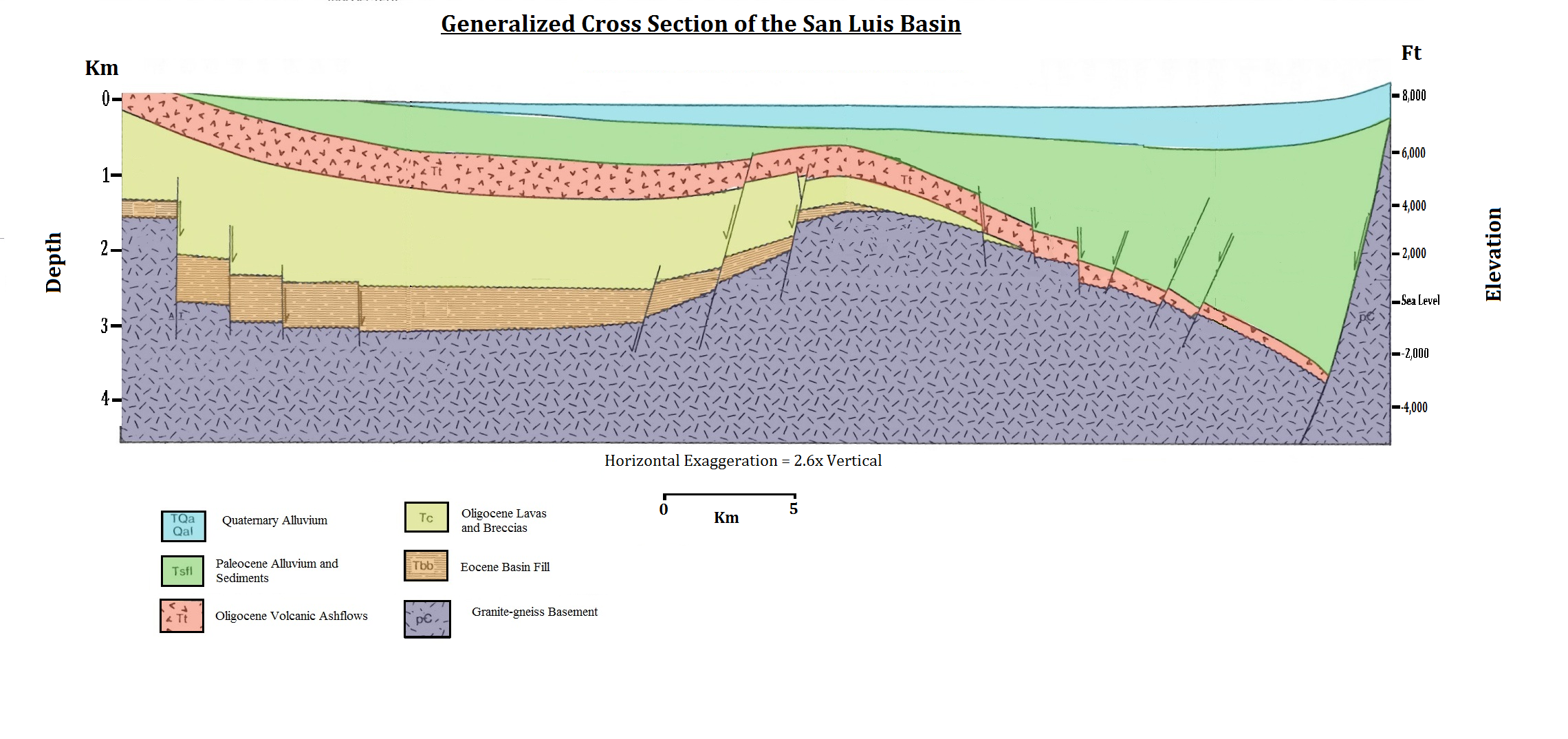
A drainage basin is an area of land in which all flowing surface water converges to a single point, such as a river mouth, or flows into another body of water, such as a lake or ocean. A basin is separated from adjacent basins by a perimeter, the drainage divide, made up of a succession of elevated features, such as ridges and hills. A basin may consist of smaller basins that merge at river confluences, forming a hierarchical pattern. Other terms for a drainage basin are catchment area, catchment basin, drainage area, river basin, water basin, and impluvium. In North America, they are commonly called a watershed, though in other English-speaking places, " watershed" is used only in its original sense, that of the drainage divide line. A drainage basin's boundaries are determined by watershed delineation, a common task in environmental engineering and science. In a closed drainage basin, or endorheic basin, rather than flowing to the ocean, water converges toward the ... [...More Info...] [...Related Items...] OR: [Wikipedia] [Google] [Baidu] |


